Category:Dorpskerk, Bloemendaal
Jump to navigation
Jump to search
| Object location | | View all coordinates using: OpenStreetMap |
|---|
church building in Bloemendaal, Netherlands  | |||||
| Upload media | |||||
| Instance of | |||||
|---|---|---|---|---|---|
| Location | Bloemendaal, North Holland, Netherlands | ||||
| Street address |
| ||||
| Located on street |
| ||||
| Heritage designation |
| ||||
| Significant event |
| ||||
 | |||||
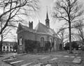
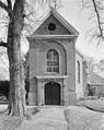
Nederlands: Hervormde kerk. Rechthoekig zaalgebouw 1635-1636
|
This is a category about rijksmonument number 9700
|
| Address |
|
Subcategories
This category has the following 2 subcategories, out of 2 total.
B
- Bloemendaal church in art (6 F)
Media in category "Dorpskerk, Bloemendaal"
The following 32 files are in this category, out of 32 total.
-
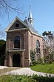 Bloemendaal-Hervormde Kerk 1635.jpg 2,048 × 3,072; 3.06 MB
-
 Dorpskerk-Bloemendaal.JPG 2,304 × 3,072; 1.7 MB
-
 Exterieur naar het noord-oosten - Bloemendaal - 20035882 - RCE.jpg 884 × 1,200; 229 KB
-
 Exterieur naar het zuid-westen - Bloemendaal - 20035883 - RCE.jpg 896 × 1,200; 224 KB
-
 Gegevens cataloguskaartje Bloemendaal, Inventarisnummer NL-HlmNHA 53004258.JPG 2,408 × 1,960; 2.38 MB
-
 Gegevens cataloguskaartje Bloemendaal, Inventarisnummer NL-HlmNHA 53004259.JPG 2,519 × 2,064; 2.64 MB
-

-
 Interieur - Bloemendaal - 20323401 - RCE.jpg 1,200 × 1,200; 216 KB
-
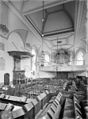
 Interieur naar het noord-westen - Bloemendaal - 20035885 - RCE.jpg 879 × 1,200; 198 KB
-
 Interieur naar het oosten - Bloemendaal - 20035884 - RCE.jpg 878 × 1,200; 177 KB
-
 Interieur naar het zuid-westen - Bloemendaal - 20035886 - RCE.jpg 885 × 1,200; 200 KB
-
 Interieur preekstoel - Bloemendaal - 20323402 - RCE.jpg 1,200 × 1,192; 202 KB
-
 Interieur tochtportaal - Bloemendaal - 20035887 - RCE.jpg 892 × 1,200; 168 KB
-
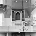
 Interieur, aanzicht orgel, orgelnummer 190 - Bloemendaal - 20359384 - RCE.jpg 957 × 1,200; 140 KB
-
 Interieur, gedenkbord - Bloemendaal - 20400078 - RCE.jpg 1,193 × 1,200; 244 KB
-
 Interieur, gedenksteen - Bloemendaal - 20400076 - RCE.jpg 1,198 × 1,200; 192 KB
-
 Interieur, gedenksteen - Bloemendaal - 20400077 - RCE.jpg 1,195 × 1,200; 245 KB
-

-

-
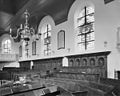 Interieur, herenbanken - Bloemendaal - 20400075 - RCE.jpg 1,200 × 958; 213 KB
-
 Interieur, het orgel - Bloemendaal - 20400073 - RCE.jpg 1,195 × 1,200; 227 KB
-
 Interieur, preekstoel met dooptuin - Bloemendaal - 20400074 - RCE.jpg 953 × 1,200; 201 KB
-
 Kerk te Bloemendaal, Inventarisnummer NL-HlmNHA 53004266.JPG 1,382 × 1,145; 538 KB
-
 Kerkgebouw achter geboomte - Bloemendaal - 20400737 - RCE.jpg 814 × 1,200; 340 KB
-

-

-
-
 Overzicht vanuit het noordoosten - Bloemendaal - 20323400 - RCE.jpg 1,187 × 1,200; 201 KB
-
 Westgevel (met ingang) - Bloemendaal - 20400066 - RCE.jpg 955 × 1,200; 388 KB
-

-
 Zuidgevel van de kerk - Bloemendaal - 20400070 - RCE.jpg 1,200 × 953; 427 KB
-


_-_Bloemendaal_-_20400066_-_RCE.jpg)


