Category:East Bay Regional Parks District
Jump to navigation
Jump to search
English: The East Bay Regional Parks District.
- Located in the eastern San Francisco Bay Area counties of Northern California.
resource district in the San Francisco Bay Area  | |||||
| Upload media | |||||
| Instance of |
| ||||
|---|---|---|---|---|---|
| Location | California, Pacific States Region | ||||
| Inception |
| ||||
| official website | |||||
| |||||
Subcategories
This category has the following 25 subcategories, out of 25 total.
B
- Brooks Island (34 F)
C
- Lake Chabot Regional Park (19 F)
- Chabot Space and Science Center (36 F)
- Coyote Hills Regional Park (40 F)
- Crown Memorial State Beach (1 F)
D
- Diablo Foothills Regional Park (12 F)
E
- Eastshore State Park (19 F)
G
- Garin Regional Park (11 F)
H
- Hayward Regional Shoreline (9 F)
I
L
- Las Trampas Regional Wilderness (30 F)
M
- McLaughlin Eastshore State Park (13 F)
- Middle Harbor Shoreline Park (15 F)
- Mission Peak (1 P, 63 F)
O
- Ohlone Wilderness Trail (10 F)
P
R
S
- Sunol Regional Wilderness (18 F)
T
Media in category "East Bay Regional Parks District"
The following 43 files are in this category, out of 43 total.
-
7ebrpd.ogg 4 min 13 s; 4.35 MB
-
 Alvarado Park (Richmond, CA).JPG 1,597 × 743; 549 KB
-
 Anthony Chabot Regional Park.jpg 4,320 × 3,240; 5.61 MB
-
 Belgum Trail Sign.jpg 3,000 × 4,000; 5.2 MB
-
 Breuner Marsh.jpg 500 × 375; 122 KB
-
 Childrensmemorialatgrovesanleandro.jpg 4,000 × 3,000; 4.44 MB
-
 Childrensmemorialdetailsanleandro.jpg 4,000 × 3,000; 5.16 MB
-
 ClaremontView.jpg 600 × 800; 155 KB
-
 CoyoteHillsView.jpg 1,600 × 1,200; 1.13 MB
-
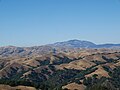 Diablo Range north from Five Canyons.jpg 4,592 × 3,448; 6.76 MB
-
 Don Castro 1.jpg 4,592 × 3,448; 7.84 MB
-
 Don Castro at Castro Valley - panoramio.jpg 2,592 × 1,552; 1.34 MB
-
 Doug Leeds 2008 East Bay Parks Fishing Derby for Special Kids (cropped).jpg 1,054 × 777; 295 KB
-
 East Bay dusk (3850037339).jpg 3,440 × 1,992; 3.64 MB
-
 East Bay Life Guard Training.JPG 1,536 × 2,048; 393 KB
-
 East Bay Park No Gatherings (49950011521).jpg 2,736 × 2,736; 3.12 MB
-
 Five Canyons housing.jpg 4,592 × 3,448; 6.94 MB
-
 Fritillaria purdyi.jpg 1,923 × 1,281; 581 KB
-
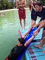
 Kids in the Quarry.JPG 4,000 × 2,664; 2.46 MB
-
 Lone tree on a summer hillside.jpg 2,679 × 2,000; 3.57 MB
-
 Mt Diablo viewed from San Ramon.jpg 3,024 × 3,382; 3.26 MB
-
 Northern Checkerspot Butterfly.jpg 1,825 × 2,436; 1.42 MB
-
 Plebejus lupini.jpg 1,819 × 1,366; 694 KB
-
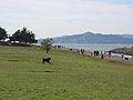 Point Isabel California.JPG 1,976 × 1,482; 493 KB
-
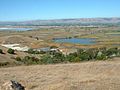
 Point Pinole.jpg 3,442 × 2,446; 3.37 MB
-
 Pointisabel2019.jpg 4,640 × 3,480; 4.44 MB
-
 Pointislabelregionalshoreline2019.jpg 4,640 × 3,480; 4.97 MB
-
 RobertsRegionalRecreationAreaOaklandCalifornia.jpg 4,032 × 2,268; 1.35 MB
-
 Round Valley Regional Park.jpg 2,856 × 2,142; 2.64 MB
-
 TamFromPinole.jpg 800 × 600; 101 KB
-
 Temescal 24.jpg 1,536 × 1,320; 458 KB
-
 Temescal 39.jpg 1,408 × 1,664; 684 KB
-
 Tilden Park 21.jpg 1,500 × 1,000; 271 KB
-
 Tilden Park 37 wiki.jpg 1,244 × 868; 189 KB
-
 Wildcat Canyon California.JPG 3,456 × 2,304; 4.79 MB
-
 Wildcat Canyon Richmond California.JPG 3,456 × 2,304; 2.5 MB
-
 Ammopelmatus fuscus (Jerusalem Cricket).jpg 1,403 × 1,052; 349 KB
-
 Arctostaphylos pallida.jpg 1,841 × 1,627; 519 KB
-
 Chrysolepis chrysophylla Huckleberry BRP 1.jpg 3,456 × 2,592; 2.62 MB
-
 Collinsia sparsiflora.jpg 1,810 × 1,358; 503 KB
-
 Cow Parsnip.jpg 525 × 619; 100 KB
-
 Marah fabaceus Seglea.jpg 374 × 490; 69 KB
-
 ChineseHouses.jpg 361 × 485; 59 KB
.JPG)


.jpg)
.jpg)
.jpg)


.jpg)


