Category:Eaton Hastings
Jump to navigation
Jump to search
village and civil parish in Vale of White Horse, Oxfordshire, England  | |||||
| Upload media | |||||
| Instance of | |||||
|---|---|---|---|---|---|
| Location | Vale of White Horse, Oxfordshire, South East England, England | ||||
| Located in or next to body of water | |||||
| Population |
| ||||
 | |||||
English: Eaton Hastings is a hamlet and civil parish located in Oxfordshire. Eaton Hastings was formerly part of Berkshire and was considerably larger than it is today, it is regarded as a deserted medieval village. The nearest town is Faringdon, approximately 3 miles away.
Subcategories
This category has the following 3 subcategories, out of 3 total.
E
- Eaton Footbridge (2 F)
- Eaton Hastings War Memorial (1 F)
Media in category "Eaton Hastings"
The following 169 files are in this category, out of 169 total.
-
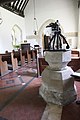
 A carved pulpit - geograph.org.uk - 3079612.jpg 533 × 800; 99 KB
-
 A covering of ivy - geograph.org.uk - 3081245.jpg 533 × 800; 187 KB
-
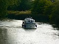
 A narrowboat on the Thames and near Kelmscott - geograph.org.uk - 2500134.jpg 1,440 × 1,080; 684 KB
-
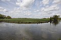
 A view south across the Thames near Kelmscott - geograph.org.uk - 2500144.jpg 1,440 × 1,080; 749 KB
-
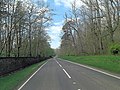
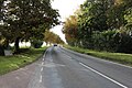
 A417 approaches Eaton Hastings - geograph.org.uk - 4012977.jpg 3,648 × 2,736; 2.28 MB
-
 A417 Eaton Hastings - geograph.org.uk - 3075123.jpg 1,024 × 683; 193 KB
-
 A417 near Ratsnest Covert - geograph.org.uk - 3131558.jpg 640 × 479; 74 KB
-
 A417 passes the New Lodges - geograph.org.uk - 4012579.jpg 3,648 × 2,736; 1.89 MB
-
 A417 south of Taylor's Hill - geograph.org.uk - 4012982.jpg 3,648 × 2,736; 2.31 MB
-
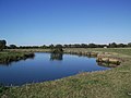
 Across the river to Grange - geograph.org.uk - 2949248.jpg 1,024 × 683; 138 KB
-
 Across the Thames towards Kelmscott - geograph.org.uk - 2501240.jpg 640 × 480; 115 KB
-
 Altar in the chancel - geograph.org.uk - 3079741.jpg 533 × 800; 85 KB
-
 An old school - geograph.org.uk - 3075067.jpg 1,024 × 683; 269 KB
-
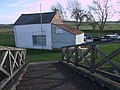 Anchor Boat Club building on the River Thames - geograph.org.uk - 3887715.jpg 4,000 × 3,000; 2.82 MB
-
 Another view of the school - geograph.org.uk - 3075122.jpg 1,024 × 683; 230 KB
-
 At "The Anchor" Boat Club - geograph.org.uk - 5074722.jpg 2,592 × 1,944; 1.4 MB
-
 Back to the A417 - geograph.org.uk - 3075262.jpg 1,024 × 683; 220 KB
-
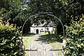
 Bell House, Eaton Hastings - geograph.org.uk - 2789188.jpg 2,848 × 2,136; 1.8 MB
-
 Benchmark on the Tower - geograph.org.uk - 3077157.jpg 533 × 800; 220 KB
-
 Bend at Kelmscott - geograph.org.uk - 2940504.jpg 1,024 × 683; 159 KB
-
 Bend in the Thames - geograph.org.uk - 2663053.jpg 640 × 478; 61 KB
-
 Bend in the Thames - geograph.org.uk - 2949246.jpg 2,501 × 755; 391 KB
-
 Big frame small window - geograph.org.uk - 3079681.jpg 533 × 800; 65 KB
-
 Boom across the weir - geograph.org.uk - 2945024.jpg 1,024 × 683; 274 KB
-
 Bridge, The Lake, Buscot Park - geograph.org.uk - 2787237.jpg 1,957 × 2,727; 1.71 MB
-
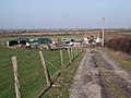
 Cattle by the Thames - geograph.org.uk - 2060870.jpg 640 × 480; 82 KB
-
 Chancel in St. Michael's Church - geograph.org.uk - 3079622.jpg 533 × 800; 111 KB
-
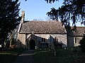 Church of Saint Michael, Eaton Hastings - geograph.org.uk - 2789446.jpg 2,848 × 2,136; 1.86 MB
-
 Cottage by the church - geograph.org.uk - 3077192.jpg 1,024 × 683; 251 KB
-
 Cottages at Eaton Hastings - geograph.org.uk - 3075113.jpg 1,024 × 683; 156 KB
-
 Couple of memorial plaques - geograph.org.uk - 3079687.jpg 1,024 × 683; 132 KB
-
 Crabtree Farm, Eaton Hastings - geograph.org.uk - 2787378.jpg 2,848 × 2,136; 1.59 MB
-
 Curtains on the chancel - geograph.org.uk - 3079773.jpg 533 × 800; 106 KB
-
 D'Arcy Dalton Way - geograph.org.uk - 4756996.jpg 640 × 480; 88 KB
-
 D'Arcy Dalton Way - geograph.org.uk - 4756999.jpg 640 × 480; 69 KB
-
 D'Arcy Dalton Way - geograph.org.uk - 4757317.jpg 640 × 480; 104 KB
-
 Danger keep Away - geograph.org.uk - 2945029.jpg 1,024 × 683; 193 KB
-
 Dedication in the porch - geograph.org.uk - 3080003.jpg 1,024 × 683; 194 KB
-
 Derelict Phone Box beside A417 - geograph.org.uk - 6605041.jpg 4,442 × 2,962; 2.57 MB
-
 Detail on the chancel arch - geograph.org.uk - 3079788.jpg 533 × 800; 87 KB
-
 Direction Sign – Signpost - geograph.org.uk - 6505095.jpg 696 × 1,200; 184 KB
-
 Door and blocked doorway - geograph.org.uk - 3079999.jpg 533 × 800; 82 KB
-

-
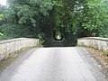
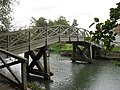 Eaton footbridge - geograph.org.uk - 2074220.jpg 640 × 480; 97 KB
-
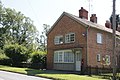
 ... former Post Office at Eaton Hastings - the clues are there! (4032332168).jpg 2,167 × 3,037; 3.86 MB
-
 Eaton Hastings - geograph.org.uk - 912621.jpg 640 × 426; 112 KB
-

-
 Entry to the Anchor Boat Club - geograph.org.uk - 2074217.jpg 640 × 480; 111 KB
-
 Ferry Cottage, Eaton Hastings - geograph.org.uk - 2789368.jpg 2,848 × 2,136; 2.33 MB
-
 First look at the weir - geograph.org.uk - 2944858.jpg 1,024 × 683; 291 KB
-
 Font and cover - geograph.org.uk - 3079991.jpg 533 × 800; 94 KB
-
 Footpath to Rhodes Farm - geograph.org.uk - 3075259.jpg 1,024 × 683; 244 KB
-
 Footpath to Stud Farm - geograph.org.uk - 3075125.jpg 1,024 × 683; 374 KB
-
 Former Post Office(^), Eaton Hastings - geograph.org.uk - 2789692.jpg 2,412 × 1,842; 1.05 MB
-
 Gatehouse at the entrance to Buscot Park Gardens - geograph.org.uk - 6268419.jpg 1,920 × 1,280; 1.36 MB
-
 Gatehouse at the entrance to Buscot Park Gardens - geograph.org.uk - 6268420.jpg 1,920 × 1,280; 1.4 MB
-

-
 Grafton Weir - geograph.org.uk - 2947879.jpg 1,024 × 683; 178 KB
-
 Grave in the church - geograph.org.uk - 3079803.jpg 683 × 1,024; 139 KB
-
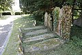
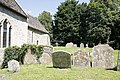
 Headstones in the churchyard - geograph.org.uk - 3081246.jpg 1,024 × 683; 292 KB
-
 Headstones under the tree - geograph.org.uk - 3077142.jpg 1,024 × 683; 288 KB
-
 House and Memorial, Eaton Hastings - geograph.org.uk - 6605038.jpg 4,863 × 3,045; 2.49 MB
-
 Icon in the alcove - geograph.org.uk - 3081247.jpg 533 × 800; 204 KB
-
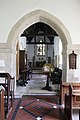
 Inside St Michael - geograph.org.uk - 3077242.jpg 1,024 × 683; 134 KB
-
 Ivy in the tomb - geograph.org.uk - 3081244.jpg 1,024 × 683; 294 KB
-
 Ivy on the headstones - geograph.org.uk - 3077223.jpg 1,024 × 683; 318 KB
-
 Lechlade Road by Buscot Gardens - geograph.org.uk - 6263561.jpg 1,920 × 1,280; 1.97 MB
-
 Looking down - geograph.org.uk - 3077201.jpg 1,024 × 683; 151 KB
-
 Looking through the arch - geograph.org.uk - 3079618.jpg 533 × 800; 102 KB
-
 Lower Farm, Eaton Hastings - geograph.org.uk - 912613.jpg 640 × 426; 88 KB
-
 Manor Farm, near Faringdon - geograph.org.uk - 2789462.jpg 2,782 × 2,053; 1.5 MB
-
 Memory of James Rice - geograph.org.uk - 3079714.jpg 1,024 × 683; 158 KB
-
 Middle of the bend - geograph.org.uk - 2949244.jpg 1,024 × 683; 114 KB
-
 Mixed Browns and Greens - geograph.org.uk - 6604721.jpg 1,600 × 1,009; 492 KB
-
 Motor boat on the Thames (1 of 2) near Kelmscott - geograph.org.uk - 2501339.jpg 1,440 × 1,080; 651 KB
-
 Motor boat on the Thames (2 of 2) near Kelmscott - geograph.org.uk - 2501340.jpg 1,440 × 1,080; 630 KB
-
 Names on the plaque - geograph.org.uk - 3075118.jpg 1,024 × 683; 185 KB
-
 Nave in St Michael - geograph.org.uk - 3079808.jpg 533 × 800; 108 KB
-
 Near the site of the Anchor Inn, Eaton Hastings - geograph.org.uk - 2501255.jpg 1,440 × 1,080; 775 KB
-
 Nos. 12-14 Roadside Cottages, Eaton Hastings - geograph.org.uk - 2789683.jpg 2,791 × 2,056; 1.44 MB
-
 Nos. 6 ^ 7 Roadside Cottages, Eaton Hastings - geograph.org.uk - 2789644.jpg 2,848 × 1,974; 1.36 MB
-
 Old Phone Box and Bus Stop - geograph.org.uk - 6605044.jpg 3,362 × 4,396; 4.49 MB
-

-
 Oldfield Farm, Eaton Hastings - geograph.org.uk - 2789202.jpg 2,848 × 2,136; 1.74 MB
-
 One of the bends - geograph.org.uk - 2948116.jpg 1,024 × 683; 157 KB
-
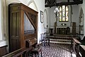 Organ in the Chancel - geograph.org.uk - 3079779.jpg 1,024 × 683; 150 KB
-
 Part of the churchyard - geograph.org.uk - 3077136.jpg 1,024 × 683; 229 KB
-
 Path from the arch - geograph.org.uk - 3077132.jpg 1,024 × 683; 296 KB
-
 Philips's Farm House - geograph.org.uk - 2949250.jpg 1,024 × 683; 112 KB
-
 Pillbox near Eaton Hastings - geograph.org.uk - 912455.jpg 640 × 426; 74 KB
-
 Pillbox near Kelmscot - geograph.org.uk - 2423847.jpg 1,024 × 680; 258 KB
-
 Pillbox opposite Eaton Hastings - geograph.org.uk - 912638.jpg 640 × 425; 96 KB
-
 Post box at the PO - geograph.org.uk - 3075074.jpg 533 × 800; 100 KB
-
 Recycled lamp - geograph.org.uk - 3079620.jpg 683 × 1,024; 124 KB
-
 Rhodes Farm, Eaton Hastings - geograph.org.uk - 2663103.jpg 640 × 478; 80 KB
-
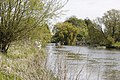
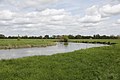
 River Thames - geograph.org.uk - 2221266.jpg 640 × 480; 30 KB
-
 River Thames - geograph.org.uk - 2682515.jpg 640 × 480; 77 KB
-
 River Thames at Kelmscott - geograph.org.uk - 2060854.jpg 640 × 480; 94 KB
-
 River Thames at Kelmscott - geograph.org.uk - 2232050.jpg 2,804 × 1,864; 1.98 MB
-
 River Thames by Kelmscott - geograph.org.uk - 2221278.jpg 640 × 480; 87 KB
-
 River Thames near Kelmscott - geograph.org.uk - 2424384.jpg 1,024 × 680; 194 KB
-
 River Thames near Kelmscott - geograph.org.uk - 6644391.jpg 6,000 × 4,000; 7.42 MB
-
 River Thames upstream from Kelmscott - geograph.org.uk - 6647061.jpg 6,000 × 4,000; 5.39 MB
-
 Riverside Landscape near Kelmscott - geograph.org.uk - 5961059.jpg 4,789 × 3,579; 3.11 MB
-
 Road to Kilmester's Farm - geograph.org.uk - 4757003.jpg 640 × 480; 65 KB
-
 Road to Lower Farm - geograph.org.uk - 3075261.jpg 1,024 × 683; 273 KB
-
 Road to the Old Weir - geograph.org.uk - 5961147.jpg 1,600 × 1,135; 662 KB
-
 Roadside Cottages - geograph.org.uk - 3075127.jpg 1,024 × 683; 184 KB
-
 Roadside Cottages, Buscot - geograph.org.uk - 6263554.jpg 1,896 × 1,244; 1.5 MB
-
 Roadside Cottages, Buscot - geograph.org.uk - 6268418.jpg 1,920 × 1,280; 1.57 MB
-
 Round the bend towards Kelmscott - geograph.org.uk - 2949238.jpg 1,024 × 683; 136 KB
-
 Sacred to the memory - geograph.org.uk - 3079609.jpg 1,024 × 683; 122 KB
-
 Small footbridge on the Thames Path - geograph.org.uk - 2060848.jpg 640 × 480; 109 KB
-
 Small window in the chancel - geograph.org.uk - 3079683.jpg 533 × 800; 67 KB
-
 Some of the Arch detail - geograph.org.uk - 3079782.jpg 533 × 800; 93 KB
-
 Some old parts in a new window - geograph.org.uk - 3079735.jpg 533 × 800; 86 KB
-
 South side churchyard - geograph.org.uk - 3081243.jpg 1,024 × 683; 292 KB
-
 St Mary - geograph.org.uk - 3079765.jpg 533 × 800; 88 KB
-
 St Matthew - geograph.org.uk - 3079615.jpg 533 × 800; 112 KB
-
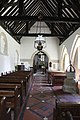
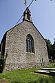
 St Michael Eaton Hastings - geograph.org.uk - 3077140.jpg 1,024 × 683; 212 KB
-
 St Michael, Eaton Hastings, aisle - geograph.org.uk - 6564418.jpg 480 × 640; 60 KB
-
 St Michael, Eaton Hastings, altar - geograph.org.uk - 6564419.jpg 640 × 480; 67 KB
-

-

-
 St Michael, Eaton Hastings, font - geograph.org.uk - 6564410.jpg 480 × 640; 53 KB
-

-
 St Michael, Eaton Hastings, organ - geograph.org.uk - 6564420.jpg 480 × 640; 54 KB
-

-

-

-

-

-

-

-

-
 St Michaels Benchmark - geograph.org.uk - 3077158.jpg 533 × 800; 215 KB
-
 Stud Farm, Eaton Hastings - geograph.org.uk - 2787388.jpg 2,848 × 2,136; 1.19 MB
-
 Stud Farm, Eaton Hastings - geograph.org.uk - 6604742.jpg 4,366 × 2,381; 1.89 MB
-
 Sundials on the corner - geograph.org.uk - 3077205.jpg 533 × 800; 198 KB
-
 Swans on the Thames - geograph.org.uk - 2074226.jpg 640 × 480; 101 KB
-
 The A417, Buscot - geograph.org.uk - 6268421.jpg 1,920 × 1,280; 1.55 MB
-
 The Chancel window of St Michael - geograph.org.uk - 3079752.jpg 533 × 800; 123 KB
-
 The Church Organ - geograph.org.uk - 3079777.jpg 533 × 800; 92 KB
-
 The entrance to Buscot Park Gardens - geograph.org.uk - 6263549.jpg 986 × 1,752; 1.26 MB
-
 The graves under the trees - geograph.org.uk - 3077238.jpg 1,024 × 683; 290 KB
-
 The Old Post Office - geograph.org.uk - 3075070.jpg 1,024 × 683; 218 KB
-
 The other cottages - geograph.org.uk - 3075120.jpg 1,024 × 683; 148 KB
-
 The Porch on St Michael - geograph.org.uk - 3077216.jpg 533 × 800; 168 KB
-
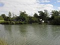
 The River Thames - geograph.org.uk - 5074698.jpg 2,592 × 1,944; 1.88 MB
-
 The River Thames at Kelmscott - geograph.org.uk - 6644340.jpg 6,000 × 4,000; 5.65 MB
-
 The River Thames, Grafton Lock - geograph.org.uk - 448820.jpg 640 × 480; 158 KB
-
 The south side of St Michael - geograph.org.uk - 3077230.jpg 1,024 × 683; 301 KB
-
 The Thames above Kelmscott, with pillbox - geograph.org.uk - 2566728.jpg 1,024 × 768; 208 KB
-
 The Thames and a narrowboat near Kelmscott - geograph.org.uk - 2500127.jpg 1,440 × 1,080; 544 KB
-
 The Thames near Kelmscott - geograph.org.uk - 2499583.jpg 1,440 × 1,080; 848 KB
-
 The Thames towards Eaton Hastings - geograph.org.uk - 2663108.jpg 640 × 478; 70 KB
-
 The way to Eaton Hastings Church - geograph.org.uk - 6604648.jpg 4,827 × 3,184; 1.76 MB
-
 The West end of St Michael - geograph.org.uk - 3077184.jpg 533 × 800; 148 KB
-
 Topiary at Grafton Lock - geograph.org.uk - 2060447.jpg 640 × 480; 107 KB
-
 Towards Buscot - geograph.org.uk - 3075124.jpg 1,024 × 683; 294 KB
-
 Towards the West end - geograph.org.uk - 3077149.jpg 1,024 × 683; 301 KB
-
 View of the Chancel wall - geograph.org.uk - 3079796.jpg 1,024 × 683; 126 KB
-
 View to the lake, Buscot Park (geograph 6147242).jpg 1,024 × 680; 223 KB
-
 Watching over the grave - geograph.org.uk - 3077177.jpg 533 × 800; 172 KB
-
 Weir Channel, Grafton Lock - geograph.org.uk - 911697.jpg 640 × 411; 66 KB
-
 Weir Keeper's House, Eaton - geograph.org.uk - 5961144.jpg 4,530 × 3,309; 2.83 MB
-
 Window in the porch - geograph.org.uk - 3080007.jpg 533 × 800; 165 KB
-
 Window on the west - geograph.org.uk - 3079604.jpg 533 × 800; 103 KB
-
 Young Thames at Eaton Hastings - geograph.org.uk - 873501.jpg 640 × 480; 125 KB


.jpg)


,_Eaton_Hastings_-_geograph.org.uk_-_2789692.jpg)


_near_Kelmscott_-_geograph.org.uk_-_2501339.jpg)
_near_Kelmscott_-_geograph.org.uk_-_2501340.jpg)


_-_geograph.org.uk_-_6564395.jpg)
_-_geograph.org.uk_-_6564400.jpg)
_-_geograph.org.uk_-_6564401.jpg)
_-_geograph.org.uk_-_6564404.jpg)
_-_geograph.org.uk_-_6564406.jpg)
_-_geograph.org.uk_-_6564408.jpg)


.jpg)


