Category:Ecclesall
Jump to navigation
Jump to search
electoral ward of Sheffield City Council | |||||
| Upload media | |||||
| Instance of |
| ||||
|---|---|---|---|---|---|
| Location | Sheffield, South Yorkshire, Yorkshire and the Humber, England | ||||
| Area |
| ||||
 | |||||

Subcategories
This category has the following 3 subcategories, out of 3 total.
A
E
- Ecclesall Woods (20 F)
Media in category "Ecclesall"
The following 72 files are in this category, out of 72 total.
-
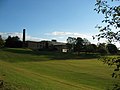
 Abbeydale Grange Lower School - geograph.org.uk - 359989.jpg 640 × 233; 41 KB
-
 Abbeydale Grange Playing Fields - geograph.org.uk - 359996.jpg 640 × 480; 84 KB
-
 Allotments, shed and houses - geograph.org.uk - 1472858.jpg 640 × 480; 84 KB
-
 Gleadless Valley from Lees Hall Road.jpg 3,688 × 1,443; 3.45 MB
-
 Heeley - the dreaming spires - geograph.org.uk - 1431612.jpg 640 × 475; 58 KB
-
 Looking down Woodseats Road - geograph.org.uk - 59342.jpg 640 × 480; 115 KB
-
 Lowfield School - geograph.org.uk - 185965.jpg 640 × 488; 85 KB
-
 Mylnhurst Lodge.jpg 2,560 × 1,920; 1.92 MB
-
 Nether Edge as seen from Meersbrook Avenue - geograph.org.uk - 58038.jpg 640 × 480; 119 KB
-
 Newfield School - geograph.org.uk - 212432.jpg 640 × 480; 72 KB
-
 Park Grange Road, Sheffield - geograph.org.uk - 347499.jpg 640 × 428; 105 KB
-

-
 Whirlow Green. - geograph.org.uk - 122755.jpg 640 × 480; 151 KB
-

-

-

-

-

-
 A view of 'The Roughs' - geograph.org.uk - 441200.jpg 480 × 640; 93 KB
-
 Archer Road Bridge - geograph.org.uk - 356485.jpg 640 × 480; 111 KB
-
 Archimedes' Screw at Heeley City farm - geograph.org.uk - 798564.jpg 480 × 640; 115 KB
-

-
 Belgrave Road Conservation Area - geograph.org.uk - 170141.jpg 640 × 480; 218 KB
-
 Bents Green Methodist Church - geograph.org.uk - 1412048.jpg 640 × 480; 86 KB
-
 Blackstock Road - geograph.org.uk - 1439125.jpg 640 × 480; 88 KB
-
 Coalpit Wood - geograph.org.uk - 1407840.jpg 640 × 480; 77 KB
-
 Ecclesall Woods. - geograph.org.uk - 122756.jpg 640 × 480; 83 KB
-
 Eccleshall Woods. - geograph.org.uk - 111027.jpg 640 × 480; 201 KB
-
 Former Abbeydale Grange Upper School - geograph.org.uk - 359201.jpg 640 × 480; 87 KB
-
 Gate and Portaloo - geograph.org.uk - 733872.jpg 640 × 480; 128 KB
-
 Gaunt Place - geograph.org.uk - 1439136.jpg 640 × 480; 94 KB
-
 Gaunt Road, Sheffield - geograph.org.uk - 179089.jpg 640 × 473; 78 KB
-

-
 Graves Park. - geograph.org.uk - 122753.jpg 640 × 480; 174 KB
-

-
 Heeley - Primitive Methodist Church - geograph.org.uk - 1431606.jpg 640 × 480; 68 KB
-
 Heeley - Sheaf Bank Works - geograph.org.uk - 1431582.jpg 640 × 480; 123 KB
-
 Heeley - The Sheaf View - geograph.org.uk - 1431603.jpg 475 × 640; 77 KB
-
 Heeley Baths - geograph.org.uk - 172834.jpg 480 × 640; 110 KB
-
 High Storrs School - geograph.org.uk - 169522.jpg 640 × 480; 91 KB
-
 Highland Cattle calf, Graves Park - geograph.org.uk - 1411889.jpg 480 × 640; 103 KB
-
 Houses on Ironside Road - geograph.org.uk - 356550.jpg 640 × 480; 83 KB
-
 Hurlfield Road - Gleadless Road - geograph.org.uk - 226091.jpg 640 × 427; 59 KB
-
 Interior, St. Peter, Greenhill - geograph.org.uk - 444354.jpg 640 × 480; 65 KB
-
 Ironside Close - geograph.org.uk - 356529.jpg 640 × 480; 70 KB
-
 Ironside Close - geograph.org.uk - 356574.jpg 640 × 480; 71 KB
-
 Ironside Close Jnc Ironside Road - geograph.org.uk - 356526.jpg 640 × 480; 74 KB
-

-

-
 Meadowhead Roundabout, Sheffield 8 - geograph.org.uk - 134847.jpg 640 × 479; 97 KB
-
 Meers Brook - geograph.org.uk - 301811.jpg 463 × 640; 101 KB
-
 Millhouses Park Boating Lake - geograph.org.uk - 356599.jpg 640 × 480; 98 KB
-
 Millhouses Park Cafe - geograph.org.uk - 356590.jpg 640 × 480; 90 KB
-

-
 Millhouses Park Paddling Pools - geograph.org.uk - 356609.jpg 640 × 480; 131 KB
-
 Millhouses Park Paddling Pools - geograph.org.uk - 356612.jpg 480 × 640; 129 KB
-
 Millhouses Park Playground - geograph.org.uk - 356592.jpg 640 × 480; 124 KB
-
 Millhouses Park Skateboard - geograph.org.uk - 356615.jpg 640 × 480; 135 KB
-
 New Housing, Norfolk Park - geograph.org.uk - 349583.jpg 640 × 428; 100 KB
-
 OAP Flats Ironside Road - geograph.org.uk - 356568.jpg 640 × 480; 89 KB
-
 Out-Houses on Ironside Road - geograph.org.uk - 356571.jpg 640 × 480; 131 KB
-

-

-
 Path up to Constable Road - geograph.org.uk - 356577.jpg 480 × 640; 132 KB
-
 Pond at Graves Park - geograph.org.uk - 421183.jpg 640 × 617; 297 KB
-

-
 The Broadfield - geograph.org.uk - 567507.jpg 640 × 394; 79 KB
-

-
 View across the Gleadless Valley - geograph.org.uk - 226089.jpg 640 × 427; 66 KB
-
 Warminster Crescent - geograph.org.uk - 212404.jpg 480 × 640; 112 KB
-
 Whirlowdale Road. - geograph.org.uk - 122754.jpg 640 × 480; 179 KB
-
 Woods Adjacent to Ironside Road - geograph.org.uk - 356553.jpg 640 × 480; 142 KB


.jpg)


_-_geograph.org.uk_-_356604.jpg)


