Category:Eccleshall
Zur Navigation springen
Zur Suche springen
Kleinstadt im Vereinigten Königreich  | |||||
| Medium hochladen | |||||
| Ist ein(e) | |||||
|---|---|---|---|---|---|
| Ort | Borough of Stafford, Staffordshire, West Midlands, England | ||||
| Eventuell gleichwertig | Eccleshall (Wikimedia-Dublette, Civil Parish in England) | ||||
| offizielle Website | |||||
 | |||||
Unterkategorien
Es werden 23 von insgesamt 23 Unterkategorien in dieser Kategorie angezeigt:
In Klammern die Anzahl der enthaltenen Kategorien (K), Seiten (S), Dateien (D)
A
- Aspley, Staffordshire (1 D)
B
- Brockton, Staffordshire (3 D)
C
- Eccleshall Castle (1 D)
- Chatcull (1 D)
- Croxton, Staffordshire (11 D)
E
- Eccleshall War Memorial (1 D)
F
- Fairoak, Staffordshire (4 D)
H
- Heamies Farm (38 D)
J
- Johnson Hall, Eccleshall (3 D)
K
- Kings Arms, Eccleshall (2 D)
P
- Pershall, Staffordshire (3 D)
- Podmore, Staffordshire (1 D)
R
- The Royal Oak, Eccleshall (3 D)
S
- Slindon, Sytch Lane (48 D)
- Sugnall (3 D)
T
W
- Walton, Eccleshall (2 D)
- Wetwood, Staffordshire (4 D)
- Whittington, Stafford (1 D)
- Wootton, Stafford (4 D)
Medien in der Kategorie „Eccleshall“
Folgende 200 Dateien sind in dieser Kategorie, von 427 insgesamt.
(vorherige Seite) (nächste Seite)-
 17-21 High Street, Eccleshall.jpg 3.101 × 2.326; 2,04 MB
-
 23 Church St, Eccleshall.jpg 4.608 × 3.456; 5,1 MB
-
 24 High Street, Eccleshall.jpg 2.203 × 2.938; 1,95 MB
-
 26 High Street, Eccleshall.jpg 1.728 × 2.633; 1,39 MB
-
 29 High Street, Eccleshall.jpg 2.081 × 2.774; 1,84 MB
-
 36 High Street, Eccleshall.jpg 3.101 × 2.326; 2,06 MB
-
 38 High Street, Eccleshall.jpg 2.081 × 2.774; 1,97 MB
-
 39 - 43 High Street, Eccleshall - geograph.org.uk - 6204534.jpg 2.448 × 3.264; 2,07 MB
-
 40 High Street, Eccleshall.jpg 2.081 × 2.774; 2,01 MB
-
 42 High Street, Eccleshall.jpg 3.166 × 2.375; 2 MB
-
 46 and 48 High Street, Eccleshall.jpg 2.326 × 3.101; 2,01 MB
-
 47 (part) ^ 49 High Street, Eccleshall - geograph.org.uk - 6204529.jpg 2.326 × 3.101; 2,06 MB
-
 51 - 55 High Street, Eccelshall - geograph.org.uk - 6204306.jpg 2.938 × 2.203; 1,94 MB
-
 54 and 56 High Street, Eccleshall.jpg 2.938 × 2.203; 2,04 MB
-
 63 High Street, Eccleshall.jpg 3.264 × 2.448; 2,28 MB
-
 8 High Street, Eccleshall.jpg 3.264 × 2.448; 1,91 MB
-
 9 Church St, Eccleshall.jpg 4.608 × 3.456; 4,43 MB
-
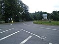
 A country road near to Standon - geograph.org.uk - 5756386.jpg 1.600 × 900; 405 KB
-
 A line of trees - geograph.org.uk - 4977334.jpg 640 × 426; 48 KB
-
 A new milepost beside the A519 - geograph.org.uk - 2469983.jpg 1.469 × 1.102; 357 KB
-
 A newly-cast milepost at Slindon North - geograph.org.uk - 2469987.jpg 857 × 1.142; 451 KB
-
 A5013 Stafford Road - geograph.org.uk - 1962775.jpg 640 × 480; 71 KB
-
 A5013 towards Stafford - geograph.org.uk - 6263060.jpg 800 × 600; 189 KB
-
 A5013, Walton - geograph.org.uk - 6263065.jpg 640 × 480; 103 KB
-
 A5013, Walton - geograph.org.uk - 6263068.jpg 800 × 600; 98 KB
-
 A519 towards Newcastle-under-Lyme - geograph.org.uk - 6260419.jpg 800 × 600; 96 KB
-
 A519 towards Newcastle-under-Lyme - geograph.org.uk - 6260424.jpg 800 × 600; 166 KB
-
 A519, Slindon - geograph.org.uk - 6260435.jpg 640 × 480; 85 KB
-
 A519, the Newport road - geograph.org.uk - 2728099.jpg 640 × 426; 94 KB
-

-
-
 Access to Burnt Wood - geograph.org.uk - 2302060.jpg 640 × 480; 121 KB
-
 Ancient oak tree - geograph.org.uk - 2250235.jpg 1.600 × 1.143; 518 KB
-
 Ankerton House - geograph.org.uk - 275166.jpg 640 × 303; 57 KB
-
 Another Footpath to Little Sugnall - geograph.org.uk - 2710075.jpg 640 × 428; 144 KB
-

-
 Ashley Heath from near Rudge Lane - geograph.org.uk - 2301833.jpg 640 × 457; 135 KB
-
 Aspley Farm - geograph.org.uk - 6260439.jpg 800 × 600; 134 KB
-

-
 B5026 towards Eccleshall - geograph.org.uk - 6262580.jpg 800 × 600; 174 KB
-
 B5026 towards Loggerheads - geograph.org.uk - 6260532.jpg 800 × 600; 100 KB
-
 B5026 towards Sugnall - geograph.org.uk - 6262575.jpg 800 × 600; 135 KB
-
 B5026 towards Wetwood - geograph.org.uk - 6260494.jpg 800 × 600; 101 KB
-
 B5026, Broughton Folly - geograph.org.uk - 6260522.jpg 800 × 600; 130 KB
-
 B5026, Pershall - geograph.org.uk - 6262584.jpg 800 × 600; 130 KB
-
 B5026, Wetwood - geograph.org.uk - 6260497.jpg 800 × 600; 133 KB
-
 Baden Hall Farm - geograph.org.uk - 4977318.jpg 640 × 426; 39 KB
-
 Baden Hall Farm - geograph.org.uk - 5355160.jpg 640 × 426; 32 KB
-
 Baden Hall Fishery - geograph.org.uk - 3839895.jpg 640 × 325; 30 KB
-
 Baden Hall Fishery - geograph.org.uk - 3839897.jpg 640 × 352; 36 KB
-
 Barn, Brooklyn Farm - geograph.org.uk - 6260469.jpg 800 × 600; 94 KB
-
 Barn, Green Farm, Pershall - geograph.org.uk - 6262567.jpg 800 × 600; 119 KB
-
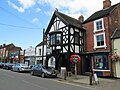
 Bell Inn, Eccleshall.jpg 800 × 600; 122 KB
-
 Bishop's Wood - geograph.org.uk - 4677179.jpg 3.264 × 2.448; 4,86 MB
-

-

-
 Bridleways through Bishop's Wood - geograph.org.uk - 2302064.jpg 640 × 480; 172 KB
-
 Brockton Lane, Cat's Hill Cross - geograph.org.uk - 6260417.jpg 800 × 600; 141 KB
-

-
 Bromley Mill Farm - geograph.org.uk - 6172705.jpg 800 × 559; 131 KB
-
 Broughton Parish Room - geograph.org.uk - 6260499.jpg 800 × 600; 120 KB
-
 Building work on Stone Lane, Eccleshall - geograph.org.uk - 4892185.jpg 1.200 × 799; 347 KB
-

-
 Cats Hill trig and the woods - geograph.org.uk - 3376659.jpg 979 × 734; 552 KB
-
 Cattle crossing - geograph.org.uk - 557502.jpg 640 × 480; 109 KB
-

-
 Cattle near Newhouse Farm - geograph.org.uk - 6260474.jpg 800 × 600; 139 KB
-
 Cattle resting - geograph.org.uk - 1354778.jpg 640 × 457; 168 KB
-
 Cattle, Podmore - geograph.org.uk - 6172704.jpg 800 × 600; 107 KB
-
 Cereal crop near The Rudge Farm - geograph.org.uk - 6172468.jpg 800 × 600; 78 KB
-
 Charnes Road - geograph.org.uk - 6172465.jpg 800 × 600; 120 KB
-
 Charnes Road - geograph.org.uk - 6172683.jpg 640 × 480; 89 KB
-
 Chatcull Brook and Podmore Wood - geograph.org.uk - 2193249.jpg 640 × 457; 175 KB
-
 Chatcull Ford - geograph.org.uk - 3944425.jpg 3.872 × 2.592; 5,32 MB
-
 Chester Lodge - geograph.org.uk - 6262585.jpg 800 × 554; 108 KB
-
 Chester Road (B5026) - geograph.org.uk - 6262589.jpg 800 × 600; 143 KB
-
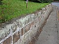 Church Wall.jpg 4.608 × 3.456; 5,87 MB
-
 Clock on High Street, Eccleshall - geograph.org.uk - 6262604.jpg 631 × 800; 111 KB
-

-

-
 Cop Mere - geograph.org.uk - 1774838.jpg 640 × 480; 361 KB
-
 Cop Mere - geograph.org.uk - 3468376.jpg 640 × 420; 73 KB
-
 Copmere - geograph.org.uk - 1954139.jpg 640 × 457; 202 KB
-
 Copmere in winter. - geograph.org.uk - 1954135.jpg 640 × 457; 214 KB
-
 Copmere. - geograph.org.uk - 1954137.jpg 640 × 457; 191 KB
-

-
 Cottage, Walk Mill - geograph.org.uk - 6262546.jpg 800 × 600; 93 KB
-
 Country Lane near Croxton - geograph.org.uk - 2713115.jpg 640 × 428; 132 KB
-
 Countryside near Millmeece - geograph.org.uk - 3680199.jpg 640 × 430; 46 KB
-
 Crop field south of Ashley - geograph.org.uk - 6172463.jpg 800 × 600; 115 KB
-
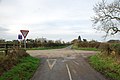 Crossroads near Chatcull - geograph.org.uk - 2722509.jpg 640 × 428; 68 KB
-
 Crossroads near Chatcull - geograph.org.uk - 6260465.jpg 800 × 600; 91 KB
-
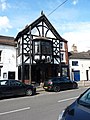
 Crown Inn, Eccleshall.jpg 3.264 × 2.448; 2 MB
-
 Dawn near Offley Marsh - geograph.org.uk - 1069868.jpg 640 × 457; 157 KB
-
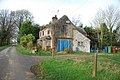
 Derelict house near Chatcull - geograph.org.uk - 6260462.jpg 800 × 531; 132 KB
-
-
 Disused Victorian postbox on the Star Inn, Walk Mill - geograph.org.uk - 6262561.jpg 1.465 × 2.490; 946 KB
-
 Diverted traffic to the left - geograph.org.uk - 2728096.jpg 640 × 426; 122 KB
-

-
 Drive to Ankerton Cottage - geograph.org.uk - 1016104.jpg 640 × 480; 113 KB
-
 Driveway near Bishop's Wood - geograph.org.uk - 2302057.jpg 640 × 480; 115 KB
-
 Ducks on a pond - geograph.org.uk - 2193235.jpg 640 × 457; 201 KB
-
 Eastfields - geograph.org.uk - 4977324.jpg 640 × 426; 44 KB
-
 Eccleshall Fire Station - geograph.org.uk - 1403241.jpg 640 × 480; 66 KB
-
 Eccleshall High Street - geograph.org.uk - 4591629.jpg 1.600 × 1.200; 592 KB
-
 Eccleshall High Street - geograph.org.uk - 6145507.jpg 6.634 × 4.423; 4,87 MB
-
 Eccleshall High Street - geograph.org.uk - 6145510.jpg 4.900 × 3.266; 2,33 MB
-

-
 Eccleshall milepost - geograph.org.uk - 2494557.jpg 768 × 1.024; 359 KB
-
 Eccleshall old fire station - geograph.org.uk - 607247.jpg 640 × 427; 213 KB
-
 Eccleshall Staffordshire UK.jpg 640 × 480; 64 KB
-
 Eccleshall's Catholic Church - geograph.org.uk - 1403060.jpg 640 × 480; 128 KB
-
 Eccleshall's Methodist Church - geograph.org.uk - 1403232.jpg 640 × 480; 118 KB
-
 Elford Grove, Elford Heath - geograph.org.uk - 2496839.jpg 640 × 428; 101 KB
-
 Elizabeth II postbox and telephone box on the A519, Slindon - geograph.org.uk - 6262274.jpg 4.890 × 3.366; 3,86 MB
-
 Elizabeth II postbox on High Street, Eccleshall - geograph.org.uk - 6263124.jpg 2.799 × 4.602; 4,12 MB
-
 Elizabeth II postbox on the A519, Slindon - geograph.org.uk - 6262263.jpg 1.703 × 2.989; 1,12 MB
-
 Elizabeth II postbox on the B5026, Croxtonbank - geograph.org.uk - 6262277.jpg 2.685 × 4.414; 3,77 MB
-
 Embankment by a sand pit - geograph.org.uk - 3839807.jpg 640 × 430; 44 KB
-

-
 Entering Slindon - geograph.org.uk - 6260426.jpg 800 × 531; 99 KB
-

-

-
 Entrance to Broughton Hall - geograph.org.uk - 6260512.jpg 800 × 488; 92 KB
-
 Entrance to Charnes Old Hall farm - geograph.org.uk - 2722566.jpg 640 × 428; 64 KB
-

-
 Entrance to Marsh Farm near Sugnall - geograph.org.uk - 2713068.jpg 640 × 428; 67 KB
-
 Evening near Dairy House Farm - geograph.org.uk - 2728094.jpg 640 × 426; 85 KB
-

-
 Farm access Track on Brockton Lane - geograph.org.uk - 2708943.jpg 640 × 428; 92 KB
-
 Farm at The Rudge - geograph.org.uk - 2301828.jpg 640 × 457; 145 KB
-
 Farm track off Shut Lane - geograph.org.uk - 6260489.jpg 800 × 600; 114 KB
-
 Farmland - geograph.org.uk - 1310020.jpg 640 × 457; 156 KB
-
 Farmland - geograph.org.uk - 2193238.jpg 640 × 457; 189 KB
-
 Farmland - geograph.org.uk - 2193256.jpg 640 × 457; 180 KB
-
 Farmland at Brockton Farm - geograph.org.uk - 5755544.jpg 1.600 × 900; 481 KB
-
 Farmland at Millmeece - geograph.org.uk - 1309995.jpg 640 × 457; 175 KB
-
 Farmland near Ashley - geograph.org.uk - 1209717.jpg 640 × 457; 169 KB
-
 Farmland near Garmelow - geograph.org.uk - 1354802.jpg 640 × 457; 129 KB
-
 Farmland near Garmelow - geograph.org.uk - 1604672.jpg 640 × 457; 141 KB
-
 Farmland near Spurley Brook - geograph.org.uk - 2293210.jpg 1.600 × 1.143; 331 KB
-
 Farmland near Walton Hurst - geograph.org.uk - 2293243.jpg 1.600 × 1.143; 338 KB
-
 Farmland, Baden Hall - geograph.org.uk - 4977321.jpg 640 × 344; 28 KB
-
 Farmland, Millmeece - geograph.org.uk - 4977333.jpg 640 × 426; 45 KB
-
 Farmland, Millmeece - geograph.org.uk - 5349731.jpg 640 × 426; 49 KB
-
 Field at Windsend - geograph.org.uk - 2728090.jpg 640 × 426; 96 KB
-
 Field entrance near Bromley Hall - geograph.org.uk - 6172693.jpg 800 × 498; 117 KB
-
 Field entrance off the B5026 - geograph.org.uk - 6260530.jpg 800 × 548; 190 KB
-
 Field entrance off the B5026 - geograph.org.uk - 6262578.jpg 800 × 600; 182 KB
-

-
 Field margin near Hookgate - geograph.org.uk - 6260534.jpg 800 × 600; 142 KB
-
 Field near Bromley Hall - geograph.org.uk - 6172686.jpg 800 × 600; 101 KB
-
 Field near Chatcull - geograph.org.uk - 6260467.jpg 800 × 600; 106 KB
-
 Field near Waltonbank - geograph.org.uk - 6263066.jpg 800 × 600; 121 KB
-
 Field towards The Dingle woodland - geograph.org.uk - 6262629.jpg 800 × 600; 99 KB
-
 Field, Cat's Hill Cross - geograph.org.uk - 6260415.jpg 800 × 600; 120 KB
-
 Fields near Pool House off the A519 - geograph.org.uk - 2721561.jpg 640 × 428; 112 KB
-
 Fingerpost, Eccleshall - geograph.org.uk - 2676750.jpg 640 × 480; 102 KB
-

-
 Fishing Lake, Baden Hall - geograph.org.uk - 2820673.jpg 640 × 430; 37 KB
-
 Flooded Gravel Pit near Coldmeece - geograph.org.uk - 2720654.jpg 640 × 428; 88 KB
-
 Flooded sand pit - geograph.org.uk - 3715075.jpg 640 × 347; 23 KB
-

-
 Foot path through Elephant Grass - geograph.org.uk - 2721577.jpg 640 × 428; 78 KB
-
 Footpath and Derelict Cottage - geograph.org.uk - 2720659.jpg 640 × 428; 114 KB
-
 Footpath and entrance to Waltonhurst - geograph.org.uk - 2555124.jpg 640 × 428; 101 KB
-

-
 Footpath Near Eccleshall Church - geograph.org.uk - 2237497.jpg 1.496 × 1.122; 1,23 MB
-
 Footpath off Langot Lane - geograph.org.uk - 2319917.jpg 3.072 × 2.304; 4,47 MB
-
 Footpath off Langot Lane - geograph.org.uk - 2319937.jpg 3.072 × 2.304; 3,99 MB
-
 Footpath over field towards Whittington - geograph.org.uk - 6260486.jpg 800 × 600; 124 KB
-
 Footpath to Little Ankerton - geograph.org.uk - 2721567.jpg 640 × 428; 75 KB
-
 Former British Legion Club, Eccleshall.jpg 2.448 × 3.264; 1,81 MB
-
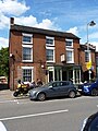 Former Midland Bank, Eccleshall.jpg 2.203 × 2.938; 1,91 MB
-
 Former Police Station, Eccleshall.jpg 2.081 × 2.774; 1,92 MB
-
 Free Gospel Chapel - geograph.org.uk - 2329386.jpg 2.304 × 3.072; 2,69 MB
-
 Garmelow in the Frost - geograph.org.uk - 1354570.jpg 640 × 480; 119 KB
-
 Gas valve compound - geograph.org.uk - 4744002.jpg 640 × 480; 122 KB
-
 Give Way at Brockton - geograph.org.uk - 5755538.jpg 1.600 × 900; 478 KB
-
 Grazing and hedgerow near Chatcull - geograph.org.uk - 6260450.jpg 640 × 480; 70 KB
-
 Grazing near Burley Cottage - geograph.org.uk - 6172712.jpg 800 × 600; 115 KB
-
 Grazing near Chatcull - geograph.org.uk - 6260451.jpg 800 × 600; 87 KB
-
 Grazing near Foxley - geograph.org.uk - 6260445.jpg 800 × 600; 97 KB
-
 Grazing near Newhouse Farm - geograph.org.uk - 6260477.jpg 800 × 600; 126 KB
-
 Grazing near Old Sturbridge Farm - geograph.org.uk - 6260407.jpg 800 × 600; 106 KB
-
 Grazing of Shut Lane - geograph.org.uk - 6260481.jpg 800 × 600; 112 KB
-
 Grazing off the B5026 near Eccleshall - geograph.org.uk - 6262587.jpg 800 × 600; 183 KB
-
 Grazing off the B5026, Pershall - geograph.org.uk - 6262582.jpg 800 × 600; 137 KB
-
 Grazing, Aspley - geograph.org.uk - 6260436.jpg 800 × 600; 109 KB
-
 Grazing, Aspley - geograph.org.uk - 6260443.jpg 800 × 600; 132 KB
-
 Grazing, Buttersbank - geograph.org.uk - 6260492.jpg 800 × 600; 105 KB
-
 Green and pleasant land - geograph.org.uk - 5756362.jpg 1.600 × 900; 342 KB
-
 Heading north from Coldmeece - geograph.org.uk - 5367177.jpg 4.128 × 2.322; 4,65 MB
-
 High Street, Eccleshall - geograph.org.uk - 2677146.jpg 640 × 480; 108 KB
-
 High Street, Eccleshall - geograph.org.uk - 2694744.jpg 480 × 640; 96 KB
-
 High Street, Eccleshall - geograph.org.uk - 3845700.jpg 1.024 × 750; 134 KB
-
 High Street, Eccleshall - geograph.org.uk - 5506533.jpg 1.024 × 682; 165 KB
-
 Highlanes heading towards Brockton - geograph.org.uk - 2713179.jpg 640 × 428; 112 KB
-
 Highlanes Lane - geograph.org.uk - 5755551.jpg 1.600 × 900; 277 KB
-
 Hilcote Hall - geograph.org.uk - 270804.jpg 640 × 480; 92 KB


_%5E_49_High_Street,_Eccleshall_-_geograph.org.uk_-_6204529.jpg)


_-_geograph.org.uk_-_6262589.jpg)


