Category:Eichstruth
Jump to navigation
Jump to search
Part of the municipality of Uder in Germany   | |||||
| Upload media | |||||
| Instance of |
| ||||
|---|---|---|---|---|---|
| Location | Uder, Eichsfeld, Thuringia, Germany | ||||
| Population |
| ||||
| Area |
| ||||
| Elevation above sea level |
| ||||
| official website | |||||
 | |||||
Subcategories
This category has the following 3 subcategories, out of 3 total.
A
E
H
Media in category "Eichstruth"
The following 11 files are in this category, out of 11 total.
-
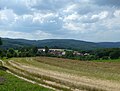
 Eichstruth 01.jpg 3,648 × 2,736; 2.4 MB
-
 Eichstruth 1996-07-31 01.jpg 4,380 × 2,850; 2.68 MB
-
 Eichstruth 1996-07-31 02.jpg 4,398 × 2,850; 2.37 MB
-
 Eichstruth 1996-07-31 03.jpg 4,356 × 2,844; 2.34 MB
-
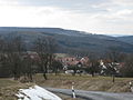
 Eichstruth Blick.JPG 3,944 × 2,975; 3.78 MB
-
 Eichstruth in EIC.svg 1,149 × 1,140; 578 KB
-
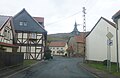
 Eichstruth Ortsansicht (1).jpg 4,320 × 3,240; 3.76 MB
-
 Eichstruth Ortsansicht (2).jpg 3,898 × 2,518; 2.27 MB
-
 Eichstruth Ortsansicht (3).jpg 3,810 × 2,598; 2.34 MB
-
 Eichstruth Ortsansicht (4).jpg 4,212 × 3,092; 4.73 MB
-
 Eichstruth.JPG 3,648 × 2,736; 3.55 MB


.jpg)
.jpg)
.jpg)
.jpg)