Category:Enceinte médiévale de Pesmes
Jump to navigation
Jump to search
| Object location | | View all coordinates using: OpenStreetMap |
|---|
|
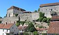
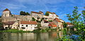
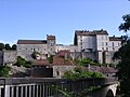
This building is inscrit au titre des monuments historiques de la France. It is indexed in the base Mérimée, a database of architectural heritage maintained by the French Ministry of Culture, under the reference PA00125416
|
 | |||||
| Upload media | |||||
| Instance of | |||||
|---|---|---|---|---|---|
| Location | Pesmes, canton of Pesmes | ||||
| Heritage designation |
| ||||
 | |||||
Subcategories
This category has the following 2 subcategories, out of 2 total.
P
- Porte de Loigerot (5 F)
- Porte Saint-Hilaire (Pesmes) (9 F)
Media in category "Enceinte médiévale de Pesmes"
The following 26 files are in this category, out of 26 total.
-
 Pesmes - fortifications 01.JPG 3,216 × 2,136; 3.67 MB
-
 Pesmes - fortifications 02.JPG 3,216 × 2,136; 3.39 MB
-
 Pesmes - fortifications 03.JPG 3,216 × 2,136; 3.57 MB
-
 Pesmes - fortifications 04.JPG 3,216 × 2,136; 3.01 MB
-
 Pesmes - fortifications 05.JPG 3,216 × 2,136; 3.5 MB
-
 Pesmes - fortifications 06.JPG 3,216 × 2,136; 3.09 MB
-
 Pesmes - fortifications 07.JPG 2,136 × 3,216; 2.89 MB
-
 Pesmes - Fortifications 1.JPG 2,136 × 3,216; 3.09 MB
-
 Pesmes - Fortifications 2.JPG 3,216 × 2,136; 3.48 MB
-
 Pesmes 09.jpg 3,456 × 2,304; 4.55 MB
-
 Pesmes 11.jpg 3,456 × 2,304; 3.9 MB
-
 Pesmes 14.jpg 1,884 × 3,162; 2.21 MB
-
 Pesmes 15.jpg 3,456 × 2,304; 6.04 MB
-
 Pesmes 16.jpg 2,304 × 3,456; 5.14 MB
-
 Pesmes 17.jpg 3,456 × 2,304; 6.48 MB
-
 Pesmes 2.JPG 2,048 × 1,536; 676 KB
-
 Pesmes 3.JPG 2,048 × 1,536; 672 KB
-
 Pesmes 60.jpg 3,456 × 2,304; 4.66 MB
-
 Pesmes 61.jpg 3,247 × 1,929; 2.22 MB
-
 Pesmes et lOgnon.jpg 1,600 × 1,064; 368 KB
-
 Pesmes la Maison royale.JPG 419 × 480; 73 KB
-
 Pesmes village.jpg 1,200 × 598; 977 KB
-
 Pesmes, enceinte médiévale.jpg 2,712 × 1,310; 1.57 MB
-
 Pesmes, le château et le pont.jpg 2,750 × 1,772; 1.84 MB
-
 Pesmes.JPG 2,048 × 1,536; 605 KB
-
 Remparts de Pesme. (1).jpg 4,000 × 3,000; 2.17 MB


.jpg)