Category:Falkirk (council area)
Mine navigeerimisribale
Mine otsikasti
Council areas (municipalities) of Scotland: Aberdeen · Aberdeenshire · Angus · Argyll and Bute · Clackmannanshire · Dumfries and Galloway · Dundee · East Ayrshire · East Dunbartonshire · East Lothian · East Renfrewshire · Edinburgh · Falkirk · Fife · Glasgow · Highland · Inverclyde · Midlothian · Moray · North Ayrshire · North Lanarkshire · Outer Hebrides · Orkney Islands · Perth and Kinross · Renfrewshire · Scottish Borders · Shetland Islands · South Ayrshire · South Lanarkshire · Stirling · West Dunbartonshire · West Lothian
unitary authority council area of Scotland   | |||||
| Laadi fail üles | |||||
| Üksikjuht nähtusest |
| ||||
|---|---|---|---|---|---|
| Asukoht |
| ||||
| Keskus | |||||
| Rahvaarv |
| ||||
| Pindala |
| ||||
| Mitte segamini ajada | |||||
| koduleht | |||||
 | |||||


Alamkategooriad
Järgmised 25 alamkategooriat on selles kategoorias (kokku 25).
A
E
G
H
I
N
P
S
T
Failid kategoorias "Falkirk (council area)"
Järgmised 32 faili on selles kategoorias (kokku 32).
-
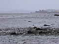
 A dirty tide on the Forth near Bo'ness - geograph.org.uk - 2588586.jpg 3648 × 2736; 4,74 MB
-
 Advancing tide east of Bo'ness on the Forth Estuary - geograph.org.uk - 2588599.jpg 3648 × 2736; 4,65 MB
-
 Blackness Bay - geograph.org.uk - 2622323.jpg 640 × 480; 239 KB
-
 Brightons Parish Church, Brightons, FK2.jpg 3024 × 4032; 2,98 MB
-
 Coat of Arms of Falkirk.svg 432 × 679; 278 KB
-

-
 FalkirkCouncilStructureMay2022.svg 360 × 185; 3 KB
-
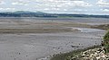
 Forth Mudflats - geograph.org.uk - 3902126.jpg 640 × 421; 378 KB
-
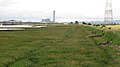
 Grangemouth dock - geograph.org.uk - 2213648.jpg 3072 × 2304; 1,11 MB
-
 Grangemouth Oil Refinery from Kinneil - geograph.org.uk - 2342216.jpg 1317 × 640; 158 KB
-
 Grangemouth Road Bridge - geograph.org.uk - 2848030.jpg 3264 × 2448; 4,04 MB
-
 Litter - geograph.org.uk - 3902744.jpg 562 × 640; 703 KB
-
 Looking east along the Forth Estuary - geograph.org.uk - 2588588.jpg 3648 × 2736; 4,69 MB
-
 Mouth of River Avon at Kinneil Kerse - geograph.org.uk - 2621981.jpg 3648 × 2050; 2,27 MB
-
 Mouth of the Avon - geograph.org.uk - 3287697.jpg 640 × 359; 56 KB
-
 Mouth of the Avon - geograph.org.uk - 3287703.jpg 640 × 359; 68 KB
-
 Mud near Blackness - geograph.org.uk - 3479271.jpg 640 × 478; 377 KB
-
 Mudflats - geograph.org.uk - 3902123.jpg 640 × 407; 378 KB
-
 Mudflats, Kinneil Kerse - geograph.org.uk - 3204774.jpg 1024 × 768; 134 KB
-
 Narrow Boats on the Union Canal, Falkirk.jpg 3310 × 3111; 1,9 MB
-
 Oyster Shells - geograph.org.uk - 3902693.jpg 640 × 427; 506 KB
-
 Oysters at Carras Gate - geograph.org.uk - 3873156.jpg 3264 × 2448; 5,42 MB
-
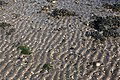
 Ripples in the Sand - geograph.org.uk - 3902689.jpg 640 × 421; 427 KB
-
 River Forth - geograph.org.uk - 1965007.jpg 640 × 359; 66 KB
-
 Salt marsh, Airth - geograph.org.uk - 1965012.jpg 640 × 359; 60 KB
-
 Sculpted by the Sea - geograph.org.uk - 3902709.jpg 640 × 416; 385 KB
-
 Shore Woods from Carras Gate - geograph.org.uk - 3873147.jpg 3264 × 2448; 5,34 MB
-
 The Bo'ness to Blackness coastal path - geograph.org.uk - 2418150.jpg 640 × 480; 102 KB
-
 The Bridges from Carras Gate - geograph.org.uk - 3873143.jpg 3264 × 2448; 2,87 MB
-
 The River Avon - geograph.org.uk - 5437412.jpg 640 × 480; 36 KB
-
 The River Avon at Grangemouth Road - geograph.org.uk - 2848023.jpg 3264 × 2448; 3,62 MB
-
 Tidal Ripples - geograph.org.uk - 3902696.jpg 640 × 427; 520 KB


