Category:Farnhill
Jump to navigation
Jump to search
village and civil parish in North Yorkshire, UK  | |||||
| Upload media | |||||
| Instance of | |||||
|---|---|---|---|---|---|
| Location | Craven, North Yorkshire, Yorkshire and the Humber, England | ||||
| Population |
| ||||
 | |||||
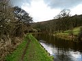
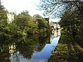
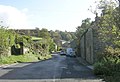
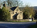
English: Farnhill is a village and civil parish in the Craven district of North Yorkshire, England. It is situated near Sutton-in-Craven and about south-east of Skipton. Farnhill is also across the canal from Kildwick and there is a church in Kildwick. There is a primary school next to the church and Farnhill backs up on to the moors. There are around 200 people living in Farnhill.
Subcategories
This category has the following 3 subcategories, out of 3 total.
F
- Farnhill Methodist Church (7 F)
S
Media in category "Farnhill"
The following 156 files are in this category, out of 156 total.
-
 A bend in the River Aire - geograph.org.uk - 3806430.jpg 640 × 503; 63 KB
-
 A629 - geograph.org.uk - 4677705.jpg 640 × 426; 56 KB
-
 A629 Skipton Road at Farnhill - geograph.org.uk - 5333880.jpg 800 × 600; 128 KB
-
 A629 Skipton Road at Farnhill - geograph.org.uk - 5416272.jpg 640 × 481; 57 KB
-
 A629 Skipton Road at Kildwick - geograph.org.uk - 5416264.jpg 640 × 481; 53 KB
-
 A629 Skipton Road in Airedale - geograph.org.uk - 5073988.jpg 800 × 583; 119 KB
-
 A629, Keighley Rd - geograph.org.uk - 4669580.jpg 640 × 403; 42 KB
-
 Across the canal at Farnhill - geograph.org.uk - 1315784.jpg 480 × 640; 80 KB
-
 Aire Valley - geograph.org.uk - 42863.jpg 640 × 480; 63 KB
-
 Approaching Farnhill Wood - geograph.org.uk - 682161.jpg 640 × 480; 95 KB
-
 Arbour Top - Grange Road, Farnhill - geograph.org.uk - 1016735.jpg 640 × 480; 355 KB
-
 Arch bridge 186 on the Leeds and Liverpool canal - geograph.org.uk - 2564439.jpg 1,024 × 768; 116 KB
-
 Back Mary Street, Farnhill - geograph.org.uk - 1261255.jpg 640 × 430; 78 KB
-
 Bainbridge Wharf, Farnhill - geograph.org.uk - 2104572.jpg 1,024 × 768; 188 KB
-
 Barn at Farnhill - geograph.org.uk - 292006.jpg 640 × 391; 102 KB
-
 Benchmark on Farnhill Bridge - geograph.org.uk - 6060485.jpg 1,024 × 683; 298 KB
-

-
 Benchmarks on Farnhill Bridge - geograph.org.uk - 3018366.jpg 2,048 × 1,536; 545 KB
-
 Bridge 183A Farnhill Bridge - geograph.org.uk - 2122648.jpg 640 × 480; 53 KB
-
 Bridge 184 Milking Hill Swing Bridge - geograph.org.uk - 2122669.jpg 640 × 480; 139 KB
-
 Bridge 184 Milking Hill Swing Bridge - geograph.org.uk - 2122672.jpg 640 × 480; 125 KB
-
 Buildings at High Farnhill (1) - geograph.org.uk - 6137445.jpg 1,024 × 768; 188 KB
-
 Buildings at High Farnhill (2) - geograph.org.uk - 6137447.jpg 1,024 × 768; 158 KB
-
 Buildings at White House Farm - geograph.org.uk - 6787786.jpg 1,024 × 576; 150 KB
-
 By the canal in Kildwick - geograph.org.uk - 2122687.jpg 640 × 480; 61 KB
-
 Canal at Farnhill Wood - geograph.org.uk - 3018631.jpg 2,048 × 1,536; 511 KB
-
 Canal at Kildwick - geograph.org.uk - 681549.jpg 640 × 480; 101 KB
-
 Canal at Redman Bridge - geograph.org.uk - 3018648.jpg 2,048 × 1,536; 674 KB
-
 Canal boats at Farnhill Bridge - geograph.org.uk - 6137429.jpg 1,024 × 768; 163 KB
-

-
 Canal Bridge 185 - Main Street, Farnhill - geograph.org.uk - 1016678.jpg 640 × 480; 291 KB
-
 Canal in Autumn - geograph.org.uk - 77252.jpg 640 × 480; 203 KB
-
 Cononley Lane - geograph.org.uk - 1016213.jpg 640 × 420; 186 KB
-
 Cottages and Shop,late c17, Newby Road, Farnhill - geograph.org.uk - 2104548.jpg 1,024 × 768; 206 KB
-
 Cowling Swing Bridge - geograph.org.uk - 643332.jpg 640 × 480; 76 KB
-
 Cows alongside the Leeds Liverpool canal - geograph.org.uk - 2565624.jpg 1,024 × 768; 122 KB
-
 Cross atop Farnhill Jubilee Tower - geograph.org.uk - 6137471.jpg 1,024 × 768; 62 KB
-
 Cruising near Kildwick - geograph.org.uk - 2122664.jpg 640 × 480; 98 KB
-
 Entering Kildwick - geograph.org.uk - 842316.jpg 640 × 427; 86 KB
-

-
 Farnhill Aqueduct (3795413519).jpg 1,818 × 1,981; 3.2 MB
-
 Farnhill Barn - geograph.org.uk - 1606519.jpg 640 × 430; 75 KB
-
 Farnhill Bridge - geograph.org.uk - 3024249.jpg 3,264 × 2,448; 1.5 MB
-
 Farnhill Bridge.jpg 640 × 480; 57 KB
-
 Farnhill Hall Farm - geograph.org.uk - 847823.jpg 640 × 480; 88 KB
-
 Farnhill Jubilee Tower - geograph.org.uk - 6137469.jpg 1,024 × 768; 130 KB
-
 Farnhill Play Area - Main Street - geograph.org.uk - 1016726.jpg 640 × 480; 306 KB
-

-
 Farnhill Wood - geograph.org.uk - 2783538.jpg 1,600 × 1,200; 356 KB
-
 Farnhill Wood - geograph.org.uk - 4605051.jpg 2,560 × 1,920; 2.22 MB
-
 Farnhill Wood - geograph.org.uk - 6137529.jpg 1,024 × 768; 155 KB
-
 Farnhill Woods - geograph.org.uk - 3023948.jpg 2,448 × 3,264; 2.61 MB
-
 Farnhill Woods - geograph.org.uk - 682172.jpg 640 × 480; 123 KB
-

-
 Farnhill, Leeds and Liverpool Canal - geograph.org.uk - 1414534.jpg 640 × 479; 66 KB
-
 Fields at Cross Hills - geograph.org.uk - 2108463.jpg 800 × 532; 57 KB
-
 Fields by the canal - geograph.org.uk - 2122639.jpg 640 × 480; 50 KB
-
 Footpath - Grange Road, Farnhill - geograph.org.uk - 1016733.jpg 640 × 480; 357 KB
-
 Footpath - Main Street - Farnhill - geograph.org.uk - 1016658.jpg 480 × 640; 279 KB
-
 Footpath - Main Street, Farnhill - geograph.org.uk - 1016662.jpg 480 × 640; 348 KB
-

-
 Hardacre Cote - geograph.org.uk - 6137452.jpg 1,024 × 768; 263 KB
-
 Hardacre Quarry - geograph.org.uk - 6137459.jpg 1,024 × 768; 280 KB
-
 High Croft Way - Starkey Lane - geograph.org.uk - 1016762.jpg 640 × 411; 182 KB
-
 Housing in Kildwick - geograph.org.uk - 2122685.jpg 640 × 480; 82 KB
-
 Jubilee Tower, Farnhill Moor - geograph.org.uk - 6475283.jpg 847 × 1,280; 481 KB
-

-

-
 Keighley Rd - geograph.org.uk - 4669581.jpg 640 × 342; 60 KB
-

-
 Kildwick Canal Bridge - geograph.org.uk - 42867.jpg 640 × 480; 78 KB
-
 Kildwick Farnhill Institute - geograph.org.uk - 880745.jpg 640 × 480; 194 KB
-
 Kildwick Reflections - geograph.org.uk - 77246.jpg 640 × 480; 163 KB
-
 Lang Kirk Close - Starkey Lane - geograph.org.uk - 1016793.jpg 640 × 427; 211 KB
-
 Large and small cairns - geograph.org.uk - 6137477.jpg 1,024 × 768; 262 KB
-
 Leeds and Liverpool Canal - Flickr - Tim Green aka atoach.jpg 4,608 × 2,592; 10.23 MB
-

-

-

-
 Leeds and Liverpool Canal at Farnhill - geograph.org.uk - 5074435.jpg 800 × 643; 128 KB
-

-

-

-
 Leeds Liverpool Canal - geograph.org.uk - 2122652.jpg 640 × 480; 115 KB
-
 Leeds Liverpool Canal in the trees - geograph.org.uk - 2122658.jpg 640 × 480; 120 KB
-
 Long barn at Farnhill Hall Farm - geograph.org.uk - 6137435.jpg 1,024 × 768; 149 KB
-
 Main Street - Farnhill - geograph.org.uk - 1016661.jpg 640 × 436; 215 KB
-
 Main Street - Farnhill - geograph.org.uk - 1016671.jpg 640 × 480; 243 KB
-
 Main Street, Farnhill - geograph.org.uk - 2104568.jpg 1,024 × 768; 178 KB
-
 Milking Hall Swing Bridge - geograph.org.uk - 4605036.jpg 2,518 × 1,862; 2.25 MB
-

-
 Old House - geograph.org.uk - 81048.jpg 640 × 480; 139 KB
-
 Old Milestone by Main Street, Farnhill (geograph 6045217).jpg 480 × 640; 452 KB
-
 Ordnance Survey Flush Bracket 985 - geograph.org.uk - 2834417.jpg 4,000 × 3,000; 4.04 MB
-
 Outhouses - geograph.org.uk - 880753.jpg 640 × 480; 188 KB
-
 Overlooking Farnhill Main Street - geograph.org.uk - 1315730.jpg 592 × 640; 120 KB
-
 Path to Crag Top - geograph.org.uk - 6137454.jpg 1,024 × 768; 241 KB
-
 Pits in the woods on Farnhill Moor - geograph.org.uk - 6137484.jpg 1,024 × 768; 434 KB
-
 Redman Swing Bridge - geograph.org.uk - 4605016.jpg 2,560 × 1,920; 1.93 MB
-
 Redman Swing Bridge No 185 - geograph.org.uk - 5339640.jpg 800 × 551; 111 KB
-
 Road junction below Farnhill - geograph.org.uk - 6137424.jpg 1,024 × 768; 94 KB
-
 Road sign, Skipton Rd - geograph.org.uk - 4677714.jpg 640 × 426; 40 KB
-

-
 Squeezing past the bridge - geograph.org.uk - 2122677.jpg 640 × 480; 111 KB
-
 Starkey Lane - geograph.org.uk - 1016784.jpg 640 × 480; 292 KB
-
 Starkey Lane, Farnhill - geograph.org.uk - 2104557.jpg 768 × 1,024; 145 KB
-
 Start of a footpath above High Farnhill - geograph.org.uk - 6137443.jpg 1,024 × 768; 340 KB
-
 Stonegate Cottage - Grange Road - geograph.org.uk - 1016761.jpg 640 × 480; 272 KB
-
 The Leeds and Liverpool Canal at Farnhill - geograph.org.uk - 3241034.jpg 1,024 × 768; 140 KB
-
 The Leeds and Liverpool Canal at Farnhill Bridge - geograph.org.uk - 3241029.jpg 1,024 × 768; 128 KB
-
 The Mullions, Newby Road, Farnhill - geograph.org.uk - 2104536.jpg 1,024 × 768; 142 KB
-

-
 Track to the east - geograph.org.uk - 6137478.jpg 1,024 × 768; 203 KB
-
 Track to the north - geograph.org.uk - 6137480.jpg 1,024 × 768; 266 KB
-
 Train passing Glusburn - geograph.org.uk - 6137416.jpg 1,024 × 768; 97 KB
-
 Tunnel under Canal at Kildwick - geograph.org.uk - 682127.jpg 640 × 480; 110 KB
-
 View across Skipton Road, Cononley - geograph.org.uk - 2104587.jpg 1,024 × 768; 121 KB
-
 View eastwards from Farnhill Jubilee Tower - geograph.org.uk - 6137473.jpg 1,024 × 768; 174 KB
-
 View from Parsons Bridge, Kildwick - geograph.org.uk - 2104507.jpg 1,024 × 768; 219 KB
-
 View from the canal - geograph.org.uk - 2122642.jpg 640 × 480; 57 KB
-
 View north along Airedale - geograph.org.uk - 5333910.jpg 800 × 521; 85 KB
-

-
 View over Farnhill - geograph.org.uk - 1315750.jpg 519 × 640; 133 KB
-
 View towards Cononley in Airedale - geograph.org.uk - 5333947.jpg 800 × 637; 109 KB
-
 Village Institute - geograph.org.uk - 847844.jpg 640 × 480; 97 KB
-

-

-

-

-

-

-

-

-

-

-

-

-

-

-

-

-
 Walled Garden at Farnhill Hall (geograph 7350874).jpg 4,000 × 3,000; 1.67 MB
-
 Which way now^ - geograph.org.uk - 2122681.jpg 480 × 640; 117 KB
-

-

-
 Young wood near Hardacre Quarry - geograph.org.uk - 6137463.jpg 1,024 × 768; 253 KB
-
 Airedale House Farm, Silsden - geograph.org.uk - 538361.jpg 640 × 428; 115 KB
-
 Approaching Grange Bridge - geograph.org.uk - 681548.jpg 640 × 480; 84 KB
-
 Brindley Road - Ingsway - geograph.org.uk - 1513742.jpg 640 × 429; 64 KB
-
 Farm near Cowling Bridge - geograph.org.uk - 681545.jpg 640 × 480; 94 KB
-
 Farnhill - geograph.org.uk - 42865.jpg 640 × 480; 94 KB
-
 Lane House Bridge - geograph.org.uk - 681546.jpg 640 × 480; 93 KB
-
 Leeds and Liverpool Canal at Kildwick. - geograph.org.uk - 201377.jpg 640 × 480; 106 KB
-
 Leeds and Liverpool Canal at Kildwick. - geograph.org.uk - 201380.jpg 640 × 480; 107 KB
-

-
 Little Slack, Kildwick - geograph.org.uk - 81055.jpg 640 × 480; 106 KB


_-_geograph.org.uk_-_6137445.jpg)
_-_geograph.org.uk_-_6137447.jpg)


.jpg)


_-_geograph.org.uk_-_5416022.jpg)


.jpg)


.jpg)

_-_geograph.org.uk_-_6789021.jpg)


