Category:Farsley
Ir a la navegación
Ir a la búsqueda
town in Leeds, West Yorkshire, United Kingdom  | |||||
| Cargar multimedia | |||||
| Instancia de | |||||
|---|---|---|---|---|---|
| Ubicación | Ciudad de Leeds, Yorkshire del Oeste, Yorkshire y Humber, Inglaterra | ||||
 | |||||
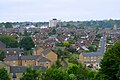
Farsley is a town in the City of Leeds, a metropolitan borough in West Yorkshire, England, 6 miles (9 km) to the west of Leeds city centre, and 4 miles (6 km) east of Bradford. Farsley could be considered a commuter town as it is situated between the two cities. It was part of the former Municipal Borough of Pudsey from 1937 until 1974 and is now part of the City of Leeds ward Calverley and Farsley. It is mentioned in the 1086 Domesday Book as Fersellei also as Ferselleia. During the industrial revolution Farsley was a centre for wool processing as there were a number of mills in the area.
Subcategorías
Esta categoría contiene las siguientes 13 subcategorías, de un total de 13.
B
- Bagley Beck (5 F)
- Business in Farsley (2 F)
F
M
- Mulberry Manor, Farsley (19 F)
N
- Night in Farsley (10 F)
S
- Stanningley Bypass (16 F)
W
- Westroyd Park, Farsley (32 F)
Archivos multimedia en la categoría «Farsley»
Los siguientes 27 archivos pertenecen a esta categoría, de un total de 27.
-
 A647 (37358774896).jpg 6000 × 4000; 10,82 MB
-
 Balloon in a hedge - geograph.org.uk - 4771483.jpg 1024 × 768; 429 kB
-
 Beech leaves, Leeds Country Way - geograph.org.uk - 3268790.jpg 640 × 480; 149 kB
-
-

-
 Farsley Cricket Club Pavilion - geograph.org.uk - 4082392.jpg 4320 × 3240; 2,25 MB
-
 Farsley Welcome 1 September 2017.jpg 3264 × 2448; 4,81 MB
-
 Field and carriage path to Greatwood Farm - geograph.org.uk - 5011707.jpg 1024 × 768; 176 kB
-

-
 Grazing Land at Thornbury - geograph.org.uk - 321405.jpg 640 × 480; 98 kB
-
 Greatwood Farm near Farsley - geograph.org.uk - 5011703.jpg 1024 × 756; 242 kB
-
 Green belt near Priesthorpe - geograph.org.uk - 43881.jpg 640 × 480; 116 kB
-

-
 Open space in Farsley - geograph.org.uk - 3939551.jpg 3771 × 2514; 2,81 MB
-
 Owlcoates Service Reservoir - geograph.org.uk - 373840.jpg 633 × 344; 25 kB
-

-
 Railway Line from New Pudsey to Bradford - geograph.org.uk - 1362881.jpg 640 × 480; 301 kB
-
 The Haven - Farmstead Road - geograph.org.uk - 1412179.jpg 640 × 480; 260 kB
-

-
 View of Farsley, Leeds - geograph.org.uk - 4986167.jpg 1280 × 853; 632 kB
-
 View of Farsley, Leeds - geograph.org.uk - 4986169.jpg 1280 × 853; 674 kB
-
 View of Farsley, Leeds - geograph.org.uk - 4986171.jpg 1280 × 853; 638 kB
-
 View of Farsley, Leeds - geograph.org.uk - 4986172.jpg 1280 × 853; 587 kB
-
 Wadlands Hall Farm near Farsley - geograph.org.uk - 5011708.jpg 640 × 480; 59 kB
-
 Water Lane, Farsley, Leeds - geograph.org.uk - 4923718.jpg 1280 × 853; 613 kB
-
 Charlton Court - off Peckover Drive - geograph.org.uk - 383021.jpg 636 × 339; 50 kB
-

.jpg)


