Category:Folksworth
Jump to navigation
Jump to search
English: Folksworth is a small village just off the A1(M), about 5 miles South West of Peterborough, England. For years it remained relatively isolated, with only a village hall, a church (St Helens) and a pub (The Fox). However, in recent years it has expanded with two new housing developments. Folksworth has a new cricket wicket installed and has four goal posts on the playing ground; there are plans to get more in the field.
Nederlands: Folksworth is een dorp (village en civil parish) in het Engelse graafschap Cambridgeshire. Het dorp ligt in het district Huntingdonshire en telt 906 inwoners.
village in Cambridgeshire, England, UK  | |||||
| Upload media | |||||
| Instance of | |||||
|---|---|---|---|---|---|
| Location | Folksworth and Washingley, Huntingdonshire, Cambridgeshire, East of England, England | ||||
 | |||||
Subcategories
This category has the following 3 subcategories, out of 3 total.
Media in category "Folksworth"
The following 27 files are in this category, out of 27 total.
-
 Dumpy postbox, Folksworth - geograph.org.uk - 1162712.jpg 640 × 480; 72 KB
-
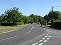
 Entering Folksworth on Morborne Road - geograph.org.uk - 6265590.jpg 4,608 × 3,456; 3.94 MB
-
 Entrance To Folksworth - geograph.org.uk - 1334833.jpg 640 × 480; 180 KB
-
 Farm road to Venetian lodge - geograph.org.uk - 1162745.jpg 640 × 480; 61 KB
-

-
 Folksworth between the Oak trees - geograph.org.uk - 1162680.jpg 640 × 480; 92 KB
-
 Folksworth road - geograph.org.uk - 1162708.jpg 640 × 480; 83 KB
-
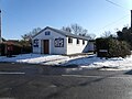 Folksworth village hall.jpg 640 × 480; 73 KB
-
 Folksworth Village Name sign on Morborne Road - geograph.org.uk - 6265593.jpg 3,817 × 2,863; 4.64 MB
-
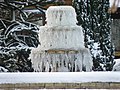 Ice fountain, Folksworth - geograph.org.uk - 1627131.jpg 640 × 480; 102 KB
-
 Lutton Junction, Folksworth - geograph.org.uk - 1334838.jpg 640 × 480; 191 KB
-
 Morborne Road, Folksworth - geograph.org.uk - 6265608.jpg 3,746 × 2,809; 3.21 MB
-
 Sunken wall at Folksworth church - geograph.org.uk - 1162717.jpg 640 × 480; 95 KB
-
 The Road To Norman Cross - geograph.org.uk - 1334832.jpg 640 × 480; 150 KB
-
 The school bus at the north end of Folksworth - geograph.org.uk - 5333706.jpg 2,000 × 1,344; 791 KB
-
 Village approach, Folksworth - geograph.org.uk - 1162684.jpg 640 × 480; 98 KB
-
 Village hall sign. Folksworth - geograph.org.uk - 1162703.jpg 640 × 480; 34 KB
-
 Village pond, Folksworth - geograph.org.uk - 1162690.jpg 640 × 480; 102 KB
-
 A place where asses meet, Denton - geograph.org.uk - 1162366.jpg 640 × 480; 130 KB
-
 Bridleway near Morborne - geograph.org.uk - 394007.jpg 640 × 428; 157 KB
-
 Bridleway north of North Wood, Washingley - geograph.org.uk - 394028.jpg 640 × 428; 131 KB
-
 Castle Grounds - geograph.org.uk - 779711.jpg 640 × 480; 88 KB
-
 Derelict Building - geograph.org.uk - 779827.jpg 640 × 480; 74 KB
-
 Farm Buildings - geograph.org.uk - 779853.jpg 640 × 480; 72 KB
-
 Farmland from the road - geograph.org.uk - 378592.jpg 640 × 480; 136 KB
-
 Pond near Folksworth - geograph.org.uk - 394030.jpg 428 × 640; 196 KB
-
 Reservoir above Stilton - geograph.org.uk - 471569.jpg 640 × 425; 79 KB


