Category:Former churches in West Yorkshire
Jump to navigation
Jump to search
Ceremonial counties of England: Bedfordshire · Berkshire · Buckinghamshire · Cambridgeshire · Cheshire · Cornwall · Cumbria · Derbyshire · Devon · Dorset · Durham · East Riding of Yorkshire · East Sussex · Essex · Gloucestershire · Greater London · Greater Manchester · Hampshire · Herefordshire · Hertfordshire · Kent · Lancashire · Leicestershire · Lincolnshire · Merseyside · Norfolk · North Yorkshire · Northamptonshire · Northumberland · Nottinghamshire · Oxfordshire · Rutland · Shropshire · Somerset · South Yorkshire · Staffordshire · Suffolk · Surrey · Tyne and Wear · Warwickshire · West Midlands · West Sussex · West Yorkshire · Wiltshire · Worcestershire
City-counties: Bristol · City of London
Former historic counties:
Other former counties:
City-counties: Bristol · City of London
Former historic counties:
Other former counties:
Wikimedia category | |||||
| Upload media | |||||
| Instance of | |||||
|---|---|---|---|---|---|
| |||||
Subcategories
This category has the following 16 subcategories, out of 16 total.
Media in category "Former churches in West Yorkshire"
The following 52 files are in this category, out of 52 total.
-
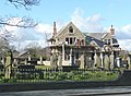
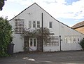
 All Saints Church - now a private residence - geograph.org.uk - 3728320.jpg 1,024 × 683; 169 KB
-
-
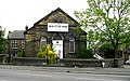
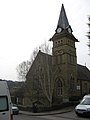
 Church for sale, Thornton - geograph.org.uk - 2474877.jpg 640 × 480; 95 KB
-
 Disused Church - Church Street, Paddock - geograph.org.uk - 921622.jpg 408 × 640; 240 KB
-
 Disused Church - Church Street, Paddock - geograph.org.uk - 921629.jpg 640 × 439; 288 KB
-
 Farnley Hill Methodist Church.jpg 1,024 × 768; 178 KB
-
-
 Former Church - geograph.org.uk - 1471222.jpg 640 × 480; 80 KB
-
 Former Church - Oldham Road, Ripponden - geograph.org.uk - 988087.jpg 640 × 521; 246 KB
-
 Former Church - St James Road - geograph.org.uk - 801230.jpg 640 × 468; 81 KB
-
 Former church on Huddersfield Road - geograph.org.uk - 1005478.jpg 480 × 640; 168 KB
-

-
 Former church on Mill Hey, Haworth - geograph.org.uk - 1416310.jpg 640 × 480; 91 KB
-
 Former church on Oldham Road - geograph.org.uk - 1336803.jpg 640 × 480; 73 KB
-
 Former church, Warley Town - geograph.org.uk - 1447372.jpg 375 × 500; 80 KB
-

-
 Former Emmanuel Church, Taylor Hill.jpg 640 × 456; 102 KB
-
 Former Hawksbridge Baptist Church.jpg 1,024 × 664; 152 KB
-
 Former Lockwood Methodist Chapel.jpg 640 × 480; 68 KB
-

-

-
 Former St Laurence church, Bolton Hall Road - geograph.org.uk - 5123513.jpg 1,024 × 768; 212 KB
-
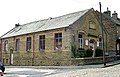
 Former Sunday School - Bakes Street - geograph.org.uk - 603476.jpg 640 × 480; 56 KB
-
 Former Town and Country Club, Leeds.jpg 2,736 × 3,648; 1.53 MB
-

-

-
 Hanover Square, Leeds - geograph.org.uk - 105117.jpg 640 × 480; 74 KB
-
 Highfield United Reformed Church (12529423514).jpg 2,395 × 2,994; 7.59 MB
-
-
-
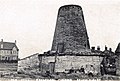 Kirkby Mill at South Kirkby, West Yorkshire, England.jpg 1,022 × 690; 686 KB
-
 Ladies Gym - Bradford Road - geograph.org.uk - 366707.jpg 636 × 439; 56 KB
-
 The Old Chapel - Hollis Place - geograph.org.uk - 558535.jpg 640 × 463; 49 KB
-
-
 Lockwood Community Centre, Mount Street - geograph.org.uk - 1822454.jpg 1,536 × 2,048; 652 KB
-

-
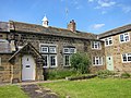
 Church House, Netherthong - geograph.org.uk - 1277752.jpg 640 × 480; 148 KB
-
 Old Schoolhouse, Wike 14 June 2022.jpg 3,648 × 2,736; 2.74 MB
-

-
 Rossefield Hall - Rossefield Road - geograph.org.uk - 516218.jpg 640 × 413; 53 KB
-

-

-

-
 St Barnabas Church Hall, Alwoodley 2012.jpg 2,592 × 1,944; 1.61 MB
-

-
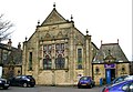
 St Paul's Church, Stanningley.jpg 1,024 × 768; 121 KB
-

-
 St Paul's Hall, Huddersfield.jpg 1,600 × 1,200; 361 KB
-
 University of Huddersfield - St Paul's Hall - geograph.org.uk - 3440766.jpg 1,600 × 1,200; 259 KB
-
 Wesleyan Church - Hick Lane - geograph.org.uk - 487203.jpg 640 × 539; 74 KB
-
 Westwood Christian Centre.jpg 800 × 600; 140 KB
-


.jpg)


