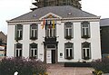
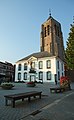
Category:Former town hall (Mol, Belgium)
Jump to navigation
Jump to search
| Object location | | View all coordinates using: OpenStreetMap |
|---|
|
This is a category about onroerend erfgoed number 52706
|
 | |||||
| Upload media | |||||
| Instance of | |||||
|---|---|---|---|---|---|
| Location | Mol, Arrondissement of Turnhout, Province of Antwerp, Flemish Region, Belgium | ||||
| Architectural style | |||||
| Heritage designation |
| ||||
| Inception |
| ||||
 | |||||
Media in category "Former town hall (Mol, Belgium)"
The following 7 files are in this category, out of 7 total.
-
 Mol - Sint-Pieter en Pauwelkerk.jpg 1,536 × 2,048; 1.09 MB
-
 Mol Graaf de Broquevillestraat 2A - 139611 - onroerenderfgoed.jpg 470 × 591; 108 KB
-
 Mol Markt 1A - 276570 - onroerenderfgoed.jpg 999 × 1,440; 358 KB
-
 Mol Markt 1A - 276571 - onroerenderfgoed.jpg 1,440 × 996; 431 KB
-
 Mol, stadhuis 2009-08-31 12.43.JPG 3,456 × 2,592; 1.17 MB
-
 Oud gemeentehuis en Sint-Pieter en Pauwelkerk Mol-Centrum.jpg 2,856 × 4,644; 4.75 MB
-
 Oud Gemeentehuis Mol Centrum.jpg 1,365 × 1,263; 254 KB


