Category:Fort Tryon Park
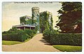
Fort Tryon Park, located in Upper Manhattan, New York City, was created when philanthropist John D. Rockefeller, Jr. began to buy up the county estates in the area where the Battle of Washington Heights was fought in the Revolutionary War, in order to create a park. He engaged Frederick Law Olmsted, Jr. of the Olmsted Brothers firm to design the park (James W. Dawson created the planting plan), and gave it to the city in 1931; the park was completed in 1935. Rockefeller also gave to the Metropolitan Museum of Art a collection of medieval art, and the museum built The Cloisters in the park to house it, completing it in 1939. The park extends from West 190th Street to Dyckman Street and from Broadway to Riverside Drive/West Side Highway. The main entrance to the part is at Margaret Corbin Circle, at the intersection of Fort Washington Avenue and Cabrini Boulevard. The park was added to the NRHP in 1978 and was designated a NYC Scenic Landmark in 1983. (Sources: Guide to NYC Landmarks (4th ed.) and AIA Guide to NYC (5th ed.))
urban park  | |||||
| 上传媒体 | |||||
| 隶属于 | |||||
|---|---|---|---|---|---|
| 位置 | 曼哈頓, 纽约, 纽约州, 美國 | ||||
| 建築師 | |||||
| 運營者 | |||||
| 文化遗产保护状况 |
| ||||
| 成立或建立時間 |
| ||||
| 面积 |
| ||||
| 官方网站 | |||||
 | |||||
子分类
本分类有以下13个子分类,共有13个子分类。
A
B
C
- Margaret Corbin Drive Arch (6 F)
H
- Heather Garden (30 F)
J
- Jacob K. Javits Playground (6 F)
L
M
S
T
- Trees of Fort Tryon Park (63 F)
V
W
- Walking paths in Fort Tryon Park (87 F)
分类“Fort Tryon Park”中的媒体文件
以下18个文件属于本分类,共18个文件。
-

-
 2013 Cabrini Boulevard in the snow 1.jpg 3,264 × 2,448;2.55 MB
-
 2013 Cabrini Boulevard in the snow 2.jpg 3,264 × 2,448;2.22 MB
-
 2015 Fort Tryon Park sunset yoga.jpg 4,608 × 3,456;4.84 MB
-
 2017 Fort Tryon stairs that lead nowhere.jpg 3,917 × 3,152;3.74 MB
-
 Blacksmith at Battle of Ft Washington jeh.jpg 3,079 × 2,309;1.9 MB
-
 Fort Tryon Linden Terrace.jpg 2,560 × 1,920;1.52 MB
-
 Fort Tryon Park by Matthew Bisanz.JPG 3,648 × 2,736;3.34 MB
-
 Fort Tryon Park Entrance.JPG 4,390 × 2,927;7.83 MB
-
 Fort Tryon, New York, NY, USA - panoramio (6).jpg 2,592 × 1,936;1.56 MB
-
 FortTryon jb.jpg 486 × 648;187 KB
-
 FtTryonPk.JPG 1,600 × 538;110 KB
-
 Libbey-Castle-Woodcliff Castle.jpg 760 × 487;64 KB
-
 Libby Castle, Ft. Washington Heights LCCN2014703716.tif 5,791 × 4,192;23.16 MB
-
 Minstrel at Renaissance Fair, Fort Tryon Park.jpg 1,024 × 724;569 KB
-
 Musket fire at Battle of Ft Washington jeh.jpg 4,605 × 3,069;6.25 MB
-
 New York City (8896836460).jpg 2,160 × 2,880;1.88 MB
-
 Parkies at Ft Tryon Pk for Battle of Ft Washington jeh.jpg 3,325 × 2,216;2.99 MB
_-_New_York_County_-_Manhattan_-_ED_31-1_to_2440_-_NARA_-_24267411_(page_1).jpg)


.jpg)


.jpg)

- Washington Heights, Manhattan
- Hudson Heights, Manhattan
- Inwood, Manhattan
- NYC Parks in Manhattan
- Frederick Law Olmsted, Jr.
- Olmsted Brothers
- James W. Dawson
- John D. Rockefeller, Jr.
- New York City landmarks in Manhattan above 110th Street
- 1935 establishments in the United States
- National Register of Historic Places in Manhattan above 110th Street