Category:Freeport, New York
둘러보기로 이동
검색으로 이동
village in Nassau County, New York, United States   | |||||
| 미디어 올리기 | |||||
| 다음 종류에 속함 | |||||
|---|---|---|---|---|---|
| 위치 | 나소군 (뉴욕주), 뉴욕주, 미국 | ||||
| 만들어진 날 |
| ||||
| 인구수 |
| ||||
| 면적 |
| ||||
| 해발고도 |
| ||||
 | |||||
"Freeport, New York" 분류에 속하는 미디어
다음은 이 분류에 속하는 파일 81개 가운데 81개입니다.
-

-
 1969 n88.jpg 1,920 × 1,080; 581 KB
-
 Abandoned RR Xing @ Penn Avenue, north of LIRR Babylon Branch Bridge; Freeport.jpg 3,648 × 2,736; 2.03 MB
-
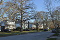
 Aerial view of a neighborhood in Freeport, New York, August 2019.JPG 5,184 × 3,888; 3.91 MB
-
 Aero view of Freeport, Long Island, N.Y. 1909.jpeg 11,312 × 6,752; 25.36 MB
-
 Aero view of Freeport, Long Island, N.Y. 1909.tif 11,312 × 6,752; 172.2 MB
-
 Baldwin Bay pano 01.jpg 14,880 × 1,776; 9.94 MB
-

-
 First school in Freeport, NY plaque.jpg 3,504 × 2,336; 3.97 MB
-
 Freeport (NY) Municipal Light and Power; Substation.jpg 3,648 × 2,736; 2.06 MB
-
 Freeport NY-1873.jpg 798 × 1,282; 514 KB
-
 Freeport snow from Warfside - panoramio.jpg 3,648 × 2,736; 3.26 MB
-
 Freeport, Long Island, NY, Memorial Day Parade 2010.jpg 5,184 × 3,456; 5.93 MB
-
 Freeport, Merrick, Belimore, Wantagh, Massapequa, Etc. NYPL1633779.tiff 7,230 × 4,468; 92.42 MB
-
 Freeport, NY - 48 S. Long Beach.jpg 4,288 × 2,848; 6.63 MB
-
 Freeport, NY - 75 W Sunrise Highway.jpg 4,288 × 2,848; 5.83 MB
-
 Freeport, NY - 9-11 Memorial.jpg 4,288 × 2,848; 5.69 MB
-
 Freeport, NY - Beach at Cow Meadow Park.jpg 4,288 × 2,848; 6.24 MB
-
 Freeport, NY - Beverley Parkway.jpg 4,288 × 2,848; 6.41 MB
-
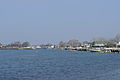
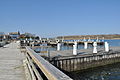 Freeport, NY - Cow Meadow Park Marina 01.jpg 4,288 × 2,848; 5.01 MB
-
 Freeport, NY - Cow Meadow Park Marina pano 01.jpg 12,868 × 1,718; 8.72 MB
-
 Freeport, NY - Cow Meadow Park.jpg 4,288 × 2,848; 6.91 MB
-
 Freeport, NY - D'Brickashaw Ferguson Way sign.jpg 4,288 × 2,848; 3.44 MB
-
 Freeport, NY - Randall Bay 01.jpg 4,288 × 2,848; 4.6 MB
-
 Freeport, NY - Randall Bay 02.jpg 4,288 × 2,848; 4.96 MB
-
 Freeport, NY - rear of S Main St buildings from Church St.jpg 4,288 × 2,848; 5.56 MB
-
 Freeport, NY - S Main at Sunrise Highway 01.jpg 4,288 × 2,848; 5.56 MB
-
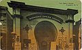 Freeport, NY - Sigmond Opera House c. 1913.jpg 1,652 × 1,018; 406 KB
-
 Freeport, NY - Waterfront Park 01.jpg 4,288 × 2,848; 5.26 MB
-
 Freeport, NY - Waterfront Park erosion 01.jpg 4,288 × 2,848; 6.17 MB
-
 Freeport, NY - yard shrine.jpg 2,848 × 4,288; 6.74 MB
-
 Freeport, NY -S Main St 01.jpg 4,288 × 2,848; 5.19 MB
-
 Freeport, NY -S Main St 02.jpg 4,288 × 2,848; 4.98 MB
-
 Freeport, NY -S Main St 03.jpg 4,288 × 2,848; 5.01 MB
-
 Freeport, NY -S Main St 04.jpg 4,288 × 2,848; 4.9 MB
-
 Freeport, NY -S Main St 05.jpg 4,288 × 2,848; 5.18 MB
-
 Freeport, NY -S Main St 06.jpg 4,288 × 2,848; 5.18 MB
-
 Freeport, NY -S Main St 07.jpg 4,288 × 2,848; 4.48 MB
-
 Freeport, NY 1921 map.jpg 1,666 × 1,783; 710 KB
-
 Freeport, NY 9-11 memorial in park by Municipal Building.jpg 4,288 × 2,848; 6.44 MB
-
 Freeport, NY electric manhole 01.jpg 4,288 × 2,848; 6.44 MB
-
 Freeport, NY firefighters memorial in park by Municipal Building 01.jpg 4,288 × 2,848; 6.39 MB
-
 Freeport, NY firefighters memorial in park by Municipal Building 02.jpg 4,288 × 2,848; 6.5 MB
-
 Freeport, NY police cars 01.jpg 4,288 × 2,848; 6.41 MB
-
 Freeport, NY police cars 02.jpg 4,288 × 2,848; 6.92 MB
-
 Freeport, NY sewer manhole 01.jpg 4,288 × 2,848; 6.44 MB
-
 Freeport, NY WW1 trench mortar.jpg 4,288 × 2,848; 6.3 MB
-
 Freeport, NY, Main Street 1971 - 01.jpg 1,864 × 1,846; 797 KB
-
 Freeport, NY, Main Street 1971 - 02.jpg 1,856 × 1,850; 948 KB
-
 Freeport-ny-map.gif 575 × 425; 76 KB
-
 Historical Markers in NYS on George Washington tour april 1790.jpg 4,032 × 3,024; 1.44 MB
-
 Hughes & Bailey 1909 map of Freeport, NY.jpg 2,828 × 1,688; 1.22 MB
-
 Looking across Baldwin Bay to Baldwin, NY banner.jpg 4,288 × 613; 1.25 MB
-
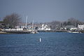
 Looking across Baldwin Bay to Baldwin, NY.jpg 4,288 × 2,848; 4.45 MB
-
 Meadowbrook Parkway from Freeport, NY Waterfront Park 01-equalized.jpg 4,288 × 2,848; 7.74 MB
-
 Meadowbrook Parkway from Freeport, NY Waterfront Park 01-rebalanced.jpg 4,288 × 2,848; 5.62 MB
-
 Meadowbrook Parkway from Freeport, NY Waterfront Park 01.jpg 4,288 × 2,848; 3.54 MB
-
 Merrick Road, Freeport, Long Island, N.Y., 1909.jpeg 1,026 × 638; 273 KB
-
 Methodist Episcopal Church, Freeport, Long Island, N.Y. 1909.jpeg 929 × 640; 249 KB
-

-
 NY Long Island Freeport-Merrick and East Bay IMG 1953.JPG 5,184 × 3,064; 8.45 MB
-
 NY Long Island Freeport-Merrick and East Bay IMG 1954.JPG 5,109 × 2,950; 8.14 MB
-
 NY Long Island Freeport-Merrick IMG 1955.JPG 5,184 × 3,456; 9.17 MB
-
 Parrot Rifle - Freeport NY 20211102 180223377.jpg 3,453 × 2,862; 2.99 MB
-
 Parrot Rifle 20211102 175947795.jpg 3,851 × 2,375; 3.17 MB
-
 Parrot Rifle 20211102 180000224.MP.jpg 4,032 × 3,024; 4.39 MB
-
 Parrot Rifle and Historic Marker 20211102 180140720.jpg 3,395 × 2,859; 2.03 MB
-
 Parrot Rifle Historic Marker 20211102 180105118.MP.jpg 4,032 × 3,024; 2.27 MB
-
 Parrot Rifle side panel 20211102 180018480.jpg 4,032 × 3,024; 4.27 MB
-
 Pocket Track on LIRR Babylon Branch before Freeport Station.jpg 4,896 × 3,264; 8.48 MB
-
 PRR Positional Signal Gantry on LIRR Babylon branch before Freeport Station.jpg 4,896 × 3,264; 8.47 MB
-
 Section 1 of Freeport NYPL1633828.tiff 7,230 × 4,468; 92.42 MB
-
 Section 2 of Freeport NYPL1633831.tiff 7,230 × 4,468; 92.42 MB
-
 Section 3 of Freeport NYPL1633834.tiff 7,230 × 4,468; 92.42 MB
-
 Section 4 of Freeport NYPL1633836.tiff 7,230 × 4,468; 92.42 MB
-
 Section 5 of Freeport NYPL1633839.tiff 7,230 × 4,468; 92.42 MB
-
 Section 6 of Freeport NYPL1633833.tiff 5,428 × 6,820; 105.91 MB
-
 Steam ferry, Freeport, Long Island, N.Y. 1909.jpeg 933 × 596; 235 KB
-
 Trubia Rifles 20211027 171357366.jpg 4,032 × 3,024; 2.93 MB
-
 W View RR Siding @ Penn Ave; Freeport, NY.jpg 3,648 × 2,736; 2.07 MB
-
 White porsche 20211012 193157986 2 (1).jpg 3,816 × 2,530; 1.25 MB


.jpeg)

_Municipal_Light_and_Power;_Substation.jpg)


.jpg)