Category:Friedrich-Zeche
Jump to navigation
Jump to search
Geotop in Landkreis Regensburg (Stadt) in Bavaria, Germany  | |||||
| Upload media | |||||
| Instance of |
| ||||
|---|---|---|---|---|---|
| Location | Regensburg, Upper Palatinate, Bavaria, Germany | ||||
| Width |
| ||||
| Length |
| ||||
| Area |
| ||||
| Elevation above sea level |
| ||||
| official website | |||||
 | |||||
Media in category "Friedrich-Zeche"
The following 2 files are in this category, out of 2 total.
-
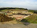 Friedrichzeche Regensburg a.jpg 2,288 × 1,712; 832 KB
-
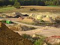 Friedrichzeche Regensburg b.jpg 2,288 × 1,712; 854 KB
