Category:Froghall
Jump to navigation
Jump to search
English: Froghall is a village situated approximately ten miles to the east of Stoke-on-Trent and two miles north of Cheadle in Staffordshire, England. Froghall sits in the Churnet Valley, A beautiful and relatively unspoilt part of Staffordshire.
village in the United Kingdom | |||||
| Upload media | |||||
| Instance of | |||||
|---|---|---|---|---|---|
| Location | Ipstones, Staffordshire Moorlands, Staffordshire, West Midlands, England | ||||
 | |||||
Subcategories
This category has the following 4 subcategories, out of 4 total.
Media in category "Froghall"
The following 81 files are in this category, out of 81 total.
-

-
 5197 USATC Class S160 2-6-0 passes the Copper Works.jpg 4,048 × 2,399; 1.58 MB
-
 80136 BR 4MT passes the old Copper Works.jpg 4,069 × 2,185; 1.48 MB
-
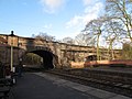
 80136 British Railways Standard class 4MT 2-6-4T Froghall Station, Churnet Valley.jpg 3,857 × 2,937; 1.45 MB
-
 80136 Froghall Copper Works 1 July 2001.jpg 1,958 × 1,122; 481 KB
-
 80136 Froghall Copper Works 2 July 2001.jpg 1,929 × 907; 294 KB
-
 A52 road bridge over the railway at Froghall - geograph.org.uk - 3089140.jpg 2,592 × 1,936; 2.47 MB
-
 Approaching bridge 52 - geograph.org.uk - 1731598.jpg 1,280 × 959; 571 KB
-
 As in days gone by - geograph.org.uk - 745622.jpg 640 × 480; 91 KB
-
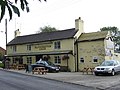 Blacksmiths Arms - geograph.org.uk - 224905.jpg 640 × 480; 99 KB
-
 Bolton's Chimney - geograph.org.uk - 427644.jpg 640 × 472; 96 KB
-
 Bridge 52 - geograph.org.uk - 1731601.jpg 1,280 × 959; 532 KB
-
 Bridge No 55 at Froghall, Staffordshire - geograph.org.uk - 2458638.jpg 800 × 600; 426 KB
-
 Bridge No 55 at Froghall, Staffordshire - geograph.org.uk - 2460672.jpg 600 × 800; 308 KB
-

-

-

-
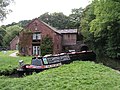
 Caldon Canal at Froghall, Staffordshire - geograph.org.uk - 2457687.jpg 800 × 544; 268 KB
-

-

-

-

-

-

-

-

-

-
 Commemorative plaque - geograph.org.uk - 582399.jpg 480 × 640; 89 KB
-
 Copper works, Froghall - geograph.org.uk - 1731569.jpg 1,280 × 959; 345 KB
-
 Date stone on the pumphouse - geograph.org.uk - 1731578.jpg 1,280 × 959; 439 KB
-
 Demolished copper works buildings, Froghall - geograph.org.uk - 2968826.jpg 1,024 × 503; 102 KB
-

-

-
 Dereliction at Froghall - geograph.org.uk - 1889477.jpg 1,600 × 1,200; 612 KB
-
 Disused Limekilns at Froghall - geograph.org.uk - 315271.jpg 640 × 480; 113 KB
-
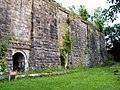 Disused Limekilns at Froghall - geograph.org.uk - 315272.jpg 640 × 480; 109 KB
-
 Fields near Hazlecross - geograph.org.uk - 396355.jpg 640 × 480; 74 KB
-

-
 Froghall Basin - geograph.org.uk - 1731559.jpg 1,280 × 959; 411 KB
-
 Froghall Basin - geograph.org.uk - 1731561.jpg 1,280 × 959; 414 KB
-
 Froghall Basin moorings, Staffordshire - geograph.org.uk - 2459341.jpg 800 × 628; 266 KB
-
 Froghall Basin moorings, Staffordshire - geograph.org.uk - 2459848.jpg 599 × 800; 276 KB
-
 Froghall Bridge.jpg 1,024 × 768; 277 KB
-
 Froghall Canal Basin, Staffordshire - geograph.org.uk - 2449238.jpg 800 × 519; 245 KB
-
 Froghall Wharf - geograph.org.uk - 396394.jpg 640 × 480; 106 KB
-
 Froghall Wharf - geograph.org.uk - 603921.jpg 639 × 430; 64 KB
-
 Froghall Wharf in 1987 - geograph.org.uk - 2745413.jpg 865 × 571; 126 KB
-

-
 Froghall Wharf.jpg 1,600 × 1,200; 750 KB
-
 Froghall works - geograph.org.uk - 1731574.jpg 1,280 × 959; 248 KB
-
 FroghallEast.JPG 2,048 × 1,536; 628 KB
-
 Harston Rock - geograph.org.uk - 591267.jpg 480 × 640; 141 KB
-
 Ice tree - geograph.org.uk - 1731581.jpg 959 × 1,280; 465 KB
-

-
 Lake in Cloughhead Wood - geograph.org.uk - 454534.jpg 640 × 480; 137 KB
-

-
 Lime kilns, Froghall Wharf.jpg 1,600 × 1,200; 757 KB
-
 LimeKilnFroghall.JPG 2,048 × 1,536; 627 KB
-
 Lock into Froghall Basin, Staffordshire - geograph.org.uk - 2449527.jpg 600 × 800; 351 KB
-
 Lock No 1 at Froghall, Staffordshire - geograph.org.uk - 2458665.jpg 800 × 565; 355 KB
-
 Lock to Froghall Basin, Staffordshire - geograph.org.uk - 2459096.jpg 800 × 618; 373 KB
-
 Lock to Froghall Basin, Staffordshire - geograph.org.uk - 2459099.jpg 536 × 800; 342 KB
-
 Lock to Froghall Basin, Staffordshire - geograph.org.uk - 2459103.jpg 525 × 640; 174 KB
-
 Milepost at SK 029 474.jpg 492 × 701; 66 KB
-
 Pipe bridge at Froghall on the Caldon Canal - geograph.org.uk - 2964981.jpg 1,024 × 768; 158 KB
-
 Pumphouse and chimney - geograph.org.uk - 1731572.jpg 1,280 × 959; 357 KB
-
 Remains of the old copper works at Froghall - geograph.org.uk - 3089177.jpg 2,592 × 1,936; 1.97 MB
-
 River Churnet at Froghall, Staffordshire - geograph.org.uk - 2456820.jpg 567 × 800; 353 KB
-
 River Churnet near Froghall - geograph.org.uk - 396375.jpg 640 × 480; 100 KB
-

-

-
 Whiston Hall - geograph.org.uk - 223845.jpg 640 × 480; 103 KB
-
 Whiston Methodist Church - geograph.org.uk - 223795.jpg 640 × 480; 113 KB
-
 Bridge along the Churnet Valley canal - geograph.org.uk - 745652.jpg 640 × 480; 90 KB
-
 Bridge Over Shirley Brook - geograph.org.uk - 591350.jpg 640 × 480; 122 KB
-

-
 Footbridge at Froghall - geograph.org.uk - 745648.jpg 640 × 480; 134 KB
-
 Footbridge in a dangerous condition - geograph.org.uk - 745645.jpg 640 × 480; 122 KB
-
 Froghall Wharf - geograph.org.uk - 21881.jpg 640 × 480; 140 KB
-
 Trickle Ridge - geograph.org.uk - 417470.jpg 480 × 640; 143 KB
-
 Turnover Bridge - geograph.org.uk - 456012.jpg 640 × 480; 114 KB


