Category:Gamerschestraat 5, Zaltbommel
Jump to navigation
Jump to search
| Object location | | View all coordinates using: OpenStreetMap |
|---|
 | |||||
| Upload media | |||||
| Instance of |
| ||||
|---|---|---|---|---|---|
| Location | Zaltbommel, Gelderland, Netherlands | ||||
| Street address |
| ||||
| Heritage designation |
| ||||
 | |||||
|
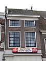
This is a category about rijksmonument number 40138
|
| Address |
|
Media in category "Gamerschestraat 5, Zaltbommel"
The following 4 files are in this category, out of 4 total.
-
 2887 Portrait-B.jpg 495 × 329; 123 KB
-
 En begin Gamersestraat, zuid wand - Zaltbommel - 20220459 - RCE.jpg 1,200 × 972; 239 KB
-
 Gamerschstraat 5.jpg 3,000 × 4,000; 984 KB
-
 Zuid-zijde - Zaltbommel - 20220458 - RCE.jpg 1,200 × 1,015; 234 KB


