Category:Geisberg (Wissembourg)
Jump to navigation
Jump to search
| Object location | | View all coordinates using: OpenStreetMap |
|---|
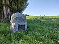
English: Geisberg is a district of Wissembourg. The hill south of the city played a role in the Battle of Wissembourg (1870).
Deutsch: Geisberg ist ein Stadtteil von Wissembourg. Die Anhöhe südlich der Stadt spielte eine Rolle in der Schlacht bei Weißenburg (1870).
Subcategories
This category has the following 4 subcategories, out of 4 total.
Media in category "Geisberg (Wissembourg)"
The following 5 files are in this category, out of 5 total.
-
 Abel douay stone.jpg 4,624 × 3,472; 10.21 MB
-
 Geisberg grenadier-denkmal.jpg 3,472 × 4,624; 13.58 MB
-
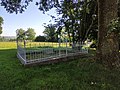 Geisberg kriegsgrab.jpg 4,624 × 3,472; 10.93 MB
-
 Geisberg monument aux morts de la guerre de 1870-1871.jpg 4,624 × 3,472; 9.52 MB
-
 Jaegerstein geisberg.jpg 3,472 × 4,624; 9.44 MB


