Category:Geography of Africa
Prijeđi na navigaciju
Prijeđi na pretraživanje
geographical features of Africa | |||||
| Postavi datoteku | |||||
| Jest |
| ||||
|---|---|---|---|---|---|
| Dio klase | |||||
| Dio šire teme | |||||
| |||||

Umjerena područja: Sjeverna Amerika · Južna Amerika · Afrika · Europa · Azija · Oceanija – Polarne regije: Antarctic · Antarktika · Arktik – Other regions: Euroazija
Geography of Africa.
Potkategorije
Ova kategorija ima sljedećih 19 potkategorija, od ukupno 19.
*
+
?
B
C
E
F
H
L
P
R
T
W
Stranice u kategoriji »Geography of Africa«
Ova kategorija sadržava samo sljedeću stranicu.
Mediji u kategoriji »Geography of Africa«
Prikazano je 200 datoteka u ovoj kategoriji, od njih ukupno 287.
(prethodna stranica) (sljedeća stranica)-
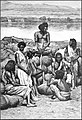
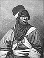
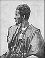
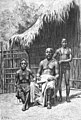
 AFR V1 D008 Bishari camel-driver.jpg 2.044 × 2.983; 850 KB
-
 AFR V1 D041 Group of Nubian women.jpg 2.064 × 3.040; 850 KB
-
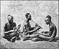
 AFR V1 D047 Bishari gum-dealers at Korosko.jpg 2.046 × 2.993; 811 KB
-
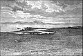
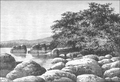
 AFR V1 D063 View of Victoria Nyanza taken from Murchison Bay.jpg 2.983 × 2.051; 781 KB
-
 AFR V1 D072 The Nile at Khartum.jpg 1.901 × 1.589; 526 KB
-
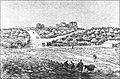
 AFR V1 D073 General view of Khartoum.jpg 3.022 × 2.078; 799 KB
-
 AFR V1 D087 The Nile at the second cataract.jpg 2.999 × 2.056; 1 MB
-
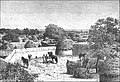
 AFR V1 D126 U-Ganda, Rubaga, principal residence of the M'Tesa.jpg 1.905 × 2.425; 832 KB
-
 AFR V1 D129 Natives of Uganda.jpg 3.023 × 2.096; 772 KB
-
 AFR V1 D133 Murchison Falls.jpg 3.009 × 2.059; 837 KB
-
 AFR V1 D140 Shuli musicians.jpg 1.902 × 1.587; 644 KB
-
 AFR V1 D142 Bari smiths.jpg 1.933 × 1.628; 456 KB
-
 AFR V1 D147 Group of Makrakas.jpg 3.014 × 2.071; 783 KB
-
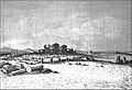
 AFR V1 D155 General view of Dem Suleiman.jpg 3.000 × 2.082; 746 KB
-
 AFR V1 D164 Shilluk type.jpg 1.311 × 1.785; 379 KB
-
 AFR V1 D176 Davezut Falls near Samara (Debra-Tabor).jpg 2.021 × 3.016; 1,36 MB
-
 AFR V1 D399 Lybian desert-mirage on the horizon.jpg 3.026 × 2.068; 653 KB
-
 AFR V1 D453 Suez canal at the Serapeum.jpg 3.051 × 2.107; 852 KB
-
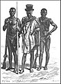
 AFR V2 D008 Arabs, Sudanese negro, and female Shilluk slave.jpg 2.007 × 2.974; 913 KB
-
 AFR V2 D027 Zawya of Mazuna, in the Algerian Dahra.jpg 2.073 × 2.815; 1,36 MB
-
 AFR V2 D033 View from the Necropolis of Cyrene.jpg 3.031 × 2.097; 1,58 MB
-
 AFR V2 D046 The Kufra oasis.jpg 2.040 × 2.972; 1,06 MB
-
 AFR V2 D057 The Kasr-El-Jebel cirque.jpg 3.032 × 2.086; 891 KB
-
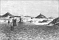
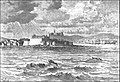
 AFR V2 D083 Tripoli from the roadstead.jpg 2.980 × 2.029; 919 KB
-
 AFR V2 D101 General view of Murzuk.jpg 3.027 × 2.091; 922 KB
-
 AFR V2 D108 General view of the Ghadames.jpg 2.968 × 2.030; 1,14 MB
-
 AFR V2 D119 Tunisian landscape view taken from the Tellat pass.jpg 3.023 × 2.067; 871 KB
-
 AFR V2 D127 Taraka island, view taken from the coast.jpg 3.008 × 2.061; 798 KB
-
 AFR V2 D161 Khumir man, women and child.jpg 2.055 × 3.030; 783 KB
-
 AFR V2 D167 Tunisian Jewess.jpg 1.301 × 1.932; 279 KB
-
 AFR V2 D170 Houses at Kasr El-Mudenin.jpg 1.876 × 1.583; 576 KB
-
 AFR V2 D172 Jerba Island Castle near Humt Suk.jpg 2.981 × 2.042; 911 KB
-
 AFR V2 D175 Cabes-View taken from the Jara gardens.jpg 3.009 × 2.027; 665 KB
-
 AFR V2 D181 Nafta and the Shott-El-Jerid.jpg 2.974 × 2.033; 763 KB
-
 AFR V2 D187 Sfakes-View taken in the Leonec street.jpg 2.023 × 3.023; 673 KB
-
 AFR V2 D189 Amphitheatre of El-Jem, viewed from the ruined side.jpg 1.972 × 1.480; 389 KB
-
 AFR V2 D194 Kasbah of Susa, viewed from the French consulate.jpg 1.857 × 1.347; 322 KB
-
 AFR V2 D196 Kairwan, the Mosque of the Swords.jpg 1.870 × 1.565; 416 KB
-
 AFR V2 D197 General view of Kairwan.jpg 3.040 × 2.089; 871 KB
-
 AFR V2 D201 Ruins of Sbeitla, the ancient Suffetla.jpg 3.021 × 2.058; 1,21 MB
-
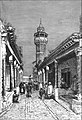 AFR V2 D211 Tunis-street in the Suk district.jpg 2.053 × 3.016; 771 KB
-
 AFR V2 D217 Old ports of Carthage.jpg 3.001 × 2.037; 917 KB
-
 AFR V2 D223 General view of El-Kef.jpg 3.036 × 2.103; 1,07 MB
-
 AFR V2 D230 Bizerta viewed from the Kasbah.jpg 2.980 × 2.035; 919 KB
-
 AFR V2 D232 Cork tree of Fernana.jpg 1.850 × 1.558; 438 KB
-
 AFR V2 D291 Saharian landscape, nomad encampment.jpg 3.011 × 2.064; 724 KB
-
 AFR V2 D305 The natural arch of Constantine.jpg 2.062 × 3.036; 958 KB
-
 AFR V2 D376 Emancipated negress, Biskra.jpg 1.876 × 2.514; 1,09 MB
-
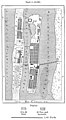
 AFR V2 D415 Relative population of the Algerian communes.jpg 1.731 × 988; 97 KB
-
 AFR V2 D428 Jebel Tiza - view taken from the Tagherut pass.jpg 2.997 × 2.064; 1,07 MB
-
 AFR V2 D434 The Sherat river.jpg 3.026 × 2.060; 985 KB
-
 AFR V2 D446 A Tangier Arab.jpg 1.545 × 1.964; 502 KB
-
 AFR V2 D447 Arab woman of Tangier.jpg 1.652 × 1.997; 354 KB
-
 AFR V2 D450 Arab camel driver.jpg 1.590 × 1.948; 564 KB
-
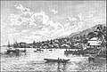
 AFR V2 D455 General view of Tetuan.jpg 3.004 × 2.057; 699 KB
-
 AFR V2 D461 Tangier, view taken from the east.jpg 3.012 × 2.051; 719 KB
-
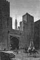
 AFR V2 D466 A gateway in Fez.jpg 1.894 × 2.537; 873 KB
-
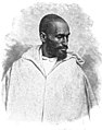
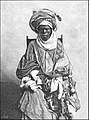
 AFR V2 D470 Mulai Tayeb, sherif of Wezzan.jpg 1.723 × 1.886; 494 KB
-
 AFR V2 D472 Rbat and mouth of the Bu-Regrag, view tken from Sla.jpg 2.967 × 2.027; 1,17 MB
-
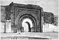 AFR V2 D477 Marocco, the Christian's Gate.jpg 3.044 × 2.088; 705 KB
-
 AFR V2 D491 Wed El-Haluf near Figuig.jpg 3.004 × 2.070; 708 KB
-
 AFR V2 D497 General view of Fez.jpg 3.068 × 2.108; 598 KB
-
 AFR V2 D499 A school in Fez.jpg 1.943 × 1.620; 401 KB
-
 AFR V2 D501 Fez, gateway of the Kasbah.jpg 2.021 × 2.974; 583 KB
-
 AFR V2 D523 Group of Tibbus.jpg 3.055 × 2.085; 613 KB
-
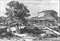
 AFR V2 D537 Jebel Khanfusa.jpg 3.056 × 2.077; 596 KB
-
 AFR V2 D546 Targui type.jpg 1.587 × 2.094; 822 KB
-
 AFR V2 D547 Tuaregs on a journey.jpg 2.062 × 3.025; 691 KB
-
 AFR V2 D559 The Egueri gorge.jpg 3.037 × 2.098; 641 KB
-
 AFR V2 D579 Mouth of the Wed Draa, view taken from the sea.jpg 2.991 × 2.057; 569 KB
-
 AFR V2 D589 Appendix statistical data.jpg 2.221 × 3.570; 291 KB
-
 AFR V2 D590 Appendix statistical data.jpg 2.054 × 3.435; 407 KB
-
 AFR V2 D591 Appendix statistical data.jpg 2.157 × 3.551; 409 KB
-
 AFR V2 D592 Appendix statistical data.jpg 2.152 × 3.506; 377 KB
-
 AFR V2 D593 Appendix statistical data.jpg 2.145 × 3.563; 309 KB
-
 AFR V2 D594 Appendix statistical data.jpg 2.060 × 3.430; 421 KB
-
 AFR V2 D595 Appendix statistical data.jpg 2.049 × 3.441; 383 KB
-
 AFR V2 D596 Appendix statistical data.jpg 2.065 × 3.425; 451 KB
-
 AFR V2 D597 Appendix statistical data.jpg 2.076 × 3.436; 330 KB
-
 AFR V2 D598 Appendix statistical data.jpg 2.055 × 3.435; 472 KB
-
 AFR V2 D599 Appendix statistical data.jpg 2.158 × 3.549; 400 KB
-
 AFR V2 D600 Appendix statistical data.jpg 2.150 × 3.496; 473 KB
-
 AFR V3 D008 Woman and children of Porto-Grande.jpg 2.341 × 3.432; 1,52 MB
-
 AFR V3 D019 Cape Sam Lourenço Madeira.jpg 3.485 × 2.386; 3,25 MB
-
 AFR V3 D022 Depths of the Azorian Atlantic.jpg 457 × 603; 49 KB
-
 AFR V3 D025 Fall of the Temperature in Deep Water.jpg 2.111 × 1.314; 130 KB
-

-
 AFR V3 D029 Atlantic Winds and Currents.jpg 2.009 × 2.427; 866 KB
-
 AFR V3 D032 Depths of the South African Atlantic.jpg 2.125 × 3.126; 1,74 MB
-
 AFR V3 D034 Mean Annual Direction of the Winds in the South African Atlantic.jpg 2.057 × 1.618; 395 KB
-
 AFR V3 D035 Summer Winds in the South African Atlantic.jpg 2.055 × 1.643; 442 KB
-
 AFR V3 D036 Currents of the South Atlantic and Lines of Icebergs.jpg 2.088 × 2.287; 633 KB
-
 AFR V3 D044 Island of San Miguel - View Taken in a Garden near Ponta-Delgada - Azores.jpg 3.454 × 2.357; 2,19 MB
-
 AFR V3 D047 Women of Fayal and San-Miguel - Azores.jpg 1.926 × 2.259; 1,21 MB
-
 AFR V3 D053 Lake of the Sete Cidades - Azores.jpg 3.502 × 2.389; 1,87 MB
-
 AFR V3 D070 Dracona of Icod in Teneriffe.jpg 2.206 × 1.997; 1,22 MB
-
 AFR V3 D073 Funchal - East View - Madeira.jpg 3.454 × 2.339; 2,15 MB
-
 AFR V3 D117 General View of Porto-Grande St Vincent Island.jpg 3.492 × 2.391; 2,29 MB
-
 AFR V3 D127 Tristao de Cunha - view taken on the north coast.jpg 3.461 × 2.373; 1,98 MB
-
 AFR V3 D135 Jamestown - St-Helena.jpg 3.477 × 2.374; 1,92 MB
-
 AFR V3 D142 Cascade of Blu-Blu on the Agoa Grande.jpg 2.415 × 3.527; 2,11 MB
-
 AFR V3 D154 View on the Bakhoy Ford of Mokaia Fara.jpg 3.512 × 2.389; 1,21 MB
-
 AFR V3 D165 Confluence of the Bafing and Bakhoy.jpg 3.471 × 2.375; 1,43 MB
-
 AFR V3 D168 Floods of the Senegal.jpg 2.013 × 1.177; 351 KB
-
 AFR V3 D172 Baobab on the Kotubadinta River South-West of Bamaku.jpg 3.449 × 2.367; 1,88 MB
-
 AFR V3 D175 Trarza Type.jpg 1.569 × 2.021; 711 KB
-
 AFR V3 D180 Wolof Girl Sixteen Years of Age.jpg 1.798 × 2.239; 818 KB
-
 AFR V3 D181 Serer Youth Twenty-One Year Old.jpg 1.884 × 2.297; 1,01 MB
-
 AFR V3 D184 Fulah Type.jpg 1.970 × 2.335; 976 KB
-
 AFR V3 D187 Toucouleur Types - The Interpreter Alpha Sega and his Sisters.jpg 3.409 × 2.315; 2,31 MB
-
 AFR V3 D195 Saint-Louis in 1700.jpg 1.222 × 2.298; 551 KB
-
 AFR V3 D196 Saint-Louis in 1880.jpg 1.257 × 2.284; 597 KB
-
 AFR V3 D199 Goree - Landing Stage and Fort.jpg 3.511 × 2.396; 2,11 MB
-
 AFR V3 D203 Kayes Railway Station.jpg 3.462 × 2.365; 1,49 MB
-
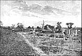 AFR V3 D207 Village of Bafulabé.jpg 3.433 × 2.325; 1,72 MB
-
 AFR V3 D210 Medina - General View.jpg 3.527 × 2.335; 2,55 MB
-
 AFR V3 D223 Felup Types.jpg 445 × 608; 66 KB
-
 AFR V3 D229 Valley of the Tominé.jpg 3.516 × 2.397; 1,77 MB
-
 AFR V3 D233 Landscape at Guiné - View Taken near Bolama.jpg 3.439 × 2.344; 2,11 MB
-
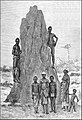 AFR V3 D235 Bujago Types and Termites' nest.jpg 2.371 × 3.474; 2,07 MB
-
 AFR V3 D249 Freetown. The Sea-breeze prevail along the coast.jpg 3.414 × 2.345; 2,2 MB
-
 AFR V3 D257 Sawpit Bay near Freetown.jpg 3.474 × 2.343; 2,28 MB
-
 AFR V3 D262 Monrovia and Cape Mensurado.jpg 3.495 × 2.379; 1,74 MB
-
 AFR V3 D265 Kroomen.jpg 2.334 × 3.476; 1,97 MB
-
 AFR V3 D276 Cape Palmas.jpg 3.507 × 2.404; 2,58 MB
-
 AFR V3 D282 Women of Grand Bassam.jpg 2.414 × 2.722; 1,17 MB
-
 AFR V3 D283 The King of Assini.jpg 2.329 × 3.444; 2,14 MB
-
 AFR V3 D286 Agni Type.jpg 2.083 × 2.517; 881 KB
-
 AFR V3 D293 The Bar at the Mouth of the Volta.jpg 3.417 × 2.325; 2,18 MB
-
 AFR V3 D303 Cape Coast - Seaward View.jpg 3.495 × 2.399; 2,13 MB
-
 AFR V3 D305 General View of Elmina Ghana.jpg 3.442 × 2.351; 2,33 MB
-
 AFR V3 D315 Lagos-European Quarters.jpg 3.505 × 2.404; 2,23 MB
-
 AFR V3 D319 A Mohammedan Yoruba Trader.jpg 2.217 × 2.980; 2,26 MB
-
 AFR V3 D320 Inland Scenery Slave Coast.jpg 2.392 × 3.498; 2,45 MB
-
 AFR V3 D325 Porto-Novo Group of Natives.jpg 3.484 × 2.374; 1,65 MB
-
 AFR V3 D331 Rock of Abeokuta.jpg 3.465 × 2.366; 2,23 MB
-
 AFR V3 D337 The Tembi-Kundu Hill and Source of the Niger.jpg 799 × 554; 189 KB
-
 AFR V3 D349 Interior of the Bambara House.jpg 2.254 × 1.533; 969 KB
-
 AFR V3 D352 Cascade Near Bamaku.jpg 3.472 × 2.390; 2,86 MB
-
 AFR V3 D357 Fillani or Fulah Types.jpg 3.487 × 2.376; 2,19 MB
-
 AFR V3 D360 The Hombori Mountains.jpg 2.055 × 1.387; 344 KB
-
 AFR V3 D362 El-Haj Abd-el-Kader Envoy of Timbuktu.jpg 1.928 × 2.746; 1,39 MB
-
 AFR V3 D367 Sokoto - View Taken in the Interior.jpg 3.490 × 2.379; 2,6 MB
-
 AFR V3 D371 A Sokoto Fulah - Brother of the Sultan.jpg 1.816 × 2.205; 882 KB
-
 AFR V3 D377 Wurno - View Taken in the Interior.jpg 3.478 × 2.372; 2,39 MB
-
 AFR V3 D390 Mac-Iver Peak.jpg 3.481 × 2.342; 2,37 MB
-
 AFR V3 D397 Yola Nigeria.jpg 2.016 × 2.354; 1,07 MB
-
 AFR V3 D398 View Taken in Demsa Poha.jpg 3.515 × 2.407; 2,42 MB
-
 AFR V3 D400 Dwelling in Nupé.jpg 3.492 × 2.394; 2,23 MB
-
 AFR V3 D401 Nupé Woman.jpg 2.382 × 3.485; 2,51 MB
-
 AFR V3 D407 Barge on the Calabar River.jpg 3.480 × 2.381; 1,91 MB
-
 AFR V3 D413 Shores of Lake Tsad.jpg 3.515 × 2.407; 2,67 MB
-
 AFR V3 D415 The Ba Busso, or Eastern Shari, at Miskin, South East of Logon.jpg 2.335 × 1.465; 1.013 KB
-
 AFR V3 D418 View taken on the banks of the Sari.jpg 3.766 × 2.493; 1,96 MB
-
 AFR V3 D425 Group of Kanem Bu Warriors.jpg 3.486 × 2.375; 2,24 MB
-
 AFR V3 D431 Kuka (Kukawa), Nigeria.jpg 2.064 × 1.675; 413 KB
-
 AFR V3 D435 The Logon Birni General view.jpg 3.486 × 2.376; 2,59 MB
-
 AFR V3 D439 Palace of the Sultan of Massena.png 3.500 × 2.374; 6,82 MB
-
 AFR V3 D448 View taken at the Foot of the Cameroons.png 3.462 × 2.360; 7,98 MB
-
 AFR V3 D471 The Fetish Stones of Samba, on the Ogoway.png 3.452 × 2.367; 5,69 MB
-
 AFR V3 D479 Mpongwe House Near Libreville.png 3.460 × 2.350; 4,94 MB
-
 AFR V3 D482 Fan Woman.png 1.549 × 2.212; 1,39 MB
-
 AFR V3 D485 Fan Women and Child on the Banks of the Ogoway.png 2.348 × 3.466; 4,47 MB
-
 AFR V3 D489 A Cabinda.png 1.746 × 2.239; 2,3 MB
-
 AFR V3 D493 American Mission on the Ogoway Between Njolé and Lambaréné.png 3.486 × 2.346; 6,94 MB
-
 AFR V3 D509 The Traveller Giraud Amid the Reeds of Lake Bangweolo.png 2.320 × 3.425; 5,3 MB
-
 AFR V3 D514 View taken from Mpala on the West Coast of Tankanyika.png 3.478 × 2.359; 5,8 MB
-
 AFR V3 D519 The U Banghi View taken at the Nkunja Station.png 3.503 × 2.386; 5,45 MB
-
 AFR V3 D523 The Yellala Falls Lower Congo.png 3.459 × 2.363; 4,66 MB
-
 AFR V3 D536 Bangala, a Station of the Independent Congo state.png 3.485 × 2.383; 5,97 MB
-
 AFR V3 D547 The Lu Kuga Emissary of Tanganyika.png 3.467 × 2.388; 4,77 MB
-
 AFR V3 D551 View Taken at Ujiji.png 3.494 × 2.367; 6,42 MB
-
 AFR V3 D555 Ma Rungu Fetishes.png 1.822 × 2.031; 4,02 MB
-
 AFR V3 D557 Tippo Tip.png 1.186 × 1.256; 246 KB
-
 AFR V3 D559 Stanley Falls Fishing at the Seventh Cataract.png 3.467 × 2.344; 5,24 MB
-
 AFR V3 D561 Under Chief of Iboko and Head Chief of the Ba Ngala.png 2.183 × 2.554; 5,64 MB
-
 AFR V3 D569 Akka Man and Woman.png 3.456 × 2.375; 5,56 MB
-
 AFR V3 D573 Niam Niam Woman.png 1.920 × 2.290; 1,38 MB
-
 AFR V3 D574 Niam-Niam Man.png 1.977 × 2.289; 1,71 MB
-
 AFR V3 D575 Group of Niam Niams and their Dwellings.png 3.560 × 2.435; 4,86 MB
-
 AFR V3 D580 Dead Trunks of Palms near M'suala on the Congo.png 2.216 × 1.841; 3,04 MB
-
 AFR V3 D587 Group of Kalundas.png 2.356 × 3.486; 5,8 MB
-
 AFR V3 D607 Stanley Pool View taken from Brazzaville.png 3.473 × 2.371; 5,89 MB
-
 AFR V3 D611 General View of Boma.png 3.483 × 2.385; 6,03 MB
-
 AFR V3 D613 Kakongo Type.png 1.493 × 1.782; 896 KB
-
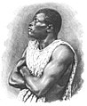
 AFR V4 D006 Group of Zulus.jpg 2.061 × 2.999; 1,22 MB
-
 AFR V4 D021 View taken on the banks of the Rio Dandé.png 3.033 × 2.071; 4,05 MB
-
 AFR V4 D033 Landscape near Quissama south of the Congo.png 3.074 × 2.126; 4,97 MB
-
 AFR V4 D036 Mu-Sorongo woman.png 1.520 × 2.246; 3,05 MB
-
 AFR V4 D043 Quissama man and Quissama woman.jpg 3.042 × 2.082; 273 KB
-
 AFR V4 D054 The king of the Kingdom of Kongo.png 1.931 × 2.429; 1,63 MB
-
 AFR V4 D059 Loanda general view.png 3.025 × 2.069; 3,65 MB
-
 AFR V4 D066 Black stones of Pungo Ndongo.png 1.805 × 1.461; 523 KB
-
 AFR V4 D073 Mossamedes general view.png 3.043 × 2.084; 4,15 MB
-
 AFR V4 D089 View taken at Walvisch Bay.png 3.040 × 2.088; 3,04 MB
-
 AFR V4 D103 Angra Pequena view taken from Nautilus Point.png 3.062 × 2.098; 4,12 MB
-
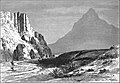
 AFR V4 D115 The Lion's head Capetown.png 3.057 × 2.115; 4,2 MB
-
 AFR V4 D123 The Falls of the Oranje.png 1.408 × 2.160; 2,06 MB
-
 AFR V4 D129 Scene on the Limpopo - the Malikoe Marico ford in Transvaal.png 3.024 × 2.064; 4,2 MB
-
 AFR V4 D145 Bushmen encampment.png 3.021 × 2.057; 3,97 MB


.jpg)


,_Nigeria.jpg)


