Category:Geography of Barbados
둘러보기로 이동
검색으로 이동
Geography of Barbados  | |||||
| 미디어 올리기 | |||||
| 다음 종류에 속함 |
| ||||
|---|---|---|---|---|---|
| 다음의 하위 개념임 | |||||
| 상위 주제 |
| ||||
| 위치 | 브리지타운, 세인트마이클구 | ||||
| 면적 |
| ||||
| |||||
"Geography of Barbados" 분류에 속하는 미디어
다음은 이 분류에 속하는 파일 9개 가운데 9개입니다.
-
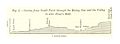
 Pg580 Fig1 Section fromnear Paynes Bay to Chalky Mount.jpg 1,405 × 475; 221 KB
-
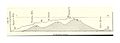
 Pg580 Fig2 Section from South Point through the Rising Sun and the Valley.jpg 1,418 × 516; 233 KB
-
 Pg585.jpg 1,392 × 497; 215 KB
-
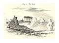 Pg588 Fig8 The Rock.jpg 1,309 × 963; 554 KB
-
 Barbados Input Administrative Boundaries (5457754450).jpg 2,524 × 3,209; 563 KB
-
 Double turbulence.jpg 576 × 428; 180 KB
-
 Front of derelict house.JPG 2,848 × 2,136; 1.47 MB
-
 Houses Excellent Landmark.JPG 2,848 × 2,136; 1.42 MB
-


.jpg)


_-_comprising_a_geographical_and_statistical_description_of_the_island,_a_sketch_of_the_historical_events_since_the_settlement_and_an_account_of_its_(14780342261).jpg)