Category:Geography of Saguache County, Colorado
Jump to navigation
Jump to search
Counties of Colorado: Adams · Alamosa · Arapahoe · Archuleta · Baca · Bent · Boulder · Chaffee · Cheyenne · Clear Creek · Conejos · Costilla · Crowley · Custer · Delta · Dolores · Douglas · Eagle · El Paso · Elbert · Fremont · Garfield · Gilpin · Grand · Gunnison · Hinsdale · Huerfano · Jackson · Jefferson · Kiowa · Kit Carson · Lake · La Plata · Larimer · Las Animas · Lincoln · Logan · Mesa · Mineral · Moffat · Montezuma · Montrose · Morgan · Otero · Ouray · Park · Phillips · Pitkin · Prowers · Pueblo · Rio Blanco · Rio Grande · Routt · Saguache · San Juan · San Miguel · Sedgwick · Summit · Teller · Washington · Weld · Yuma
City-counties: Denver
City-counties: Denver
Wikimedia category | |||||
| Upload media | |||||
| Instance of | |||||
|---|---|---|---|---|---|
| Category combines topics | |||||
| Saguache County | |||||
county in Colorado, United States   | |||||
| Instance of | |||||
| Named after | |||||
| Location | Colorado | ||||
| Capital | |||||
| Inception |
| ||||
| Highest point | |||||
| Population |
| ||||
| Area |
| ||||
| official website | |||||
 | |||||
Subcategories
This category has the following 23 subcategories, out of 23 total.
C
- Carnero Pass (2 F)
- Challenger Point (6 F)
- Cochetopa Pass (3 F)
- Crestone Needle (4 F)
- Crestone Peak (12 F)
H
K
L
- Los Pinos Pass (2 F)
M
O
- Mount Ouray (11 F)
P
- Penitente Canyon (Colorado) (8 F)
- Poncha Pass (7 F)
S
- Saguache Creek (3 F)
Z
- Mount Zwischen (4 F)
Media in category "Geography of Saguache County, Colorado"
The following 10 files are in this category, out of 10 total.
-
 Carnero Creek (Colorado).JPG 4,000 × 5,752; 14.55 MB
-
 East-trending dike of mafic dacite.JPG 5,514 × 3,886; 13.07 MB
-
 Galena Peak, Sangre de Cristo Range.jpg 4,682 × 2,563; 3.12 MB
-
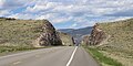 Highway 285 roadcuts.JPG 5,435 × 2,707; 9.02 MB
-
 Hunts Peak, Colorado.jpg 2,832 × 1,337; 947 KB
-
 Jacks Creek Volcano.JPG 5,028 × 3,498; 11.18 MB
-
 Leach Airport.JPG 5,269 × 3,371; 11 MB
-
 Middle Creek (Saguache County, Colorado).JPG 5,731 × 3,703; 15.33 MB
-
 Roadcut at Highway 285 and Saguache County Road X.JPG 5,760 × 3,640; 13.61 MB
-
 Unnamed peaks in Saguache County.JPG 5,178 × 3,812; 11.6 MB
.JPG)


.JPG)

