Category:Geography of Texas
Sari la navigare
Sari la căutare
States of the United States: Alabama · Alaska · Arizona · Arkansas · California · Carolina de Nord · Carolina de Sud · Colorado · Connecticut · Dakota de Nord · Dakota de Sud · Delaware · Florida · Georgia · Hawaii · Idaho · Illinois · Indiana · Iowa · Kansas · Kentucky · Louisiana · Maine · Maryland · Massachusetts · Michigan · Minnesota · Mississippi · Missouri · Montana · Nebraska · Nevada · New Hampshire · New Jersey · New Mexico · New York · Ohio · Oklahoma · Oregon · Pennsylvania · Rhode Island · Tennessee · Texas · Utah · Vermont · Virginia · Virginia de Vest · Washington · Wisconsin · Wyoming – Districtul Columbia: Washington, D.C.
the insular areas of the United States: Comunitatea Insulelor Mariane de Nord · Guam · Insulele Virgine Americane · Puerto Rico · Samoa Americană – Atolul Johnston · Atolul Midway · Atolul Palmyra · Insula Baker · Insula Howland · Insula Jarvis · Insula Navassa · Insula Wake · Reciful Kingman
the insular areas of the United States: Comunitatea Insulelor Mariane de Nord · Guam · Insulele Virgine Americane · Puerto Rico · Samoa Americană – Atolul Johnston · Atolul Midway · Atolul Palmyra · Insula Baker · Insula Howland · Insula Jarvis · Insula Navassa · Insula Wake · Reciful Kingman
English: Geography of Texas.
Español: Geografía de Texas.
geographical Features of Texas | |||||
| Încarcă multimedia | |||||
| Este un/o |
| ||||
|---|---|---|---|---|---|
| Subclasă a | |||||
| Fațetă a | |||||
| Locul actual |
| ||||
 | |||||
Subcategorii
Această categorie conține următoarele 21 de subcategorii, dintr-un total de 21.
Fișiere media din categoria „Geography of Texas”
Următoarele 35 fișiere se află în această categorie, dintr-un total de 35.
-
 100th meridian US.svg 959x593; 66 KB
-
 1998 South Central Texas Flood 3.png 723x715; 58 KB
-
 32nd parallel US.svg 959x593; 66 KB
-
 Amelia1978073109GOES2IR.png 115x122; 13 KB
-
 Austin-Round Rock-Marble Falls CSA.png 491x455; 16 KB
-
 Big Sandy Creek, Polk Co, TX.jpg 5.067x3.178; 11,26 MB
-
 Book of Texas (1916) (14750507446).jpg 2.048x1.878; 1,48 MB
-
 EB9 Texas - geographical divisions.jpg 855x787; 173 KB
-
 GrahamSquare.jpg 1.024x768; 361 KB
-
 Granbury MSA.png 491x455; 9 KB
-
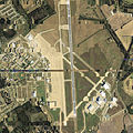 James Connally Air Force Base - Texas - 2006.jpg 754x755; 205 KB
-

-
 Kingsville MSA.png 491x455; 9 KB
-
 Matagorda Bay Texas.png 300x284; 13 KB
-
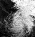 Naomi 1968 Rapid Intensification.JPG 251x264; 47 KB
-
 Osage Plains-33.jpg 266x202; 23 KB
-
 Regions of Texas.PNG 302x284; 16 KB
-
 Regions of Texas.svg 512x512; 307 KB
-
 SouthTexas.svg 512x512; 305 KB
-
 Texas Panhandle.PNG 300x284; 15 KB
-
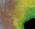 Texas topographic.jpg 840x691; 227 KB
-
 TexasPanhandle.svg 512x512; 305 KB
-
 TexasRegions.svg 512x512; 307 KB
-
 TexasSouthPlains.svg 512x512; 305 KB
-
 TexasValley.svg 512x512; 305 KB
-
 TransPecosTexas.svg 512x512; 305 KB
-
 TXMap-doton-Gause.png 492x446; 9 KB
-
 TXMap-doton-Heidenheimer.png 492x446; 9 KB
-
 TXMap-doton-Lohn.png 492x446; 9 KB
-
 Tyler-Jacksonville CSA.png 491x455; 9 KB
-
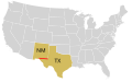
 US map-Arklatex.PNG 572x371; 19 KB
-
 USGS map of Sabine Pass.jpg 1.500x1.924; 900 KB
-
 WestTexas.svg 512x512; 305 KB
-
 WinterGardenRegion TX.png 491x455; 14 KB
-
 WinterGardenRegion2 TX.png 491x455; 9 KB


_(14750507446).jpg)


