Category:Geology of England
Saltar para a navegação
Saltar para a pesquisa
Overview of the geology of England | |||||
| Carregar ficheiro | |||||
| Subclasse de | |||||
|---|---|---|---|---|---|
| Localização |
| ||||
| |||||
Inglaterra | ||
|---|---|---|
|
Subcategorias
Esta categoria contém as seguintes 47 subcategorias (de um total de 47).
+
B
C
- Canyards Hills (4 F)
D
E
F
G
- Gunthorpe formation (9 F)
H
I
K
M
O
P
R
S
T
V
W
- White Coppice Geology Trail (2 F)
Multimédia na categoria "Geology of England"
Esta categoria contém os seguintes 33 ficheiros (de um total de 33).
-
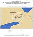
 Ancestral Thames Anglian glaciation.jpg 1 343 × 1 636; 242 kB
-
 Ancestral Thames Early Pleistocene.jpg 1 208 × 1 500; 194 kB
-
 Ancestral Thames post-Anglian.jpg 1 409 × 1 571; 259 kB
-
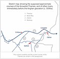 Ancestral Thames pre-Anglian.jpg 1 009 × 990; 131 kB
-
 Ancestral-Thames Oligocene-Pliocene.jpg 1 419 × 1 353; 205 kB
-
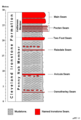 CDI General Log.png 530 × 786; 16 kB
-
 Geology of UK - Section from Snowdon to Harwich.jpg 1 185 × 397; 123 kB
-
 Halton Castle1.jpg 1 250 × 1 650; 1,9 MB
-
 Meridian Line Marker - geograph.org.uk - 93225.jpg 640 × 480; 203 kB
-
 OldRedSandstoneBeddingPlane.jpg 1 920 × 1 480; 1,65 MB
-
 Books from the Biodiversity Heritage Library (IA SiluriansystemfIMurc).pdf 1 541 × 1 945, 656 páginas; 70,06 MB
-
 Spurrell's layers.jpg 3 266 × 1 728; 429 kB
-
 St Mary the Virgin, Send - geograph.org.uk - 432876.jpg 640 × 437; 85 kB
-
 The Quarterly journal of the Geological Society of London (12961131495).jpg 1 185 × 2 056; 508 kB
-
 The Quarterly journal of the Geological Society of London (1904) (14781971991).jpg 2 030 × 3 124; 750 kB
-
 The Quarterly journal of the Geological Society of London (1907) (14754510446).jpg 1 724 × 3 168; 678 kB
-
 The Quarterly journal of the Geological Society of London (1913) (14781600621).jpg 1 788 × 2 852; 825 kB
-
 WealdBasinCrossSection.png 2 362 × 520; 133 kB
-
 WealdBasinCrossSection.svg 1 134 × 250; 45 kB
-
 Wessex basin lithostratigraphy.png 1 605 × 2 226; 737 kB
-
 Wessex Basin Lithostratigraphy.svg 744 × 1 052; 2,27 MB
-
 Giggleswick Scar - geograph.org.uk - 42107.jpg 640 × 480; 109 kB
-
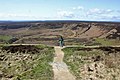 Hole of Horcum - geograph.org.uk - 432017.jpg 2 048 × 1 360; 1,04 MB
-
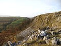
 Kay Nest, Tripsdale - geograph.org.uk - 26294.jpg 640 × 480; 63 kB
-
 Kilve Beach Rocks - geograph.org.uk - 581843.jpg 640 × 422; 112 kB
-
 Limestone Pavement at Moughton - geograph.org.uk - 637404.jpg 480 × 640; 111 kB
-
 Limestone pavement by Bastow Wood - geograph.org.uk - 728592.jpg 640 × 480; 105 kB
-
 Moughton Scar - geograph.org.uk - 637325.jpg 640 × 480; 83 kB
-
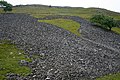
 Shake Holes on Kisdon - geograph.org.uk - 225150.jpg 640 × 480; 121 kB
-
 Side Wall of Bull Scar. - geograph.org.uk - 564618.jpg 640 × 427; 308 kB
-
 Standards Shap - geograph.org.uk - 342349.jpg 640 × 480; 138 kB
-
 Standards Shap - geograph.org.uk - 342356.jpg 640 × 480; 121 kB
-
 The Banbury Stone on Bredon Hill - geograph.org.uk - 300985.jpg 640 × 427; 261 kB


.jpg)
_(14781971991).jpg)
_(14754510446).jpg)
_(14781600621).jpg)


