Category:Geology of Germany
Saltar para a navegação
Saltar para a pesquisa
overview of the geology of Germany | |||||
| Carregar ficheiro | |||||
| Subclasse de | |||||
|---|---|---|---|---|---|
| |||||
Subcategorias
Esta categoria contém as seguintes 82 subcategorias (de um total de 82).
*
+
A
B
C
D
E
F
G
- Geozentrum Nordbayern (24 F)
- Gipskeuper (11 F)
- Goldshöfer Sande (6 F)
H
K
M
N
- North German Basin (5 F)
O
P
Q
R
- Roer Valley Graben (5 F)
S
- Soil profiles in Germany (5 F)
- Surface geology of Germany (1 F)
T
U
V
Multimédia na categoria "Geology of Germany"
Esta categoria contém os seguintes 39 ficheiros (de um total de 39).
-
 Aachener Kreide Hergenrath Aachen Member.jpg 2 006 × 1 405; 2,3 MB
-
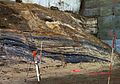
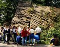
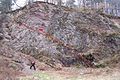
 Baenderschieferpano bei Zueschen (Elop).jpg 7 162 × 2 669; 2,75 MB
-
 Crossbedding.PNG 489 × 264; 349 kB
-
 Dedenborn Mullions.jpg 2 659 × 2 116; 2,11 MB
-
 ETH-BIB-Nephelinit, Katzenbuckel, Odenwald, Schliff HTZ 330-Dia 247-02320.tif 4 961 × 4 128; 58,63 MB
-
 Fluss-Anzapfung Strunkpass Schwäbische Alb.jpg 1 800 × 1 200; 666 kB
-
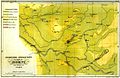 Geognostische Doemitz Koch 1856.jpg 1 630 × 1 060; 394 kB
-
 Geognostische Karte SW Mecklenburg Sabban 1896.jpg 1 615 × 1 097; 437 kB
-
 Geognostische beschreibung der Eifel (IA geognostischebes00stei).pdf 1 177 × 1 643, 176 páginas; 12,13 MB
-
 Graupensandrinne Hegau Schwäbische Alb1.jpg 1 800 × 1 200; 635 kB
-
 Graupensandrinne Hegau Schwäbische Alb2.jpg 1 800 × 1 200; 517 kB
-
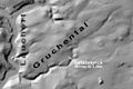 Gruchental Gefälleknick Schwäbische Alb.jpg 1 200 × 800; 379 kB
-
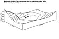 Karstwanne-Modell Schwäbische Alb.jpg 1 800 × 1 200; 276 kB
-
 Karstwannen+Flüsse Schwäbische Alb.jpg 1 800 × 1 431; 694 kB
-
 Lauchert Bittelschießer-Täle Schwäbische Alb 5.jpg 800 × 1 200; 308 kB
-
 Lithostratigraphie Saar-Nahe-Becken.jpg 659 × 1 558; 108 kB
-
 Meyers b7 s0130a.jpg 3 096 × 1 701; 525 kB
-
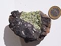
 Muséum de Nantes - 495 - Bismuth (Allemagne).jpg 2 668 × 2 464; 1,32 MB
-
 Neuengamme-GK1.jpg 1 291 × 1 040; 467 kB
-
 Oligozän Paläogeographie.png 2 050 × 2 008; 341 kB
-

-
 Overschuiving Eifel.jpg 800 × 533; 82 kB
-
 Panorama Strossenbau.jpg 909 × 339; 86 kB
-
 Park Villa Haas Härtlinge aus Eisenkiesel mit Quarziteinlagerungen.png 1 372 × 1 372; 4,37 MB
-
 Peridotitic mantle xenolith.JPG 2 560 × 1 920; 942 kB
-
 Plattenrandueberstandhaedrich234.jpg 1 176 × 874; 375 kB
-
 Poehla erzgaenge.JPG 2 304 × 3 072; 3,15 MB
-
 Rheingraben und Schichtstufenland.png 2 388 × 812; 535 kB
-
 Russkohlenfloez.jpg 3 890 × 2 022; 7,5 MB
-
 Satellitenbild Niederrheinische Bucht.png 1 625 × 1 359; 3,71 MB
-
 Satellitenbild Niederrheinisches Tiefland.png 1 619 × 1 356; 3,7 MB
-
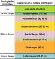 SchoenbuchGeologischeSchichtung.png 411 × 440; 19 kB
-
 Sondierung Kommende Pontstraße.jpg 1 280 × 960; 558 kB
-
 Stratigraphisches Profil Bamberg - Bayreuth - Fichtelgebirge.jpg 23 575 × 2 668; 7,77 MB
-
 Subherzyne Senke.jpg 2 514 × 1 813; 1,25 MB
-
 TambiaClose.jpg 1 662 × 1 272; 2,62 MB
-
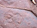
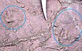 Tetrapodenspuren.jpg 1 722 × 1 071; 2,34 MB
-
 Vorfluter Donau+Neckar+Flüsse+Strunkpass Schwäbische Alb.jpg 1 800 × 1 431; 669 kB
-
 Zementmergelschüsseln Schwäbische Alb.jpg 1 800 × 1 200; 1,14 MB


.jpg)


_1_(14817993170).jpg)


.jpg)