Category:Glazert Burn
Jump to navigation
Jump to search
stream in North Ayrshire, Scotland, UK, tributary of Annick Water  | |||||
| Upload media | |||||
| Instance of | |||||
|---|---|---|---|---|---|
| Location | North Ayrshire, Scotland | ||||
| Mouth of the watercourse |
| ||||
 | |||||

Media in category "Glazert Burn"
The following 21 files are in this category, out of 21 total.
-
 Bridge over small burn - geograph.org.uk - 1426566.jpg 640 × 480; 92 KB
-
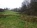
 Burn below Dunlop Kirk - geograph.org.uk - 1769365.jpg 1,632 × 1,224; 767 KB
-
 Dunlop Hill - geograph.org.uk - 96329.jpg 640 × 479; 108 KB
-
 Gallowayford.jpg 1,012 × 580; 66 KB
-
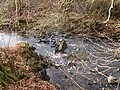
 Glazer Burn - geograph.org.uk - 1149086.jpg 640 × 480; 98 KB
-
 Glazert Burn - geograph.org.uk - 1769400.jpg 1,632 × 1,224; 791 KB
-
 Glazert Burn - geograph.org.uk - 261990.jpg 480 × 640; 143 KB
-
 Glazert Burn - geograph.org.uk - 262066.jpg 480 × 640; 127 KB
-
 Glazertford.JPG 2,288 × 1,712; 804 KB
-
 Kennox House country mansion.jpg 4,032 × 3,024; 3.9 MB
-
 Kennox House.jpg 4,032 × 3,024; 3.25 MB
-
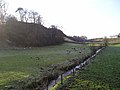
 Meeting of the waters - geograph.org.uk - 262044.jpg 640 × 480; 102 KB
-
 Old Mill site & Hapland Mill dam, Dunlop, East Ayrshire. Glazert Burn.jpg 4,602 × 3,448; 7.64 MB
-
 Old mills site & Hapland Mill lade, Dunlop, East Ayrshire. Glazert Burn.jpg 4,608 × 3,456; 3.6 MB
-
 Straightbow Bridge, Dunlop - geograph.org.uk - 1737436.jpg 3,648 × 2,736; 4.33 MB
-
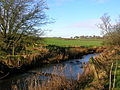
 The Glazert Burn - geograph.org.uk - 290727.jpg 480 × 640; 80 KB
-
 The millpond site, Glazert Water, Dunlop, East Ayrshire.jpg 4,896 × 3,672; 6.45 MB
-
 The old millpond and dam site, Glazert Water, Dunlop, East Ayrshire.jpg 4,896 × 3,672; 5.92 MB
-
 The old millpond, Glazert Water, Dunlop, East Ayrshire.jpg 4,896 × 3,672; 4.87 MB
-
 The Wee Wood and Glazert Burn, Dunlop, East Ayrshire.jpg 4,688 × 3,516; 3.73 MB
-
 The Wee Wood, Dunlop, East Ayrshire.jpg 4,896 × 3,672; 5.69 MB


