Category:Gowa Regency
Zur Navigation springen
Zur Suche springen
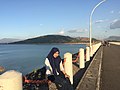
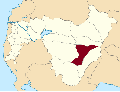
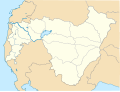
English: Gowa is a region in the province of South Sulawesi, Indonesia. It is a "level 2 district," with an area of 1,883 km² and a population of approximately 500,000 people. The capital is Sungguminasa and the famous hill resort of Malino is within the region.
Français : Gowa est un kabupaten de la province indonésienne de Sulawesi du Sud dans l'île de Célèbes. Son chef-lieu est Sungguminasa.
Bahasa Indonesia: Kabupaten Gowa adalah salah satu Daerah Tingkat II di provinsi Sulawesi Selatan, Indonesia. Ibu kota kabupaten ini terletak di Kota Sungguminasa. Kabupaten ini memiliki luas wilayah 1.883,32 km² dan berpenduduk sebanyak ±500.000 jiwa.
Jawa: Kabupatèn Gowa iku salah siji kabupatèn ing Provinsi Sulawesi Kidul, kutha Sungguminasa iku ibukutha kabupatèné, kutha-kutha liyané : --- lan liya-liyané. Jembar wilayah Kabupatèn iki ± --- km² utawa --- hèktar.
Bahasa Melayu: Goa adalah salah sebuah daerah Sulawesi Selatan
Bezirk in Indonesien  | |||||
| Medium hochladen | |||||
| Ist ein(e) | |||||
|---|---|---|---|---|---|
| Ort | Sulawesi Selatan, Indonesien | ||||
| Hauptstadt |
| ||||
| Einwohnerzahl |
| ||||
| Fläche |
| ||||
| Höhe über dem Meeresspiegel |
| ||||
| offizielle Website | |||||
 | |||||
Unterkategorien
Es werden 6 von insgesamt 6 Unterkategorien in dieser Kategorie angezeigt:
In Klammern die Anzahl der enthaltenen Kategorien (K), Seiten (S), Dateien (D)
K
- Katangka Cemetery (25 D)
- Katangka Old Mosque (13 D)
M
- Museum Balla Lompoa (16 D)
P
- Parigi, Gowa (3 D)
S
- Somba Opu Fortress (17 D)
Medien in der Kategorie „Gowa Regency“
Folgende 62 Dateien sind in dieser Kategorie, von 62 insgesamt.
-
 73.06.00 SulawesiSelatan Gowa.svg 165 × 212; 865 KB
-
 Abd. Rauf Malaganni, Wakil Bupati Gowa (Periode II).png 238 × 316; 35 KB
-
 Adnan Purichta Ichsan, Bupati Gowa (Periode II).png 261 × 330; 45 KB
-
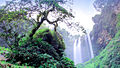
 Air Terjun Coban Jahe.jpg 550 × 412; 75 KB
-
 Air terjun sanginan.jpg 720 × 960; 128 KB
-
 Air terjun takapala.jpg 5.133 × 3.456; 7,06 MB
-
 Air terjun tombolo pao.jpg 1.600 × 900; 624 KB
-
 Andi Maddusila Andi Idjo.jpg 2.832 × 3.002; 4,27 MB
-
 Bajeng Barat District location Map.svg 6.888 × 5.227; 2,75 MB
-
 Bajeng District location Map.svg 6.888 × 5.227; 2,74 MB
-
 Barombong District location Map.svg 6.888 × 5.227; 2,74 MB
-
 Bendungan Bili-bili.jpg 1.280 × 960; 111 KB
-
 Biringbulu District location Map.svg 6.888 × 5.227; 2,73 MB
-
 Bissoloro, Gowa.jpg 1.280 × 960; 154 KB
-
 Bontolempangan District location Map.svg 6.888 × 5.227; 2,74 MB
-

-
 Bontoloe, Bontolempangan, Gowa Regency, South Sulawesi, Indonesia - panoramio.jpg 2.048 × 1.536; 1,03 MB
-
 Bontomarannu District location Map.svg 6.888 × 5.227; 2,74 MB
-
 Bontonompo District location Map.svg 6.888 × 5.227; 2,74 MB
-
 Bontonompo Selatan District location Map.svg 6.888 × 5.227; 2,74 MB
-
 Bungaya District location Map.svg 6.888 × 5.227; 2,73 MB
-
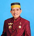
 Bupati Gowa Adnan Purichta Ichsan.jpg 576 × 720; 36 KB
-

-

-

-
 COLLECTIE TROPENMUSEUM Kroning van de Raja van Goa TMnr 60052126.jpg 700 × 673; 108 KB
-

-

-

-
 Gantarang, Tinggimoncong, Gowa Regency, South Sulawesi, Indonesia - panoramio (1).jpg 1.200 × 1.600; 672 KB
-
 Gantarang, Tinggimoncong, Gowa Regency, South Sulawesi, Indonesia - panoramio (2).jpg 1.200 × 1.600; 708 KB
-
 Gantarang, Tinggimoncong, Gowa Regency, South Sulawesi, Indonesia - panoramio (3).jpg 1.200 × 1.600; 697 KB
-
 Gantarang, Tinggimoncong, Gowa Regency, South Sulawesi, Indonesia - panoramio.jpg 1.200 × 1.600; 362 KB
-
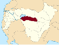
 Gowa Regency location map.svg 1.602 × 1.216; 4,65 MB
-
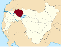
 Gowa Regency Map.jpg 827 × 827; 210 KB
-
 Gunung Bollangi, Gowa.jpg 4.160 × 3.120; 4,83 MB
-

-
 Home Samiun Achmad ^ Megawati - panoramio.jpg 1.600 × 1.200; 441 KB
-
 Ichsan Yasin Limpo.jpg 200 × 295; 12 KB
-
 Kab. Gowa.jpg 1.280 × 1.280; 387 KB
-
 Kebun Binatang Citra Satwa Celebes Gowa.jpg 677 × 523; 85 KB
-
 KITLV A685 - Woning van de civiel gezaghebber te Soenggoeminasa, KITLV 81991.tiff 6.819 × 5.538; 80,7 MB
-
 Lambang Kabupaten Gowa.png 360 × 373; 156 KB
-
 Lembah Ramma (Valley of Bawakaraeng).jpg 569 × 697; 39 KB
-
 Lembah ramma malino.jpeg 2.364 × 1.774; 1,24 MB
-
 Manuju District location Map.svg 6.888 × 5.227; 2,74 MB
-
 Mesjid Mewah Langkoah Kec.botlem.jpg 4.160 × 2.352; 2,51 MB
-
 New Coat of Arms of Gowa.png 256 × 275; 278 KB
-
 Pallangga District location Map.svg 6.888 × 5.227; 2,74 MB
-
 Parangloe District location Map.svg 6.888 × 5.227; 2,73 MB
-
 Parigi District location Map.svg 6.888 × 5.227; 2,74 MB
-
 Pattallassang District location Map.svg 6.888 × 5.227; 2,74 MB
-
 Permen No. 137 Tahun 2017 - Sulawesi Selatan.pdf 1.950 × 1.275, 119 Seiten; 594 KB
-
 Sejuk - panoramio.jpg 3.648 × 2.736; 4,72 MB
-
 Somba Opu District location Map.svg 1.602 × 1.216; 4,65 MB
-
 Tinggimoncong District location Map.svg 6.888 × 5.227; 2,74 MB
-
 Tmesisternopsis pauli Heller, 1897 (3576467196).jpg 2.001 × 1.033; 453 KB
-
 Tombolo Pao District location Map.png 6.888 × 5.227; 2,02 MB
-
 Tombolo Pao District location Map.svg 6.888 × 5.227; 2,73 MB
-
 Tompobulu District location Map.svg 6.888 × 5.227; 2,73 MB
-
 Wakil Bupati Bantaeng M. Yasin.jpg 2.400 × 3.000; 525 KB
-
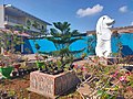 Wisata Kebun Gowa.jpg 720 × 540; 63 KB

.png)
.png)


.jpg)


.jpg)
.jpg)
.jpg)


.jpg)


.jpg)


