Category:Grafham, Cambridgeshire
Jump to navigation
Jump to search
village in Huntingdonshire, Cambridgeshire, United Kingdom  | |||||
| Upload media | |||||
| Instance of | |||||
|---|---|---|---|---|---|
| Location | Huntingdonshire, Cambridgeshire, East of England, England | ||||
| official website | |||||
 | |||||
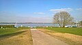
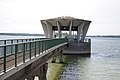
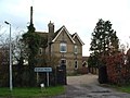
English: Grafham, Cambridgeshire is a small village near Huntingdon and St Neots. The village gives its name to the nearby reservoir, Grafham Water.
Subcategories
This category has the following 2 subcategories, out of 2 total.
B
G
- Grafham Water (64 F)
Media in category "Grafham, Cambridgeshire"
The following 161 files are in this category, out of 161 total.
-
 A plantation near to Grafham Water - geograph.org.uk - 2832835.jpg 2,592 × 1,944; 2.77 MB
-
 All Saints church at Grafham - geograph.org.uk - 6011482.jpg 588 × 800; 138 KB
-
 All Saints church, Grafham - geograph.org.uk - 2832714.jpg 2,592 × 1,944; 1.56 MB
-
 All Saints Church, Grafham - geograph.org.uk - 2994290.jpg 480 × 640; 104 KB
-
 All Saints church, Grafham - geograph.org.uk - 5341663.jpg 5,376 × 3,024; 2.28 MB
-
 All Saints' church, Grafham - geograph.org.uk - 4623419.jpg 4,320 × 3,240; 2.94 MB
-
 Approaching the tower - geograph.org.uk - 2419524.jpg 1,874 × 1,406; 971 KB
-
 At the end of Church Road - geograph.org.uk - 6162577.jpg 4,975 × 3,379; 2.84 MB
-
 B661 Eastwards - geograph.org.uk - 279627.jpg 640 × 480; 85 KB
-
 Bank and Valve Tower, Grafham Water - geograph.org.uk - 2994393.jpg 640 × 480; 63 KB
-
 Bank of Grafham Water - geograph.org.uk - 2994386.jpg 480 × 640; 95 KB
-
 Bank of Grafham Water reservoir - geograph.org.uk - 3483486.jpg 4,320 × 3,240; 3.34 MB
-
 Bench Mark on Grafham Church - geograph.org.uk - 1191318.jpg 480 × 640; 133 KB
-
 Beside the Water Tower - geograph.org.uk - 2419519.jpg 1,536 × 2,048; 1.42 MB
-
 Brampton Road - geograph.org.uk - 1194845.jpg 640 × 480; 98 KB
-
 Brampton Road - geograph.org.uk - 1194867.jpg 640 × 480; 76 KB
-
 Brampton Road towards Grafham - geograph.org.uk - 2994287.jpg 640 × 480; 77 KB
-
 Breach Road in Grafham - geograph.org.uk - 6011514.jpg 800 × 426; 69 KB
-
 Breach Road, Grafham - geograph.org.uk - 2261447.jpg 4,000 × 3,000; 4.16 MB
-
 Breach Road, Grafham village - geograph.org.uk - 2832810.jpg 2,592 × 1,944; 1.53 MB
-
 Bridge crossing Hartham Street track - geograph.org.uk - 6009341.jpg 800 × 694; 271 KB
-
 Bridge to the Valve Tower - geograph.org.uk - 6163107.jpg 5,152 × 3,864; 3.17 MB
-
 Bridleway control post - geograph.org.uk - 1276784.jpg 480 × 640; 94 KB
-
 Burger Van at Model Farm - geograph.org.uk - 958385.jpg 640 × 480; 73 KB
-
 Camp Fire on the Beach - geograph.org.uk - 6162568.jpg 4,843 × 3,473; 3.71 MB
-
 Church Hill Bay, Grafham Water - geograph.org.uk - 3739099.jpg 1,600 × 1,067; 708 KB
-
 Church Hill, Grafham (4808415953).jpg 2,642 × 1,979; 1,012 KB
-
 Church Road at Grafham - geograph.org.uk - 6011474.jpg 800 × 469; 118 KB
-
 Church Road, Grafham (4808418091).jpg 2,641 × 1,979; 1,021 KB
-
 Church Road, Grafham - geograph.org.uk - 2994292.jpg 640 × 480; 97 KB
-
 Church Road, Grafham - geograph.org.uk - 6161790.jpg 4,350 × 3,097; 2.14 MB
-
 Cinnamon Indian Restaurant, Grafham - geograph.org.uk - 1203913.jpg 640 × 480; 50 KB
-
 Cinnamon Restaurant, Grafham - geograph.org.uk - 2261438.jpg 4,000 × 3,000; 3.38 MB
-
 Converted Barns, Grafham - geograph.org.uk - 1203906.jpg 640 × 480; 62 KB
-
 Cottages on Buckden Road, Grafham - geograph.org.uk - 5341740.jpg 4,016 × 2,274; 1.48 MB
-
 Cottages on Church Road, Grafham - geograph.org.uk - 5341668.jpg 5,376 × 3,024; 1.76 MB
-
 Cottages, Church Street, Grafham - geograph.org.uk - 1203905.jpg 640 × 480; 61 KB
-
-
 Curved Dam leading to the Tower - geograph.org.uk - 2020567.jpg 3,872 × 2,592; 2.03 MB
-
 Curved Dam Wall at Grafham Water - geograph.org.uk - 2020551.jpg 2,592 × 3,872; 2.35 MB
-
 Cycle track at Grafham Water - geograph.org.uk - 6009366.jpg 800 × 600; 126 KB
-
 Cycleway and footpath at Grafham Water - geograph.org.uk - 6011286.jpg 800 × 561; 116 KB
-
 Cycleway and footpath at Grafham Water - geograph.org.uk - 6011292.jpg 800 × 657; 254 KB
-
 Cycleway beyond Hill Farm - geograph.org.uk - 6162582.jpg 4,845 × 3,521; 3.34 MB
-
 Cycleway in the Woods - geograph.org.uk - 6161738.jpg 4,267 × 3,200; 3.76 MB
-
 Cycling up Church Hill - geograph.org.uk - 6161760.jpg 5,152 × 3,864; 4.16 MB
-
 Disused railway bridge - geograph.org.uk - 485726.jpg 640 × 480; 133 KB
-
 Eastern end of Grafham Water - geograph.org.uk - 6011279.jpg 800 × 513; 71 KB
-
 Edge of the field - geograph.org.uk - 2705194.jpg 2,804 × 2,656; 5.92 MB
-

-
 Farmland beyond the Reservoir - geograph.org.uk - 6163111.jpg 4,808 × 3,319; 2.15 MB
-
 Farmland near Grafham - geograph.org.uk - 2994282.jpg 640 × 480; 100 KB
-
 Farmland near Grafham - geograph.org.uk - 2994379.jpg 640 × 480; 71 KB
-
 Farmland near Grafham Water - geograph.org.uk - 2994391.jpg 640 × 480; 72 KB
-
 Farmland south of Grafham - geograph.org.uk - 2832822.jpg 2,592 × 1,944; 1.29 MB
-
 Farmland towards the B661 - geograph.org.uk - 2994397.jpg 640 × 480; 69 KB
-

-
 Firing Range and Bridleway - geograph.org.uk - 1191303.jpg 640 × 480; 104 KB
-
 Fishing boats on Grafham Water - geograph.org.uk - 6011281.jpg 800 × 543; 72 KB
-
 Flat calm - geograph.org.uk - 2325762.jpg 1,944 × 2,592; 1.45 MB
-
 Flying with midges - geograph.org.uk - 5341631.jpg 5,332 × 2,942; 994 KB
-
 Footbridge to the Tower - geograph.org.uk - 2232755.jpg 4,752 × 3,168; 5.67 MB
-
 Footpath across the field - geograph.org.uk - 1552613.jpg 640 × 480; 74 KB
-
 Footpath along the dam - geograph.org.uk - 2232751.jpg 4,752 × 3,168; 5.26 MB
-
 Footpath along the dam - geograph.org.uk - 2232764.jpg 4,752 × 3,168; 5.74 MB
-
 Footpath leading up to the dam - geograph.org.uk - 2232739.jpg 4,752 × 3,168; 6.54 MB
-
 Footpath off Church Road - geograph.org.uk - 6161798.jpg 1,600 × 1,200; 770 KB
-
 Footpath to Buckden - geograph.org.uk - 532254.jpg 640 × 427; 86 KB
-
 Footpath-Cyclepath at Grafham Water - geograph.org.uk - 2232732.jpg 4,752 × 3,168; 7.44 MB
-
 Former Schoolhouse, Grafham - geograph.org.uk - 1203911.jpg 640 × 480; 55 KB
-
 Gaynes Cove on Grafham Water - geograph.org.uk - 5334129.jpg 3,264 × 2,448; 4.25 MB
-
 Geese on Grafham Water - geograph.org.uk - 6009415.jpg 800 × 529; 48 KB
-
 Grafham - geograph.org.uk - 3514390.jpg 4,320 × 3,240; 5.55 MB
-
 Grafham - geograph.org.uk - 3514397.jpg 4,320 × 3,240; 5.49 MB
-
 Grafham Church - geograph.org.uk - 1958803.jpg 3,872 × 2,592; 2.38 MB
-
 Grafham Cycling - geograph.org.uk - 2611227.jpg 1,600 × 1,200; 641 KB
-
 Grafham former station geograph-3568204-by-Ben-Brooksbank.jpg 2,342 × 1,478; 3.3 MB
-
 Grafham Parish Church - geograph.org.uk - 2261466.jpg 3,000 × 4,000; 3.79 MB
-
 Grafham Parish Church - geograph.org.uk - 2261471.jpg 4,000 × 3,000; 3.62 MB
-
 Grafham Village Hall - geograph.org.uk - 1203920.jpg 640 × 480; 54 KB
-
 Grafham Water - geograph.org.uk - 2425586.jpg 2,048 × 1,536; 1.32 MB
-
 Grafham Water at Marlow Park - geograph.org.uk - 6184991.jpg 5,047 × 3,161; 3.74 MB
-
 Grafham Water by the Visitor Centre - geograph.org.uk - 5341612.jpg 5,278 × 2,836; 1.67 MB
-
 Grafham Water by the Visitor Centre - geograph.org.uk - 5341614.jpg 5,302 × 2,886; 1.87 MB
-
 Grafham Water car park - geograph.org.uk - 1194067.jpg 640 × 480; 58 KB
-
 Grafham Water dam - geograph.org.uk - 2611211.jpg 1,600 × 1,200; 643 KB
-
 Grafham Water from the Dam - geograph.org.uk - 6163101.jpg 4,776 × 3,290; 2.55 MB
-
 Grafham Water near Grafham - geograph.org.uk - 5341637.jpg 5,376 × 3,024; 2.33 MB
-
 Grafham Water near Grafham - geograph.org.uk - 5341643.jpg 5,376 × 3,024; 2.63 MB
-
 Grafham Water near Model Farm - geograph.org.uk - 5341538.jpg 4,480 × 2,520; 1.78 MB
-
 Grafham Water playground - geograph.org.uk - 2293878.jpg 1,024 × 768; 135 KB
-
 Grafham Water Scene - geograph.org.uk - 6218805.jpg 800 × 600; 127 KB
-
 Grafham Water Scene - geograph.org.uk - 6218813.jpg 800 × 600; 138 KB
-
 Grafham Water through the trees - geograph.org.uk - 3059153.jpg 640 × 427; 96 KB
-

-
 Grafham Water.jpg 4,160 × 3,120; 2.78 MB
-

-
 Hartham Street track at Calpher Wood - geograph.org.uk - 6009330.jpg 800 × 535; 119 KB
-
 Hill Farm, Grafham Water (4808096457).jpg 2,317 × 1,736; 675 KB
-
 House in Grafham - geograph.org.uk - 2994295.jpg 640 × 480; 109 KB
-
 Houses on Church Road, Grafham - geograph.org.uk - 6161779.jpg 4,525 × 3,093; 1.85 MB
-
 Looking north to Brampton wood - geograph.org.uk - 485723.jpg 640 × 480; 114 KB
-
 Looking towards Grafham Water - geograph.org.uk - 2994298.jpg 640 × 480; 107 KB
-
 Model Farm - geograph.org.uk - 2232746.jpg 4,752 × 3,168; 7.09 MB
-
 No picnics today - geograph.org.uk - 279628.jpg 640 × 480; 93 KB
-
 North shore of Grafham Water - geograph.org.uk - 6009355.jpg 800 × 530; 121 KB
-
 North Shore of Grafham Water - geograph.org.uk - 6161749.jpg 4,877 × 3,349; 3.77 MB
-
 Northern shoreline of Grafham Water - geograph.org.uk - 6009362.jpg 800 × 602; 137 KB
-
 Oil seed rape near Grafham Water - geograph.org.uk - 6009323.jpg 794 × 800; 246 KB
-
 Old gate - geograph.org.uk - 1958748.jpg 3,872 × 2,592; 2.46 MB
-
 Ordnance Survey Trig Pillar S5880 - geograph.org.uk - 3323844.jpg 4,000 × 3,000; 3.64 MB
-
 Pararge aegeria - geograph.org.uk - 971684.jpg 640 × 481; 67 KB
-
 Park Homes, Grafham - geograph.org.uk - 1203915.jpg 640 × 480; 78 KB
-
 Path at the Grafham Water Nature Reserve - geograph.org.uk - 6009407.jpg 800 × 456; 101 KB
-
 Path beside Grafham Water - geograph.org.uk - 2994390.jpg 640 × 480; 54 KB
-
 Path beside Grafham Water - geograph.org.uk - 2994398.jpg 640 × 480; 56 KB
-
 Path heading east near Grafham Water - geograph.org.uk - 2994381.jpg 480 × 640; 146 KB
-
 Path near Grafham Water - geograph.org.uk - 2994303.jpg 640 × 480; 132 KB
-
 Path to Marlow Park at Grafham Water - geograph.org.uk - 6011433.jpg 800 × 694; 232 KB
-
 Photographer by the Lake - geograph.org.uk - 6163095.jpg 1,600 × 1,072; 362 KB
-
 Photographing a Sabine's Gull, Grafham Water - geograph.org.uk - 3739109.jpg 1,600 × 1,108; 648 KB
-
 Rectory Bay, Grafham Water - geograph.org.uk - 2611182.jpg 1,600 × 1,200; 762 KB
-
 Road to Grafham - geograph.org.uk - 1194062.jpg 640 × 480; 80 KB
-
 Rocky shoreline at Grafham Water - geograph.org.uk - 6009414.jpg 800 × 532; 116 KB
-
 Rose Cottage, Grafham - geograph.org.uk - 1203883.jpg 640 × 480; 78 KB
-
 Rutland Cycle Shop, Grafham Water - geograph.org.uk - 6161707.jpg 5,472 × 3,648; 3.89 MB
-
 Sabine's Gull, Grafham Water - geograph.org.uk - 3739105.jpg 1,600 × 1,019; 247 KB
-
 Sale Day At Model Farm - geograph.org.uk - 958281.jpg 640 × 480; 72 KB
-
 Savages Creek - geograph.org.uk - 2326874.jpg 4,752 × 3,168; 6.32 MB
-
 Savages Creek Hide - geograph.org.uk - 2326867.jpg 4,752 × 3,168; 7.3 MB
-
 Shed, The Old Pied Horse - geograph.org.uk - 1203895.jpg 640 × 480; 105 KB
-
 Shed, The Old Pied Horse, Grafham - geograph.org.uk - 2261479.jpg 4,000 × 3,000; 4.16 MB
-
 Shoreline at Grafham Water - geograph.org.uk - 6009410.jpg 800 × 613; 107 KB
-
 Slipway at Grafham Water Sailing Club - geograph.org.uk - 5341567.jpg 5,310 × 2,900; 1.62 MB
-
 Steep Hill - Watch Your Speed - geograph.org.uk - 6161733.jpg 3,985 × 3,000; 3.18 MB
-
 Thatched Cottages, Grafham - geograph.org.uk - 1203892.jpg 640 × 480; 99 KB
-
 The dam at Grafham Water - geograph.org.uk - 6011275.jpg 800 × 480; 98 KB
-
 The Grafham Water dam - geograph.org.uk - 2832708.jpg 2,592 × 1,944; 1.34 MB
-
 The Old Pied Horse, Grafham - geograph.org.uk - 1203894.jpg 640 × 480; 98 KB
-
 The Old Pied Horse, Grafham - geograph.org.uk - 2261459.jpg 4,000 × 3,000; 4.12 MB
-
 The Old Rectory, Grafham - geograph.org.uk - 1203898.jpg 640 × 480; 98 KB
-
 The Sale Field - geograph.org.uk - 958375.jpg 640 × 480; 75 KB
-
 The Start of the Cycleway - geograph.org.uk - 6161721.jpg 3,855 × 4,483; 4.17 MB
-
 The Water Tower at Grafham - geograph.org.uk - 1191284.jpg 480 × 640; 91 KB
-
 Tower at Grafham Water - geograph.org.uk - 1958769.jpg 3,872 × 2,592; 2.23 MB
-
 Track to Grafham Water - geograph.org.uk - 279625.jpg 640 × 480; 103 KB
-
 Tree lined path at Grafham Water - geograph.org.uk - 6011430.jpg 800 × 600; 202 KB
-
 Trees beside Grafham Water - geograph.org.uk - 2994385.jpg 640 × 480; 117 KB
-
 Two up two down - geograph.org.uk - 2325769.jpg 1,705 × 1,279; 652 KB
-
 Under the Bridge - geograph.org.uk - 2020559.jpg 3,872 × 2,592; 1.91 MB
-
 Valve Tower at Grafham Water - geograph.org.uk - 2232759.jpg 4,752 × 3,168; 5.82 MB
-
 Valve tower at Grafham Water - geograph.org.uk - 6011269.jpg 800 × 451; 66 KB
-
 Valve tower at Grafham Water - geograph.org.uk - 6011274.jpg 800 × 555; 103 KB
-
 Valve Tower, Grafham Water - geograph.org.uk - 2994394.jpg 2,571 × 2,020; 648 KB
-

-
 Village Farm, Grafham - geograph.org.uk - 1203900.jpg 640 × 480; 77 KB
-
 Visitor centre car park, Grafham Water - geograph.org.uk - 6017017.jpg 1,600 × 1,064; 262 KB
-
 Water Tower near Grafham - geograph.org.uk - 4623407.jpg 3,240 × 4,320; 5.4 MB
-
 Wayfaring - geograph.org.uk - 2419533.jpg 1,857 × 1,393; 872 KB
-
 Woodland near Grafham Water - geograph.org.uk - 2994299.jpg 640 × 480; 123 KB
-
 Young trees planted beside the bridleway - geograph.org.uk - 1276775.jpg 640 × 480; 107 KB


.jpg)

.jpg)


.jpg)


