Category:Hatsukaichi, Hiroshima
Saltar para a navegação
Saltar para a pesquisa
city in Hiroshima prefecture, Japan    | |||||
| Carregar ficheiro | |||||
| Instância de | |||||
|---|---|---|---|---|---|
| Nomeado em referência a |
| ||||
| Localização |
| ||||
| Banhado por | |||||
| Chefe de governo |
| ||||
| Natureza jurídica |
| ||||
| Data de criação ou fundação |
| ||||
| População |
| ||||
| Área |
| ||||
| Substituiu |
| ||||
| sítio web oficial | |||||
 | |||||
Subcategorias
Esta categoria contém as seguintes 8 subcategorias (de um total de 8).
Multimédia na categoria "Hatsukaichi, Hiroshima"
Esta categoria contém os seguintes 198 ficheiros (de um total de 198).
-
 (The rock of a snake) narrated to a legend - panoramio.jpg 3 648 × 2 736; 3,15 MB
-
 3 Chome Ajinadai, Hatsukaichi-shi, Hiroshima-ken 738-0053, Japan - panoramio (1).jpg 2 048 × 1 536; 1,95 MB
-
 3 Chome Ajinadai, Hatsukaichi-shi, Hiroshima-ken 738-0053, Japan - panoramio.jpg 2 048 × 1 536; 1,77 MB
-
 3 Chome Ōnohara, Hatsukaichi-shi, Hiroshima-ken 739-0441, Japan - panoramio.jpg 4 000 × 3 000; 4,51 MB
-
 A miniature, near Itsukushima jinja shrine - panoramio.jpg 2 672 × 4 000; 3,61 MB
-
 A rainy day, (the shrine of three goddesses) - panoramio.jpg 1 600 × 1 200; 1,13 MB
-
 After rain is a "Itsukushima" over which clouds like a dragon hang. - panoramio.jpg 2 048 × 1 536; 1 004 kB
-
 Arinoura Beach on Itsukushima Island 2.jpg 3 976 × 2 982; 2,49 MB
-
 BACKEN MOZART 02.JPG 3 648 × 2 736; 3,93 MB
-
 Bamboo forest - panoramio (2).jpg 4 928 × 3 264; 12,04 MB
-
 Boat on the River - Miyajima (42090424891).jpg 3 456 × 4 608; 10,3 MB
-
 Boat Race Miyajima from JR Miyajima Ferry.jpg 3 981 × 2 986; 3,21 MB
-
 CHUGOKU JOZO 20121124-2.JPG 4 000 × 3 000; 4,08 MB
-
 Chupea-Park 20120505-1.JPG 4 000 × 3 000; 3,02 MB
-
 Chupea-Pool 20120505-1.JPG 4 000 × 3 000; 4,22 MB
-
 Chupea-Pool 20120505-2.JPG 4 000 × 3 000; 4,53 MB
-
 Did people of tens of thousands of years ago also swim here - panoramio.jpg 3 648 × 2 736; 2,77 MB
-
 Edion hatsukaichi Office.JPG 2 816 × 2 112; 2,37 MB
-
 Emblem of Hatsukaichi, Hiroshima.jpg 129 × 112; 4 kB
-
 Emblem of Hatsukaichi, Hiroshima.svg 350 × 300; 166 byte
-
 Eternal journey - panoramio.jpg 2 848 × 2 136; 2,82 MB
-
 Ex AEON Hatukaichi 20140927.JPG 2 816 × 2 112; 2,45 MB
-
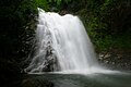 Fubukinotaki.jpg 1 024 × 683; 115 kB
-
 FUMAKILLA headquarters 20121124-01.JPG 4 000 × 3 000; 4,03 MB
-
 Gokurakuji setonaikai.jpg 4 032 × 3 024; 1,76 MB
-
 Hatsukaichi 20121229.gif 800 × 449; 826 kB
-
 Hatsukaichi city center area Aerial photograph.2008.jpg 5 107 × 3 831; 7,5 MB
-
 Hatsukaichi in Hiroshima Prefecture Ja.svg 780 × 700; 29 kB
-
 Hatsukaichi in Hiroshima Prefecture.png 1 281 × 901; 44 kB
-
 Hatsukaichi Ono Post office.jpg 1 600 × 1 200; 493 kB
-
 Hatsukaichi post office 51006.JPG 1 600 × 1 200; 586 kB
-
 Hatsukaichi, Hiroshima.svg 686 × 631; 23 kB
-
 Hiroshima Bay 廣島灣 - panoramio.jpg 6 000 × 4 000; 3,88 MB
-
 Hiroshima Natalie 1974.jpg 1 379 × 1 502; 307 kB
-
 Hiroshima Natalie 1988.jpg 1 265 × 1 433; 306 kB
-
 Hiroshima-006 (49324522063).jpg 7 360 × 4 912; 28,17 MB
-
 House in Ajina.jpg 2 480 × 1 655; 2,12 MB
-
 In the wild - panoramio (1).jpg 4 928 × 3 264; 11,03 MB
-
 In the wild - panoramio.jpg 4 928 × 3 264; 7,16 MB
-
 Itsukushima Island and Ono Strait from train of Sanyo Main Line.jpg 3 998 × 2 999; 2,41 MB
-
 Japan Houses.JPG 2 304 × 1 728; 1,07 MB
-
 Japan National Route 2 in front of Miyajimaguchi Station.jpg 3 997 × 2 998; 3,59 MB
-
 JR Miyajima Ferry from West Pine Grove on Itsukushima Island.jpg 3 985 × 2 989; 2,93 MB
-
 Kannon-do Hall - panoramio.jpg 1 800 × 1 200; 760 kB
-
 Katsura Park 1 Sakurao Castle.jpg 2 400 × 1 800; 1,88 MB
-
 Katsura Park 2 Monument.jpg 2 400 × 1 800; 1,65 MB
-
 Lights in the Light (5029907663).jpg 2 000 × 1 402; 1,05 MB
-
 Manhole cover of Hatsukaichi, Hiroshima.jpg 3 843 × 2 882; 5,57 MB
-
 Map Hatsukaichi en.png 1 281 × 901; 44 kB
-
 Megahira Ski resorts.jpg 3 264 × 2 448; 1,44 MB
-
 Mitaraigawa River near river mouth.jpg 4 032 × 3 024; 2,93 MB
-
 MIYAJIMA ISLAND HIROSHIMA BAY JAPAN JUNE 2012 (7419236626).jpg 3 690 × 2 778; 4,68 MB
-
 MIYAJIMA ISLAND HIROSHIMA BAY JAPAN JUNE 2012 (7419247180).jpg 3 190 × 2 391; 4,24 MB
-
 Miyajimaguchi Ferry Terminal 001.jpg 3 979 × 2 653; 7,18 MB
-
 Miyajimaguchi Post Office 20170310.jpg 3 951 × 2 964; 2,79 MB
-
 Miyajimaguchi Post Office 20170909.jpg 3 144 × 2 359; 1,5 MB
-
 Miyajimaguchi Restaurant Ueno(Conger) 宮島口 上野商店(あなご) - panoramio.jpg 3 648 × 2 736; 4,02 MB
-
 Miyajimaguchi 宮島口 - panoramio (1).jpg 6 000 × 4 000; 5,44 MB
-
 Miyajimaguchi 宮島口 - panoramio (2).jpg 5 646 × 3 762; 5,19 MB
-
 Miyajimaguchi.jpg 2 587 × 1 774; 2,31 MB
-
 Mokuzaikokita, Hatsukaichi, Hiroshima Prefecture 738-0021, Japan - panoramio.jpg 2 048 × 1 536; 2,01 MB
-
 Mt.Jippozan.jpg 2 592 × 1 944; 1,87 MB
-
 National Route 488、吉和村付近 - panoramio.jpg 2 160 × 1 620; 1,64 MB
-
 Nikko (1425591891).jpg 1 061 × 1 600; 278 kB
-
 Observatory - panoramio (6).jpg 1 800 × 1 200; 479 kB
-

-
 Ono Strait from Honden of Toyokuni Shrine 2.jpg 4 024 × 3 018; 3,5 MB
-
 Ono Strait from Honden of Toyokuni Shrine.jpg 4 003 × 3 003; 3,87 MB
-
 Ono Strait from JR Miyajima Ferry (north) 1.jpg 4 032 × 3 024; 1,96 MB
-
 Ono Strait from JR Miyajima Ferry (north) 2.jpg 4 032 × 3 024; 2,2 MB
-
 Ono Strait from JR Miyajima Ferry (north) 4.jpg 4 032 × 3 024; 2,23 MB
-
 Ono Strait from JR Miyajima Ferry (north) 5.jpg 4 032 × 3 024; 2,29 MB
-
 Ono Strait from JR Miyajima Ferry (north) 6.jpg 4 021 × 3 016; 3,26 MB
-
 Ono Strait from JR Miyajima Ferry (north) 7.jpg 3 985 × 2 989; 3,14 MB
-
 Ono Strait from JR Miyajima Ferry (north) 8.jpg 4 005 × 3 004; 2,19 MB
-
 Ono Strait from JR Miyajima Ferry (west) 1.jpg 3 994 × 2 996; 2,83 MB
-
 Ono Strait from JR Miyajima Ferry (west) 2.jpg 4 032 × 3 024; 2,32 MB
-
 Ono Strait from JR Miyajima Ferry (west) 3.jpg 3 992 × 2 994; 3,33 MB
-
 Ono Strait from JR Miyajima Ferry (west) 4.jpg 4 032 × 3 024; 2,35 MB
-
 Ono Strait from JR Miyajima Ferry (west) 5.jpg 4 032 × 3 024; 2,38 MB
-
 Ono Strait from JR Miyajima Ferry (west) 6.jpg 4 021 × 3 016; 3 MB
-
 Ono Strait from JR Miyajima Ferry (west) 7.jpg 3 990 × 2 993; 2 MB
-
 Ono Strait from JR Miyajima Ferry (west) 8.jpg 4 020 × 3 015; 2,43 MB
-
 Ono Strait from Mikasanohama Beach on Itsukushima Island 2.jpg 3 990 × 2 992; 2,62 MB
-
 Ono Strait from Mikasanohama Beach on Itsukushima Island.jpg 4 016 × 3 012; 2,77 MB
-
 Ono Strait from Miyajima Station.jpg 4 032 × 3 024; 1,56 MB
-
 Ono Strait from north side of Itsukushima Shrine 1.jpg 4 032 × 3 024; 2,26 MB
-
 Ono Strait from north side of Itsukushima Shrine 2.jpg 3 978 × 2 983; 2,42 MB
-
 Ono Strait from West Pine Grove on Itsukushima Island 1.jpg 3 999 × 2 999; 2,94 MB
-
 Ono Strait from West Pine Grove on Itsukushima Island 2.jpg 4 032 × 3 024; 2,03 MB
-
 Ono Strait near Miyajima Station 2.jpg 4 024 × 3 018; 2,99 MB
-
 Ono Strait near Miyajima Station 3.jpg 4 011 × 3 008; 3,18 MB
-
 Ono Strait near Miyajima Station.jpg 4 032 × 3 024; 2,41 MB
-
 Ono Strait near Seifukan Hall of Hiroshima University of Economics 2.jpg 3 997 × 2 998; 2,81 MB
-
 Ono Strait near Seifukan Hall of Hiroshima University of Economics 3.jpg 4 032 × 3 024; 2,35 MB
-
 Ono Strait near Seifukan Hall of Hiroshima University of Economics 4.jpg 4 007 × 3 005; 3,23 MB
-
 Ono Strait near Seifukan Hall of Hiroshima University of Economics.jpg 3 941 × 2 956; 3,15 MB
-
 Ono, Hatsukaichi, Hiroshima Prefecture 739-0488, Japan - panoramio (1).jpg 2 592 × 1 944; 1,14 MB
-
 Ono, Hatsukaichi, Hiroshima Prefecture 739-0488, Japan - panoramio (10).jpg 4 928 × 3 264; 8,65 MB
-
 Ono, Hatsukaichi, Hiroshima Prefecture 739-0488, Japan - panoramio (11).jpg 4 928 × 3 264; 7,08 MB
-
 Ono, Hatsukaichi, Hiroshima Prefecture 739-0488, Japan - panoramio (12).jpg 4 928 × 3 264; 8,59 MB
-
 Ono, Hatsukaichi, Hiroshima Prefecture 739-0488, Japan - panoramio (2).jpg 2 592 × 1 944; 1,68 MB
-
 Ono, Hatsukaichi, Hiroshima Prefecture 739-0488, Japan - panoramio (3).jpg 2 592 × 1 944; 1,4 MB
-
 Ono, Hatsukaichi, Hiroshima Prefecture 739-0488, Japan - panoramio (4).jpg 2 592 × 1 944; 1,72 MB
-
 Ono, Hatsukaichi, Hiroshima Prefecture 739-0488, Japan - panoramio (5).jpg 2 048 × 1 536; 2,88 MB
-
 Ono, Hatsukaichi, Hiroshima Prefecture 739-0488, Japan - panoramio (6).jpg 4 928 × 3 264; 11,77 MB
-
 Ono, Hatsukaichi, Hiroshima Prefecture 739-0488, Japan - panoramio (7).jpg 4 928 × 3 264; 14,12 MB
-
 Ono, Hatsukaichi, Hiroshima Prefecture 739-0488, Japan - panoramio (8).jpg 4 928 × 3 264; 8,81 MB
-
 Ono, Hatsukaichi, Hiroshima Prefecture 739-0488, Japan - panoramio (9).jpg 4 928 × 3 264; 8,17 MB
-
 Ono, Hatsukaichi, Hiroshima Prefecture 739-0488, Japan - panoramio.jpg 1 944 × 2 592; 1,17 MB
-
 Onoseto Strait 大野瀨戶 - panoramio.jpg 6 000 × 4 000; 4,38 MB
-
 Orange tree - panoramio.jpg 4 000 × 3 000; 4,93 MB
-
 Otorii - panoramio (2).jpg 1 800 × 1 200; 596 kB
-
 Pier of Miyajima Station from south side.jpg 4 032 × 3 024; 2,42 MB
-
 Pier of Miyajimaguchi Station (Ferry) from JR Miyajima Ferry.jpg 4 032 × 3 024; 2,14 MB
-
 Population distribution of Hatsukaichi, Hiroshima, Japan.svg 512 × 256; 22 kB
-

-
 Setonaikai - panoramio.jpg 4 592 × 3 056; 4,78 MB
-
 Sunrise at Miyajima S.A. - panoramio.jpg 2 848 × 2 136; 2,92 MB
-
 The artificial rock supporting the dragon of a megalith - panoramio.jpg 1 536 × 2 048; 2,28 MB
-
 THE BIG Miyauchi 20140726.JPG 4 288 × 3 216; 3,86 MB
-

-
 The lower part of the bird of a megalith - panoramio.jpg 3 648 × 2 736; 3,29 MB
-
 The pole of a megalith remains into woods. - panoramio.jpg 2 736 × 3 648; 3,01 MB
-

-

-
 The round mountain which symbolizes "scarab" of Egyptian hieroglyphs - panoramio.jpg 1 600 × 1 200; 752 kB
-
 The sunrise in morning mist - panoramio.jpg 2 048 × 1 536; 758 kB
-
 The vestige of megalith civilization remains in the slope of the mountain. - panoramio.jpg 3 648 × 2 736; 3,38 MB
-
 The work of art of a megalith has crumbled. - panoramio.jpg 3 648 × 2 736; 3,12 MB
-
 Tina court.jpg 1 920 × 1 280; 350 kB
-
 Torii in front of Miyajimaguchi Station (Ferry).jpg 4 032 × 3 024; 2,24 MB
-
 Train of Hiroden Miyajima Line on east side of Hiroden-Hatsukaichi Station.jpg 3 947 × 2 960; 3,21 MB
-
 View from Hatsukaichi Station.jpg 3 920 × 2 940; 2,47 MB
-
 View from Tonooka Hill on Itsukushima Island.jpg 4 032 × 3 024; 3,09 MB
-
 View in front of Miyajimaguchi Station.jpg 4 032 × 3 024; 2 MB
-
 View of Seto Inland Sea from train near Ajina-Higashi Station.JPG 3 179 × 2 385; 1,93 MB
-
 When a tide level is filled, the frog of a megalith appears. - panoramio.jpg 1 600 × 1 200; 598 kB
-
 When looking at the setting sun in the shrine of three goddesses - panoramio.jpg 1 536 × 2 048; 821 kB
-
 When the processed megalith toppled, the tree was damaged and it unified. - panoramio.jpg 3 648 × 2 736; 2,87 MB
-
 Wild place - panoramio.jpg 4 928 × 3 264; 7,35 MB
-
 Youmetown hatsukaichi.jpg 1 504 × 1 004; 245 kB
-
 あいプラザ.jpg 1 200 × 800; 560 kB
-
 ざんねんさん - panoramio.jpg 1 000 × 667; 826 kB
-
 ひろしま男子駅伝の折り返し地点(JR西日本山陽本線宮島口-大野浦駅間の前空駅東).jpg 3 264 × 2 448; 1,81 MB
-
 もみのき荘 - panoramio.jpg 1 100 × 732; 598 kB
-
 ウッドワン本社01.jpg 680 × 510; 69 kB
-
 ウッドワン本社02.jpg 680 × 501; 53 kB
-
 デオデオ本社01.jpg 2 272 × 1 704; 794 kB
-
 デオデオ本社02.jpg 2 272 × 1 704; 983 kB
-
 京大原爆災害調査班遭難記念碑 - panoramio.jpg 700 × 439; 320 kB
-
 依田神社 - panoramio.jpg 800 × 1 200; 1,06 MB
-
 十方山山頂二等三角点.jpg 1 600 × 1 200; 1,16 MB
-
 吉和 魅惑の里 - panoramio.jpg 1 100 × 732; 588 kB
-
 吉和魅惑の里 特産館 - panoramio.jpg 1 100 × 732; 614 kB
-
 四十八坂 - panoramio.jpg 667 × 1 000; 800 kB
-
 地下道の掲示 - panoramio.jpg 2 288 × 1 520; 1,84 MB
-
 城山山頂 Mt.Siroyama - panoramio.jpg 1 400 × 931; 698 kB
-
 塩屋漁港 - panoramio - oono100.jpg 1 200 × 800; 766 kB
-
 塩屋漁港 - panoramio.jpg 1 200 × 800; 563 kB
-
 大田神社 - panoramio - oono100.jpg 550 × 367; 51 kB
-
 大田神社 - panoramio.jpg 550 × 367; 48 kB
-
 大頭神社 - panoramio.jpg 550 × 364; 68 kB
-
 妹背の滝 - panoramio.jpg 750 × 500; 121 kB
-
 宮島口桟橋あなごめし(宮島口駅).jpg 4 000 × 2 672; 1,04 MB
-
 小瀬川温泉 - panoramio.jpg 1 100 × 732; 774 kB
-
 広島ナタリー跡01.JPG 3 264 × 2 448; 2,99 MB
-
 広島ナタリー跡02.JPG 2 272 × 1 704; 944 kB
-
 広島ナタリー跡03.JPG 3 264 × 2 448; 2,94 MB
-
 広島ナタリー跡04.JPG 2 272 × 1 704; 973 kB
-
 広島ナタリー跡05.JPG 2 272 × 1 704; 945 kB
-
 広島県 廿日市市 市内.jpg 1 500 × 843; 137 kB
-
 広島電鉄廿日市変電所01.jpg 3 264 × 2 448; 3,15 MB
-
 広島電鉄廿日市変電所02.JPG 2 732 × 2 304; 2,78 MB
-
 廿日市 - panoramio (6).jpg 2 376 × 1 782; 1,99 MB
-
 廿日市市 塩屋 - panoramio.jpg 1 200 × 787; 307 kB
-
 廿日市市 福面 - panoramio.jpg 1 200 × 800; 213 kB
-
 廿日市市 陣場 - panoramio.jpg 1 200 × 800; 422 kB
-
 廿日市市.jpg 465 × 467; 100 kB
-
 廿日市市八坂付近から見る宮島 Miyajima, seen from Yasaka Hatsukaichi - panoramio.jpg 4 608 × 3 072; 2,42 MB
-
 廿日市市八坂付近の鉄門 Iron gate of Yasaka Hatsukaichi - panoramio.jpg 4 608 × 3 072; 4,02 MB
-
 廿日市市峠341の鉄塔 - panoramio (1).jpg 3 072 × 4 608; 3,1 MB
-
 廿日市市峠341の鉄塔 - panoramio.jpg 3 072 × 4 608; 2,84 MB
-
 廿日市市阿品 - panoramio.jpg 2 228 × 1 628; 1,23 MB
-
 悪谷下橋・北側 - panoramio.jpg 1 024 × 768; 261 kB
-
 梅原港 - panoramio.jpg 1 200 × 800; 748 kB
-
 永慶寺橋西詰交差点付近の景色 Near the Intersection of Eikeiji bridge west - panoramio (1).jpg 4 608 × 3 072; 3 MB
-
 永慶寺橋西詰交差点付近の景色 Near the Intersection of Eikeiji bridge west - panoramio.jpg 3 072 × 4 608; 2,66 MB
-
 浅原郵便局 Post office - panoramio.jpg 1 100 × 746; 762 kB
-
 渡ノ瀬貯水池 - panoramio.jpg 1 100 × 733; 215 kB
-
 竹林 - panoramio (1).jpg 4 592 × 3 056; 9,06 MB
-
 米山神社 - panoramio.jpg 550 × 383; 338 kB
-
 経小屋山からの眺望01 - panoramio.jpg 1 100 × 733; 135 kB
-
 経小屋山からの眺望02 - panoramio.jpg 1 100 × 733; 143 kB
-
 蘭陵王 - panoramio.jpg 1 520 × 2 288; 1,65 MB
-
 誓真釣井 Seishin-Tsurui Wall - panoramio.jpg 1 944 × 2 592; 2,09 MB
-
 阿品 Ajina - panoramio.jpg 5 128 × 3 073; 4,65 MB
-
 2代目ロゴ.JPG 4 000 × 3 000; 4,03 MB
_narrated_to_a_legend_-_panoramio.jpg)
_-_panoramio.jpg)

.jpg)
.jpg)


.jpg)


.jpg)


_%E5%AE%AE%E5%B3%B6%E5%8F%A3_%E4%B8%8A%E9%87%8E%E5%95%86%E5%BA%97(%E3%81%82%E3%81%AA%E3%81%94)_-_panoramio.jpg)
.jpg)
.jpg)


.jpg)
.jpg)


_1.jpg)
_2.jpg)
_4.jpg)
_5.jpg)
_6.jpg)
_7.jpg)
_8.jpg)
_1.jpg)
_2.jpg)
_3.jpg)
_4.jpg)
_5.jpg)
_6.jpg)
_7.jpg)
_8.jpg)


.jpg)

_from_JR_Miyajima_Ferry.jpg)


.jpg)


.jpg)


.jpg)


.jpg)


.jpg)


.jpg)


.jpg)
.jpg)
.jpg)
.jpg)
.jpg)
.jpg)
.jpg)
.jpg)
.jpg)
.jpg)
.jpg)
.jpg)
.jpg)
.jpg)
.jpg)
.jpg)