Category:Herenstraat 33, Utrecht
Jump to navigation
Jump to search
| Object location | | View all coordinates using: OpenStreetMap |
|---|
building in Utrecht, Netherlands  | |||||
| Upload media | |||||
| Instance of | |||||
|---|---|---|---|---|---|
| Location | Utrecht, Netherlands | ||||
| Street address |
| ||||
| Heritage designation |
| ||||
 | |||||
|
This is a category about rijksmonument number 36131
|
| Address |
|
Media in category "Herenstraat 33, Utrecht"
The following 3 files are in this category, out of 3 total.
-
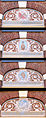 Herenstraat 33 Utrecht vier details.jpg 1,569 × 4,025; 1.28 MB
-
 Herenstraat.33.Utrecht.jpg 3,000 × 4,000; 5.21 MB
-
 Voorgevel - Utrecht - 20235713 - RCE.jpg 805 × 1,200; 167 KB
