Category:Heston
Saltar para a navegação
Saltar para a pesquisa
human settlement in the London Borough of Hounslow  | |||||
| Carregar ficheiro | |||||
| Instância de | |||||
|---|---|---|---|---|---|
| Localização | Hounslow, Grande Londres, Londres, Inglaterra | ||||
| Área |
| ||||
 | |||||
Subcategorias
Esta categoria contém as seguintes 6 subcategorias (de um total de 6).
Multimédia na categoria "Heston"
Esta categoria contém os seguintes 69 ficheiros (de um total de 69).
-
-
 Alderney Avenue - geograph.org.uk - 2507150.jpg 640 × 480; 77 kB
-
 Alderney Avenue - geograph.org.uk - 2507153.jpg 640 × 480; 79 kB
-
 Alderney Avenue, Heston - geograph.org.uk - 2125918.jpg 4 320 × 3 240; 3,97 MB
-
 All Saints, Broad Walk, Heston, TW5 - geograph.org.uk - 1750687.jpg 1 000 × 616; 137 kB
-
 All Saints, Broad Walk, Heston, TW5 - geograph.org.uk - 1750689.jpg 1 000 × 495; 141 kB
-
 Approaching the shops, Heston - geograph.org.uk - 3144639.jpg 640 × 480; 113 kB
-
 Church Road from The Crossways, Heston - geograph.org.uk - 3606492.jpg 2 048 × 1 536; 1,49 MB
-
 Cranford Lane, Heston - geograph.org.uk - 2240053.jpg 800 × 600; 291 kB
-
-
-

-
 FelthamHestonConstituency.svg 400 × 310; 272 kB
-
 Fern Lane - geograph.org.uk - 80603.jpg 640 × 480; 85 kB
-
 Gresham Road, Heston - geograph.org.uk - 2125903.jpg 4 320 × 3 240; 4,8 MB
-
 Heston - Old Park Way - geograph.org.uk - 5102025.jpg 4 608 × 3 456; 5,91 MB
-
 Heston - Sutton Hall Road - geograph.org.uk - 5102022.jpg 4 608 × 3 456; 6,17 MB
-
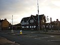
 Heston and Isleworth Fire Station - geograph.org.uk - 86317.jpg 640 × 480; 105 kB
-
 Heston Community School from the air - geograph.org.uk - 5074393.jpg 640 × 480; 193 kB
-
 Heston Flats - panoramio (1).jpg 3 648 × 2 736; 1,75 MB
-
 Heston Flats - panoramio.jpg 3 648 × 2 736; 2,47 MB
-
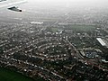 Heston from the air - geograph.org.uk - 3787167.jpg 640 × 480; 130 kB
-
 Heston from the air - geograph.org.uk - 3994379.jpg 640 × 393; 155 kB
-
 Heston from the air - geograph.org.uk - 3994387.jpg 640 × 422; 160 kB
-
 Heston from the air - geograph.org.uk - 5085006.jpg 640 × 480; 232 kB
-
 Heston from the air - geograph.org.uk - 5085019.jpg 640 × 480; 208 kB
-
 Heston from the air - geograph.org.uk - 5085037.jpg 640 × 480; 234 kB
-
 Heston from the air - geograph.org.uk - 5085057.jpg 640 × 480; 232 kB
-
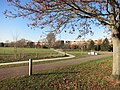
 Heston Park - geograph.org.uk - 2110680.jpg 2 048 × 1 360; 1,69 MB
-
 Heston Park - geograph.org.uk - 2110686.jpg 1 024 × 1 536; 699 kB
-
 Heston Park - geograph.org.uk - 2110688.jpg 1 536 × 1 024; 431 kB
-
 Heston Park - geograph.org.uk - 5214388.jpg 4 000 × 3 000; 4,74 MB
-
 Heston Parke - geograph.org.uk - 2110692.jpg 2 048 × 1 360; 1,34 MB
-
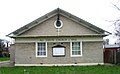
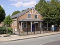 Heston Village Hall.jpeg 1 280 × 960; 270 kB
-
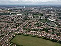
 Heston, Hounslow - geograph.org.uk - 4916216.jpg 3 960 × 2 640; 7,71 MB
-
 Hounslow milestone - geograph.org.uk - 1612837.jpg 640 × 480; 96 kB
-
 Jersey Road, Heston - geograph.org.uk - 2125919.jpg 4 320 × 3 240; 4,01 MB
-
 Jersey Road, Heston - geograph.org.uk - 2125920.jpg 4 320 × 3 240; 3,82 MB
-
 Lampton by Heston, Middlesex (geograph 4915553).jpg 6 000 × 4 000; 7,06 MB
-
 Lovat Walk, Heston - geograph.org.uk - 3697233.jpg 2 560 × 1 920; 2,02 MB
-
 Meadow Waye, Heston - geograph.org.uk - 5214403.jpg 4 000 × 3 000; 2,46 MB
-
 New Heston Road, Heston - geograph.org.uk - 3697255.jpg 2 560 × 1 920; 2 MB
-
 North Hyde Lane at the junction of New Heston Road - geograph.org.uk - 3606207.jpg 2 048 × 1 536; 1,39 MB
-
 North Hyde Lane going over the M4 motorway - geograph.org.uk - 3606195.jpg 2 048 × 1 536; 1,43 MB
-
 North Hyde Lane, Heston - geograph.org.uk - 899301.jpg 640 × 480; 66 kB
-
 Phoenix Way, Heston - geograph.org.uk - 2240049.jpg 800 × 600; 247 kB
-
-
 Shops on North Hyde Lane from Thorncliffe Road - geograph.org.uk - 3606483.jpg 2 043 × 1 497; 1,42 MB
-
 Shops on North Hyde Lane, Heston - geograph.org.uk - 3606216.jpg 2 048 × 1 536; 1,5 MB
-
 Shops on Vicarage Farm Road, Heston - geograph.org.uk - 2240064.jpg 800 × 600; 257 kB
-
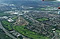
 Springwell schools from the air - geograph.org.uk - 5085029.jpg 640 × 480; 238 kB
-
 Sutton Hall Road, Heston - geograph.org.uk - 2240094.jpg 800 × 600; 238 kB
-
 Sutton Road - geograph.org.uk - 2507143.jpg 640 × 480; 108 kB
-
 Sutton Road at the junction of Upper Sutton Lane - geograph.org.uk - 3606278.jpg 2 048 × 1 536; 1,48 MB
-
 Sutton Road, Heston - geograph.org.uk - 2240097.jpg 800 × 600; 253 kB
-
 Sutton Road, Heston - geograph.org.uk - 3606485.jpg 2 048 × 1 536; 1,41 MB
-
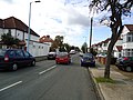
 The Crossways (road) Heston - geograph.org.uk - 2240076.jpg 800 × 600; 212 kB
-
 The Crossways at the junction of Sutton Way - geograph.org.uk - 3606256.jpg 2 048 × 1 536; 1,48 MB
-
 The Crossways at the junction of The Warren - geograph.org.uk - 3606251.jpg 2 048 × 1 536; 1,51 MB
-
 The Crossways, Heston - geograph.org.uk - 3606491.jpg 2 048 × 1 536; 1,51 MB
-
 The Rising Sun on Cranford Lane, Heston - geograph.org.uk - 2240057.jpg 800 × 600; 244 kB
-
 The Warren, Heston - geograph.org.uk - 3606488.jpg 2 048 × 1 536; 1,4 MB
-
 Thorncliffe Road at the junction of Craneswater - geograph.org.uk - 3606159.jpg 2 048 × 1 536; 1,48 MB
-
 Thorncliffe Road. North Hyde - geograph.org.uk - 4270849.jpg 2 560 × 1 920; 1,98 MB
-
 Vicarage Farm Road at the junction of Cranford Lane - geograph.org.uk - 3697517.jpg 2 560 × 1 920; 1,9 MB
-
 Vicarage Farm Road at the junction of Orchard Avenue - geograph.org.uk - 3606240.jpg 2 048 × 1 536; 1,48 MB
-
 Vicarage Farm Road, Heston - geograph.org.uk - 3035991.jpg 640 × 480; 81 kB
-
 Vicarage Farm Road, Heston - geograph.org.uk - 3073587.jpg 640 × 480; 134 kB
-
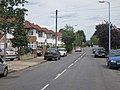
 West Way (road) Heston - geograph.org.uk - 2240082.jpg 800 × 600; 265 kB


.jpg)


.jpg)


_Heston_-_geograph.org.uk_-_2240076.jpg)


_Heston_-_geograph.org.uk_-_2240082.jpg)