Category:Hewelsfield and Brockweir
Saltar para a navegação
Saltar para a pesquisa
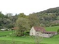
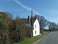
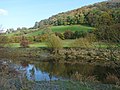
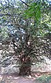
English: Hewelsfield and Brockweir is a civil parish in the Forest of Dean district, in the county of Gloucestershire, England.
civil parish in Forest of Dean, Gloucestershire, England | |||||
| Carregar ficheiro | |||||
| Instância de | |||||
|---|---|---|---|---|---|
| Localização | Forest of Dean, Gloucestershire, Sudoeste da Inglaterra, Inglaterra | ||||
 | |||||
Subcategorias
Esta categoria contém as seguintes 3 subcategorias (de um total de 3).
Multimédia na categoria "Hewelsfield and Brockweir"
Esta categoria contém os seguintes 71 ficheiros (de um total de 71).
-
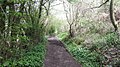
 A Tintern - Brockweir path - geograph.org.uk - 2938290.jpg 640 × 360; 296 kB
-
 A valley above the Wye Valley - geograph.org.uk - 5497405.jpg 1 024 × 683; 282 kB
-
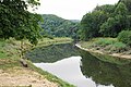
 Afon Gwy - River Wye at Tintern - geograph.org.uk - 6048927.jpg 800 × 548; 117 kB
-
 B4228 in Oakhill Wood - geograph.org.uk - 3427359.jpg 1 024 × 768; 167 kB
-
 B4228 northbound near Cowshill Farm - geograph.org.uk - 4623244.jpg 640 × 480; 37 kB
-
 B4228 south of Hewelsfield - geograph.org.uk - 1984055.jpg 640 × 480; 267 kB
-
 Boathouse beside the river Wye - geograph.org.uk - 2757334.jpg 1 600 × 1 064; 734 kB
-
 Caswell Wood - geograph.org.uk - 5155875.jpg 1 024 × 575; 492 kB
-
 Cattle on the move - geograph.org.uk - 5973296.jpg 6 000 × 4 000; 7,5 MB
-
 Descent through the wood - geograph.org.uk - 1519183.jpg 640 × 426; 123 kB
-
 Downstream along the Wye, Tintern - geograph.org.uk - 5317372.jpg 800 × 488; 94 kB
-

-
 East bank of river Wye, Tintern - geograph.org.uk - 952683.jpg 640 × 426; 90 kB
-
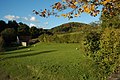
 Field below Pool Court House - geograph.org.uk - 5496685.jpg 1 024 × 683; 255 kB
-
 Flowers on the lane - geograph.org.uk - 3050016.jpg 640 × 480; 144 kB
-
 Footpath junction at Hart Hill - geograph.org.uk - 1984045.jpg 640 × 480; 283 kB
-

-
 Hewelsfield Common - geograph.org.uk - 2796152.jpg 1 024 × 577; 301 kB
-
 Hewelsfield Common.jpg 5 180 × 2 913; 3,58 MB
-

-
 Layby on the B4228 - geograph.org.uk - 5496789.jpg 1 024 × 683; 275 kB
-

-
 On the Wye Valley way footpath - geograph.org.uk - 6164716.jpg 1 024 × 768; 325 kB
-
 Over the river from Tintern - geograph.org.uk - 5155867.jpg 1 024 × 768; 339 kB
-

-
 Part of the River Wye at Tintern - geograph.org.uk - 3091035.jpg 640 × 480; 100 kB
-
 Pasture land of West Gloucestershire - geograph.org.uk - 1984050.jpg 640 × 480; 255 kB
-
 Path and lane junction - geograph.org.uk - 3050010.jpg 640 × 480; 125 kB
-
 Path junction in the Wye Valley - geograph.org.uk - 5773089.jpg 1 024 × 768; 365 kB
-
 Pool Cottage, Hewelsfield - geograph.org.uk - 3427344.jpg 1 024 × 769; 143 kB
-

-
 River Wye - geograph.org.uk - 1352156.jpg 640 × 426; 87 kB
-
 River Wye - geograph.org.uk - 2675450.jpg 640 × 480; 126 kB
-
 River Wye - geograph.org.uk - 2938302.jpg 640 × 360; 228 kB
-
 River Wye - geograph.org.uk - 3622477.jpg 427 × 640; 105 kB
-
 River Wye - geograph.org.uk - 3622500.jpg 640 × 427; 67 kB
-
 River Wye at Tintern - geograph.org.uk - 2254202.jpg 1 024 × 683; 156 kB
-
 River Wye at Tintern - geograph.org.uk - 5772852.jpg 1 024 × 768; 162 kB
-
 River Wye at Tintern - geograph.org.uk - 5915536.jpg 1 024 × 768; 241 kB
-
 River Wye at Tintern Abbey - geograph.org.uk - 5589070.jpg 1 600 × 1 200; 857 kB
-
 River Wye at Tintern looking north - geograph.org.uk - 5589045.jpg 1 600 × 1 200; 669 kB
-
 River Wye at Tintern Parva - geograph.org.uk - 3621110.jpg 640 × 427; 94 kB
-
 River Wye in Autumn - geograph.org.uk - 2683957.jpg 1 600 × 1 200; 514 kB
-
 River Wye, Tintern - geograph.org.uk - 2544697.jpg 2 816 × 2 112; 1,91 MB
-

-
 Road junction near Hewelsfield - geograph.org.uk - 5497402.jpg 1 024 × 683; 289 kB
-
 Slipway on the River Wye - geograph.org.uk - 6224045.jpg 4 032 × 2 268; 5,89 MB
-
 Small stream flowing down to the Wye Valley Path - geograph.org.uk - 2757312.jpg 1 600 × 1 064; 785 kB
-
 Steep valley - geograph.org.uk - 2796164.jpg 1 024 × 577; 313 kB
-
 Stubble field near Hewelsfield - geograph.org.uk - 5496619.jpg 1 024 × 683; 305 kB
-
 The bottom of Mill Hill - geograph.org.uk - 5975297.jpg 6 000 × 4 000; 4,57 MB
-
 The King Yew in Woolaston Wood - geograph.org.uk - 1232617.jpg 400 × 640; 168 kB
-
 The lane to Alvington - geograph.org.uk - 1519162.jpg 640 × 426; 59 kB
-
 The River Wye above Tintern - geograph.org.uk - 5961303.jpg 6 000 × 4 000; 7,18 MB
-
 The River Wye at Tintern - geograph.org.uk - 5961296.jpg 6 000 × 4 000; 6,84 MB
-
 The River Wye at Tintern - geograph.org.uk - 5965853.jpg 6 000 × 4 000; 6,91 MB
-
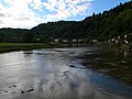
 The River Wye at Tintern - geograph.org.uk - 6048971.jpg 800 × 553; 119 kB
-
 The river Wye at Tintern Parva - geograph.org.uk - 2088379.jpg 640 × 480; 59 kB
-
 The river Wye at Tintern Parva - geograph.org.uk - 2088384.jpg 640 × 480; 64 kB
-
 The Wye at Tintern - looking downstream - geograph.org.uk - 2701014.jpg 2 729 × 1 632; 896 kB
-
 Tintern to Brockweir road - geograph.org.uk - 5155877.jpg 1 024 × 575; 454 kB
-

-
 Tranquil Wye, Tintern - geograph.org.uk - 4119175.jpg 800 × 600; 115 kB
-
 Unsealed road opposite Tintern - geograph.org.uk - 5155870.jpg 1 024 × 575; 417 kB
-

-
 Waterfall beside Wye Valley Walk - geograph.org.uk - 2758989.jpg 426 × 640; 154 kB
-
 Wireworks bridge, Tintern - geograph.org.uk - 3582022.jpg 800 × 692; 106 kB
-
 Within Clay Wood - geograph.org.uk - 2798116.jpg 1 024 × 577; 347 kB
-

-
 Wye valley at Tintern - geograph.org.uk - 2131178.jpg 1 024 × 681; 281 kB
-
 Wye Valley Path - geograph.org.uk - 2758918.jpg 1 600 × 1 104; 657 kB


