Category:High Atlas
Vai alla navigazione
Vai alla ricerca
العربية: الأطلس الكبير
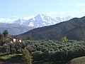
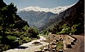
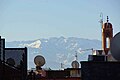
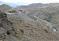
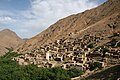
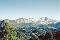
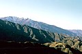
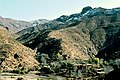
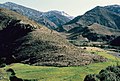
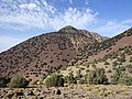
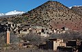
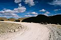
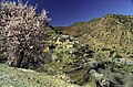
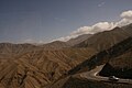
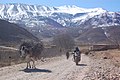
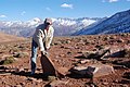
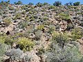
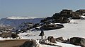
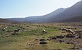
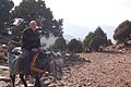
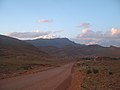
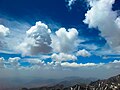
English: High Atlas, also called the Grand Atlas Mountains, is a mountain range of the Atlas Mountains system, in central Morocco.
Français : Haut Atlas
mountain range in central Morocco  | |||||
| Carica un file multimediale | |||||
| Istanza di | |||||
|---|---|---|---|---|---|
| Parte di | |||||
| Materiale usato | |||||
| Luogo |
| ||||
| Lunghezza |
| ||||
| Catena montuosa | |||||
| Punto più alto | |||||
| Altezza sul mare |
| ||||
 | |||||
Sottocategorie
Questa categoria contiene le 39 sottocategorie indicate di seguito, su un totale di 39.
A
- Aourirt n'Ouassif (14 F)
- Ayt Bou Oulli (3 F)
B
D
F
- Foothills of High Atlas (1 F)
G
I
- Ighil Igdamn (ⵉⵖⵉⵍ ⵉⴳⵯⴷⴰⵎⵏ) (11 F)
- Ighil Tizal (11 F)
J
- Jbel Ayachi (11 F)
- Jbel Azourki (2 F)
L
- Lac Isli (5 F)
M
- Maps of the High Atlas (1 F)
- Moulay Brahim (25 F)
O
- Ouirgane (4 F)
- Ounila Valley (3 F)
- Ourika River (24 F)
R
S
T
- Tizi n Ayt Imi (16 F)
- Tizi n Tadghat (2 F)
- Tizi n'Test (12 F)
- Tizi n'Tichka (31 F)
- Todgha Gorge (144 F)
V
- Villages du Haut Atlas Central (17 F)
ⵉ
- ⵉⵖⵉⵍ ⵎⴳⵯⵏ (10 F)
File nella categoria "High Atlas"
Questa categoria contiene 200 file, indicati di seguito, su un totale di 233.
(pagina precedente) (pagina successiva)-
 "Das größte zusammenhängende Oasengebiet Marokkos". 01.jpg 5 283 × 3 220; 4,38 MB
-
 "Das größte zusammenhängende Oasengebiet Marokkos". 02.jpg 5 906 × 3 633; 13,97 MB
-
 "Das größte zusammenhängende Oasengebiet Marokkos". 03.jpg 5 126 × 5 906; 9,26 MB
-
 "Das größte zusammenhängende Oasengebiet Marokkos". 04.jpg 3 937 × 5 906; 10,19 MB
-
 "Das größte zusammenhängende Oasengebiet Marokkos". 05.jpg 5 906 × 3 937; 11,14 MB
-
 "Das größte zusammenhängende Oasengebiet Marokkos". 06.jpg 5 906 × 3 937; 20,99 MB
-
 "Das größte zusammenhängende Oasengebiet Marokkos". 07.jpg 3 509 × 4 473; 6,85 MB
-
 "Das größte zusammenhängende Oasengebiet Marokkos". 08.jpg 5 311 × 3 267; 5,16 MB
-
 "Das größte zusammenhängende Oasengebiet Marokkos". 09.jpg 5 486 × 4 173; 5,22 MB
-
 "Das größte zusammenhängende Oasengebiet Marokkos". 10.jpg 5 906 × 3 937; 10,66 MB
-
 "Das größte zusammenhängende Oasengebiet Marokkos". 11.jpg 5 906 × 3 937; 8,5 MB
-
 "Das größte zusammenhängende Oasengebiet Marokkos". 12.jpg 5 906 × 3 937; 3,98 MB
-
 "Das größte zusammenhängende Oasengebiet Marokkos". 13.jpg 5 627 × 2 736; 3,92 MB
-
 "Das größte zusammenhängende Oasengebiet Marokkos". 14.jpg 5 906 × 3 937; 7,38 MB
-
 "Das größte zusammenhängende Oasengebiet Marokkos". 15.jpg 5 906 × 2 817; 5,53 MB
-
 "Das größte zusammenhängende Oasengebiet Marokkos". 16.jpg 5 906 × 2 624; 8,69 MB
-
 "Das größte zusammenhängende Oasengebiet Marokkos". 17.jpg 5 906 × 2 914; 5,58 MB
-
 "Das größte zusammenhängende Oasengebiet Marokkos". 18.jpg 5 906 × 4 335; 11,52 MB
-
 "Das größte zusammenhängende Oasengebiet Marokkos". 19.jpg 5 906 × 2 289; 1,88 MB
-
 "Das größte zusammenhängende Oasengebiet Marokkos". 20.jpg 5 906 × 2 348; 3,07 MB
-
 "Spektakuläre Haarnadelkurven". 01.jpg 3 812 × 5 906; 6,4 MB
-
 "Spektakuläre Haarnadelkurven". 02.jpg 3 937 × 5 906; 7,83 MB
-
 "Spektakuläre Haarnadelkurven". 03.jpg 5 906 × 3 709; 8,44 MB
-
 "Spektakuläre Haarnadelkurven". 04.jpg 5 906 × 3 760; 8,95 MB
-
 "Spektakuläre Haarnadelkurven". 05.jpg 5 906 × 3 939; 9,34 MB
-
 "Spektakuläre Haarnadelkurven". 06.jpg 5 827 × 5 906; 12,17 MB
-
 "Spektakuläre Haarnadelkurven". 07.jpg 5 906 × 4 549; 10,17 MB
-
 "Spektakuläre Haarnadelkurven". 08.jpg 5 906 × 3 939; 9,36 MB
-
 "Spektakuläre Haarnadelkurven". 09.jpg 5 475 × 4 155; 7,72 MB
-
 AtlasMfromOurika.JPG 3 072 × 2 304; 1,91 MB
-
 RIVIERE de l'OURIKA.JPG 1 912 × 1 173; 349 KB
-
 0105 Riad AZZAR, Marrakesch - Blick zum Atlas (37358887756).jpg 1 400 × 933; 81 KB
-
 High atlas from oasis.JPG 2 592 × 1 944; 2,36 MB
-
 2013.Tishka.pass(2).jpg 3 383 × 2 193; 2,09 MB
-
 2013.Tishka.Pass.N(2).jpg 3 922 × 2 706; 5,35 MB
-
 Aguerd n ozro.jpg 2 256 × 1 496; 912 KB
-
 Ait Bo olli moulet efants.jpg 1 920 × 1 080; 417 KB
-
 Ait mazigh.jpg 3 264 × 2 448; 4,46 MB
-
 Amssakrou, Morocco, 2008.jpg 3 008 × 2 000; 4,19 MB
-
 Atlas (1983) 01.jpg 1 062 × 710; 698 KB
-
 Atlas (1983) 02.jpg 990 × 661; 782 KB
-
 Atlas (1983) 03.jpg 1 062 × 710; 501 KB
-
 Atlas (1983) 04.jpg 1 062 × 710; 979 KB
-
 Atlas (1983) 05.jpg 1 049 × 710; 906 KB
-
 Atlas mountains, High Atlas range.jpg 4 000 × 3 000; 7,9 MB
-
 Atlas mountains, Imlil, 2022 10 30.jpg 4 000 × 3 000; 6,44 MB
-
 Atlas mountains, Tizi Oussem village.jpg 4 000 × 3 000; 5,7 MB
-
 Atlas, Dades river, loundry.jpg 5 573 × 3 653; 18,8 MB
-
 Atlas, pueblos (1983) 06.jpg 1 023 × 648; 887 KB
-
 Atlas, pueblos (1983) 08.jpg 721 × 1 061; 749 KB
-
 Ayt Imi.jpg 2 192 × 1 381; 708 KB
-
 Azib Likemt.jpg 4 752 × 3 168; 5,08 MB
-
 Berber village Atlas.jpg 3 504 × 2 336; 7,76 MB
-
 Berberdorf Nfiss Valley.jpg 3 872 × 2 592; 10,52 MB
-
 Between mountains and rivers.jpg 4 928 × 3 264; 13,67 MB
-
 Bloc diagramme Lias Haut Atlas.jpg 678 × 562; 102 KB
-
 Boumalne du Dadès.JPG 6 000 × 4 000; 23,21 MB
-
 Col du Ouano 02.jpg 1 840 × 1 232; 2,01 MB
-
 Col du Ouano.jpg 1 840 × 1 232; 3,3 MB
-
-
 Comere bagant Atlasse moulet tcherdjî.jpg 640 × 360; 74 KB
-
 Dades Valley1(js).jpg 5 579 × 3 652; 10,15 MB
-
 Dern n Tifnout.jpg 960 × 540; 88 KB
-
 Ecoregion PA1010.png 550 × 550; 467 KB
-

-
 ETH-BIB-Asni, 60 km südlich von Marrakech-Tschadseeflug 1930-31-LBS MH02-08-0378.tif 4 961 × 3 631; 51,64 MB
-
 ETH-BIB-Atlasgebirge aus 3000 m Höhe-Tschadseeflug 1930-31-LBS MH02-08-0357.tif 4 961 × 3 578; 50,89 MB
-
 ETH-BIB-Atlasgebirge aus 4000 m Höhe-Tschadseeflug 1930-31-LBS MH02-08-0365.tif 4 961 × 3 555; 50,58 MB
-
 ETH-BIB-Atlasgebirge aus 4000 m Höhe-Tschadseeflug 1930-31-LBS MH02-08-0457.tif 4 961 × 3 540; 50,34 MB
-
 ETH-BIB-Atlasgebirge aus 4200 m Höhe-Tschadseeflug 1930-31-LBS MH02-08-0364.tif 4 961 × 3 567; 50,73 MB
-

-
 ETH-BIB-Berberdorf im Hohen Atlas-Tschadseeflug 1930-31-LBS MH02-08-0467.tif 4 961 × 3 621; 51,5 MB
-
 ETH-BIB-Berberfrauen, Hoher Atlas-Tschadseeflug 1930-31-LBS MH02-08-0471.tif 4 961 × 3 605; 51,29 MB
-
 ETH-BIB-Berg im Hohen Atlas-Tschadseeflug 1930-31-LBS MH02-08-0226.tif 4 961 × 3 566; 50,71 MB
-
 ETH-BIB-Berg im Hohen Atlas-Tschadseeflug 1930-31-LBS MH02-08-0362.tif 4 410 × 5 906; 74,64 MB
-
 ETH-BIB-Berg im Hohen Atlas-Tschadseeflug 1930-31-LBS MH02-08-0363.tif 4 284 × 5 898; 72,4 MB
-

-
 ETH-BIB-Hoch-Atlas von Asni-Dia 247-09102.tif 3 681 × 2 663; 28,14 MB
-
 ETH-BIB-Hoch-Atlas, Berberdorf, südl. Yjoukak-Dia 247-09105.tif 3 658 × 2 386; 25,08 MB
-
 ETH-BIB-Hoch-Atlas, roter Rillenberg ob Asni-Dia 247-09103.tif 3 605 × 2 857; 29,57 MB
-
 ETH-BIB-Hoch-Atlas, von "Hardmeier" talabwärts (gegen Norden)-Dia 247-09106.tif 3 723 × 2 833; 30,26 MB
-
 ETH-BIB-Hoch-Atlas, von "Hardmeier" talaufwärts (gegen Südost)-Dia 247-09107.tif 3 746 × 2 828; 30,4 MB
-
 ETH-BIB-Tal von Asni mit Hohem Atlas-Tschadseeflug 1930-31-LBS MH02-08-0421.tif 4 961 × 3 637; 51,7 MB
-
 Gerhard Pils 2022 Illustrated Flora of Morocco.jpg 795 × 1 120; 236 KB
-
 Goats crossing Tizi n'Tamatert, Morocco, 2008.jpg 3 008 × 2 000; 3,94 MB
-
 Gorges du todra.jpg 1 024 × 667; 160 KB
-
 Gourza versant nord.jpg 945 × 619; 117 KB
-
 GRAND ATLAS.jpg 8 112 × 4 563; 9,64 MB
-
 Grand Atlasse Demnate-Warzazate anuti.JPG 2 256 × 1 496; 743 KB
-
 Grand Atlasse Demnate-Warzazate.JPG 2 256 × 1 496; 928 KB
-
 Green home.jpg 3 072 × 3 072; 2,32 MB
-
 Haut Atlas.jpg 2 116 × 1 468; 861 KB
-
 Haut Atlas01.jpg 2 288 × 1 712; 738 KB
-
 High Atals mountain-Morocco.jpg 3 264 × 1 836; 3,12 MB
-
 High Atlas between Marrakech and Tizi n'Test pass.jpg 2 000 × 3 008; 851 KB
-
 High Atlas mountaines.jpg 3 264 × 2 448; 2,89 MB
-
 High Atlas Mountains (MODIS 2024-01-04).jpg 2 077 × 1 603; 531 KB
-
 High atlas mountains.jpg 1 000 × 667; 461 KB
-
 High Atlas roads.jpg 2 448 × 3 264; 1,74 MB
-
 High Atlas, routes (js).jpg 3 000 × 1 961; 3,6 MB
-
 High Atlas-green copper-red Iron.jpg 4 032 × 1 908; 3,31 MB
-
 High Atlas-Morocco.jpg 1 280 × 606; 333 KB
-
 High Atlas-The olive grinding mill (js).jpg 3 000 × 1 967; 3,17 MB
-
 High Atlas-village (js).jpg 5 580 × 3 654; 19,44 MB
-
 High Atlas.JPG 1 800 × 1 200; 649 KB
-
 High Atlas10.jpg 5 616 × 3 630; 20,13 MB
-
 High Atlas11.jpg 5 401 × 3 269; 16,52 MB
-
 High Atlas12(js).jpg 5 592 × 3 648; 12,1 MB
-
 High Atlas13(js).jpg 5 568 × 3 642; 12,49 MB
-
 High Atlas14(js).jpg 5 598 × 3 654; 9,1 MB
-
 High Atlas15(js).jpg 5 567 × 3 642; 8,5 MB
-
 High Atlas2 (js).jpg 3 000 × 1 958; 3,11 MB
-
 High Atlas3 (js).jpg 3 000 × 1 942; 3,38 MB
-
 High Atlas5 (js).jpg 3 000 × 1 950; 4,13 MB
-
 High Atlas6 (js).jpg 3 000 × 1 969; 5,52 MB
-
 High Atlas7 (js).jpg 3 000 × 1 975; 3,85 MB
-
 High Atlas8 (js).jpg 5 547 × 3 638; 16,46 MB
-
 High Atlas9.jpg 5 576 × 3 612; 13,75 MB
-
 HighAtlasMorocco.jpg 1 840 × 1 232; 570 KB
-
 Hoge Atlas.jpg 3 888 × 2 592; 3,33 MB
-
 Hoher atlas dadestal.jpg 1 400 × 422; 101 KB
-
 Ighil Igwdamen di Timite ⵉⵖⵉⵍ ⵉⴳⵯⴷⴰⵎⵏ ⵣⵖ ⵜⵉⵎⵉⵜ.jpg 2 256 × 1 496; 728 KB
-
 Ighil igwdamen ågne moto ⵉⵖⵉⵍ ⵉⴳⵯⴷⴰⵎⵏ ⵣⵖ ⵉⵎⵍⵖⴰⵙ.jpg 2 256 × 1 496; 921 KB
-
 Ighil Mgon d' Imi n Ifri moto.jpg 1 920 × 1 080; 286 KB
-
 Ighil tarkeddit ighil rat poirteu schayes.jpg 2 256 × 1 496; 1 006 KB
-
 Ighil tarkeddit ighil rat råyeu schayes.jpg 2 256 × 1 496; 929 KB
-
 Ighil tarkeddit plantes eschayixheusès pires.jpg 1 242 × 1 082; 367 KB
-
 Ighil tarkeddit ⵉⵖⵉⵍ ⵜⴰⵔⴽⴷⴷⵉⵜ ⵣⵖ ⵜⵉⵣⵉ ⵓⴱⴰⴷⵓ.jpg 2 256 × 1 496; 940 KB
-
 Ighil Tizal ⵉⵖⵉⵍ ⵜⵉⵣⴰⵍ.jpg 2 256 × 1 496; 914 KB
-
 Ighil Wawelzate ⵉⵖⵉⵍ ⵡⴰⵡⵍⵣⴰⵜ.jpg 2 256 × 1 496; 914 KB
-
 Ikhf n Irhir (ⵉⵅⴼ ⵏ ⵉⵖⵉⵔ) moskêye.jpg 1 465 × 2 159; 406 KB
-
 Ikhf n Irhir (ⵉⵅⴼ ⵏ ⵉⵖⵉⵔ) voye viè Azorki.jpg 2 256 × 1 496; 872 KB
-
 Ikhf n Irhir (ⵉⵅⴼ ⵏ ⵉⵖⵉⵔ) voye viè Tabane.jpg 2 256 × 1 496; 941 KB
-
 Ikhf n Irhir (ⵉⵅⴼ ⵏ ⵉⵖⵉⵔ) vå.jpg 2 256 × 1 496; 991 KB
-
 Illustrated Flora of Morocco.jpg 1 783 × 1 219; 326 KB
-
 Imlil 1.jpg 5 312 × 2 988; 7,02 MB
-
 Imlil and its valley and way to Jbel Toubkal 27.jpg 4 032 × 3 024; 5,45 MB
-
 Imlil and its valley and way to Jbel Toubkal 29.jpg 4 032 × 3 024; 4,12 MB
-
 Imlil and its valley and way to Jbel Toubkal 32.jpg 4 032 × 3 024; 4,88 MB
-
 Imlil and its valley and way to Jbel Toubkal 44.jpg 4 032 × 3 024; 3,87 MB
-
 ISS010-E-7619 - View of Morocco.jpg 3 032 × 2 064; 1,12 MB
-
 ISS050-E-29810 - View of Morocco.jpg 4 928 × 3 280; 2,25 MB
-
 Jbel Gourza vu de Ifourirn.jpg 960 × 540; 103 KB
-
 Jibal Atlas, Tichka, Marrakesh 2.jpg 960 × 720; 135 KB
-
 Jibal Atlas, Tichka, Marrakesh 4.jpg 960 × 720; 168 KB
-
 Jurassique Haut Atlas central.jpg 950 × 631; 100 KB
-
 Kasbah Goundafa Morocco.jpg 3 872 × 2 592; 3,77 MB
-

-
 Le djebel Toubkal est le point culminant du Haut Atlas ainsi que du Maroc.png 1 920 × 1 080; 2,24 MB
-
 Le djebel Toubkal est le point culminant du Haut Atlas.png 1 920 × 1 080; 2,68 MB
-
 Mape voye Bougmesse Kelaa Mgouna.jpg 2 256 × 1 496; 977 KB
-
 Maroc petit village dans le haut atlas.jpg 1 024 × 768; 153 KB
-
 Maroc un village dans le haut atlas.jpg 2 476 × 891; 395 KB
-
 Marokko- Agadir- Hohe Atlas - Fahrt nach Immouzer - Trockenhänge - panoramio.jpg 3 648 × 2 736; 5,32 MB
-
 Marokko- Agadir- Hohe Atlas- Wanderung im "Paradiestal" Trockenhänge - panoramio.jpg 3 648 × 2 736; 6,22 MB
-
 Marrakech to High Atlas Mountains.jpg 991 × 494; 111 KB
-
 Marrocos (23162314062).jpg 4 928 × 3 264; 6,14 MB
-
 Matate valley seen from Tizi n'Aguersioual, Morocco, 2008.jpg 2 000 × 3 008; 5,82 MB
-
 Mgoun voye Demnate Warzazate.JPG 2 256 × 1 496; 825 KB
-
 Mit dem Fahrrad am Col du Tirherhouzine Marokko.jpg 1 840 × 1 232; 2,51 MB
-
 Mont Rate Ayites Blal.jpg 2 256 × 1 496; 880 KB
-
 Morocco, Amezri to Mgoun valley, Sarcocapnos.jpg 2 500 × 1 664; 1,02 MB
-
 Moulet muzete ABG.jpg 640 × 360; 80 KB
-
 Moulet tcherdjî montinne ABG.jpg 640 × 360; 93 KB
-
 Moultîs ABG.jpg 640 × 360; 75 KB
-
 Moultîs Oucaymeden.jpg 2 256 × 1 496; 987 KB
-
 Oucaymeden tchandele glaece.jpg 640 × 360; 60 KB
-
 Oucaymedene aazib moulet.jpg 640 × 360; 111 KB
-
 Ourika berbere village (1).jpg 3 008 × 2 000; 4,73 MB
-
 Ourika berbere village.jpg 3 008 × 2 000; 1,66 MB
-
 Ourika river.jpg 1 024 × 683; 981 KB
-
 Overview of Imlil from Aroumd, Morocco, 2008.jpg 2 691 × 1 789; 3,6 MB
-
 Overview of Tinerhourhine, looking towards Amssakrou, Morocco, 2008.jpg 2 791 × 1 856; 4,3 MB
-
 Page from book Gerhard Pils 2022 Illustrated Flora of Morocco.jpg 793 × 1 121; 221 KB
-
 Palmeraie de Tinerhir Vallée du Todra.Maroc.jpg 1 800 × 1 222; 870 KB
-
 Panoramic view of typical Berber village (Morocco - High Atlas Mountains).jpg 1 743 × 400; 154 KB
-
 Passåjhe Ayites Imi copete oto.jpg 2 256 × 1 496; 870 KB
-
 Passåjhe Ayites Imi meur nive oto dilé.jpg 2 256 × 1 496; 897 KB
-
 Passåjhe Ayites Imi pectî.jpg 2 256 × 1 496; 729 KB
-
 Passåjhe des Ayites Imi dischindêye.jpg 2 256 × 1 496; 951 KB
-
 Passåjhe des Ayites Imi dizo.jpg 2 256 × 1 496; 962 KB
-
 Passåjhe des Ayites Imi voye enivrêye.jpg 2 256 × 1 496; 931 KB
-
 Paysage de montagnes-02-dequoi.jpg 640 × 480; 66 KB
-
 Paysage de montagnes-dequoi.jpg 640 × 480; 69 KB
-
 Plateau de Tarkeddit, Massif du M'Goun, Haut Atlas, Maroc (49334859623).jpg 5 184 × 3 174; 6,59 MB
-
 Pormoenneu a moulet Oucaymeden.jpg 3 008 × 2 000; 2,58 MB
-
 Rahamna yebe Djebletes Grand Atlasse.jpg 640 × 360; 63 KB
-
 Route au milieu des montagnes-dequoi.jpg 640 × 480; 67 KB
-
 Sunset is beautiful on mountains.jpg 4 608 × 3 456; 3,33 MB
-
 Tazaghart Waterfall.jpg 4 752 × 3 168; 3,45 MB
-
 The Light Path.jpg 6 016 × 4 000; 6,27 MB
-
 The perfection of nature.jpg 1 920 × 1 080; 116 KB
-
 The sky and atlas.jpg 2 581 × 1 936; 2,31 MB
-
 The Toubkal Refuge.jpg 6 016 × 4 000; 5,98 MB
-
 ThiMil Chevre.jpg 850 × 565; 69 KB
-
 ThiMil Figuier.jpg 850 × 565; 87 KB
-
 ThiMil Hsayn.jpg 850 × 565; 194 KB
-
 Tifnout Iferouane mountain.jpg 1 920 × 2 560; 650 KB
-
 Tifnout mountain.jpg 3 264 × 2 448; 3,02 MB
-
 Timit, Hoher Atlas, Agadir Sidi Chems.jpg 3 647 × 1 747; 3,85 MB


.jpg)

.jpg)
.jpg)


_01.jpg)
_02.jpg)
_03.jpg)
_04.jpg)
_05.jpg)


_06.jpg)
_08.jpg)


.jpg)


.jpg)


.jpg)


.jpg)
.jpg)


.jpg)
.jpg)
.jpg)
.jpg)
.jpg)
.jpg)
.jpg)
.jpg)
.jpg)
.jpg)


_mosk%C3%AAye.jpg)
_voye_vi%C3%A8_Azorki.jpg)
_voye_vi%C3%A8_Tabane.jpg)
_v%C3%A5.jpg)


.jpg)


.jpg)


.jpg)


.jpg)