Category:Hillesley and Tresham
Jump to navigation
Jump to search
English: Hillesley and Tresham is a civil parish in the Stroud District of Gloucestershire, England. It had a population of 591 according to the 2001 census. The parish contains the villages of Hillesley and Tresham. The Lyvett (Levett) family, an Anglo-Norman family prominent in Sussex, were lords of the manor of Hillesley in 12th and 13th centuries. The family also held Boxwell, Chipping Sodbury and other places in Gloucestershire.
civil parish in Gloucestershire, United Kingdom | |||||
| Upload media | |||||
| Instance of | |||||
|---|---|---|---|---|---|
| Location | Stroud, Gloucestershire, South West England, England | ||||
| Population |
| ||||
 | |||||
Subcategories
This category has the following 2 subcategories, out of 2 total.
H
T
Media in category "Hillesley and Tresham"
The following 121 files are in this category, out of 121 total.
-
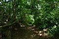
 A delightful lane - geograph.org.uk - 6603644.jpg 1,600 × 1,067; 670 KB
-
 A preserved benchmark - geograph.org.uk - 6594875.jpg 1,600 × 1,200; 1.02 MB
-
 A unnamed stream near Lower Kilcott Farm - geograph.org.uk - 3452344.jpg 800 × 600; 197 KB
-
 A46 at Gloucestershire county boundary - geograph.org.uk - 6408530.jpg 800 × 600; 124 KB
-
 A46 at Tresham Turn - geograph.org.uk - 6408550.jpg 800 × 600; 140 KB
-
 Alderley area from the air - geograph.org.uk - 2092187.jpg 640 × 480; 73 KB
-
 Beaufort ^ Berkeley Hunt, Tresham, Gloucestershire 2017 - geograph.org.uk - 6621731.jpg 2,560 × 1,703; 1.06 MB
-
 Beaufort ^ Berkeley Hunt, Tresham, Gloucestershire 2017 - geograph.org.uk - 6621752.jpg 2,885 × 1,142; 815 KB
-
 Benchmark behind the ivy - geograph.org.uk - 6603648.jpg 1,600 × 1,067; 639 KB
-
 Benchmark on a wall - geograph.org.uk - 6603631.jpg 1,600 × 1,067; 602 KB
-
 Bridge Farmhouse, Lower Kilcott, Gloucestershire 2012 - geograph.org.uk - 5816690.jpg 2,240 × 1,488; 884 KB
-
 Bridleway to Tresham - geograph.org.uk - 5094263.jpg 6,000 × 4,000; 4.15 MB
-
 Cattle making the most of the shade - geograph.org.uk - 5092757.jpg 6,000 × 4,000; 6.22 MB
-
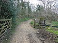
 Cotswold Way Path and Road Junction - geograph.org.uk - 5437913.jpg 3,264 × 2,448; 2.82 MB
-

-

-

-
 Curtis Mill Cottage, Lower Kilcott, Gloucestershire 2012 - geograph.org.uk - 5816650.jpg 2,240 × 1,488; 845 KB
-
 Farm track near Lower Kilcott - geograph.org.uk - 5097198.jpg 6,000 × 4,000; 4.74 MB
-
 Farm track on Clay Hill - geograph.org.uk - 5097238.jpg 6,000 × 4,000; 6.41 MB
-
 Farmland just west of the A46 - geograph.org.uk - 2489555.jpg 2,592 × 1,944; 1.09 MB
-
 Field entrance near Kilcott Mill - geograph.org.uk - 5094273.jpg 6,000 × 4,000; 4.67 MB
-
 Fields south of Field Barn - geograph.org.uk - 2506501.jpg 2,592 × 1,944; 1.21 MB
-
 Fishing, Lower Kilcott, Gloucestershire 2012 - geograph.org.uk - 5816664.jpg 2,240 × 1,488; 964 KB
-
 Fishing, Lower Kilcott, Gloucestershire 2012 - geograph.org.uk - 5816694.jpg 2,152 × 1,394; 881 KB
-
 Fishing, Lower Kilcott, Gloucestershire 2012 - geograph.org.uk - 5816703.jpg 2,158 × 1,386; 617 KB
-
 Footbridge in Midger Wood - geograph.org.uk - 2506531.jpg 2,592 × 1,944; 2.15 MB
-
 Footpaths leaving Kilcott Lane - geograph.org.uk - 5097192.jpg 6,000 × 4,000; 5.02 MB
-
 Foxholes Wood on the Hillside - geograph.org.uk - 5437915.jpg 3,264 × 2,448; 1.69 MB
-

-
 Gateway to Nimords Barn - geograph.org.uk - 2216735.jpg 2,816 × 1,880; 3.28 MB
-
 Hareley Common - geograph.org.uk - 6731870.jpg 4,032 × 3,024; 2.12 MB
-
 Hat bales in a field next to Claypit Wood - geograph.org.uk - 5478858.jpg 3,776 × 2,520; 3.96 MB
-
 Hillside above Kilcott Mill - geograph.org.uk - 5094248.jpg 6,000 × 4,000; 4.77 MB
-
 Horses in Field, Lower Kilcott, Gloucestershire 2012 - geograph.org.uk - 5816691.jpg 2,240 × 1,488; 853 KB
-
 Horses in the Field - geograph.org.uk - 5437767.jpg 3,264 × 2,448; 3.17 MB
-

-
 Kilcott Road at the Cotswold Way and Monarch's Way turn-off - geograph.org.uk - 5478936.jpg 3,776 × 2,520; 4.01 MB
-
 Kilcott Road through Lower Kilcott - geograph.org.uk - 5478864.jpg 3,776 × 2,520; 4.04 MB
-
 Land prepared for monoculture - geograph.org.uk - 5726136.jpg 2,048 × 1,536; 1.41 MB
-
 Lane N through Lower Kilcott - geograph.org.uk - 5616369.jpg 5,184 × 2,920; 6.04 MB
-
 Lane to Lower Kilcott, Gloucestershire 2012 - geograph.org.uk - 5816720.jpg 2,196 × 1,392; 957 KB
-
 Last of the snow - geograph.org.uk - 5699127.jpg 2,048 × 1,536; 1.04 MB
-
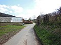
 Lower Kilcott Farm, Gloucestershire 2012 - geograph.org.uk - 5816666.jpg 2,240 × 1,488; 767 KB
-
 Lower Kilcott Farm, Gloucestershire 2012 - geograph.org.uk - 5816712.jpg 2,208 × 1,392; 732 KB
-
 Lower Kilcott Farmhouse, Gloucestershire 2012 - geograph.org.uk - 5816715.jpg 1,393 × 937; 421 KB
-
 Lower Kilcott Valley, Gloucestershire 2012 - geograph.org.uk - 5816719.jpg 2,182 × 1,383; 947 KB
-
 Lower Kilcott, Gloucestershire 2012 - geograph.org.uk - 5816686.jpg 2,240 × 1,488; 1,002 KB
-
 Lower Kilcott, Gloucestershire 2012 - geograph.org.uk - 5816708.jpg 2,179 × 1,386; 760 KB
-
 Lower Kilcott, Gloucestershire 2012 - geograph.org.uk - 5816711.jpg 2,176 × 1,400; 1.13 MB
-
 Once a corn mill - Kilcott Mill, Gloucestershire - geograph.org.uk - 6066342.jpg 1,024 × 686; 160 KB
-
 Open hillside near Claypit Wood - geograph.org.uk - 5097221.jpg 6,000 × 4,000; 4.67 MB
-
 Ozleworth Valley, nr Tresham, Gloucestershire 2017 - geograph.org.uk - 5309815.jpg 2,896 × 1,944; 1.48 MB
-
 Ozleworth Valley, nr Tresham, Gloucestershire 2017 - geograph.org.uk - 6621739.jpg 2,759 × 1,776; 1.31 MB
-
 Ozleworth Valley, nr Tresham, Gloucestershire 2017 - geograph.org.uk - 6621743.jpg 2,690 × 1,776; 1.12 MB
-
 Parting of the Cotswold Way and the Monarch's Way - geograph.org.uk - 5478949.jpg 3,776 × 2,520; 4.16 MB
-
 Path in Midger Wood - geograph.org.uk - 5466992.jpg 2,448 × 3,264; 3.79 MB
-
 Ploughed Field by The Cotswold Way - geograph.org.uk - 5437763.jpg 3,264 × 2,448; 2.86 MB
-
 Pond at Lower Kilcott - geograph.org.uk - 5097202.jpg 6,000 × 4,000; 5.57 MB
-
 Pond near Splatts Wood - geograph.org.uk - 641396.jpg 640 × 480; 84 KB
-
 Rivet benchmark on roadside wall - geograph.org.uk - 6603637.jpg 1,600 × 1,067; 785 KB
-
-
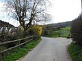
 Road leaving Tresham by The Furlongs - geograph.org.uk - 2990392.jpg 1,024 × 722; 169 KB
-
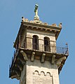 Somerset Monument - geograph.org.uk - 749391.jpg 572 × 640; 85 KB
-
 Steep path at the bottom of Claypit Wood - geograph.org.uk - 5478861.jpg 3,776 × 2,520; 3.16 MB
-
 Stream Cottage, Lower Kilcott, Gloucestershire 2012 - geograph.org.uk - 5816713.jpg 2,205 × 1,409; 936 KB
-
 Stream, Lower Kilcott, Gloucestershire 2012 - geograph.org.uk - 5816692.jpg 2,240 × 1,488; 1.08 MB
-
 The Cotswold Way at Clay Hill - geograph.org.uk - 3452509.jpg 800 × 600; 150 KB
-
 The Cotswold Way at Claypit Wood - geograph.org.uk - 3452484.jpg 800 × 600; 159 KB
-
 The Cotswold Way at Claypit Wood - geograph.org.uk - 3452486.jpg 800 × 600; 142 KB
-
 The Cotswold Way at Claypit Wood - geograph.org.uk - 3452491.jpg 800 × 600; 191 KB
-
 The Cotswold Way at Kilcott Mill - geograph.org.uk - 3452327.jpg 800 × 600; 194 KB
-
 The Cotswold Way at Lower Kilcott - geograph.org.uk - 3452370.jpg 800 × 600; 154 KB
-
 The Cotswold Way at Lower Kilcott - geograph.org.uk - 3452402.jpg 800 × 600; 152 KB
-
 The Cotswold Way at Lower Kilcott - geograph.org.uk - 3452409.jpg 800 × 600; 154 KB
-
 The Cotswold Way at Lower Kilcott - geograph.org.uk - 3452414.jpg 800 × 600; 148 KB
-
 The Cotswold Way at Lower Kilcott - geograph.org.uk - 3452421.jpg 800 × 600; 156 KB
-
 The Cotswold Way at Lower Kilcott Farm - geograph.org.uk - 3452353.jpg 800 × 600; 159 KB
-
 The Cotswold Way at Lower Kilcott Farm - geograph.org.uk - 3452356.jpg 800 × 600; 160 KB
-
 The Cotswold Way at Lower Kilcott Farm - geograph.org.uk - 3452362.jpg 800 × 600; 149 KB
-
 The Cotswold Way at Lower Kilcott Farm - geograph.org.uk - 3452364.jpg 800 × 600; 154 KB
-
 The Cotswold Way enters Claypit Wood - geograph.org.uk - 3452477.jpg 800 × 600; 127 KB
-
 The Cotswold Way in Claypit Wood - geograph.org.uk - 5097229.jpg 6,000 × 4,000; 4.74 MB
-
 The Cotswold Way leaves Claypit Wood - geograph.org.uk - 3452495.jpg 800 × 600; 148 KB
-
 The Cotswold Way near Greenhill Wood - geograph.org.uk - 3452440.jpg 800 × 600; 158 KB
-
 The Cotswold Way near Greenhill Wood - geograph.org.uk - 3452445.jpg 800 × 600; 182 KB
-
 The Cotswold Way near Greenhill Wood - geograph.org.uk - 3452449.jpg 800 × 600; 168 KB
-
 The Cotswold Way near Greenhill Wood - geograph.org.uk - 3452453.jpg 800 × 600; 170 KB
-
 The Cotswold Way near Greenhill Wood - geograph.org.uk - 3452458.jpg 800 × 600; 155 KB
-
 The Cotswold Way near Kilcott Mill - geograph.org.uk - 5094237.jpg 6,000 × 4,000; 4.92 MB
-
 The Cotswold Way on the flanks of Winner Hill - geograph.org.uk - 5483063.jpg 3,776 × 2,520; 3.5 MB
-
 The Cotswold Way towards Bridge Farm - geograph.org.uk - 3452385.jpg 800 × 600; 180 KB
-
 The Cotswold Way towards Claypit Wood - geograph.org.uk - 3452464.jpg 800 × 600; 160 KB
-
 The Cotswold Way towards Claypit Wood - geograph.org.uk - 3452470.jpg 800 × 600; 173 KB
-
 The Cotswold Way towards Claypit Wood - geograph.org.uk - 3452472.jpg 800 × 600; 161 KB
-
 The Cotswold Way towards Claypit Wood - geograph.org.uk - 3452475.jpg 800 × 600; 180 KB
-
 The Cotswold Way towards Kilcott Mill - geograph.org.uk - 3452314.jpg 800 × 600; 182 KB
-
 The Cotswold Way towards Kilcott Mill - geograph.org.uk - 3452317.jpg 800 × 600; 180 KB
-
 The Cotswold Way towards Kilcott Mill - geograph.org.uk - 3452319.jpg 800 × 600; 147 KB
-
 The Cotswold Way towards Kilcott Mill - geograph.org.uk - 3452323.jpg 800 × 600; 182 KB
-
 The Cotswold Way towards Lower Kilcott - geograph.org.uk - 3452330.jpg 800 × 600; 159 KB
-
 The Cotswold Way towards Lower Kilcott - geograph.org.uk - 3452337.jpg 800 × 600; 160 KB
-
 The Cotswold Way turns right here - geograph.org.uk - 3452433.jpg 800 × 600; 160 KB
-
 The fishing lake at Kilcott Valley - geograph.org.uk - 3452368.jpg 800 × 600; 156 KB
-
 The fishing lake at Kilcott Valley - geograph.org.uk - 3452378.jpg 800 × 600; 163 KB
-
 The Fleece - geograph.org.uk - 6731860.jpg 4,032 × 3,024; 2.07 MB
-
 The Kilcott lane - geograph.org.uk - 3662630.jpg 2,592 × 1,944; 987 KB
-
 The Kilcott Road - geograph.org.uk - 2506533.jpg 2,592 × 1,944; 1.77 MB
-
 The Old Post Office, Tresham - geograph.org.uk - 6594885.jpg 1,600 × 1,200; 994 KB
-
 Topograph at Tresham Millennium Garden - geograph.org.uk - 5699648.jpg 2,048 × 1,536; 1.7 MB
-
 Track above Lower Kilcott - geograph.org.uk - 5097207.jpg 6,000 × 4,000; 4.51 MB
-
 Track with snow - geograph.org.uk - 5699647.jpg 1,536 × 2,048; 984 KB
-
 Tresham Sign, Gloucestershire 2012 - geograph.org.uk - 6621761.jpg 980 × 612; 161 KB
-
 Tresham Valley, Gloucestershire 2012 - geograph.org.uk - 5738398.jpg 2,183 × 1,378; 651 KB
-

-
 Valley near Splatts Wood - geograph.org.uk - 641393.jpg 640 × 480; 73 KB
-
 Wall and farmland - geograph.org.uk - 5726103.jpg 2,048 × 1,536; 995 KB
-
 Wide ride in Small Coombe - geograph.org.uk - 6781630.jpg 4,032 × 3,024; 4.16 MB
-
 Winding road through Splatt's Plantation - geograph.org.uk - 3081935.jpg 1,024 × 662; 174 KB
-
 Woodland Edge - geograph.org.uk - 5466994.jpg 3,264 × 2,448; 3.3 MB
-
 Woodland lane near the A46 - geograph.org.uk - 1076268.jpg 640 × 480; 128 KB


