Category:Idukki district
Sautar la navigacion
Sautar la recèrca

English: Idukki (Malayalam: ഇടുക്കി ജില്ല, is one among the 14 districts of Kerala state, India. The district headquarters is located at Painavu. The name of the district is derived from the Malayalam word Idukki, meaning "narrow gauge". Idukki has an area of 5,105.22 km2 (1,971.1 sq mi) and is Keralas second largest district. Rugged mountains and forests cover about 97 percent of the total area of the district. Idukki borders the Kerala districts of Pathanamthitta to the south, Kottayam to the southwest, Ernakulam to the northwest, Thrissur to the north and Coimbature, and Dindigul and Theni districts in Tamil Nadu to the east. There are four taluks viz: Devikulam, Udumbanchola, Peermade and Thodupuzha and 65 villages in the district. There is only one Municipal town in the district is Thodupuzha, Munnar is census town.
9°51′0″N 76°56′24″E / 9.85°N 76.94°E
district de l'Inde   | |||||
| Mandar de mèdias | |||||
| Natura de l'element | |||||
|---|---|---|---|---|---|
| Emplaçament | Kerala, Índia | ||||
| Capitala | |||||
| Data de fondacion / creacion |
| ||||
| Populacion |
| ||||
| Superfícia |
| ||||
| Altitud |
| ||||
| De pas confondre amb | |||||
| site oficial | |||||
 | |||||
Soscategorias
Aquesta categoria dispausa de 8 soscategorias, sus un total de 8.
*
Articles dins la categoria « Idukki district »
Aquesta categoria conten unicament la pagina seguenta.
I
Fichièrs multimèdia dins la categoria « Idukki district »
Los 8 fichièrs seguents figuran dins aquesta categoria, sus una soma de 8.
-
 Cheeyappara Waterfalls 01.jpg 3 376 × 6 000 ; 8,88 Mo
-
 Cheeyappara Waterfalls 04.jpg 3 376 × 6 000 ; 8,19 Mo
-
 Early morning in Idukki.jpg 2 048 × 1 365 ; 142 Ko
-
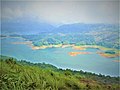 Idukki lake.jpg 2 048 × 1 536 ; 404 Ko
-
 Mannathara padam .jpg 3 120 × 4 160 ; 3,76 Mo
-
 Sengulam Dam - Kerala.jpg 6 000 × 3 376 ; 7,5 Mo
-
 Sengulam Dam.jpg 6 000 × 3 376 ; 7,88 Mo
-
 Specifications description board of Sengulam Dam- Kerala.jpg 6 000 × 3 376 ; 7,06 Mo


