Category:Ihlow (Oberbarnim)
Jump to navigation
Jump to search
| Object location | | View all coordinates using: OpenStreetMap |
|---|
village in Brandenburg state, Germany  La chiesa | |||||
| Upload media | |||||
| Instance of |
| ||||
|---|---|---|---|---|---|
| Location | Oberbarnim, Märkisch-Oderland District, Brandenburg, Germany | ||||
 | |||||
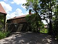
Deutsch: Das Dorf Ihlow gehört zur Gemeinde Oberbarnim , Landkreis Märkisch-Oderland , Land Brandenburg, Deutschland.
English: The village Ihlow belongs to Oberbarnim municipality , Märkisch-Oderland district, Brandenburg state, Germany
Français : Le village de Ihlow fait partie de la commune de Oberbarnim , arrondissement de Märkisch-Oderland , état fédéral de Brandebourg, Allemagne
Subcategories
This category has only the following subcategory.
D
Media in category "Ihlow (Oberbarnim)"
The following 7 files are in this category, out of 7 total.
-
 Schloss Ihlow Oberbarnim.jpg 3,648 × 2,736; 5.49 MB
-
 IhlowOberbarnimTeich.jpg 4,032 × 3,024; 3.56 MB
-
 Oberbarnim Ihlow Dorfteich.JPG 2,592 × 1,944; 4.02 MB
-
 Oberbarnim Ihlow Hinweistafel Oberbarnimer Feldsteinroute.JPG 1,944 × 2,592; 2.07 MB
-
 Oberbarnim Ihlow Ökohof.JPG 2,592 × 1,944; 3.28 MB
-
 Siegelmarke Amt Ihlow - Kreis Oberbarnim W0212779.jpg 270 × 267; 17 KB
-
 Siegelmarke Amt Ihlow W0369308.jpg 269 × 270; 12 KB


