Category:Illinois River
Saltar para a navegação
Saltar para a pesquisa
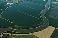
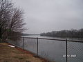
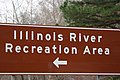
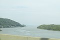
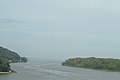
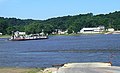
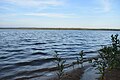
English: The Illinois River is a major river through Illinois in the United States. It feeds into the Mississippi River.
Illinois tributary of the Mississippi River in the United States  Riu Illinois a Starved Rock State Park | |||||
| Carregar ficheiro | |||||
| Instância de | |||||
|---|---|---|---|---|---|
| Localização | Illinois, EUA | ||||
| Comprimento |
| ||||
| Desagua | |||||
| Bacia hidrográfica |
| ||||
| Estado ribeirinho | |||||
| Tributário |
| ||||
| Lagos no curso do rio |
| ||||
 | |||||
Subcategorias
Esta categoria contém as seguintes 17 subcategorias (de um total de 17).
A
B
F
H
I
- Illinois Waterway Project Office (15 F)
L
- La Grange Lock and Dam (28 F)
M
- Maps of the Illinois River (25 F)
- Marseilles Lock and Dam (24 F)
P
- Peoria Lake (9 F)
- Peoria Lock and Dam (31 F)
- Powerton Lake (5 F)
S
Multimédia na categoria "Illinois River"
Esta categoria contém os seguintes 81 ficheiros (de um total de 81).
-
-
 1992 Maxum 1800 SR on the Illinois River (5749624344).jpg 4 288 × 2 848; 910 kB
-

-
 Barge Going Up Illinois River - Pekin IL (25539201268).jpg 2 400 × 1 600; 1,68 MB
-
 Biennial report of the director (20343389536).jpg 2 992 × 1 890; 1,45 MB
-
 BoyceGrave5.jpg 2 272 × 1 704; 674 kB
-
 Bulletin (1904) (20239166690).jpg 2 816 × 1 696; 1,24 MB
-
 Bulletin (1932) (19807239243).jpg 3 664 × 2 216; 1,29 MB
-
 Bulletin of the Illinois State Laboratory of Natural History (1878-(1918)) (20443966932).jpg 2 824 × 1 840; 1,38 MB
-
 Bulletin of the Illinois State Laboratory of Natural History (1901) (14576764720).jpg 3 008 × 1 822; 1,22 MB
-
 Bulletin of the Illinois State Laboratory of Natural History (1901) (14576834178).jpg 2 816 × 1 612; 886 kB
-
 Bulletin of the Illinois State Laboratory of Natural History (1901) (14761102334).jpg 2 320 × 3 259; 536 kB
-
 Bulletin of the Illinois State Laboratory of Natural History (1901) (14783326293).jpg 2 816 × 1 700; 962 kB
-
 Bulletin of the Illinois State Laboratory of Natural History (1910-1913) (20265160888).jpg 2 800 × 1 592; 1,15 MB
-

-
 Chautauqua levee road.jpg 4 016 × 3 008; 5,08 MB
-
-
 Des Plaines Fish and Wildlife Area - panoramio.jpg 3 264 × 1 952; 1,68 MB
-
 Emiquon National Wildlife Refuge.jpg 1 024 × 319; 176 kB
-
 Flooding along the Illinois River (After).jpg 3 840 × 2 880; 4,71 MB
-
 Flooding along the Illinois River (Before).jpg 3 840 × 2 880; 4,05 MB
-

-
 Fort Pimiteoui.jpg 974 × 605; 292 kB
-
 Geography of the middle Illinois valley (IA geographyofmiddl00barrrich).pdf 856 × 1 352, 182 páginas; 31,09 MB
-
 Gfp-illinois-starved-rock-state-park-across-the-river.jpg 2 500 × 1 667; 602 kB
-
 Gfp-illinois-starved-rock-state-park-shoreline-landscape.jpg 2 500 × 1 667; 382 kB
-
 Gfp-illinois-starved-rock-state-park-up-the-river.jpg 2 500 × 1 667; 366 kB
-
 Goldenrod showboat 20190728.tif 527 × 595; 919 kB
-
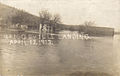 Griggsville Landing.jpg 808 × 510; 137 kB
-
 HD.6B.276 (11842858626).jpg 3 200 × 2 540; 809 kB
-
 I-39lincolnbridge2.jpg 968 × 395; 41 kB
-
 Illinois Congressman Aaron Schock at Beardstown River in 2009.PNG 487 × 366; 325 kB
-
 Illinois River (east to west).jpg 19 414 × 1 974; 5,05 MB
-
 Illinois River - panoramio.jpg 3 872 × 2 592; 4,51 MB
-
 Illinois River -Peoria 2016-09-23 009.jpg 4 608 × 3 072; 1,74 MB
-
 Illinois River -Peoria 2016-09-23 010.jpg 4 608 × 3 072; 1,79 MB
-
 Illinois River A Lincoln Mem Bridge .jpg 2 424 × 1 536; 1,36 MB
-
 Illinois River at LaSalle. Shot with a DJI Phantom 4 camera drone.jpg 3 867 × 2 126; 3,87 MB
-
 Illinois River from River Trail - panoramio.jpg 3 456 × 5 184; 6,46 MB
-
 Illinois River near LaSalle Illinois.jpg 3 867 × 2 126; 2,84 MB
-
 Illinois River P6081337.jpg 3 072 × 2 304; 1,05 MB
-
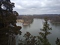
 Illinois River, seen from Starved Rock.jpg 864 × 1 152; 166 kB
-
 KampsvilleFaehre.jpg 880 × 532; 514 kB
-
 Kmcpia4mar09.jpg 2 344 × 720; 238 kB
-
 La Salle on ice by E.H. Garret 1883.jpg 544 × 405; 63 kB
-
 La Salle Rail Bridge - panoramio.jpg 3 072 × 2 304; 1,45 MB
-
 Lake Senachwine shoreline, 2019.jpg 6 000 × 4 000; 7,43 MB
-
 Lake Senachwine, 2019.jpg 6 000 × 4 000; 6,43 MB
-
 Marseilles IL Marseilles Hydro Plant2.jpg 2 634 × 2 304; 766 kB
-
 Marshall SFWA 20231027 0063.jpg 4 441 × 2 961; 6,53 MB
-
 Marshall SFWA 20231027 0065.jpg 4 574 × 3 049; 7,27 MB
-
 Marshall SFWA 20231027 0073.jpg 4 491 × 2 994; 8,8 MB
-
 Marshall SFWA 20231027 0078.jpg 4 426 × 2 951; 8,78 MB
-
 McClugage Bridge P6080003 Illinois River.jpg 3 072 × 2 304; 1,07 MB
-
 Mississippi near St-Louis normally and in flood 93.jpg 540 × 672; 157 kB
-
 Murray Baker Bridge at night.jpg 800 × 533; 37 kB
-
 Pekin boat club 20231019 0128.jpg 4 399 × 2 933; 5,05 MB
-
 Pekin Bridge 20231018 0731.jpg 4 425 × 2 950; 5,19 MB
-
 Pekin bridge pier 20231018 0747.jpg 4 608 × 3 072; 4,55 MB
-
 Pekin riverfront 20231019 0129.jpg 4 319 × 2 879; 4,46 MB
-
 Pekin riverfront 20231019 0137.jpg 4 197 × 2 798; 4,26 MB
-
 Pekin riverfront 20231019 0140.jpg 4 608 × 3 072; 4,03 MB
-
 Pelicans on Illinois River.jpg 4 000 × 2 250; 2,78 MB
-
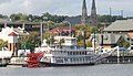
 Peoria - "Julia Belle Swain" and Illinois River.jpg 1 000 × 617; 299 kB
-
 Peoria - Caterpillar Administration Building from Savings Tower.jpg 1 150 × 767; 454 kB
-
 Peoria - Murray Baker Bridge, Security Savings Building and Caterpillar.jpg 1 050 × 714; 375 kB
-
 Peoria Grandview Drive 2008.JPG 3 264 × 2 448; 2,24 MB
-
 Peoria Heights - View from Water Tower 1970.jpg 1 050 × 701; 379 kB
-
 Peoria Illinois Skyline.jpg 5 344 × 1 312; 2,11 MB
-
 Peoria skyline banner.jpg 2 100 × 300; 734 kB
-
 Peoria Skyline Panoramic.jpg 21 264 × 1 968; 20,13 MB
-
 Peoria Waterworks Main Building.JPG 2 112 × 2 816; 2,73 MB
-
 Plum Island from Starved Rock.jpg 4 016 × 3 008; 4,1 MB
-
 Plumisland.jpg 2 048 × 1 536; 691 kB
-
 Portgalena riverview.jpg 315 × 242; 33 kB
-

-
 Spirit of Peoria.jpg 1 202 × 694; 270 kB
-
 Starved Rock Illinois on Illinois River.jpg 800 × 600; 89 kB
-
 Sunset on Illinois River at campground near Peoria, Illinois - Flickr - Jay Sturner.jpg 1 600 × 1 200; 1,82 MB
-
 View of Illinois Rive starved rock.JPG 3 072 × 2 304; 3,11 MB
-
 View upstream from Starved Rock.jpg 4 016 × 3 008; 5,08 MB
.jpg)
.jpg)
.jpg)
.jpg)

_(20239166690).jpg)
_(19807239243).jpg)
)_(20443966932).jpg)
_(14576764720).jpg)
_(14576834178).jpg)
_(14761102334).jpg)
_(14783326293).jpg)
_(20265160888).jpg)
_(20265164568).jpg)


.jpg)
.jpg)


.jpg)


_Illinois_River_Family_Siluridae.jpeg)
.jpg)