Category:Irish Sea
Saltar para a navegação
Saltar para a pesquisa
mar  | |||||
| Carregar ficheiro | |||||
| Instância de | |||||
|---|---|---|---|---|---|
| Parte de | |||||
| Nomeado em referência a | |||||
| Localização |
| ||||
| Composto de | |||||
| Afluente do lago |
| ||||
| Estado ribeirinho | |||||
 | |||||
Subcategorias
Esta categoria contém as seguintes 21 subcategorias (de um total de 21).
B
- Battle of Bishops Court (5 F)
C
- Cardigan Bay (1 P, 78 F)
D
- Dundalk Bay (13 F)
G
H
I
L
- Leinster (ship, 1897) (7 F)
M
O
R
- Rampside Gas Terminal (4 F)
S
T
Multimédia na categoria "Irish Sea"
Esta categoria contém os seguintes 114 ficheiros (de um total de 114).
-
 Approaching duo (8045735798).jpg 3 000 × 2 250; 4,85 MB
-
 Arklow Bank Wind Park as seen from Arklow.jpg 5 150 × 3 431; 6,89 MB
-
 AT Brown Mauretania.jpg 400 × 300; 15 kB
-
 Balcary Bay Auchincairn - panoramio.jpg 3 264 × 2 448; 989 kB
-
 Barmouth MMB 01.jpg 2 346 × 1 482; 1,28 MB
-
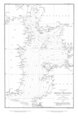 Beechey Tidal Chart of the Irish Channel dated 1846.tiff 4 016 × 6 142; 1,56 MB
-
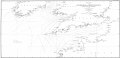 Beechey Tide Chart of the English, Irish and Bristol Channels Ingoing dated 1848.tif 8 325 × 4 061; 1,65 MB
-
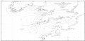 Beechey Tide Chart of the English, Irish and Bristol Channels Outgoing dated 1848.tif 8 226 × 4 079; 1,65 MB
-
 Benkid77 Liverpool Bay 1 090809.JPG 3 648 × 2 736; 3,58 MB
-
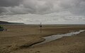
 Bettystown meath beach.jpg 4 592 × 3 056; 3,18 MB
-
 Bettystown meath shell.jpg 4 592 × 3 056; 3,36 MB
-
 Boat communications equipment (15741711097).jpg 4 649 × 3 131; 8,64 MB
-
 Boat to Isle of Man. Irish Sea (050230) (9453726762).jpg 1 604 × 2 330; 1,24 MB
-
 Bray head railway.jpg 4 592 × 3 056; 3,71 MB
-
 Bray Head to Greystones cliff walk.jpg 2 688 × 1 520; 1,17 MB
-
 Bridge (8045721465).jpg 3 000 × 2 250; 7,91 MB
-
 Calf Sound, Isle of Man.JPG 4 000 × 3 000; 3,49 MB
-
 Choppy seas (8045718439) (2).jpg 2 997 × 1 971; 7,44 MB
-
 Clogher Head position.jpg 2 121 × 2 215; 2,15 MB
-
 Clogherhead Beach.jpg 3 456 × 2 304; 1,37 MB
-
 Colorful harbor (8045722118) (2).jpg 2 993 × 1 773; 5,89 MB
-
 Colwyn Bay in the Afternoon Panorama.jpg 3 000 × 1 000; 693 kB
-
 Colwyn Bay panorama.jpg 1 920 × 888; 395 kB
-
 Distant approach (8045698947).jpg 3 000 × 2 250; 7,91 MB
-
 Distant nuclear power plant at Heysham as seen from Fleetwood - DSC06580.JPG 3 648 × 2 736; 3,66 MB
-
Dive survey video by Natural Resources Wales.webm 3 min 30 s, 1 280 × 720; 48,5 MB
-
 Dolphins playing off Almorness - geograph.org.uk - 50937.jpg 640 × 480; 47 kB
-
 Douglas Complex platforms UK 2013 A.jpg 4 608 × 3 456; 3,55 MB
-
 Douglas Complex platforms UK 2013 B.jpg 4 608 × 3 456; 3,41 MB
-
 Douglas oil complex, Irish Sea off North Wales.jpg 5 522 × 3 449; 6,69 MB
-
 Dun Laoghaire Ireland Sea.jpg 3 008 × 2 000; 506 kB
-
 Dun Laoghaire Ireland1.jpg 3 008 × 2 000; 651 kB
-
 Dun Laoghaire Ireland2.jpg 3 008 × 2 000; 691 kB
-
 Dún Laoghaire PD Dún Laoghaire, Ireland, Dublin. Sea Cloud.jpg 3 008 × 2 000; 603 kB
-
 Dún Laoghaire PD Dún Laoghaire, Ireland, Dublin. Sea Cloud2.jpg 3 008 × 2 000; 589 kB
-
 Dún Laoghaire promenade.JPG 11 040 × 3 117; 1,37 MB
-

-
-
 End of the Bray Head to Greystones cliff walk.jpg 2 688 × 1 520; 1,15 MB
-
 Ferry between Rosslare Ireland and Pembroke Wales.jpg 1 632 × 1 232; 333 kB
-
 FMIB 43876 Course of the Tide in the Irish Sea.jpeg 883 × 985; 249 kB
-
 French Fishing Vessel 'Alf' in the Irish Sea MOD 45155246.jpg 2 650 × 1 750; 2,83 MB
-
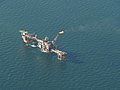
 Gas Rig.JPG 4 000 × 3 000; 3,37 MB
-
 Gerard Byrne Sorrento Terrace Dalkey Ireland July 2014 oil on canvas.jpg 1 986 × 2 000; 3,33 MB
-
 Gull1 (8045674490).jpg 1 892 × 1 485; 4,92 MB
-
 Gull2 (8045665463).jpg 2 808 × 2 026; 7,29 MB
-
 Harlech waves and houses.jpg 2 355 × 1 521; 1,43 MB
-
 High tide at Mockbeggar Wharf-by-Peter-Craine.jpg 640 × 480; 51 kB
-
 IMG Brittas Bay1529.jpg 3 888 × 2 592; 3,66 MB
-
 IMG DublinBay1467a.jpg 3 888 × 2 592; 3,19 MB
-
 Irish Sea 4.82844W 53.54821N.png 992 × 653; 912 kB
-
 Irish Sea satellite image.jpg 436 × 576; 54 kB
-
 Irish Sea, Dublin (507257) (32890492772).jpg 3 692 × 2 077; 2,37 MB
-
 Irish Sea, Dublin (507259) (33046427145).jpg 3 889 × 1 947; 1,74 MB
-
 Irish Sea-Celtic Sea.jpg 4 032 × 3 024; 4,03 MB
-
 Irish.Sea.at.Man.cross.section.jpg 1 800 × 420; 48 kB
-
 Isle of Man Beach.jpg 3 493 × 2 564; 3,31 MB
-
 Isle of Man Steam Packet Company - geograph.org.uk - 1814993.jpg 428 × 640; 50 kB
-
 Laxey Bay - Isle of Man - kingsley - 26-APR-09.jpg 2 560 × 1 920; 1 013 kB
-
 Lush cliffs1 (8045652775) (2).jpg 2 996 × 1 925; 10,13 MB
-
 Milners Tower - Bradda Head - Isle of Man - kingsley - 24-APR-09.jpg 1 920 × 2 560; 1,03 MB
-
 Mists (8045642249) (2).jpg 3 000 × 2 250; 8,11 MB
-
 Mockbeggar Wharf-by-Sue-Adair.jpg 640 × 480; 57 kB
-
 More harbor (8045601814).jpg 3 000 × 1 899; 6,54 MB
-
 Mouth of the River Avoca. - geograph.org.uk - 599466.jpg 640 × 480; 47 kB
-
 MS Stena Explorer Dun Laoghaire.jpg 1 600 × 1 066; 329 kB
-
 MV Balmoral - Niarbyl - Isle of Man - kingsley - 23-JUN-09.jpg 2 560 × 1 920; 665 kB
-
 Niarbyl Bay - Isle of Man - kingsley - 23-JUN-09.jpg 2 560 × 1 920; 1,12 MB
-
 NorthWest Donegal2.jpg 2 048 × 1 536; 238 kB
-
 Off shore wind farm (3333359968).jpg 3 036 × 2 466; 4,11 MB
-
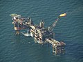
 Oil Rig in the Irish Sea - panoramio.jpg 4 320 × 3 240; 1,38 MB
-
 Overlook (8045578508).jpg 2 400 × 2 104; 6,69 MB
-
 Panorama of Rhyl and Prestatyn and the Irish Sea, from the top of Gop Hill.jpg 7 264 × 1 792; 6,43 MB
-
 Panoramic view from the Great Orme of Snowdonia and Irish Sea.jpg 14 691 × 3 580; 16,9 MB
-
 Peel Bay Sunset - Isle of Man - kingsley - 23-JUN-09.jpg 2 560 × 1 920; 1,12 MB
-
 Photo on the Irish Sea outside Dublin.jpg 1 936 × 2 592; 1,81 MB
-
 PIA01804 md.jpg 600 × 421; 55 kB
-
 Plaque atop Snaefell Mountain - Isle of Man - kingsley - 24-JUN-09.jpg 2 560 × 1 920; 1,09 MB
-
 PRINCE ARTHUR CDSPC.JPG 700 × 452; 67 kB
-
 Pwllheli MMB 01 Bay.jpg 2 341 × 1 492; 1,2 MB
-

-

-

-

-
 Sea stack at the slieve league cliffs.jpg 1 280 × 960; 408 kB
-
 Seaweed and Seapoint.jpg 2 268 × 4 032; 2,43 MB
-
 Sediment in Bristol Channel and the Irish Sea (MODIS 2020-03-26).jpg 2 945 × 2 268; 585 kB
-
 Sediment in the Irish Sea (MODIS 2015-05-04).jpg 1 800 × 2 400; 829 kB
-
 Sediment in the Irish Sea (MODIS 2022-03-22).jpg 3 074 × 2 384; 526 kB
-
 Skellig Michael rock face.jpg 2 238 × 2 818; 11,56 MB
-
 South Training Wall, River Boyne - geograph.org.uk - 562960.jpg 640 × 480; 48 kB
-
 Southwest Isle of Man - Niarbyl - kingsley - 23-JUN-09.jpg 2 560 × 1 920; 1,51 MB
-
 SS Mauretania II.jpg 350 × 228; 51 kB
-
 Star Cleo.jpg 4 342 × 1 447; 2,52 MB
-
 StenaEmblaPassingStenaEdda.jpg 2 899 × 1 907; 832 kB
-
 String (8045535313).jpg 4 000 × 3 000; 9,7 MB
-
 Sunrise Bray.jpg 3 548 × 2 378; 3,98 MB
-
 Sunset (38216322286).jpg 960 × 1 280; 349 kB
-
 Sunset over Cardigan Bay (6064327659).jpg 1 600 × 1 200; 305 kB
-
 Telegraph Cable in Howth.jpg 5 715 × 4 000; 23,22 MB
-
 Tern1.jpg 600 × 450; 27 kB
-
 The end of the Bray Head to Greystones cliff walk.jpg 2 688 × 1 520; 1,06 MB
-

-
 Turbulent sea, sea foam.jpg 597 × 400; 68 kB
-
 Tuskar Evening Sky.jpg 1 600 × 1 200; 317 kB
-
 Untouched Bray 02.jpg 4 032 × 3 024; 3,59 MB
-
 Vessel in Port Oriel.jpg 3 456 × 2 304; 1,88 MB
-
 View of Baily Lighthouse.jpg 4 762 × 2 545; 9,83 MB
-
 Warrenpoint red sky.jpg 1 024 × 590; 362 kB
-
 Water (8045619941) (2).jpg 3 000 × 2 250; 5,54 MB
-
 Wexford Wildfowl reserve - geograph.org.uk - 1256731.jpg 640 × 479; 45 kB
-
 White harbor (8045534236).jpg 2 969 × 1 418; 4,56 MB
-
 Whitesands Beach Wales-UK.jpg 5 472 × 3 648; 1,73 MB
-
 Wicklow Coast with Black Castle.jpg 2 592 × 1 936; 1,83 MB
.jpg)


.jpg)
_(9453726762).jpg)


.jpg)

_(2).jpg)


_(2).jpg)

.jpg)


.jpg)
.jpg)


_(32890492772).jpg)
_(33046427145).jpg)


_(2).jpg)

_(2).jpg)

.jpg)


.jpg)

.jpg)


.jpg)


.jpg)
.jpg)
.jpg)


.jpg)

.jpg)
.jpg)


_(2).jpg)

.jpg)

