Category:Isle of Bute
Ir a la navegación
Ir a la búsqueda
island in the Firth of Clyde in Scotland   | |||||
| Cargar multimedia | |||||
| Instancia de | |||||
|---|---|---|---|---|---|
| Ubicación | Argyll and Bute, Escocia | ||||
| Situado cerca del cuerpo de agua | |||||
| Capital | |||||
| Ancho |
| ||||
| Longitud |
| ||||
| Población |
| ||||
| Superficie |
| ||||
| Elevación sobre el nivel del mar |
| ||||
| Diferente de | |||||
 | |||||
The Isle of Bute, an island off the west coast of Scotland, in Argyll and Bute. There are two traditions concerning the geographic relationship of the islands in the Firth of Clyde to the other western islands. One is that they are in the Inner Hebrides. A second is that the Hebrides extend only as far south as the Kintyre Peninsula, exclusive. For the arguments see the articles.
Subcategorías
Esta categoría contiene las siguientes 13 subcategorías, de un total de 13.
*
B
C
- Coasts of Bute (7 F)
E
- Ettrick Bay (64 F)
G
- Game larders in Scotland (4 F)
M
R
S
- Scalpsie Bay (20 F)
- St Blane's Church, Bute (14 F)
Archivos multimedia en la categoría «Isle of Bute»
Los siguientes 200 archivos pertenecen a esta categoría, de un total de 335.
(página anterior) (página siguiente)-
 19-27 Mount Stuart Road (36170826622).jpg 5184 × 3888; 8,06 MB
-
 23-25 East Princes Street. (35503725664).jpg 3888 × 5184; 8,45 MB
-
 26 Argyle Place (36170776582).jpg 5184 × 3888; 8,5 MB
-
 27 Craigmore Road (35942630510).jpg 5184 × 3888; 8,71 MB
-
 2nd green Isle of Bute Golf Course - geograph.org.uk - 3542671.jpg 4000 × 3000; 2,23 MB
-
 33-34 Mount Stuart Road (35530879903).jpg 5184 × 3888; 8,68 MB
-
 33-36 Mount Stuart Road (36170830792).jpg 5184 × 3888; 7,72 MB
-
 52 and 51 Mount Stuart Road (35530811603).jpg 5184 × 3888; 8,13 MB
-
 54 Mount Stuart Road (36170759682).jpg 5184 × 3888; 8,64 MB
-
 7-9 Castle Street (35503706444).jpg 3888 × 5184; 9,74 MB
-

-
 A view towards the island of Bute - geograph.org.uk - 3685788.jpg 640 × 480; 314 kB
-
 Albany Terrace (36339433695).jpg 5184 × 3888; 7,82 MB
-
 All roads lead to Rothesay (269962507).jpg 1024 × 768; 301 kB
-
 Ardbeg (36295076086).jpg 5184 × 3888; 8,27 MB
-
 Ardbeg Baptist Church, Rothesay - geograph.org.uk - 704739.jpg 640 × 480; 74 kB
-
 Ardbeg Point (35942704600).jpg 5184 × 3888; 8,1 MB
-
 Ardencraig gardens Isle of Bute.jpg 2592 × 1944; 3,41 MB
-
 Ardscalpsie Bay , Isle of Bute (7754969364).jpg 3982 × 2978; 8,54 MB
-
 Ardscalpsie Point - Isle of Bute - geograph.org.uk - 5829298.jpg 4224 × 3187; 2,51 MB
-

-
 Arran and Bute - geograph.org.uk - 890585.jpg 640 × 341; 58 kB
-
 Arran from Bute - Flickr - Graham Grinner Lewis.jpg 2048 × 1536; 612 kB
-
 Ascog Bank (35530769603).jpg 5184 × 3888; 8,08 MB
-
 Ascog Bay (35530774263).jpg 5184 × 3888; 7,62 MB
-
 Ascog Bay (36339397245).jpg 5184 × 3888; 8,34 MB
-
 Ascog Free Church (36339401045).jpg 5184 × 3888; 8,67 MB
-
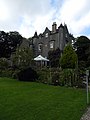 Ascog Hall (35503600744).jpg 3888 × 5184; 9,08 MB
-
 Ascog Hall Fernery (36170706522).jpg 3888 × 5184; 7,93 MB
-
 Ascog Hall Fernery (36295010956).jpg 5184 × 3888; 8,44 MB
-
 Ascog Hall Gardens (35503596414).jpg 5184 × 3888; 8,83 MB
-
 Ascog Hall Gardens (35942653770).jpg 3888 × 5184; 7,69 MB
-
 Ascog Hall Gardens (36339404615).jpg 5184 × 3888; 7,71 MB
-
 Ascog Mansion (35503587724).jpg 5184 × 3888; 5,96 MB
-
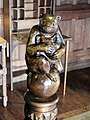 Badger Playing Bagpipes at Mount Stuart House (36294969406).jpg 3888 × 5184; 8,46 MB
-
 Balmory Hall (36339408785).jpg 5184 × 3888; 7,59 MB
-
 Balmory Hall Gate Lodge (36170715672).jpg 5184 × 3888; 7,78 MB
-
 Basking Seals, Scalpsie Bay, Isle of Bute - geograph.org.uk - 2338567.jpg 3416 × 2130; 776 kB
-
 Battery Place (36295105926).jpg 5184 × 3888; 8,36 MB
-
 Bavanaburei (Telugu- బావనబూరె) (1356393024).jpg 2816 × 2112; 2,8 MB
-
 Beattie Court (36295107936).jpg 5184 × 3888; 8,38 MB
-
 Bogany Point (35503655464).jpg 5184 × 3888; 8,6 MB
-
 Bogany Point (36339436295).jpg 5184 × 3888; 8,45 MB
-
 Boyd's Port (36295030786).jpg 5184 × 3888; 7,88 MB
-
 Bus-shelter at Kerrycroy - geograph.org.uk - 1297489.jpg 640 × 435; 66 kB
-
 Bute and Arran hills from Toward - geograph.org.uk - 148309.jpg 640 × 480; 44 kB
-
 Bute Cow (36339292295).jpg 5184 × 3888; 8,55 MB
-
 Bute Lane (269963044).jpg 768 × 1024; 432 kB
-
 Bute satellite.jpg 600 × 810; 97 kB
-
 Carmona retusa (1355456161).jpg 2816 × 2112; 2,7 MB
-
 Carrick Point - Isle of Bute - geograph.org.uk - 5830242.jpg 4320 × 3240; 3 MB
-
 Carrick Point Coastline - Isle of Bute - geograph.org.uk - 5830256.jpg 4239 × 3131; 2,05 MB
-
 Castle Street (36295094026).jpg 3888 × 5184; 8,31 MB
-
 Castle Toward seen from Bute (36339385895).jpg 5184 × 3888; 14,59 MB
-
 Castle Toward South Lodge (36170690942).jpg 5184 × 3888; 12,79 MB
-
 Chandlers Hotel (36295006806).jpg 5184 × 3888; 8,46 MB
-
 Chapel Hill House (36202719671).jpg 5184 × 3888; 7,8 MB
-
 Cioch na h-Oige - geograph.org.uk - 664199.jpg 640 × 437; 97 kB
-
 Coastline, Isle of Bute - geograph.org.uk - 3277072.jpg 1073 × 1433; 218 kB
-
-
 Colintraive Ferry - geograph.org.uk - 229513.jpg 640 × 480; 74 kB
-
 Collared Dove at Kilchattan Bay (36170751402).jpg 5184 × 3888; 4,06 MB
-
 Cows (269963506).jpg 1024 × 768; 468 kB
-
 Craigmore (35530766973).jpg 5184 × 3888; 8,52 MB
-
 Craigmore Pier (36295051396).jpg 5184 × 3888; 7,85 MB
-
 Crows at Kilchattan Bay (36339428905).jpg 5184 × 3888; 6,51 MB
-
 Descending to Ardbeg. (36202905831).jpg 3888 × 5184; 8,85 MB
-
 Disused Oil Jetty - geograph.org.uk - 393933.jpg 640 × 480; 192 kB
-

-
 DSCN1087 (36295128516).jpg 5184 × 3888; 8,25 MB
-
 DSCN1208 (36202835971).jpg 5184 × 3888; 8,8 MB
-
 DSCN1259 (35503548384).jpg 5184 × 3888; 7,61 MB
-
 Dunagoil Bay - Isle of Bute - geograph.org.uk - 5588496.jpg 2947 × 2232; 832 kB
-
 Dunagon and Lubas Bays (35942660960).jpg 5184 × 3888; 8,88 MB
-
 Earthwork at Cnoc an Rath - geograph.org.uk - 5518114.jpg 640 × 481; 92 kB
-
 East Coast of Bute (269965601).jpg 1024 × 768; 342 kB
-
 Ecosse-été 2012 532.jpg 3456 × 4608; 5,88 MB
-
 Ecosse-été 2012 542.jpg 3264 × 2448; 3,36 MB
-
 Edge of Bute - geograph.org.uk - 357546.jpg 480 × 640; 64 kB
-
 Ettrick Bay (36170636642).jpg 5184 × 3888; 8,27 MB
-
 Ettrick Bay (36202717061).jpg 5184 × 3888; 8,4 MB
-
 Ettrick Bay (36202759641).jpg 5184 × 3888; 7,49 MB
-
 Ettrick Bay (36202763381).jpg 5184 × 3888; 8,71 MB
-
 Ettrick Bay (36339296535).jpg 5184 × 3888; 7,96 MB
-
 Facing south west from Toward Point - geograph.org.uk - 82901.jpg 640 × 480; 117 kB
-
 Ferry from Rothesay - geograph.org.uk - 1384340.jpg 640 × 309; 19 kB
-
 Ferry painting on the fly ? (7782067490).jpg 2482 × 3750; 1,32 MB
-
 Former Baptist Church (36170778812).jpg 5184 × 3888; 7,44 MB
-
 Former Free Church (36202918411).jpg 5184 × 3888; 7,62 MB
-
 Former Rothesay Academy (35503675764).jpg 5184 × 3888; 8,75 MB
-
 Former Sea Baths (36339445165).jpg 5184 × 3888; 7,87 MB
-
 Former United Free Church (35503701844).jpg 5184 × 3888; 8,9 MB
-
 From the summit of Goatfell - geograph.org.uk - 1570127.jpg 640 × 480; 117 kB
-
 Gannet in Rothesay Bay (36202723671).jpg 5184 × 3888; 8,27 MB
-
 Garroch Head - geograph.org.uk - 5552837.jpg 640 × 367; 72 kB
-
 Glencallum Bay (35503629834).jpg 5184 × 3888; 8,12 MB
-
 Glencallum Bay (35942673220).jpg 5184 × 3888; 8,35 MB
-
 Glencallum Bay - Isle of Bute - geograph.org.uk - 6167463.jpg 4320 × 3240; 4,99 MB
-
 Glencallum Bay and Lighthouse - geograph.org.uk - 4004 (cropped).jpg 640 × 400; 33 kB
-
 Glencallum Bay and Lighthouse - geograph.org.uk - 4004.jpg 640 × 480; 49 kB
-
 Glencallum Bay and Little Cumbrae (36295032156).jpg 5184 × 3888; 7,84 MB
-
 Glencallum Bay Isle of Bute - geograph.org.uk - 3521985.jpg 4000 × 3000; 2,44 MB
-
 Glendale Hotel (35942743530).jpg 3888 × 5184; 7,8 MB
-
 Glenfaulds (36295109436).jpg 3888 × 5184; 8,44 MB
-
 Gowk Stone, near Fintry Bay, Great Cumbrae,.JPG 4422 × 3194; 6,74 MB
-
 Gryff Rhys.jpg 632 × 455; 47 kB
-
 Gull following the ferry to Bute (35503765124).jpg 5184 × 3888; 11,45 MB
-
 Gull following the ferry to Bute (35530899373).jpg 5184 × 3888; 7,65 MB
-
 Gull following the ferry to Bute (36295147856).jpg 5184 × 3888; 12,24 MB
-
 Heading down the Clyde from Wemyss Bay (36295150656).jpg 5184 × 3888; 7,91 MB
-
 Heron in Rothesay Bay (35530665323).jpg 3888 × 5184; 10,18 MB
-
 Heron in Rothesay Bay (35942563660).jpg 3888 × 5184; 7,57 MB
-
 Herring Gull in Rothesay (35530669233).jpg 5184 × 3888; 8,17 MB
-
 Herring Gull in Rothesay (35942566170).jpg 5184 × 3888; 8,87 MB
-
 Herring Gull in Rothesay (36294942206).jpg 5184 × 3888; 8,17 MB
-
 High Kirk of Rothesay (36202758431).jpg 5184 × 3888; 8,53 MB
-
 High Kirk of Rothesay Mausoleum (35503480734).jpg 5184 × 3888; 7,71 MB
-
 Innellan (36170855202).jpg 5184 × 3888; 8,28 MB
-
 Island of Bute - geograph.org.uk - 804107.jpg 640 × 480; 74 kB
-
 Jackdaw at Port Bannatyne (35503467194).jpg 5184 × 3888; 8,66 MB
-
 Jackdaw at Port Bannatyne (35530656853).jpg 5184 × 3888; 8,12 MB
-
 Kames Castle (35503469304).jpg 3888 × 5184; 8,01 MB
-
 Kames Castle Lodge (35530659783).jpg 5184 × 3888; 8,54 MB
-
 Kames, view from the hotel beer garden - geograph.org.uk - 923017.jpg 640 × 480; 114 kB
-
 Kerrycroy Bay (35530698933).jpg 5184 × 3888; 7,54 MB
-
 Kerrycroy Bay Bute - geograph.org.uk - 1529785.jpg 640 × 480; 72 kB
-
 Kerrycroy Village (35942586790).jpg 5184 × 3888; 8,43 MB
-
 Kerrycroy Village (36170643832).jpg 5184 × 3888; 7,37 MB
-
 Kerrytonlia Point - Isle of Bute - geograph.org.uk - 5720904.jpg 4133 × 3071; 1,91 MB
-
 Kilchattan Bay (35942684450).jpg 5184 × 3888; 8,94 MB
-
 Kilchattan Bay (36170724762).jpg 5184 × 3888; 7,74 MB
-
 Kilchattan Bay (36170755162).jpg 5184 × 3888; 7,01 MB
-
 Kilchattan Bay (36202862591).jpg 5184 × 3888; 9,69 MB
-
 Kilchattan Bay Pier (35530788573).jpg 5184 × 3888; 7,56 MB
-
 Kilchattan Reservoir (36339426205).jpg 5184 × 3888; 9,65 MB
-
 Kingarth War Memorial (35942656860).jpg 3888 × 5184; 7,96 MB
-
 Kuruvinci (Tamil- குருவிஞ்சி) (1356385722).jpg 2816 × 2112; 3,03 MB
-
 Kyles-of-bute-2013-10-12.jpg 2048 × 1232; 899 kB
-
 Leaving Wemyss Bay (36295141666).jpg 5184 × 3888; 7,76 MB
-
 Leaving Wemyss Bay (36295149316).jpg 5184 × 3888; 7,95 MB
-
 Little Cumbrae (36170748652).jpg 5184 × 3888; 8,5 MB
-
 Little Cumbrae from Bute (35503638384).jpg 5184 × 3888; 7,3 MB
-
 Little Cumbrae from Bute (36339424675).jpg 5184 × 3888; 9,76 MB
-
 Loch Ascog (36170719772).jpg 5184 × 3888; 8,36 MB
-
 Loch Fad (35530673553).jpg 5184 × 3888; 7,36 MB
-
 Loch Fad (36170622752).jpg 5184 × 3888; 8,18 MB
-
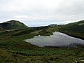 Loch Na Leighe (35942668540).jpg 5184 × 3888; 9,54 MB
-
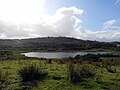
 Loch Quien, Bute - geograph-3537628.jpg 640 × 480; 113 kB
-
 Loch Quien, Isle of Bute, Buteshire - geograph-4053072.jpg 1920 × 1280; 1,12 MB
-
 Loch Striven (36202974731).jpg 5184 × 3888; 8,17 MB
-
 Looking across to Ardyne Point (35503672624).jpg 5184 × 3888; 8,84 MB
-
 Looking East from St Blane's Hill (35942666030).jpg 5184 × 3888; 7,25 MB
-
 Looking North from Ardbeg Point (35503670254).jpg 5184 × 3888; 7,85 MB
-
 Looking North from Rothesay. (36170793422).jpg 5184 × 3888; 8,52 MB
-
 Looking to the mainland - Flickr - Graham Grinner Lewis.jpg 2048 × 1536; 655 kB
-
 Looking Towards The Isle of Bute - geograph.org.uk - 765338.jpg 480 × 640; 67 kB
-
 Lubas Port - Isle of Bute - geograph.org.uk - 5588468.jpg 3072 × 2304; 1,13 MB
-
 Madras (36170694242).jpg 5184 × 3888; 8,89 MB
-
 Main Lobby of Mount Stuart House (35503556504).jpg 5184 × 3888; 7,39 MB
-
 McGill WIng (36202718041).jpg 5184 × 3888; 7,71 MB
-
 Memorial to Midget Submarine Crews (35503468264).jpg 3888 × 5184; 8,09 MB
-
 Moored yachts at Mount Stuart - geograph.org.uk - 5426560.jpg 3264 × 2448; 3,34 MB
-
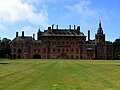
 Mount Stuart from the north-west, Isle of Bute.jpg 1815 × 949; 693 kB
-
 Mount Stuart Gardens (36339372545).jpg 5184 × 3888; 8,13 MB
-
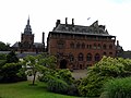
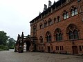
 Mount Stuart House (35503562664).jpg 3888 × 5184; 9,84 MB
-
 Mount Stuart House (35530713843).jpg 5184 × 3888; 10,18 MB
-
 Mount Stuart House (35530723633).jpg 5184 × 3888; 9,22 MB
-
 Mount Stuart House (35530749713).jpg 5184 × 3888; 8,81 MB
-
 Mount Stuart House (35942590960).jpg 5184 × 3888; 7,6 MB
-
 Mount Stuart House (35942596440).jpg 5184 × 3888; 8,13 MB
-
 Mount Stuart House (35942597470).jpg 5184 × 3888; 7,97 MB
-
 Mount Stuart House (35942615370).jpg 5184 × 3888; 8,08 MB
-
 Mount Stuart House (36170648732).jpg 5184 × 3888; 7,96 MB
-
 Mount Stuart House (36170672012).jpg 3888 × 5184; 7,66 MB
-
 Mount Stuart House (36339328505).jpg 5184 × 3888; 7,54 MB
-
 Mount Stuart House (36339339595).jpg 5184 × 3888; 7,42 MB
-
 Mount Stuart House (36339374055).jpg 5184 × 3888; 7,88 MB
-
 Mount Stuart House Bathroom (35503534914).jpg 5184 × 3888; 7,55 MB
-
 Mount Stuart House Bathroom (35530728663).jpg 3888 × 5184; 8,18 MB
-
 Mount Stuart House Bedroom (35942600180).jpg 3888 × 5184; 8,93 MB
-
 Mount Stuart House Beehive Well (35530706223).jpg 3888 × 5184; 8,24 MB
-
 Mount Stuart House Chapel (35530745923).jpg 5184 × 3888; 10,39 MB
-
 Mount Stuart House Chapel (36202777431).jpg 3888 × 5184; 8,41 MB
-
 Mount Stuart House Chapel (36339362265).jpg 3888 × 5184; 7,66 MB
-
 Mount Stuart House Chapel (36339363695).jpg 3888 × 5184; 7,96 MB
-
 Mount Stuart House Conservatory (35530730853).jpg 5184 × 3888; 8,97 MB
-
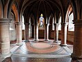 Mount Stuart House Crypt (35503545644).jpg 5184 × 3888; 7,59 MB
-
 Mount Stuart House Gardens (36202819821).jpg 5184 × 3888; 7,99 MB
-
 Mount Stuart House Grounds (35530707513).jpg 5184 × 3888; 8,49 MB
-
 Mount Stuart House Grounds (36202782431).jpg 3888 × 5184; 8,25 MB
-
 Mount Stuart House Grounds (36339336095).jpg 5184 × 3888; 8,16 MB
-
 Mount Stuart House Library (35942614560).jpg 5184 × 3888; 8,89 MB
-
 MounT Stuart House Main Lobby (35530740043).jpg 5184 × 3888; 7,69 MB
-
 Mount Stuart House Main Lobby (35942604740).jpg 5184 × 3888; 7,88 MB
-
 Mount Stuart House Main Lobby (36170686012).jpg 5184 × 3888; 7,04 MB
-
 Mount Stuart House Main Lobby (36294979566).jpg 5184 × 3888; 8,04 MB
-
 Mount Stuart House Main Staircase (35530742913).jpg 5184 × 3888; 8,07 MB
-
 Mount Stuart House Main Staircase (36339366905).jpg 5184 × 3888; 7,78 MB
-
 Mount Stuart House North Lodge (35530704583).jpg 3888 × 5184; 7,93 MB
-
 Mount Stuart House Tapestry (36202815141).jpg 5184 × 3888; 10,37 MB
.jpg)
.jpg)
.jpg)
.jpg)

.jpg)
.jpg)
.jpg)
.jpg)
.jpg)


.jpg)
.jpg)
.jpg)

.jpg)

.jpg)


.jpg)
.jpg)
.jpg)
.jpg)
.jpg)
.jpg)
.jpg)
.jpg)
.jpg)
.jpg)
.jpg)
.jpg)
.jpg)
.jpg)

.jpg)
_(1356393024).jpg)
.jpg)
.jpg)
.jpg)
.jpg)


.jpg)
.jpg)
.jpg)


.jpg)
.jpg)
.jpg)
.jpg)
.jpg)


.jpg)
.jpg)
.jpg)
.jpg)
.jpg)
.jpg)

.jpg)
.jpg)
.jpg)

.jpg)

.jpg)


.jpg)
.jpg)
.jpg)
.jpg)
.jpg)


.jpg)
.jpg)
.jpg)
.jpg)
.jpg)
.jpg)

.jpg)

.jpg)
.jpg)

.jpg)

.jpg)

.jpg)
.jpg)


.jpg)
.jpg)
.jpg)
.jpg)
.jpg)
.jpg)
.jpg)
.jpg)
.jpg)
.jpg)
.jpg)
.jpg)

.jpg)
.jpg)
.jpg)
.jpg)

.jpg)

.jpg)
.jpg)

.jpg)
.jpg)
.jpg)
.jpg)
.jpg)
.jpg)
.jpg)
_(1356385722).jpg)

.jpg)
.jpg)
.jpg)
.jpg)
.jpg)
.jpg)
.jpg)
.jpg)
.jpg)


.jpg)
.jpg)
.jpg)
.jpg)
.jpg)


.jpg)
.jpg)
.jpg)
.jpg)


.jpg)
.jpg)
.jpg)
.jpg)
.jpg)
.jpg)
.jpg)
.jpg)
.jpg)
.jpg)
.jpg)
.jpg)
.jpg)
.jpg)
.jpg)
.jpg)
.jpg)
.jpg)
.jpg)
.jpg)
.jpg)
.jpg)
.jpg)
.jpg)
.jpg)
.jpg)
.jpg)
.jpg)
.jpg)
.jpg)
.jpg)
.jpg)
.jpg)
.jpg)
.jpg)
.jpg)
.jpg)