Category:Joodse begraafplaats (Leek, Groningen)
Jump to navigation
Jump to search
| Object location | | View all coordinates using: OpenStreetMap |
|---|
 | |||||
| Upload media | |||||
| Instance of | |||||
|---|---|---|---|---|---|
| Part of | |||||
| Location | Leek, Westerkwartier, Groningen, Netherlands | ||||
| Located on street |
| ||||
| Owned by |
| ||||
| Heritage designation |
| ||||
 | |||||
Deutsch: Jüdischer Friedhof
English: Jewish cemetery
Nederlands: Joodse begraafplaats, Roomsterweg, Leek
|
This is a category about rijksmonumentcomplex number 513630
|
Begraafplaats
|
This is a category about rijksmonument number 513631
|
Begraafplaatshek
|
This is a category about rijksmonument number 513632
|
Metaheerhuis (baarhuisje)
|
This is a category about rijksmonument number 513633
|
| Address |
|
Subcategories
This category has only the following subcategory.
B
Media in category "Joodse begraafplaats (Leek, Groningen)"
The following 28 files are in this category, out of 28 total.
-
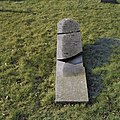
 Afgebroken grafsteen, links achter begraafplaats - Leek - 20367472 - RCE.jpg 1,200 × 1,200; 332 KB
-
 Bakstenen hek met metalen opstand aan de straatzijde - Leek - 20367737 - RCE.jpg 1,200 × 1,200; 492 KB
-
 Bakstenen hekwerk met metselwerk vanaf begraafplaats - Leek - 20367738 - RCE.jpg 1,200 × 958; 243 KB
-
 Beschadigde grafsteen - Leek - 20367517 - RCE.jpg 1,200 × 1,200; 513 KB
-
 Beschadigde grafsteen - Leek - 20367615 - RCE.jpg 1,200 × 1,200; 490 KB
-
 Beschadigde grafsteen, links voor baarhuisje - Leek - 20367463 - RCE.jpg 1,200 × 1,200; 413 KB
-
 Beschadigde grafsteen, voor baarhuisje - Leek - 20367460 - RCE.jpg 1,200 × 1,200; 383 KB
-
 Gebroken grafsteen - Leek - 20367448 - RCE.jpg 1,200 × 1,200; 499 KB
-
 Gebroken grafsteen - Leek - 20367454 - RCE.jpg 1,200 × 1,200; 519 KB
-
 Gebroken grafsteen - Leek - 20367518 - RCE.jpg 1,200 × 1,200; 564 KB
-
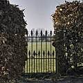
 Hek, Joodse begraafplaats, Leek.JPG 4,608 × 3,456; 2.77 MB
-
 Hekpijler met betonnen muts - Leek - 20367722 - RCE.jpg 1,200 × 1,200; 356 KB
-

-
 Joodse begraafplaats, Leek.JPG 4,032 × 3,024; 2.39 MB
-
 Overzicht begraafplaats - Leek - 20367760 - RCE.jpg 1,200 × 958; 340 KB
-
 Overzicht beukenhaag - Leek - 20367752 - RCE.jpg 1,200 × 958; 395 KB
-

-
 Overzicht grafstenen vanaf hek - Leek - 20367755 - RCE.jpg 1,200 × 958; 278 KB
-
 Overzicht hekwerk - Leek - 20367750 - RCE.jpg 1,200 × 958; 296 KB
-
 Overzicht hekwerk vanaf Roomsterweg - Leek - 20367744 - RCE.jpg 1,200 × 958; 290 KB
-
 Overzicht op beukenhaag vanaf begraafplaats - Leek - 20367753 - RCE.jpg 1,200 × 958; 252 KB
-
 Overzicht pad naar baarhuisje - Leek - 20367742 - RCE.jpg 1,200 × 958; 322 KB
-
 Overzicht pad richting baarhuisje - Leek - 20367757 - RCE.jpg 1,200 × 958; 265 KB
-
 Overzicht pad richting baarhuisje - Leek - 20367763 - RCE.jpg 1,200 × 958; 252 KB
-
 Overzicht pad richting hek - Leek - 20367749 - RCE.jpg 1,200 × 958; 298 KB
-
 Overzicht van enkele grafstenen - Leek - 20367747 - RCE.jpg 1,200 × 958; 344 KB
-

-
 Toegangshek, gezicht vanaf begraafplaats - Leek - 20367617 - RCE.jpg 1,200 × 1,200; 377 KB


_te_Leek_gezien_vanaf_de_overzijde_van_het_water_-_Leek_-_20367746_-_RCE.jpg)


