Category:June 2009 in North Yorkshire
Jump to navigation
Jump to search
Deutsch: Bilder, die im Juni 2009 in North Yorkshire aufgenommen worden sind. Bitte beachten Sie, dass dies weder das Datum des Uploads noch das Datum des Scannens eines Fotos ist.
English: Images/pictures taken in North Yorkshire during June 2009. Note this is not the date of the upload, nor the date a photo was scanned.
Español: Fotografías o imágenes tomadas en North Yorkshire durante junio 2009. No es la fecha de subida ni escaneo, sino la fecha en que las fotografías o imágenes se crearon.
Esperanto: Bildoj faritaj en North Yorkshire en junio 2009. Tio ne estas la dato, kiam la bildoj estis alŝutitaj aŭ skanitaj.
Français : Photographies ou images prises en North Yorkshire durant juin 2009. Ce n'est pas la date du téléchargement ou du scan.
Galego: Fotografías ou imaxes tomadas en North Yorkshire durante xuño 2009. Non é a data de subida nin escaneamento, senón a data na que se crearon as fotografías ou imaxes.
Italiano: Fotografie o immagini scattate a North Yorkshire nel giugno 2009. Nota bene: la data non si riferisce né a quella di upload né a quella in cui la foto è stata digitalizzata.
Norsk bokmål: Bilder tatt i North Yorkshire i løpet av juni 2009. Merk at dette ikke er datoen for opplasting, eller når et bilde har blitt skannet.
Norsk nynorsk: Bilete teke i North Yorkshire i løpet av juni 2009. Merk at dette ikkje er datoen for opplasting, eller når eit bilete har vorte skanna.
Русский: Изображения, сделанные в North Yorkshire в течение июнь 2009 (не дата загрузки изображения).
Українська: Зображення, зроблені в North Yorkshire протягом червень 2009. Зауважте, що це не дата завантаження чи дата сканування фотографії.
| June 2008 | ← | June 2009 | → | June 2010 | |||||||
| Jan | Feb | Mar | Apr | May | Jun | Jul | Aug | Sep | Oct | Nov | Dec |
| 102 | 130 | 132 | 160 | 279 | 263 | 181 | 133 | 125 | 110 | 109 | 159 |
|---|---|---|---|---|---|---|---|---|---|---|---|
Subcategories
This category has only the following subcategory.
Y
Media in category "June 2009 in North Yorkshire"
The following 200 files are in this category, out of 262 total.
(previous page) (next page)-
 New Bridge at Kettlewell - geograph.org.uk - 1346424.jpg 640 × 479; 73 KB
-
 Bridge over the beck at Kettlewell - geograph.org.uk - 1365967.jpg 640 × 419; 84 KB
-
 Starbotton Village - geograph.org.uk - 1365980.jpg 640 × 426; 71 KB
-
 A corner of Kettlewell - geograph.org.uk - 1387215.jpg 640 × 439; 324 KB
-
 Parting of the ways - geograph.org.uk - 1387264.jpg 640 × 439; 346 KB
-
 Town Head - geograph.org.uk - 1387284.jpg 640 × 431; 287 KB
-
 Zarina's tearoom, New Lane - geograph.org.uk - 1387289.jpg 640 × 424; 287 KB
-
 A hare - geograph.org.uk - 1509412.jpg 640 × 426; 113 KB
-
 The Leeds Hotel - geograph.org.uk - 1351063.jpg 578 × 640; 92 KB
-
 Farmland near the A170 - geograph.org.uk - 1355173.jpg 640 × 480; 84 KB
-
 A clear path - geograph.org.uk - 1342539.jpg 480 × 640; 77 KB
-
 A Nidderdale Farmstead - geograph.org.uk - 1351444.jpg 640 × 480; 68 KB
-

-
 A swift hunting on Buckden Pike - geograph.org.uk - 1351773.jpg 640 × 426; 36 KB
-
 A165 Roundabout - geograph.org.uk - 1355245.jpg 640 × 480; 62 KB
-
 All Change. - geograph.org.uk - 1342814.jpg 640 × 480; 127 KB
-
 All Saints Church - Church Hill - geograph.org.uk - 1359651.jpg 640 × 480; 232 KB
-
 All Saints Church, Wykeham - geograph.org.uk - 1379272.jpg 640 × 480; 100 KB
-
 All Saints Graveyard - Church Hill - geograph.org.uk - 1359655.jpg 640 × 480; 231 KB
-
 All Saints, Pickhill - geograph.org.uk - 1355993.jpg 476 × 640; 67 KB
-
 All Saints, Pickhill - geograph.org.uk - 1356999.jpg 480 × 640; 106 KB
-
 Ana Cross on Spaunton Moor - geograph.org.uk - 1608494.jpg 640 × 480; 54 KB
-
 B1253 towards Octon Crossroads - geograph.org.uk - 1335009.jpg 640 × 480; 84 KB
-
 B1253 towards Octon Crossroads - geograph.org.uk - 1335031.jpg 640 × 480; 72 KB
-
 Barn with canalside access - geograph.org.uk - 1395491.jpg 640 × 480; 119 KB
-
 Bog Lane sewage treatment works - geograph.org.uk - 1390336.jpg 640 × 480; 173 KB
-

-
 Bridge at Settle over the Ribble - geograph.org.uk - 1384318.jpg 640 × 480; 125 KB
-

-
 Brigholme Barn - geograph.org.uk - 1351577.jpg 640 × 480; 59 KB
-
 Brompton Stables - geograph.org.uk - 1364028.jpg 640 × 477; 108 KB
-
 Brook Street - demolition site - geograph.org.uk - 1395353.jpg 640 × 480; 141 KB
-
 Brook Street swing bridge - geograph.org.uk - 1395345.jpg 640 × 480; 110 KB
-
-

-
 Captain Cook Square - geograph.org.uk - 1386122.jpg 640 × 460; 114 KB
-
 Carousel Walk - The Fairway - geograph.org.uk - 1358990.jpg 640 × 480; 228 KB
-

-
 Church Wynd, Burneston - geograph.org.uk - 1344044.jpg 640 × 421; 79 KB
-
 Clapham Station - geograph.org.uk - 1384521.jpg 640 × 480; 78 KB
-
 Clapham Station - geograph.org.uk - 1384525.jpg 640 × 480; 82 KB
-
 Clapham Station - geograph.org.uk - 1384532.jpg 640 × 480; 98 KB
-
 Common back yard with washing - geograph.org.uk - 1395449.jpg 640 × 480; 136 KB
-
 Cottage by the Green, East Marton - geograph.org.uk - 1377411.jpg 640 × 471; 143 KB
-
 Cottages, Ruston - geograph.org.uk - 1379253.jpg 640 × 480; 81 KB
-
 Cow Close Hill - geograph.org.uk - 1333030.jpg 640 × 480; 87 KB
-
 Crakehall Primary School - geograph.org.uk - 1342216.jpg 640 × 480; 100 KB
-
 Crakehall Station - geograph.org.uk - 1342217.jpg 640 × 480; 105 KB
-
 Crane off Coach Street - geograph.org.uk - 1338577.jpg 480 × 640; 91 KB
-
 Croome Dale Plantation - geograph.org.uk - 1335000.jpg 640 × 480; 86 KB
-
 Crop Field near West Lutton - geograph.org.uk - 1334988.jpg 640 × 480; 102 KB
-
 Crop Field North of Sherburn Cut - geograph.org.uk - 1379110.jpg 640 × 480; 79 KB
-
 Crop Field North of Starr Carr Farm - geograph.org.uk - 1354231.jpg 640 × 480; 91 KB
-
 Crop Field with Poppies, Seamer - geograph.org.uk - 1354306.jpg 640 × 480; 87 KB
-
 Crop Field, Allison Wold Farm - geograph.org.uk - 1378921.jpg 640 × 480; 105 KB
-
 Culvert Lane - geograph.org.uk - 1391153.jpg 640 × 480; 158 KB
-
 Culvert Lane - overgrown - geograph.org.uk - 1391198.jpg 640 × 480; 225 KB
-
 Culvert Lane passing under the canal - geograph.org.uk - 1391205.jpg 640 × 480; 154 KB
-
 Dales Museum, Hawes - geograph.org.uk - 1378601.jpg 640 × 480; 103 KB
-
 St John's Church, Dalton - geograph.org.uk - 1349121.jpg 480 × 640; 63 KB
-
 Danby railway station - geograph.org.uk - 1599293.jpg 640 × 427; 92 KB
-
 Deighton Avenue - Eversley Court - geograph.org.uk - 1358954.jpg 640 × 480; 234 KB
-

-
-

-
 Eller Bottoms - geograph.org.uk - 1353979.jpg 640 × 480; 83 KB
-
 Emergency phone on the A65 at Thorlby - geograph.org.uk - 1397222.jpg 640 × 480; 233 KB
-
 Exelby Pinfold - geograph.org.uk - 1343658.jpg 640 × 480; 97 KB
-
 Exelby Smithy - geograph.org.uk - 1343629.jpg 640 × 403; 80 KB
-
 Falsgrave Road, Scarborough - geograph.org.uk - 1355186.jpg 640 × 480; 95 KB
-
 Farm Buildings, Allison Wold - geograph.org.uk - 1378905.jpg 640 × 480; 80 KB
-
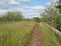
 Farm Track, Sherburn Ings - geograph.org.uk - 1379141.jpg 640 × 480; 85 KB
-
 Farmland near Ling farm - geograph.org.uk - 1335036.jpg 640 × 480; 58 KB
-
 Farmland, Little Pasture - geograph.org.uk - 1335011.jpg 640 × 480; 57 KB
-
 Ferris Wheel in Scarborough (3603010151).jpg 2,000 × 3,008; 2.27 MB
-
 Ferris Wheel in Scarborough (3603824438).jpg 2,000 × 3,008; 2 MB
-
 Field access track, Cracoe - geograph.org.uk - 1351774.jpg 640 × 480; 121 KB
-
 Field adjacent to the A65 at Stirton - geograph.org.uk - 1390325.jpg 640 × 480; 105 KB
-
 Field Boundary - geograph.org.uk - 1334975.jpg 640 × 480; 90 KB
-
 Field Boundary at Crossley Wood - geograph.org.uk - 1347640.jpg 640 × 480; 79 KB
-
 Field Boundary, Helperthorpe Pasture - geograph.org.uk - 1335021.jpg 640 × 480; 85 KB
-
 Field Drain near Starr Carr Farm - geograph.org.uk - 1354227.jpg 640 × 480; 106 KB
-
 Field Drain, Sherburn Ings - geograph.org.uk - 1379134.jpg 640 × 480; 92 KB
-
 Field Entrance - geograph.org.uk - 1333886.jpg 640 × 480; 119 KB
-
 Field Entrance - geograph.org.uk - 1379829.jpg 640 × 480; 77 KB
-

-
 Field Entrance, beside the A1039 - geograph.org.uk - 1354084.jpg 640 × 480; 117 KB
-
 Field Entrance, Weaverthorpe Pasture - geograph.org.uk - 1335044.jpg 640 × 480; 88 KB
-
 Field Marshall no 16384 SIIIA (ex french) at Newby 2009 - IMG 2545.jpg 2,256 × 1,504; 2 MB
-
 Field Near Prospect Farm - geograph.org.uk - 1369831.jpg 427 × 640; 82 KB
-
 Field North of the A64 - geograph.org.uk - 1378977.jpg 640 × 480; 50 KB
-
 Field of dreams (4101981560).jpg 3,008 × 2,000; 3.21 MB
-

-
 Field of Winter Barley - geograph.org.uk - 1350225.jpg 640 × 480; 94 KB
-
 Fields and stone walls - geograph.org.uk - 1650302.jpg 640 × 428; 70 KB
-
 Fields on Givendale Rigg - geograph.org.uk - 1350769.jpg 640 × 480; 72 KB
-
 Fields on Givendale Rigg - geograph.org.uk - 1350771.jpg 640 × 480; 61 KB
-
 Fields towards Hollingworth Spring - geograph.org.uk - 1369977.jpg 640 × 480; 48 KB
-
 Finkle Hill - from Kirkgate - geograph.org.uk - 1357603.jpg 480 × 640; 242 KB
-

-
 Footbridge over River Skirfare - geograph.org.uk - 1346452.jpg 640 × 479; 125 KB
-
 Footpath to Hebden - geograph.org.uk - 1357574.jpg 1,024 × 683; 112 KB
-
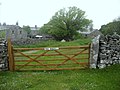
 Gate into the pasture - geograph.org.uk - 1397278.jpg 640 × 480; 128 KB
-
 Gate toUpper Winskill Farm - geograph.org.uk - 1355598.jpg 640 × 480; 85 KB
-
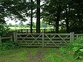 Gated Field Entrance - geograph.org.uk - 1379805.jpg 640 × 480; 122 KB
-
 Giggleswick Station - geograph.org.uk - 1370172.jpg 640 × 480; 86 KB
-
 Giggleswick Station - geograph.org.uk - 1370175.jpg 640 × 480; 104 KB
-
 Giggleswick Station - geograph.org.uk - 1370179.jpg 640 × 480; 87 KB
-
 Giggleswick Station - geograph.org.uk - 1384428.jpg 640 × 480; 118 KB
-
 All Saints, Girsby - geograph.org.uk - 1342977.jpg 640 × 480; 79 KB
-
 Goat Scar Lane - geograph.org.uk - 1357559.jpg 640 × 480; 88 KB
-
 Grassington Bridge - geograph.org.uk - 1344866.jpg 640 × 480; 86 KB
-
 Green Lane to High Field - geograph.org.uk - 1335013.jpg 640 × 480; 134 KB
-
 Green Lane, Weaverthorpe - geograph.org.uk - 1333992.jpg 640 × 480; 77 KB
-
 Hall Garth Mews - Kirkgate - geograph.org.uk - 1357580.jpg 640 × 480; 223 KB
-
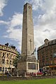 Harrogate cenotaph (6156671829).jpg 2,666 × 4,000; 2.32 MB
-
 Helwith Bridge Quarry - geograph.org.uk - 1384205.jpg 640 × 480; 82 KB
-
 Henry's Mews - Kirkgate - geograph.org.uk - 1357572.jpg 640 × 480; 231 KB
-
 Heslaker Farm - geograph.org.uk - 1395617 (cropped).jpg 624 × 234; 65 KB
-
 Heslaker Farm - geograph.org.uk - 1395617.jpg 640 × 480; 87 KB
-
 Hilltop Manor Care Home - Finkle Street - geograph.org.uk - 1357634.jpg 640 × 480; 270 KB
-
 House on Stepney Drive - geograph.org.uk - 1355181.jpg 640 × 480; 113 KB
-
 Howe Postbox - geograph.org.uk - 1357001.jpg 463 × 640; 101 KB
-
 Hunmanby Lock up June 209 (Nigel Coates).jpg 2,592 × 1,944; 1.55 MB
-
 Inghey old bridge (1) - geograph.org.uk - 1395598.jpg 640 × 480; 150 KB
-
 Inghey old bridge (2) - geograph.org.uk - 1395603.jpg 640 × 480; 198 KB
-
 John Deere 6630 Premium at Newby 2009 - 2473.jpg 2,256 × 1,504; 2.12 MB
-
 Jowland Winn - geograph.org.uk - 1347641.jpg 640 × 480; 98 KB
-
 Late spring flowers on Bog Lane - geograph.org.uk - 1390337.jpg 640 × 480; 232 KB
-
 Leander approaching Skipton - geograph.org.uk - 1375440.jpg 640 × 484; 111 KB
-
 Level crossing at Niffany - geograph.org.uk - 1391228.jpg 640 × 480; 116 KB
-

-

-
 Lobb Ghyll Viaduct.jpg 2,961 × 2,793; 5.26 MB
-
 Low Street - from Kirkgate - geograph.org.uk - 1357614.jpg 640 × 480; 243 KB
-
 Lyndale Garage, Gargrave - geograph.org.uk - 1397374.jpg 640 × 480; 126 KB
-
 Malton Lane, West Lutton - geograph.org.uk - 1334980.jpg 640 × 480; 80 KB
-
 Manor Farm, Thorlby - geograph.org.uk - 1396775.jpg 640 × 480; 134 KB
-

-
 Minor Road Towards Butterwick - geograph.org.uk - 1335059.jpg 640 × 480; 75 KB
-
 Minor Road Towards Cowlam Grange - geograph.org.uk - 1335001.jpg 640 × 480; 78 KB
-
 Minor Road Towards Sherburn - geograph.org.uk - 1378900.jpg 640 × 480; 84 KB
-
 Minor Road Towards Sherburn - geograph.org.uk - 1378912.jpg 640 × 480; 82 KB
-
 Minor Road Towards Sherburn - geograph.org.uk - 1378918.jpg 640 × 480; 74 KB
-
 Minor Road Towards Sledmere - geograph.org.uk - 1334986.jpg 640 × 480; 83 KB
-
 Minor Road Towards Sledmere - geograph.org.uk - 1334990.jpg 640 × 480; 96 KB
-
 Minor Road Towards Sledmere - geograph.org.uk - 1334994.jpg 640 × 480; 63 KB
-
 Minor Road Towards Weaverthorpe - geograph.org.uk - 1335012.jpg 640 × 480; 63 KB
-
 Minor Road Towards Weaverthorpe - geograph.org.uk - 1335035.jpg 640 × 480; 73 KB
-
 Minor Road Towards Weaverthorpe - geograph.org.uk - 1335041.jpg 640 × 480; 100 KB
-
 Minor Road Towards Wykeham - geograph.org.uk - 1379147.jpg 640 × 480; 67 KB
-
 Near Sulber pot Limestone - geograph.org.uk - 1386296.jpg 640 × 480; 75 KB
-
 New steps adjacent to Dewhursts Mill - geograph.org.uk - 1395402.jpg 640 × 480; 128 KB
-
 Newby - geograph.org.uk - 1384559.jpg 640 × 480; 110 KB
-
 Newby - geograph.org.uk - 1384575.jpg 640 × 480; 77 KB
-
 Newby - geograph.org.uk - 1384579.jpg 640 × 480; 111 KB
-
 Newby - geograph.org.uk - 1384584.jpg 640 × 480; 107 KB
-
 Niffany water pumping station - geograph.org.uk - 1395591.jpg 640 × 480; 114 KB
-

-
 Old guide post, Cracoe - geograph.org.uk - 1351656.jpg 480 × 640; 142 KB
-
 Old road direction signs, Cracoe - geograph.org.uk - 1351620.jpg 640 × 480; 138 KB
-
 Only Ghost Trains Stop Here Now. - geograph.org.uk - 1342905.jpg 480 × 640; 113 KB
-
 Overgrown stile - geograph.org.uk - 1390326.jpg 640 × 480; 258 KB
-
 Pastures East of Upper Winskill - geograph.org.uk - 1357543.jpg 640 × 480; 35 KB
-
 Pavement on Low Midge Hills - geograph.org.uk - 1375252.jpg 640 × 480; 117 KB
-
 Phone box in Settle - geograph.org.uk - 1369879.jpg 640 × 480; 116 KB
-
 All Saints, Pickhill - geograph.org.uk - 1355966.jpg 640 × 480; 91 KB
-
 Pickhill Station - geograph.org.uk - 1355106.jpg 640 × 412; 65 KB
-
 Pipe bridge across the canal - geograph.org.uk - 1395440.jpg 640 × 480; 173 KB
-
 Post Office and Store - Low Street - geograph.org.uk - 1358215.jpg 640 × 423; 205 KB
-

-
 Private road to Fair Oaks farm - geograph.org.uk - 1378679.jpg 640 × 480; 55 KB
-
 Raikes Road - geograph.org.uk - 1395205.jpg 640 × 480; 80 KB
-
 Rape field (3646724299).jpg 3,008 × 1,516; 1.8 MB
-
 Rape field with poppies (3646722185).jpg 2,488 × 1,708; 2.77 MB
-
 Redmire railway station on the Wensleydale Railway 23 June 2009.jpg 640 × 480; 86 KB
-
 Ribblehead Viaduct from Broadrake - geograph.org.uk - 1382168.jpg 640 × 480; 111 KB
-
 Ribblehead Viaduct from Broadrake - geograph.org.uk - 1382195.jpg 640 × 480; 126 KB
-
 Ribblehead Viaduct from Broadrake - geograph.org.uk - 1382202.jpg 640 × 480; 93 KB
-
 Ribblehead Viaduct from Ivescar - geograph.org.uk - 1382091.jpg 640 × 480; 87 KB
-
 Ribblehead Viaduct from Ivescar - geograph.org.uk - 1382106.jpg 640 × 480; 99 KB
-
 Ribblehead Viaduct from Ivescar - geograph.org.uk - 1382141.jpg 640 × 480; 62 KB
-
 Ribblehead Viaduct from Ivescar - geograph.org.uk - 1382147.jpg 640 × 480; 100 KB
-
 Ribblehead Viaduct from Ivescar - geograph.org.uk - 1382164.jpg 640 × 480; 121 KB
-
 Ribblehead Viaduct from Parker's Moss - geograph.org.uk - 1382476.jpg 640 × 480; 109 KB
-
 Rievaulx Abbey - geograph.org.uk - 1334289.jpg 640 × 404; 294 KB
-

-
 Roundabout Skipton - geograph.org.uk - 1357988.jpg 640 × 426; 84 KB
-
 Ruined squeeze stile - geograph.org.uk - 1357560.jpg 1,024 × 683; 245 KB
-
 Scarborough fire station - geograph.org.uk - 1394815.jpg 640 × 426; 204 KB
-
 Selby, Market Cross - geograph.org.uk - 1372231.jpg 640 × 480; 78 KB
-
 Selby, Market Cross - geograph.org.uk - 1372240.jpg 640 × 480; 79 KB
-
 Selby, Market Cross - geograph.org.uk - 1372282.jpg 640 × 480; 74 KB
-
 Selby, Market Lane - geograph.org.uk - 1372211.jpg 640 × 480; 66 KB
-
 Settrington Beacon on Beacon Wold - geograph.org.uk - 1357436.jpg 640 × 480; 52 KB
-
 Settrington Service Reservoir - geograph.org.uk - 1376587.jpg 640 × 490; 87 KB
-
 Sheep on the Aire flood plain - geograph.org.uk - 1395545.jpg 640 × 480; 74 KB
-
 Sherburn Library - off Finkle Street - geograph.org.uk - 1357625.jpg 640 × 480; 285 KB
-
 Sinderby Station Awaits its Fate. - geograph.org.uk - 1342865.jpg 640 × 480; 102 KB
-


_at_Redmire_Station_-_geograph.org.uk_-_1378631.jpg)


.jpg)
.jpg)


_at_Newby_2009_-_IMG_2545.jpg)


.jpg)


.jpg)


.jpg)
_-_geograph.org.uk_-_1395598.jpg)
_-_geograph.org.uk_-_1395603.jpg)


.jpg)


.jpg)
.jpg)


.jpg)