Category:Kenilworth
Salti al navigilo
Salti al serĉilo
town in Warwickshire, England, UK  Tŵr Cloc Kenilworth | |||||
| Alŝuti plurmedion | |||||
| Estas |
| ||||
|---|---|---|---|---|---|
| Loko | Warwick, Warwickshire, West Midlands, Anglio | ||||
| Eventuale la sama kiel | Kenilworth (Wikimedia duplicated page, civila paroĥo) | ||||
| oficiala retejo | |||||
 | |||||
Subkategorioj
Ĉi tiu kategorio havas la 17 jenajn subkategoriojn, el 17 entute.
A
- Allotments in Kenilworth (9 D)
C
- Chesford Grange Hotel (3 D)
- Kenilworth clock tower (19 D)
F
- 2 Fieldgate Lane, Kenilworth (4 D)
K
- Kenilworth War Memorial (10 D)
P
- The Pleasance, Kenilworth (12 D)
- Priory Theatre, Kenilworth (2 D)
S
- Shops in Kenilworth (67 D)
Dosieroj en kategorio “Kenilworth”
La jenaj 200 dosieroj estas en ĉi tiu kategorio, el 1 151 entute.
(antaŭa paĝo) (sekva paĝo)-

-
 'Kids Club', St Augustine's School - geograph.org.uk - 1974881.jpg 640 × 480; 91 KB
-

-
 'Party in the Park' at Abbey Fields - geograph.org.uk - 1874245.jpg 640 × 480; 100 KB
-

-

-
 1 White's Row, Kenilworth - geograph.org.uk - 2092035.jpg 640 × 480; 88 KB
-
 1-7 Arthur Street, Kenilworth - geograph.org.uk - 1815889.jpg 640 × 480; 78 KB
-
 13-15 Southbank Road, Kenilworth - geograph.org.uk - 2177344.jpg 640 × 480; 105 KB
-
 15-19 High Street, Kenilworth.jpg 2 560 × 1 440; 1,43 MB
-
 17-29 The Square, Kenilworth - geograph.org.uk - 2196680.jpg 640 × 480; 69 KB
-
 1930's council houses, Albion Street - geograph.org.uk - 1803868.jpg 640 × 480; 64 KB
-
 194-200 Warwick Road, Kenilworth - geograph.org.uk - 2090399.jpg 640 × 480; 59 KB
-
 1960's flats, Albion Street - geograph.org.uk - 1803885.jpg 640 × 480; 58 KB
-
-
 20-041 & 20-006 Kenilworth 30-07-87 (32369870483).jpg 2 592 × 1 728; 1,66 MB
-
 21 Clinton Lane Kenilworth.jpg 4 032 × 3 024; 3,17 MB
-
 21 High Street, Kenilworth.jpg 1 440 × 2 560; 1,31 MB
-
 23 (part) ^ 25 New Street, Kenilworth - geograph.org.uk - 6235311.jpg 3 264 × 2 448; 1,76 MB
-
 24-30 Station Road, Kenilworth - geograph.org.uk - 2203736.jpg 640 × 480; 96 KB
-
 35 ^ 37 New Street, Kenilworth - geograph.org.uk - 6233648.jpg 2 081 × 2 774; 1,74 MB
-
 46 and 48 New Street, Kenilworth - geograph.org.uk - 1973673.jpg 640 × 480; 104 KB
-
 47-061 Kenilworth Junction May 77 (36913031765).jpg 2 592 × 1 728; 3,71 MB
-
 47-144 Kenilworth Junction May 77 (36516529670).jpg 2 157 × 1 438; 2,64 MB
-
 50-62 Whitemoor Road, Kenilworth - geograph.org.uk - 1947588.jpg 640 × 480; 93 KB
-
 56 Whitemoor Road, Kenilworth - geograph.org.uk - 1947591.jpg 480 × 640; 91 KB
-
 Class 87 87032 Kenilworth on a West Coast Main Line express, early 1980s.jpg 2 535 × 1 700; 860 KB
-
 9 and 9a Southbank Road, Kenilworth - geograph.org.uk - 1861313.jpg 640 × 480; 95 KB
-
 A clue in the name - geograph.org.uk - 2756000.jpg 1 024 × 768; 175 KB
-
 A field of wheat with wild plants around it - geograph.org.uk - 6162629.jpg 2 000 × 1 330; 2,62 MB
-

-

-

-

-
 A frosty view towards Cumnor House - geograph.org.uk - 2190296.jpg 640 × 480; 130 KB
-
 A leafy suburb of Kenilworth - geograph.org.uk - 6160294.jpg 2 000 × 1 330; 2,88 MB
-

-

-

-

-

-
 A very new wood - geograph.org.uk - 6162618.jpg 2 000 × 1 330; 2,82 MB
-

-

-
 A view south to Rudfyn Manor - geograph.org.uk - 5444564.jpg 640 × 384; 308 KB
-

-

-
 A452 near Chesford bridge - geograph.org.uk - 1723887.jpg 2 000 × 1 503; 207 KB
-
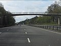 A46 - Glasshouse Wood footbridge - geograph.org.uk - 2902642.jpg 640 × 480; 60 KB
-
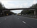 A46 - Rocky Lane bridge - geograph.org.uk - 2902645.jpg 640 × 480; 56 KB
-
 A46 approaching junction with A452 - geograph.org.uk - 5163339.jpg 2 866 × 1 822; 3,21 MB
-
 A46 near Stoneleigh - geograph.org.uk - 5163329.jpg 3 008 × 2 000; 709 KB
-

-
 A46 south of Stoneleigh junction - geograph.org.uk - 2902628.jpg 640 × 480; 47 KB
-
 Abattoir Entrance - geograph.org.uk - 2171004.jpg 640 × 480; 92 KB
-

-
 Abbey End car park, Kenilworth - geograph.org.uk - 1907242.jpg 640 × 480; 72 KB
-
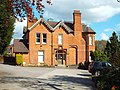
 Abbey End Dental Practice in Kenilworth - geograph.org.uk - 5867512.jpg 1 024 × 680; 142 KB
-
 Abbey End, Kenilworth - geograph.org.uk - 1473035.jpg 640 × 428; 89 KB
-
 Abbey End, Kenilworth - geograph.org.uk - 1848462.jpg 640 × 480; 85 KB
-
 Abbey End, Kenilworth - geograph.org.uk - 3668283.jpg 3 872 × 2 592; 4,11 MB
-
 Abbey End, Kenilworth - geograph.org.uk - 4990684.jpg 2 560 × 1 440; 1,43 MB
-
 Abbey Field site - geograph.org.uk - 2490678.jpg 1 199 × 938; 245 KB
-
 Abbey Fields - geograph.org.uk - 1652803.jpg 640 × 512; 98 KB
-
 Abbey Fields - geograph.org.uk - 1802507.jpg 640 × 480; 110 KB
-
 Abbey Fields - geograph.org.uk - 2548991.jpg 1 280 × 960; 515 KB
-
 Abbey Fields - geograph.org.uk - 2549095.jpg 1 280 × 960; 691 KB
-
 Abbey Fields - geograph.org.uk - 3791083.jpg 640 × 480; 134 KB
-
 Abbey Fields - geograph.org.uk - 3791091.jpg 640 × 480; 99 KB
-
 Abbey Fields - geograph.org.uk - 602066.jpg 640 × 480; 96 KB
-
 Abbey Fields - geograph.org.uk - 913657.jpg 640 × 480; 124 KB
-
 Abbey Fields from Abbey Hill, Kenilworth - geograph.org.uk - 1847068.jpg 640 × 480; 115 KB
-
 Abbey Fields in the snow - geograph.org.uk - 1652818.jpg 640 × 480; 97 KB
-
 Abbey Fields Kenilworth - geograph.org.uk - 5412408.jpg 2 000 × 1 333; 2,67 MB
-
 Abbey Fields Lake - geograph.org.uk - 2548995.jpg 1 280 × 959; 491 KB
-

-

-
 Abbey Fields pool - geograph.org.uk - 3791088.jpg 640 × 480; 73 KB
-
 Abbey Fields pool - geograph.org.uk - 673475.jpg 640 × 480; 95 KB
-
 Abbey Fields pool - geograph.org.uk - 684780.jpg 640 × 480; 97 KB
-
 Abbey Fields, Kenilworth - geograph.org.uk - 1849075.jpg 640 × 480; 79 KB
-
 Abbey Fields, Kenilworth - geograph.org.uk - 1849104.jpg 640 × 480; 98 KB
-
 Abbey Fields, Kenilworth - geograph.org.uk - 3670061.jpg 3 872 × 2 592; 3,98 MB
-
 Abbey Fields, towards Abbey Hill - geograph.org.uk - 602058.jpg 640 × 446; 96 KB
-
 Abbey Guest House - geograph.org.uk - 2755989.jpg 1 024 × 768; 184 KB
-

-
-
 Abbey Hill in the snow - geograph.org.uk - 2200321.jpg 640 × 480; 113 KB
-
 Abbey Hill in the snow - geograph.org.uk - 2201848.jpg 640 × 480; 94 KB
-
 Abbey Hill, Kenilworth - geograph.org.uk - 1812415.jpg 640 × 480; 123 KB
-

-

-
 Abbey Hotel Kenilworth - geograph.org.uk - 1974446.jpg 640 × 412; 64 KB
-
-

-
 Across the fields - geograph.org.uk - 1615040.jpg 640 × 480; 77 KB
-
 Across the fields - geograph.org.uk - 1615050.jpg 640 × 480; 72 KB
-

-
 Albion Road Kenilworth - geograph.org.uk - 5412425.jpg 2 000 × 1 333; 1,96 MB
-

-
 Almanack in Kenilworth - geograph.org.uk - 5867402.jpg 1 024 × 944; 157 KB
-
 Alpine sport in Abbey Fields, late 1981 - geograph.org.uk - 5695113.jpg 640 × 431; 179 KB
-
 An enlarged Tha Kitchen, Kenilworth - geograph.org.uk - 2954886.jpg 640 × 480; 70 KB
-

-
 Angus Drive - geograph.org.uk - 2433937.jpg 640 × 480; 87 KB
-
 Approach to the tiltyard - geograph.org.uk - 5054154.jpg 640 × 426; 116 KB
-
 Approaching Birmingham Road bridge over A46 - geograph.org.uk - 3581363.jpg 1 024 × 768; 90 KB
-
 Arden Road, Windy Arbour - geograph.org.uk - 3774357.jpg 640 × 480; 82 KB
-

-
 Ashow Lane or Rocky Lane, Kenilworth - geograph.org.uk - 1974279.jpg 640 × 480; 117 KB
-
 Avenue of trees - geograph.org.uk - 5543133.jpg 768 × 1 024; 364 KB
-
 Avenue Road, Kenilworth - geograph.org.uk - 5868004.jpg 1 024 × 755; 152 KB
-
 Avenue, Abbey fields - geograph.org.uk - 2279668.jpg 640 × 412; 73 KB
-

-

-

-
 Bank Gallery, High Street, Kenilworth - geograph.org.uk - 5872443.jpg 1 024 × 823; 289 KB
-
 Barn at Oaks Farm - geograph.org.uk - 1880859.jpg 640 × 480; 109 KB
-
 Barn at Oaks Farm - geograph.org.uk - 1880908.jpg 640 × 480; 104 KB
-
 Barns at Oaks Farm - geograph.org.uk - 48662.jpg 640 × 480; 78 KB
-
 Barrowfield Lane, Kenilworth - geograph.org.uk - 5874759.jpg 1 024 × 974; 256 KB
-
 Beauchamp Road, Kenilworth - geograph.org.uk - 386270.jpg 640 × 480; 91 KB
-
 Beauchamp Road, Kenilworth - geograph.org.uk - 386271.jpg 640 × 480; 129 KB
-
 Beauchamp Road, Kenilworth - geograph.org.uk - 386886.jpg 640 × 480; 96 KB
-
 Beech, Abbey Fields - geograph.org.uk - 602407.jpg 480 × 640; 97 KB
-
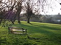
 Bench in frost-covered Abbey Fields - geograph.org.uk - 2190286.jpg 640 × 480; 100 KB
-
 Berkeley Road, Kenilworth - geograph.org.uk - 1882770.jpg 640 × 480; 102 KB
-
 Best Drive - geograph.org.uk - 2433921.jpg 640 × 480; 91 KB
-
 Birches Lane Kenilworth - geograph.org.uk - 5412357.jpg 2 000 × 1 333; 2,87 MB
-
 Birmingham Road near Kenilworth - geograph.org.uk - 2901939.jpg 640 × 480; 149 KB
-
 Blossom and daffodils, Priory Road - geograph.org.uk - 1812479.jpg 640 × 480; 118 KB
-
 Blossom, Crackley Wood - geograph.org.uk - 1262071.jpg 480 × 640; 99 KB
-
 Bluebells, Crackley Wood - geograph.org.uk - 1474107.jpg 640 × 480; 98 KB
-
 Bobby's Food Service Lorry - geograph.org.uk - 5699890.jpg 6 032 × 4 014; 2,91 MB
-
 Bollards on Leyes Lane - geograph.org.uk - 2867158.jpg 640 × 480; 95 KB
-
 Borrowell Terrace houses, Kenilworth - geograph.org.uk - 5886559.jpg 1 024 × 731; 153 KB
-

-

-
 Bridge over the Kenilworth Greenway - geograph.org.uk - 1651207.jpg 640 × 481; 100 KB
-
 Bridge St Kenilworth - geograph.org.uk - 2826721.jpg 640 × 480; 85 KB
-
 Bridge Street in Kenilworth - geograph.org.uk - 4440563.jpg 1 024 × 819; 233 KB
-
 Broken tree in Crackley Wood - geograph.org.uk - 1037931.jpg 480 × 640; 98 KB
-

-
 Brookside Avenue, Kenilworth - geograph.org.uk - 5874794.jpg 1 024 × 778; 136 KB
-
 Bullimore Wood and A46 sliproad - geograph.org.uk - 1723915.jpg 2 000 × 1 492; 193 KB
-
-

-
 Bungalows and apartments - geograph.org.uk - 5699916.jpg 6 032 × 4 014; 3,9 MB
-

-
 Camp Barn - geograph.org.uk - 14274.jpg 640 × 480; 99 KB
-
 Camp Barn - geograph.org.uk - 1612129.jpg 640 × 480; 72 KB
-
-

-

-
 Caravan park entrance - geograph.org.uk - 6160299.jpg 2 000 × 1 330; 2,06 MB
-

-
 Carpark at the Tennis ^ Squash club - geograph.org.uk - 6233569.jpg 1 306 × 979; 489 KB
-

-
 Castle Defensive Ditch at the Brays - geograph.org.uk - 2820925.jpg 640 × 480; 148 KB
-
 Castle Entrance - geograph.org.uk - 4536502.jpg 800 × 600; 117 KB
-
 Castle Farm Recreation Centre - geograph.org.uk - 1882686.jpg 640 × 480; 109 KB
-
 Castle Heights - geograph.org.uk - 4536517.jpg 800 × 600; 84 KB
-
 Castle Road in Kenilworth - geograph.org.uk - 4443362.jpg 1 024 × 771; 317 KB
-
 Castle Road View - geograph.org.uk - 4536506.jpg 800 × 600; 96 KB
-
 Castle Road, Kenilworth - geograph.org.uk - 2040590.jpg 640 × 480; 94 KB
-
 Castle Road, Kenilworth - geograph.org.uk - 2218075.jpg 640 × 480; 109 KB
-
 Castle Road, Kenilworth - geograph.org.uk - 2549271.jpg 1 280 × 960; 650 KB
-
 Centenary Way - geograph.org.uk - 1612082.jpg 640 × 480; 104 KB
-
 Centenary Way - geograph.org.uk - 1612089.jpg 640 × 480; 105 KB
-
 Centenary Way - geograph.org.uk - 1612099.jpg 640 × 480; 94 KB
-
 Centenary Way heads for Kenilworth - geograph.org.uk - 1583213.jpg 640 × 426; 423 KB
-
 Centenary Way leaves Rouncil Lane - geograph.org.uk - 1612139.jpg 640 × 480; 105 KB
-
 Centenary Way near Oaks Farm - geograph.org.uk - 6264976.jpg 5 456 × 3 632; 4,64 MB
-
 Centenary Way towards Rouncil Lane - geograph.org.uk - 6264964.jpg 5 456 × 3 632; 4,41 MB
-
 Centenary Way towards Rouncil Lane - geograph.org.uk - 6264965.jpg 5 456 × 3 632; 7,12 MB
-
 Centenary Way towards Rouncil Lane - geograph.org.uk - 6264969.jpg 5 456 × 3 632; 4,87 MB
-
 Centenary Way towards Rouncil Lane - geograph.org.uk - 6264973.jpg 5 456 × 3 632; 4,89 MB
-
 Centenary Way towards Rouncil Lane - geograph.org.uk - 6265094.jpg 5 456 × 3 632; 4,66 MB
-
 Centenary Way towards Rouncil Lane - geograph.org.uk - 6265097.jpg 5 456 × 3 632; 4,89 MB
-
 Centenary Way towards Rouncil Lane - geograph.org.uk - 6265101.jpg 5 456 × 3 632; 4,64 MB
-
 Centenary Way towards Warwick - geograph.org.uk - 6264954.jpg 5 456 × 3 632; 6,04 MB
-
 Centenary Way towards Warwick - geograph.org.uk - 6264957.jpg 5 456 × 3 632; 5,82 MB
-
 Changed times - geograph.org.uk - 1215694.jpg 640 × 428; 78 KB
-

-
 Chase Farm from South - geograph.org.uk - 2806361.jpg 800 × 535; 142 KB
-
 Chase Lane - geograph.org.uk - 2820979.jpg 640 × 480; 137 KB
-
 Chase Lane - geograph.org.uk - 2821798.jpg 640 × 480; 93 KB
-
 Chase Lane Kenilworth - geograph.org.uk - 1974401.jpg 640 × 480; 120 KB
-
 Chase Lane near Little Chase Farm - geograph.org.uk - 2820952.jpg 640 × 480; 81 KB
-
 Chase Lane towards Chase Cottages - geograph.org.uk - 2154879.jpg 640 × 480; 64 KB
-
 Chase Lane, Kenilworth - geograph.org.uk - 787053.jpg 640 × 415; 111 KB
-
 Chase Woods and Park Pale - geograph.org.uk - 2820944.jpg 640 × 468; 60 KB
-
 Cherry Way, Kenilworth - geograph.org.uk - 1815691.jpg 640 × 480; 93 KB
-

-

-
 Christmas tree in Talisman Square - geograph.org.uk - 2186744.jpg 480 × 640; 77 KB
-
 Christmas tree in Talisman Square - geograph.org.uk - 2186745.jpg 640 × 480; 76 KB
-
 Christmas trees and wreaths for sale - geograph.org.uk - 2186746.jpg 640 × 480; 83 KB
-
 Clarkes Avenue footpath - geograph.org.uk - 3179709.jpg 1 024 × 768; 300 KB
-
 Cleared area inside Kenilworth Common - geograph.org.uk - 838846.jpg 640 × 428; 176 KB


.jpg)


_%5E_25_New_Street,_Kenilworth_-_geograph.org.uk_-_6235311.jpg)


.jpg)
.jpg)


_-_geograph.org.uk_-_2902648.jpg)


