Category:Kerk op de Hoogte
Springe nei navigaasje
Springe nei sykjen
| Object location | | View all coordinates using: OpenStreetMap |
|---|
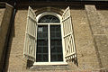
church building in Weststellingwerf, Netherlands  | |||||
| Media oplade | |||||
| Is in | |||||
|---|---|---|---|---|---|
| Lokaasje | Wolvegea, Fryslân, Nederlân | ||||
| Street address |
| ||||
| Located on street |
| ||||
| Heritage designation |
| ||||
| Inception |
| ||||
| Significant event |
| ||||
| offisjele webstee | |||||
 | |||||
|
This is a category about rijksmonument number 38881
|
| Adres |
|
Media yn de kategory "Kerk op de Hoogte"
Dizze kategory befettet 28 de folgjende bestannen, fan yn totaal 28.
-
 Exterieur naar het noord-westen - Wolvega - 20216764 - RCE.jpg 1.200 × 958; 260 KB
-
 Exterieur naar het westen - Wolvega - 20216765 - RCE.jpg 959 × 1.200; 203 KB
-
 Exterieur naar het zuid-westen - Wolvega - 20216769 - RCE.jpg 959 × 1.200; 227 KB
-
 Exterieur noord-zijde naar het zuid-oosten - Wolvega - 20216766 - RCE.jpg 1.200 × 959; 273 KB
-
 Exterieur noord-zijde naar het zuid-westen - Wolvega - 20216768 - RCE.jpg 1.200 × 965; 304 KB
-
 Exterieur zuid-gevel - Wolvega - 20216767 - RCE.jpg 1.200 × 962; 294 KB
-
 Interieur naar het oosten - Wolvega - 20216763 - RCE.jpg 1.200 × 960; 159 KB
-

-
 Interieur, aanzicht orgel, orgelnummer 1702 - Wolvega - 20359311 - RCE.jpg 956 × 1.200; 184 KB
-
 Kerk vanuit het noorden - Wolvega - 20216758 - RCE.jpg 907 × 1.200; 170 KB
-
 Kerk vanuit het zuiden - Wolvega - 20216759 - RCE.jpg 1.200 × 895; 236 KB
-
 Notabelenbank - Wolvega - 20216762 - RCE.jpg 903 × 1.200; 180 KB
-
 Orgel - Wolvega - 20216760 - RCE.jpg 889 × 1.200; 163 KB
-
 Preekstoel - Wolvega - 20216761 - RCE.jpg 870 × 1.200; 168 KB
-
 Wolvega Friesland.jpg 4.770 × 3.177; 4,89 MB
-
 WOLVEGA KERK OP DE HOOGTE 01.jpg 6.000 × 4.000; 14,01 MB
-
 WOLVEGA KERK OP DE HOOGTE 02.jpg 4.000 × 6.000; 15,8 MB
-
 WOLVEGA KERK OP DE HOOGTE 03.jpg 6.000 × 4.000; 16,32 MB
-
 WOLVEGA KERK OP DE HOOGTE 04.jpg 4.000 × 6.000; 13,09 MB
-
 WOLVEGA KERK OP DE HOOGTE 05.jpg 4.000 × 6.000; 15,12 MB
-
 WOLVEGA KERK OP DE HOOGTE 06.jpg 6.000 × 4.000; 17,78 MB
-
 WOLVEGA KERK OP DE HOOGTE 07.jpg 4.000 × 6.000; 12,91 MB
-
 WOLVEGA KERK OP DE HOOGTE 08.jpg 6.000 × 4.000; 15,4 MB
-
 WOLVEGA KERK OP DE HOOGTE 09.jpg 5.374 × 3.583; 15,2 MB
-
 Wolvega Kerk op hoogte.jpg 3.168 × 4.224; 4,68 MB
-
 Wolvega. Friesland. Gemeente Weststellingwerf Holland.jpg 2.992 × 2.792; 7,43 MB
-
 Wolvega..jpg 4.770 × 3.177; 5,02 MB
-
 Wolvegea, PKN-tsjerke ('Tsjerke op 'e Hichte').jpg 2.198 × 2.198; 2,29 MB


.jpg)