Category:Kerkweg 18, Vorchten
Jump to navigation
Jump to search
| Object location | | View all coordinates using: OpenStreetMap |
|---|
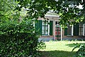
farmhouse in Heerde, Netherlands  | |||||
| Upload media | |||||
| Instance of | |||||
|---|---|---|---|---|---|
| Location | Vorchten, Heerde, Gelderland, Netherlands | ||||
| Street address |
| ||||
| Located on street |
| ||||
| Heritage designation |
| ||||
 | |||||
|
This is a category about rijksmonument number 21159
|
| Address |
|
Media in category "Kerkweg 18, Vorchten"
The following 6 files are in this category, out of 6 total.
-
 Voorgevel - Vorchten - 20246791 - RCE.jpg 1,200 × 810; 267 KB
-
 Voorgevel nr. VO3-A - Vorchten - 20476292 - RCE.jpg 1,200 × 900; 193 KB
-
 Voorgevel nr. VO3-C - Vorchten - 20476289 - RCE.jpg 1,200 × 900; 197 KB
-
 Vorchten21159.jpg 4,288 × 2,848; 6.34 MB
-
 Zijgevel met kleine aanbouw nr. VO3-D - Vorchten - 20476291 - RCE.jpg 1,200 × 900; 184 KB
-
 Zijgevel nr. VO3-B - Vorchten - 20476290 - RCE.jpg 1,200 × 900; 173 KB


