Category:Kirche und Burgruine Ringgenberg
Jump to navigation
Jump to search
| Object location | | View all coordinates using: OpenStreetMap |
|---|
church building and castle ruin in Ringgenberg in the canton of Bern, Switzerland   | |||||
| Upload media | |||||
| Instance of | |||||
|---|---|---|---|---|---|
| Part of | |||||
| Location | Ringgenberg, Interlaken-Oberhasli administrative district, Oberland administrative region, Bern, Switzerland | ||||
| Street address |
| ||||
| Heritage designation | |||||
| Elevation above sea level |
| ||||
 | |||||
Subcategories
This category has only the following subcategory.
K
Media in category "Kirche und Burgruine Ringgenberg"
The following 38 files are in this category, out of 38 total.
-
 5467 - Ringgenberg - Kirche am Brienzersee.JPG 3,648 × 2,736; 2.17 MB
-
 5474 - Ringgenberg - Kirche am Brienzersee.JPG 3,648 × 2,736; 2.38 MB
-
 5475 - Ringgenberg - Kirche am Brienzersee.JPG 3,648 × 2,736; 2.71 MB
-
 5479 - Ringgenberg - Kirche am Brienzersee.JPG 3,648 × 2,736; 2.11 MB
-
 ArxRinggenberg-20130717i.jpg 2,816 × 2,112; 2.71 MB
-
 Burgkirche Ringgenberg.jpg 2,592 × 1,944; 2.13 MB
-
 Kirche Ringgenberg (2016).jpg 4,032 × 3,024; 3.11 MB
-
 Kirche-Burgruine-Ringgenberg.JPG 4,000 × 3,000; 4.18 MB
-
 Playing the Pipe Organ (14765429261).jpg 3,840 × 5,300; 21.26 MB
-
 5480 - Ringgenberg - Kirche am Brienzersee.JPG 3,648 × 2,736; 2.56 MB
-
 Ringgenberg BE Burgkirche Schutzmassnahmen 1.jpg 4,608 × 3,456; 6.2 MB
-
 Ringgenberg BE Burgkirche Schutzmassnahmen 2.jpg 4,608 × 3,456; 5.69 MB
-
 Ringgenberg BE mit Kirche und Burgruine-20140501.jpg 3,000 × 2,000; 5.84 MB
-
 Ringgenberg Church.JPG 791 × 997; 105 KB
-
 Ringgenberg Kirche und Burgruine DSC06225.jpg 3,646 × 2,280; 11.21 MB
-
 Ringgenberg Kirche und Burgruine DSC06227 GIMP.jpg 4,000 × 2,672; 13.49 MB
-
 Ringgenberg Kirche und Burgruine DSC06228 GIMP.jpg 4,000 × 2,672; 11.59 MB
-
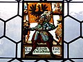 Ringgenberg, églilse. Vitrail armorié 4.jpg 4,608 × 3,456; 6.53 MB
-
 Ringgenberg, église, intérieur, vue vers le choeur.jpg 4,608 × 3,456; 6.34 MB
-
 Ringgenberg, église. Bancs d'origine.jpg 4,608 × 3,456; 6.32 MB
-
 Ringgenberg, église. Cartouche avec inscription 1671.jpg 4,608 × 3,456; 7.02 MB
-
 Ringgenberg, église. Décor peint.jpg 4,608 × 3,456; 5.67 MB
-
 Ringgenberg, église. Fonts baptismaux 1671.jpg 3,456 × 4,608; 6.34 MB
-
 Ringgenberg, église. Intérieur, vu vers l'ouest.jpg 4,608 × 3,456; 6.61 MB
-
 Ringgenberg, église. Orgue 1837, par Anton Carlen.jpg 4,608 × 3,456; 6.69 MB
-
 Ringgenberg, église. Restauration 1911.jpg 4,608 × 3,456; 6.53 MB
-
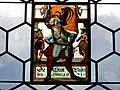 Ringgenberg, église. Vitrail armorié 2.jpg 4,608 × 3,456; 5.6 MB
-
 Ringgenberg, église. Vitrail armorié 3.jpg 4,608 × 3,456; 6.12 MB
-
 Ringgenberg, église. Vitrail armorié 5.jpg 4,608 × 3,456; 6.02 MB
-
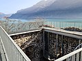
 Ringgenberg, église. Vue depuis la grande tour du château.jpg 3,456 × 4,608; 6.66 MB
-
 Ringgenberg, église.jpg 1,024 × 768; 138 KB
-
 Ringgenberg,église. Vitrail armorié 1.jpg 3,456 × 4,608; 6.69 MB
-
 Ruine Ringgenberg 2020.jpg 6,936 × 9,248; 23.52 MB
-
 Ruine Ringgenberg 360 Panorama.jpg 27,231 × 4,287; 45.5 MB
-
 Ruine Ringgenberg Fenster.jpg 6,936 × 9,248; 18.06 MB
-
 Ruine Ringgenberg innere Treppe.jpg 6,936 × 9,248; 14.31 MB
-
 Ruine Ringgenberg Plattform.jpg 9,248 × 6,936; 15.7 MB
-
 Ruine Ringgenberg äussere Treppe.jpg 6,936 × 9,248; 20.49 MB


.jpg)

.jpg)


