Category:Kirkwall
Zur Navigation springen
Zur Suche springen
Hauptort der schottischen Insel Mainland  | |||||
| Medium hochladen | |||||
| Ist ein(e) |
| ||||
|---|---|---|---|---|---|
| Ort |
| ||||
| Einwohnerzahl |
| ||||
| Fläche |
| ||||
 | |||||
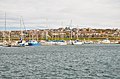
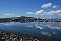
English: Kirkwall is the largest town and capital of Orkney, off the coast of northern mainland Scotland.
Unterkategorien
Es werden 19 von insgesamt 19 Unterkategorien in dieser Kategorie angezeigt:
In Klammern die Anzahl der enthaltenen Kategorien (K), Seiten (S), Dateien (D)
B
- Bay of Kirkwall (6 D)
- Big Tree, Kirkwall (11 D)
- Bishop's Palace, Kirkwall (18 D)
C
E
- Earl's Palace, Kirkwall (54 D)
G
- Grain Earth House (14 D)
K
- Kirkwall Hotel (8 D)
- Kirkwall Sheriff Court (1 D)
- Kirkwall Town Hall (17 D)
L
- Lingro burn (2 D)
O
- Orkney Library and Archive (9 D)
- Orkney Wireless Museum (7 D)
S
- Scapa distillery (11 D)
T
Medien in der Kategorie „Kirkwall“
Folgende 196 Dateien sind in dieser Kategorie, von 196 insgesamt.
-
 A965 Kirkwall to Stromness road - geograph.org.uk - 377693.jpg 640 × 480; 93 KB
-
 Across the roofs of Kirkwall - geograph.org.uk - 2633377.jpg 4.000 × 3.000; 2,79 MB
-
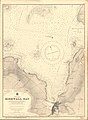 Admiralty Chart No 1553 Kirkwall Bay, Published 1898.jpg 8.222 × 11.239; 29,66 MB
-
 Admiralty Chart No 2180a Northern portion of the Orkney Islands, Scotland, Published 1886.jpg 11.916 × 8.312; 9,53 MB
-
 Admiralty Chart No 2180b Southern portion of the Orkney Islands, Scotland, Published 1886.jpg 11.787 × 8.260; 11,67 MB
-
 Admiralty Chart No 2584 Approaches to Kirkwall, Published 1898.jpg 16.431 × 11.287; 60,02 MB
-
 Albert Street (Kirkwall) (1) (Kenny McFly).jpg 1.836 × 3.264; 2,88 MB
-
 Albert Street (Kirkwall) (2) (Kenny McFly).jpg 3.264 × 1.836; 2,41 MB
-
 Albert Street (Kirkwall) (3) (Kenny McFly).jpg 3.264 × 1.836; 1,93 MB
-
 Approach to Kirkwall from the SW - geograph.org.uk - 861294.jpg 640 × 376; 54 KB
-
 Bay of Weyland - geograph.org.uk - 6231291.jpg 1.024 × 768; 130 KB
-

-
 Bollards to cyclists - geograph.org.uk - 1119200.jpg 640 × 468; 85 KB
-
 Bridge at Inganess Bay - geograph.org.uk - 377626.jpg 640 × 480; 146 KB
-
 Bringing home the dinner, Kirkwall - geograph.org.uk - 283984.jpg 640 × 480; 106 KB
-
 Broad road in Kirkwall in summer 2012 (1).JPG 4.752 × 3.168; 4,28 MB
-
 Broad road in Kirkwall in summer 2012 (2).JPG 4.752 × 3.168; 4,35 MB
-
 Building in Kirkwall in summer 2012 (1).jpg 4.633 × 2.785; 11,75 MB
-
 Buildings opposite to Orkney Library and Archive.jpg 3.280 × 2.464; 2,07 MB
-
 Centre for Nordic Studies, Kirkwall - geograph.org.uk - 4469961.jpg 640 × 480; 423 KB
-
 Centre for Nordic Studies, Kirkwall - geograph.org.uk - 4469962.jpg 640 × 480; 439 KB
-

-
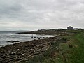
 Coastline below Castlegreen, Carness - geograph.org.uk - 4989668.jpg 1.024 × 682; 88 KB
-
 Council Offices on School Place, Kirkwall (geograph 5877147).jpg 1.600 × 1.098; 494 KB
-

-
 Cromwell Road - geograph.org.uk - 5839812.jpg 640 × 427; 288 KB
-

-
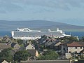
 Cruise ship - geograph.org.uk - 283976.jpg 632 × 412; 73 KB
-
 Cycle Lane - geograph.org.uk - 1119192.jpg 640 × 425; 96 KB
-
-
 Ferry MSC Lirica in port Kirkwall in summer 2012.JPG 4.752 × 3.168; 4,57 MB
-
 Ferry Terminal at Kirkwall - geograph.org.uk - 3479053.jpg 640 × 424; 74 KB
-
 Fire station in Kirkwall, Orkneys.jpg 5.364 × 2.806; 6,41 MB
-
 Foreshore Bay of Kirkwall - geograph.org.uk - 172761.jpg 640 × 427; 94 KB
-
 Former Drill Hall - Junction Road - geograph.org.uk - 4677460.jpg 1.162 × 1.600; 308 KB
-
 Galtness Coast Gun Battery - geograph.org.uk - 14949.jpg 640 × 307; 64 KB
-
 Galtness Gun Battery - geograph.org.uk - 232402.jpg 640 × 485; 54 KB
-
 Glaitness school in Kirkwall in summer 2012.JPG 4.752 × 3.168; 4,68 MB
-
 Harbour Street towards the Kirkwall Hotel - geograph.org.uk - 6172931.jpg 3.648 × 2.432; 3,32 MB
-
 Hatston Industrial Estate - geograph.org.uk - 283978.jpg 640 × 480; 78 KB
-
 Hatston Pier, Kirkwall, Orkney - geograph.org.uk - 5855362.jpg 1.600 × 1.065; 414 KB
-
 Houses on the Carness Road - geograph.org.uk - 4538584.jpg 640 × 480; 417 KB
-
 Hrossey.jpg 1.157 × 600; 145 KB
-
 Inganess Bay - geograph.org.uk - 172762.jpg 640 × 427; 65 KB
-
 Inganess Bay - geograph.org.uk - 377623.jpg 640 × 480; 105 KB
-
 Iolanthe (50792289783).jpg 2.031 × 1.364; 1.005 KB
-
 Ivy covered house in Kirkwall - geograph.org.uk - 953221.jpg 640 × 480; 99 KB
-
 John Rae 20120923 Orkney I 1.jpg 1.920 × 1.278; 1,29 MB
-
 Jolly Sign - geograph.org.uk - 853164.jpg 640 × 480; 63 KB
-
 Kirkwall (Panorama) (Kenny McFly).jpg 8.096 × 1.664; 3,77 MB
-
 Kirkwall - geograph.org.uk - 13762.jpg 640 × 480; 57 KB
-
 Kirkwall - geograph.org.uk - 67143.jpg 634 × 205; 47 KB
-
 Kirkwall at dusk - geograph.org.uk - 3550865.jpg 1.024 × 682; 203 KB
-
 Kirkwall banner.JPG 4.550 × 650; 1,04 MB
-
 Kirkwall from ferry to Westray - panoramio.jpg 2.591 × 1.619; 2,27 MB
-
 Kirkwall from the air (1980) - geograph.org.uk - 3709777.jpg 1.047 × 673; 303 KB
-

-
 Kirkwall from the Westray ferry - geograph.org.uk - 285782.jpg 640 × 479; 74 KB
-
 Kirkwall Harbour - geograph.org.uk - 3349422.jpg 1.600 × 1.066; 304 KB
-
 Kirkwall Harbour - geograph.org.uk - 3488009.jpg 1.440 × 964; 292 KB
-
 Kirkwall Harbour - geograph.org.uk - 3585160.jpg 640 × 480; 166 KB
-
 Kirkwall harbour - geograph.org.uk - 4551139.jpg 2.592 × 1.944; 1,09 MB
-
 Kirkwall Harbour - geograph.org.uk - 5317529.jpg 2.000 × 1.333; 302 KB
-
 Kirkwall Harbour - geograph.org.uk - 5660578.jpg 640 × 480; 72 KB
-
 Kirkwall Harbour - geograph.org.uk - 5839813.jpg 640 × 427; 242 KB
-
 Kirkwall Harbour - geograph.org.uk - 5922288.jpg 1.497 × 1.361; 753 KB
-
 Kirkwall harbour - geograph.org.uk - 6021505.jpg 1.024 × 768; 321 KB
-
 Kirkwall Harbour, Orkney - geograph.org.uk - 2190072.jpg 800 × 542; 93 KB
-
 Kirkwall Highlighted.png 480 × 525; 43 KB
-
 Kirkwall marina - geograph.org.uk - 4551145.jpg 2.592 × 1.944; 1,21 MB
-
 Kirkwall Marina - geograph.org.uk - 5839811.jpg 640 × 427; 277 KB
-
 Kirkwall Marina - geograph.org.uk - 6231284.jpg 1.024 × 768; 141 KB
-
 Kirkwall Orkney-Mainland.jpg 284 × 213; 14 KB
-
 Kirkwall Post Office - geograph.org.uk - 950871.jpg 640 × 480; 63 KB
-
 Kirkwall Quay - geograph.org.uk - 1199753.jpg 640 × 439; 100 KB
-
 Kirkwall view out to sea.jpg 1.024 × 768; 39 KB
-
 Kirkwall Youth Hostel - geograph.org.uk - 17297.jpg 640 × 480; 76 KB
-
 Kirkwall, Early morning, Ayre Hotel - geograph.org.uk - 3744769.jpg 1.024 × 768; 161 KB
-
 Kirkwall, Harbour - geograph.org.uk - 5727500.jpg 640 × 480; 51 KB
-
 Kirkwall, Orkney Mainland - geograph.org.uk - 5726878.jpg 3.264 × 2.448; 1,92 MB
-
 Kirkwall-centre.jpg 1.920 × 1.440; 807 KB
-
 Kirkwall.jpg 640 × 853; 94 KB
-
 Klimadiagramm-metrisch-deutsch-Kirkwall (Orkney-Inseln)-GB.png 1.024 × 713; 112 KB
-
 Landscape around Kirkwall in summer 2012.JPG 4.752 × 3.168; 4,18 MB
-
 Landscape with geese - geograph.org.uk - 1083082.jpg 426 × 640; 37 KB
-
 Leaving Kirkwall (1397534019).jpg 2.048 × 1.248; 264 KB
-
 Leaving Kirkwall 01 HDR (1347235384).jpg 2.048 × 1.191; 474 KB
-
 Leaving Kirkwall 03 HDR (1346347625).jpg 2.048 × 1.322; 412 KB
-
 Leaving Kirkwall 05a HDR (1347237470).jpg 2.048 × 1.302; 663 KB
-
 Leaving Kirkwall 06 (1347238828).jpg 2.048 × 1.536; 198 KB
-
 Leaving Kirkwall on the Earl Sigurd - geograph.org.uk - 3479181.jpg 515 × 640; 80 KB
-
 Light on the Firth - geograph.org.uk - 2469563.jpg 1.364 × 1.914; 1,78 MB
-

-
 Main Street, Kirkwall - geograph.org.uk - 523087.jpg 433 × 640; 47 KB
-
 Marina at Kirkwall - geograph.org.uk - 3479021.jpg 640 × 424; 88 KB
-
 Masonic Hall, Castle Street, Kirkwall - geograph.org.uk - 4067328.jpg 5.184 × 3.456; 3,56 MB
-

-
 Mercat cross, Kirkwall - geograph.org.uk - 3619675.jpg 3.872 × 2.592; 5,32 MB
-
 Moonrise in Kirkwall (1) (Kenny McFly).jpg 1.836 × 3.264; 1,25 MB
-
 Moonrise in Kirkwall (2) (Kenny McFly).jpg 1.836 × 3.264; 1,78 MB
-
 Moorland below Burrey Brae - geograph.org.uk - 1247679.jpg 640 × 427; 102 KB
-
 MV Hebridean Sky at Kirkwall Pier - geograph.org.uk - 6202616.jpg 1.600 × 1.065; 342 KB
-
 Odin Stone Shop - geograph.org.uk - 951784.jpg 640 × 480; 63 KB
-

-

-
 Orcadian Street - geograph.org.uk - 878217.jpg 400 × 486; 37 KB
-
 Ordnance Survey One-Inch Sheet 6 Orkney (Kirkwall), Published 1959.jpg 8.275 × 9.882; 8,34 MB
-
 Orkney Parliamentary Office - geograph.org.uk - 953190.jpg 640 × 480; 91 KB
-
 Orkney Sunset (4454743306).jpg 853 × 1.280; 407 KB
-
 Overhead Kirkwall - geograph.org.uk - 861276.jpg 640 × 339; 82 KB
-
 Papdale House - geograph.org.uk - 1119223.jpg 640 × 450; 124 KB
-
 Papdale House - geograph.org.uk - 1119236.jpg 640 × 425; 116 KB
-
 Papdale Primary School - geograph.org.uk - 1119230.jpg 640 × 366; 71 KB
-
 Pipe band - geograph.org.uk - 283981.jpg 640 × 480; 118 KB
-
 Pipe band in Albert St, Kirkwall - geograph.org.uk - 283982.jpg 640 × 480; 108 KB
-
 Plaque of Robert Laing - geograph.org.uk - 517177.jpg 640 × 614; 63 KB
-
 Plowed field at Holm branch road, .jpg 5.184 × 3.456; 12,8 MB
-
 Pomona Cafe, Kirkwall - geograph.org.uk - 953244.jpg 640 × 480; 67 KB
-
 Post box in Kirkwall.JPG 3.000 × 4.000; 3,33 MB
-
 Reflections in Kirkwall Harbour - geograph.org.uk - 3619701.jpg 3.872 × 2.592; 3,36 MB
-
 Replica of town cross in Kirkwall in summer 2012.jpg 4.752 × 3.168; 6,32 MB
-
 Road junction - geograph.org.uk - 366403.jpg 640 × 480; 109 KB
-
 Road junction at HY463119 - geograph.org.uk - 234722.jpg 640 × 480; 100 KB
-
 Romulus2.jpg 640 × 387; 66 KB
-
-
 Royal Bank of Scotland, Kirkwall - geograph.org.uk - 953098.jpg 640 × 480; 73 KB
-
 Scapa Crescent, Kirkwall - geograph.org.uk - 1446486.jpg 640 × 428; 102 KB
-
 Scapa Crescent, Kirkwall - geograph.org.uk - 1446494.jpg 640 × 428; 79 KB
-
 Shapinsay ferry at Kirkwall Harbour - geograph.org.uk - 4538344.jpg 640 × 480; 364 KB
-
 Shetland - panoramio (27).jpg 1.944 × 2.592; 1,16 MB
-
 Shetland - panoramio (54).jpg 2.592 × 1.944; 1,42 MB
-
 Shore Street, Kirkwall - geograph.org.uk - 5917724.jpg 1.024 × 683; 213 KB
-
 Sport centrum in Kirkwall in summer 2012.JPG 4.752 × 3.168; 4,15 MB
-
 Stmagnus.jpg 800 × 324; 52 KB
-
-
 Sunset in Kirkwall (1) (Kenny McFly).jpg 3.264 × 1.836; 1,37 MB
-
 Sunset in Kirkwall (2) (Kenny McFly).jpg 3.264 × 1.836; 2,39 MB
-
 Swimming pool in Kirkwall in summer 2012.JPG 4.752 × 3.168; 4,43 MB
-
 Tall Ship Alva - geograph.org.uk - 3479156.jpg 480 × 640; 111 KB
-

-

-

-
-
 Tesco in Kirkwall in summer 2012.JPG 4.752 × 3.168; 3,97 MB
-
 The Auld Motor Hoose pub - geograph.org.uk - 950877.jpg 640 × 480; 50 KB
-
 The Bay of Kirkwall - geograph.org.uk - 3619707.jpg 3.872 × 2.592; 3,93 MB
-
 The Courthouse, Kirkwall (50880651587).jpg 1.760 × 1.050; 461 KB
-
 The Earl's Palace gardens, Kirkwall - geograph.org.uk - 953080.jpg 640 × 480; 114 KB
-
 The Groatie Hoose - geograph.org.uk - 1441813.jpg 640 × 509; 111 KB
-
 The Hostel - geograph.org.uk - 1119215.jpg 640 × 459; 74 KB
-
 The Longship gift shop, Kirkwall - geograph.org.uk - 953202.jpg 640 × 480; 75 KB
-
 The Orcadian newsagents - geograph.org.uk - 953211.jpg 640 × 480; 79 KB
-
 The Orkney Hotel - geograph.org.uk - 953112.jpg 640 × 480; 78 KB
-
 The Orkney Housing Centre - geograph.org.uk - 953169.jpg 640 × 480; 76 KB
-
 The Pickaquoy Centre Campsite, Peerie Sea Loan, Kirkwall - geograph.org.uk - 4056431.jpg 5.048 × 3.365; 3,83 MB
-
 The Pickaquoy Centre Campsite, Peerie Sea Loan, Kirkwall - geograph.org.uk - 4056434.jpg 4.909 × 3.273; 3,02 MB
-

-
 The road approaching Kirkwall - geograph.org.uk - 654204.jpg 640 × 480; 49 KB
-
 The tug Erlend at Kirkwall pier - geograph.org.uk - 4989674.jpg 1.024 × 682; 119 KB
-
 Uncommon street sign, Kirkwall. - geograph.org.uk - 1508825.jpg 640 × 480; 113 KB
-
 Unidentified Petrobius Kirkwall.jpg 2.595 × 3.459; 4,94 MB
-
 Victoria Street, Kirkwall - geograph.org.uk - 1446538.jpg 428 × 640; 65 KB
-
 Victoria Street, Kirkwall - geograph.org.uk - 953104.jpg 640 × 480; 67 KB
-
 View to Kirkwall from Wideford Hill - geograph.org.uk - 3745694.jpg 1.024 × 768; 179 KB
-
 W.H.B. Sutherland Pharmacy - geograph.org.uk - 953163.jpg 640 × 480; 64 KB
-
 Westray Ferry - geograph.org.uk - 5839816.jpg 427 × 640; 248 KB
-
 Wind turbine - geograph.org.uk - 234730.jpg 640 × 480; 73 KB
-
 Yeark.... - panoramio.jpg 3.240 × 4.320; 4,95 MB
-
 An inappropriate sign in Kirkwall - geograph.org.uk - 481523.jpg 640 × 480; 89 KB
-
 Approaching Newfield Cott - geograph.org.uk - 1438363.jpg 640 × 412; 79 KB
-
-
 Berstane Woods - geograph.org.uk - 234720.jpg 640 × 480; 124 KB
-
 Blackhall - geograph.org.uk - 194377.jpg 640 × 479; 57 KB
-
 Carness - geograph.org.uk - 194394.jpg 640 × 480; 73 KB
-
 Craigiefield - geograph.org.uk - 194361.jpg 640 × 485; 48 KB
-

-

-
 Farm of Blackhall - geograph.org.uk - 234723.jpg 640 × 480; 109 KB
-
 Grainepark, Kirkwall - geograph.org.uk - 181026.jpg 640 × 487; 61 KB
-
 Hairdressers and butcher shop - geograph.org.uk - 283980.jpg 640 × 480; 119 KB
-
 Hatston Industrial Estate - geograph.org.uk - 521684.jpg 640 × 473; 76 KB
-
 Heatherhoose and farm - geograph.org.uk - 234750.jpg 640 × 480; 73 KB
-
 Holland - geograph.org.uk - 503026.jpg 640 × 480; 80 KB
-
-
 Kirkwall - geograph.org.uk - 13764.jpg 480 × 640; 84 KB
-
 Kirkwall from across the bay - geograph.org.uk - 400992.jpg 640 × 394; 105 KB
-
 Kirkwall houses - geograph.org.uk - 181033.jpg 640 × 487; 60 KB
-

-

-
-
-
 Saverock - geograph.org.uk - 366409.jpg 640 × 480; 103 KB
-
 Saverock farm sign - geograph.org.uk - 366416.jpg 640 × 480; 98 KB
-
 The Black Building - geograph.org.uk - 234725.jpg 640 × 480; 90 KB
-
 View northwards from Wideford Hill - geograph.org.uk - 447901.jpg 640 × 320; 29 KB
-


_(1)_(Kenny_McFly).jpg)
_(2)_(Kenny_McFly).jpg)
_(3)_(Kenny_McFly).jpg)


.JPG)
.JPG)
.jpg)


.jpg)


.jpg)


_-_geograph.org.uk_-_3709777.jpg)


-GB.png)


.jpg)
.jpg)
.jpg)
.jpg)
.jpg)


_(Kenny_McFly).jpg)
_(Kenny_McFly).jpg)


.jpg)
.jpg)

,_Published_1959.jpg)

.jpg)


.jpg)
.jpg)


_(Kenny_McFly).jpg)
_(Kenny_McFly).jpg)


.jpg)


_(14597267398).jpg)


_(Kenny_McFly).jpg)