Category:Knettishall
Jump to navigation
Jump to search
English: Knettishall is a village and civil parish in the St Edmundsbury district of Suffolk in eastern England. Located on the south bank of the River Little Ouse (the Norfolk-Suffolk border), in 2005 it had a population of 40.
village and civil parish in Suffolk, UK | |||||
| Upload media | |||||
| Instance of | |||||
|---|---|---|---|---|---|
| Location | St Edmundsbury, Suffolk, East of England, England | ||||
 | |||||
Subcategories
This category has the following 2 subcategories, out of 2 total.
A
- All Saints, Knettishall (8 F)
R
Media in category "Knettishall"
The following 137 files are in this category, out of 137 total.
-
 A field mouse - geograph.org.uk - 4564201.jpg 640 × 504; 444 KB
-
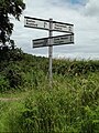
 A meeting of ways - geograph.org.uk - 5414931.jpg 800 × 563; 193 KB
-
 A sugar beet crop field - geograph.org.uk - 4564112.jpg 640 × 360; 393 KB
-

-
 All Saints Church House, Knettishall - geograph.org.uk - 5020204.jpg 3,072 × 2,304; 1.89 MB
-
 Angles Way, by Knettishall Heath Country Park - geograph.org.uk - 3016442.jpg 3,648 × 2,736; 3.33 MB
-
 Birches and bracken - geograph.org.uk - 4564183.jpg 640 × 360; 385 KB
-
 Birches in Knettishall Heath - geograph.org.uk - 4564181.jpg 640 × 360; 379 KB
-
 Brickkiln Covert, Knettishall - geograph.org.uk - 4564172.jpg 640 × 360; 379 KB
-
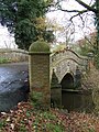
 Bridge on Knettishall Road - geograph.org.uk - 5032235.jpg 3,072 × 2,304; 1.88 MB
-
 Bridge on Knettishall Road - geograph.org.uk - 5032252.jpg 3,072 × 2,304; 1.83 MB
-
 Byway at Knettishall - geograph.org.uk - 243337.jpg 640 × 427; 68 KB
-
 C146 The Street ^ Bridge - geograph.org.uk - 5019863.jpg 3,072 × 2,304; 1.84 MB
-
 C146 The Street ^ Bridge - geograph.org.uk - 5021388.jpg 3,072 × 2,304; 1.82 MB
-
 C146 The Street, Knettishall - geograph.org.uk - 5019896.jpg 3,072 × 2,304; 1.87 MB
-
 C146 The Street, Knettishall - geograph.org.uk - 5020046.jpg 3,072 × 2,304; 1.78 MB
-
 C146 The Street, Knettishall - geograph.org.uk - 5020061.jpg 3,072 × 2,304; 1.91 MB
-
 C146 The Street, Knettishall - geograph.org.uk - 5020076.jpg 3,072 × 2,304; 1.76 MB
-
 C146 The Street, Knettishall - geograph.org.uk - 5021379.jpg 3,072 × 2,304; 1.84 MB
-
 C636 Nethergate Street ^ Roadsign - geograph.org.uk - 5019928.jpg 2,304 × 3,072; 1.81 MB
-
 C636 Nethergate Street, Knettishall - geograph.org.uk - 5019995.jpg 2,624 × 1,983; 2.04 MB
-
 C636 Nethergate Street, Knettishall - geograph.org.uk - 5020048.jpg 3,072 × 2,304; 1.75 MB
-
 C636 Nethergate Street, Knettishall - geograph.org.uk - 5021344.jpg 3,072 × 2,304; 1.81 MB
-
 C636 Nethergate Street, Knettishall - geograph.org.uk - 5031007.jpg 3,072 × 2,304; 1.96 MB
-
 C636 Nethergate Street, Knettishall - geograph.org.uk - 5031503.jpg 3,072 × 2,304; 1.84 MB
-
 C636 Nethergate Street, Knettishall - geograph.org.uk - 5031605.jpg 3,072 × 2,304; 1.93 MB
-
 C636 Nethergate Street, Knettishall - geograph.org.uk - 5031612.jpg 3,072 × 2,304; 1.59 MB
-
 C636 Nethergate Street, Knettishall - geograph.org.uk - 5031673.jpg 3,072 × 2,304; 2.63 MB
-
 C636 Nethergate Street, Knettishall Heath - geograph.org.uk - 5031677.jpg 3,072 × 2,304; 1.54 MB
-
 C636 Nethergate Street, Knettishall Heath - geograph.org.uk - 5031920.jpg 3,072 × 2,304; 1.69 MB
-
 Car park in Knettishall Country Park - geograph.org.uk - 4431215.jpg 640 × 483; 383 KB
-
 Conifers in Knettishall Country Park - geograph.org.uk - 4431216.jpg 640 × 480; 349 KB
-
 Cottage in Norwich Lane, Knettishall - geograph.org.uk - 4431219.jpg 640 × 552; 405 KB
-

-
 Crop fields beside farm track - geograph.org.uk - 4564132.jpg 640 × 480; 466 KB
-
 Crop fields in Knettishall - geograph.org.uk - 4431225.jpg 640 × 480; 383 KB
-
 Crop fields north of Sapiston Covert - geograph.org.uk - 4564194.jpg 640 × 360; 231 KB
-
 Crop fields north of Sapiston Covert - geograph.org.uk - 4564195.jpg 640 × 360; 222 KB
-
 Crop fields, Knettishall - geograph.org.uk - 4564135.jpg 640 × 480; 427 KB
-
 Crossroads, Knettishall - geograph.org.uk - 4431224.jpg 640 × 480; 324 KB
-
 Entering Knettishall on the C636 Nethergate Road - geograph.org.uk - 5031000.jpg 3,072 × 2,304; 1.9 MB
-
 Entrance to Knettishall Heath car park - geograph.org.uk - 5031941.jpg 3,072 × 2,304; 1.76 MB
-
 Exmoor Ponies on Knettishall Heath - geograph.org.uk - 4430342.jpg 640 × 480; 380 KB
-
 Exmoor Ponies on Knettishall Heath - geograph.org.uk - 4431201.jpg 638 × 640; 614 KB
-
 Exmoor Ponies on Knettishall Heath - geograph.org.uk - 4431204.jpg 640 × 480; 489 KB
-
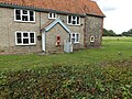
 Farmhouse at Hall Farm Knettishall - geograph.org.uk - 5643769.jpg 3,217 × 2,413; 2.09 MB
-
 Farmland near Knettishall - geograph.org.uk - 3016349.jpg 3,648 × 2,736; 2.46 MB
-
-

-
 Former runway of RAF Knettishall - geograph.org.uk - 1412562.jpg 427 × 640; 92 KB
-
 Gate into The Scotches - geograph.org.uk - 4564178.jpg 640 × 398; 388 KB
-
 Hall Farm Knettishall - geograph.org.uk - 4430390.jpg 640 × 481; 105 KB
-
 House at junction, Knettishall - geograph.org.uk - 3409215.jpg 4,320 × 3,240; 4.74 MB
-
 Hut Hill Tumulus - geograph.org.uk - 911509.jpg 640 × 480; 60 KB
-
 Irrigation equipment on farm track - geograph.org.uk - 4564122.jpg 640 × 600; 454 KB
-
 Knettishall airfield - geograph.org.uk - 1045365.jpg 640 × 480; 68 KB
-
 Knettishall Airfield hangars - geograph.org.uk - 1045409.jpg 640 × 480; 91 KB
-
 Knettishall Airfield runway - geograph.org.uk - 1045386.jpg 640 × 480; 66 KB
-
 Knettishall Airstrip - geograph.org.uk - 1360088.jpg 640 × 512; 64 KB
-
 Knettishall Heath - geograph.org.uk - 5765874.jpg 1,420 × 1,014; 484 KB
-
 Knettishall Heath car park - geograph.org.uk - 5031942.jpg 3,072 × 2,304; 2.06 MB
-
 Knettishall Heath Country Park - geograph.org.uk - 4431206.jpg 640 × 480; 378 KB
-
 Knettishall Heath Country Park - geograph.org.uk - 4564187.jpg 640 × 360; 387 KB
-
 Knettishall Heath sign on Knettishall Road - geograph.org.uk - 5031935.jpg 2,304 × 3,072; 3.73 MB
-
 Knettishall Road, Knettishall - geograph.org.uk - 5031907.jpg 3,072 × 2,304; 1.82 MB
-
 Knettishall Road, Knettishall - geograph.org.uk - 5031912.jpg 3,072 × 2,304; 1.89 MB
-
 Knettishall Road, Knettishall - geograph.org.uk - 5031928.jpg 3,072 × 2,304; 1.81 MB
-
 Knettishall Road, Knettishall Heath - geograph.org.uk - 5031974.jpg 3,072 × 2,304; 1.79 MB
-
 Knettishall Road, Knettishall Heath - geograph.org.uk - 5032227.jpg 3,072 × 2,304; 1.85 MB
-
 Knettishall Village Name sign on the C636 Nethergate Road - geograph.org.uk - 5031001.jpg 3,072 × 2,304; 1.87 MB
-
 Knettishall Village Name sign on the C636 Nethergate Road - geograph.org.uk - 5031459.jpg 2,304 × 3,072; 4.68 MB
-

-
 Lane towards Knettishall, looking NNE - geograph.org.uk - 800449.jpg 640 × 301; 42 KB
-
 Little Ouse River off Knettishall Road Bridge - geograph.org.uk - 5032242.jpg 2,304 × 3,072; 4.41 MB
-
 Little Ouse River off Knettishall Road Bridge - geograph.org.uk - 5032244.jpg 2,304 × 3,072; 5.18 MB
-
 Little Ouse River off Knettishall Road Bridge - geograph.org.uk - 5034290.jpg 3,072 × 2,304; 1.92 MB
-

-

-

-
 Minor road past All Saints church - geograph.org.uk - 4564138.jpg 640 × 480; 349 KB
-
 Minor road to Knettishall - geograph.org.uk - 4564108.jpg 640 × 480; 384 KB
-

-
 Nature Reserve, Knettishall Heath - geograph.org.uk - 3409165.jpg 4,320 × 3,240; 7.2 MB
-
 New Hedge - geograph.org.uk - 2306400.jpg 1,600 × 1,200; 404 KB
-
 Norwich Lane junction, Knettishall - geograph.org.uk - 4431220.jpg 640 × 480; 349 KB
-
 Norwich Lane through Brickkiln Covert - geograph.org.uk - 4564170.jpg 640 × 360; 326 KB
-
 Norwich Lane, Knettishall - geograph.org.uk - 5031623.jpg 3,072 × 2,304; 3.08 MB
-
 On Icknield Way - view N near Halfmoon Plantation - geograph.org.uk - 6014478.jpg 5,184 × 2,920; 6.54 MB
-
 Part of Hall Farm - geograph.org.uk - 3016331.jpg 3,648 × 2,736; 2.6 MB
-
 Pasture by Six Acre Covert, Knettishall - geograph.org.uk - 4431227.jpg 640 × 389; 248 KB
-
 Path in Knettishall Heath - geograph.org.uk - 4564189.jpg 640 × 360; 359 KB
-
 Path in Knettishall Heath Country Park - geograph.org.uk - 4564185.jpg 640 × 360; 326 KB
-
 Path into Knettishall Heath - geograph.org.uk - 4564179.jpg 640 × 360; 393 KB
-
 Peddars Way footbridge over Little Ouse River - geograph.org.uk - 5923082.jpg 4,608 × 3,456; 5.75 MB
-
 Peddars Way through Blackwater Plantation - geograph.org.uk - 5923087.jpg 4,608 × 3,456; 5.28 MB
-
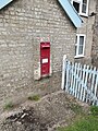
 Post Office Cottages Victorian Postbox - geograph.org.uk - 5044429.jpg 3,072 × 2,304; 1.98 MB
-
 Post Office Cottages Victorian Postbox - geograph.org.uk - 5044430.jpg 3,072 × 2,304; 1.99 MB
-
 Post Office Cottages Victorian Postbox - geograph.org.uk - 5044467.jpg 2,304 × 3,072; 3.84 MB
-
 Post Office Cottages Victorian Postbox - geograph.org.uk - 5044471.jpg 2,304 × 3,072; 3.67 MB
-
 Post Office Cottages Victorian Postbox - geograph.org.uk - 5044473.jpg 2,304 × 3,072; 4.09 MB
-
 Post Office Cottages ^ C636 Nethergate Street - geograph.org.uk - 5031020.jpg 2,304 × 3,072; 3.01 MB
-

-
 Riddlesworth Hall School across into Norfolk - geograph.org.uk - 4430392.jpg 1,024 × 768; 343 KB
-
 Riddlesworth Hall School hiding behind trees - geograph.org.uk - 3409193.jpg 4,320 × 3,240; 6.04 MB
-
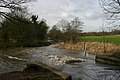
 River Little Ouse - geograph.org.uk - 5765868.jpg 2,104 × 1,184; 560 KB
-
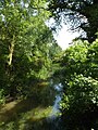
 River Little Ouse at Knettishall - geograph.org.uk - 338087.jpg 640 × 427; 75 KB
-

-
 Road crossing the main runway - geograph.org.uk - 4564116.jpg 640 × 360; 315 KB
-

-
 Road Junction - geograph.org.uk - 1635137.jpg 640 × 480; 88 KB
-
 Roadsign on the C636 Nethergate Street - geograph.org.uk - 5019917.jpg 2,304 × 3,072; 1.75 MB
-
 Roadsign on the C636 Nethergate Street - geograph.org.uk - 5019972.jpg 3,072 × 2,304; 1.94 MB
-
 Roadsign on the C636 Nethergate Street - geograph.org.uk - 5021383.jpg 2,304 × 3,072; 1.78 MB
-
 Roadsign on the C636 Nethergate Street - geograph.org.uk - 5031618.jpg 2,304 × 3,072; 4 MB
-
 Roadsign on the C636 Nethergate Street - geograph.org.uk - 5031919.jpg 2,240 × 2,978; 4.79 MB
-

-

-
 Standing In Norfolk - geograph.org.uk - 1619239.jpg 480 × 640; 137 KB
-
 Sugar beet crop, Knettishall - geograph.org.uk - 4564114.jpg 640 × 360; 325 KB
-
 The former main runway - geograph.org.uk - 4564109.jpg 640 × 480; 359 KB
-
 The former main runway - geograph.org.uk - 4564119.jpg 640 × 480; 502 KB
-
 The north-eastern perimeter track - geograph.org.uk - 4564121.jpg 640 × 360; 336 KB
-

-
 The southern end of the Peddars Way - geograph.org.uk - 5415967.jpg 800 × 602; 200 KB
-
 To Knettishall on Norwich Lane - geograph.org.uk - 4564190.jpg 640 × 360; 363 KB
-
 Track into fields by Stonehill House - geograph.org.uk - 4564174.jpg 640 × 360; 249 KB
-
 Track past Sapiston Covert - geograph.org.uk - 4564197.jpg 640 × 480; 294 KB
-
 Track skirting Sapiston Covert - geograph.org.uk - 4564191.jpg 640 × 480; 289 KB
-
 View along Norwich Lane - geograph.org.uk - 4564176.jpg 640 × 360; 264 KB
-

-

-
 Weir on the Little Ouse River - geograph.org.uk - 5032258.jpg 3,072 × 2,304; 2.04 MB
-
 Edge of Wall Covert, Knettishall - geograph.org.uk - 741756.jpg 640 × 480; 93 KB
-
 Hall Farm - geograph.org.uk - 372711.jpg 640 × 480; 66 KB
-
 Harvest over at Fen Street - geograph.org.uk - 221437.jpg 640 × 427; 82 KB
-
 Knettishall Heath - geograph.org.uk - 311764.jpg 640 × 428; 108 KB
-
 Pigs near Riddlesworth Hall - geograph.org.uk - 311747.jpg 640 × 428; 94 KB


