Category:Koci Łeb Tower in Toruń
Jump to navigation
Jump to search
| Object location | | View all coordinates using: OpenStreetMap |
|---|
  | |||||
| Upload media | |||||
| Instance of | |||||
|---|---|---|---|---|---|
| Location | Toruń, Kuyavian-Pomeranian Voivodeship, Poland | ||||
| Architectural style | |||||
| Heritage designation |
| ||||
 | |||||
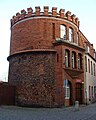
Polski: Toruń, ul. Podmurna 74 - Baszta Koci Łeb z murem, obecnie budynek Urzędu Miasta (XVI, 1703)
English: Cat's Head Tower in Toruń, Poland
Media in category "Koci Łeb Tower in Toruń"
The following 15 files are in this category, out of 15 total.
-
 Torun baszta Koci Leb.JPG 1,932 × 2,416; 1.41 MB
-
 Toruń, Baszta Koci Łeb (z parkingu przy UM) (OLA Z.).JPG 2,072 × 3,104; 2.16 MB
-
 Ul. Podmurna 74, Toruń.JPG 2,117 × 2,894; 2.27 MB
-
 602998 Toruń Baszta Koci Łeb.JPG 2,848 × 4,272; 6.46 MB
-
 Baszta Koci Łeb w Toruniu.jpg 6,000 × 4,000; 13.15 MB
-
 Baszta Koci Łeb.jpg 3,762 × 3,260; 2.23 MB
-
 Ul. Podmurna 74 (front), Toruń.JPG 2,478 × 3,967; 3.37 MB
-
 Koci Łeb Tower in Toruń.jpg 3,456 × 5,184; 5.59 MB
-
 Torun baszta Koci Leb2.jpg 1,280 × 807; 200 KB
-
 Baszta Koci Leb, Podmurna 74 (Ola Z.).jpg 711 × 534; 58 KB
-
 Toruń (DerHexer) 2010-07-17 030.jpg 2,848 × 4,288; 7.47 MB
-
 Toruń round building 2009-1.jpg 2,592 × 3,888; 3.63 MB
-
 Toruń round building 2009.jpg 2,592 × 3,888; 3.67 MB
-
 Toruń, Baszta Koci Łeb (od strony parkingu przy UM) (OLA Z.).JPG 2,241 × 1,526; 1.38 MB
-
 Toruń, Baszta Koci Łeb w Toruniu.jpg 6,000 × 4,000; 12.36 MB
_(OLA_Z.).JPG)


,_Toru%C5%84.JPG)

.jpg)
_2010-07-17_030.jpg)


_(OLA_Z.).JPG)
