Category:Löwenburg (Bad Honnef)
Jump to navigation
Jump to search
| Object location | | View all coordinates using: OpenStreetMap |
|---|
castle ruin in Bad Honnef, Germany     | |||||
| Upload media | |||||
| Instance of | |||||
|---|---|---|---|---|---|
| Location | Bad Honnef, Rhein-Sieg District, Cologne Government Region, North Rhine-Westphalia, Germany | ||||
| Heritage designation |
| ||||
| Inception |
| ||||
 | |||||
Subcategories
This category has only the following subcategory.
Media in category "Löwenburg (Bad Honnef)"
The following 28 files are in this category, out of 28 total.
-
 2019-06-30-bad-honnef-loewenburg-01.jpg 3,648 × 2,736; 3.91 MB
-
 Ahorn auf der Spitze des Loewenbergs.jpg 4,608 × 3,456; 3.25 MB
-
 Bad Honnef Löwenburg 1879.jpg 1,660 × 1,110; 319 KB
-
 Bad Honnef Löwenburg Lithographie ca. 1840.jpg 1,673 × 1,521; 314 KB
-
 Bad Honnef Löwenburg Rekonstruktionsversuch.jpg 1,632 × 975; 405 KB
-
 Bad Honnef Löwenburg Zeichnung 1867.jpg 1,646 × 1,965; 1.11 MB
-
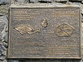
 Beschreibung der Löwenburg.JPG 3,072 × 2,304; 5.12 MB
-
 Burgruine Löwenburg im ersten Tageslicht.jpg 5,434 × 3,057; 12.55 MB
-
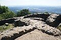
 Durchgang in der Löwenburg-Ruine.jpg 3,120 × 4,160; 4.86 MB
-
 Einsamer Ahorn.jpg 4,608 × 3,456; 10.22 MB
-
 Hauptdreieckspunkt Löwenburg.jpg 3,072 × 2,304; 5.65 MB
-
 Loewenburg 1.jpg 1,144 × 856; 135 KB
-
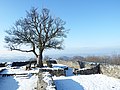
 Loewenburg im Schnee.jpg 4,186 × 3,140; 13.65 MB
-
 Loewenburg Siebengebirge 1.jpg 4,592 × 3,056; 6.22 MB
-
 Loewenburg Siebengebirge 2.jpg 4,592 × 3,056; 6.33 MB
-
 Loewenburg Siebengebirge 3.jpg 4,592 × 3,056; 5.65 MB
-
 Loewenburg Siebengebirge 4.jpg 4,592 × 3,056; 6.07 MB
-
 Loewenburg Siebengebirge 5.jpg 4,592 × 3,056; 5.88 MB
-
 Loewenburg Siebengebirge 6.jpg 4,592 × 3,056; 6.71 MB
-
 Loewenburg Siebengebirge 7.jpg 4,592 × 3,056; 5.14 MB
-
 Loewenburg Siebengebirge 8.jpg 4,592 × 3,056; 7.19 MB
-
 Löwenburg - Siebengebirge 03-2014.jpg 4,032 × 2,268; 5.02 MB
-
 Löwenburg 1700.jpg 2,232 × 1,441; 792 KB
-
 Löwenburg Siebengebirge DE 2015.jpg 2,000 × 1,333; 1.19 MB
-
 Löwenburg Siebengebirge.JPG 1,600 × 1,067; 1.15 MB
-
 Löwenburg-019.JPG 3,632 × 2,227; 2.78 MB
-
 Siebengebirge ruine loewenburg wv ds 08 2008.jpg 1,400 × 1,050; 274 KB
-
 Wenzel Hollar Drachenfels and Löwenburg about 1650.jpg 1,371 × 597; 831 KB


