Category:Landhuis Rustenburg
Jump to navigation
Jump to search
| Object location | | View all coordinates using: OpenStreetMap |
|---|
building in Bunde, Netherlands .JPG) | |||||
| Upload media | |||||
| Instance of | |||||
|---|---|---|---|---|---|
| Location | Bunde, Limburg, Netherlands | ||||
| Street address |
| ||||
| Located on street |
| ||||
| Heritage designation |
| ||||
 | |||||
|
This is a category about rijksmonument number 28469
|
| Address |
|
Media in category "Landhuis Rustenburg"
The following 19 files are in this category, out of 19 total.
-
 Bunde-Geulstraat 47 (1).JPG 4,000 × 3,000; 4.92 MB
-
 Bunde-Geulstraat 47 (2).JPG 4,000 × 3,000; 4.79 MB
-
 Bunde-Geulstraat 47 (3).JPG 4,000 × 3,000; 4.93 MB
-

-
 Gevel - Bunde - 20044872 - RCE.jpg 1,200 × 881; 217 KB
-
 Hoeve Rustenburg detail interieur - Bunde - 20044903 - RCE.jpg 960 × 1,200; 226 KB
-
 Hoeve Rustenburg detail trapleuning - Bunde - 20044904 - RCE.jpg 944 × 1,200; 196 KB
-
 Hoeve Rustenburg muurkast - Bunde - 20044902 - RCE.jpg 956 × 1,200; 263 KB
-
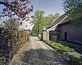
 Hoeve Rustenburg noord-gevel van de binnenplaats - Bunde - 20044898 - RCE.jpg 1,200 × 953; 303 KB
-
 Hoeve Rustenburg schuurdeur - Bunde - 20044901 - RCE.jpg 945 × 1,200; 225 KB
-
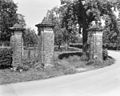 Hoeve Rustenburg, hekpijlers - Bunde - 20044895 - RCE.jpg 1,200 × 959; 358 KB
-
 Hoeve Rustenburg, hekpijlers - Bunde - 20044896 - RCE.jpg 1,200 × 941; 415 KB
-
 Hoeve Rustenburg, hekpijlers - Bunde - 20044897 - RCE.jpg 1,200 × 1,000; 318 KB
-
 Huis Rustenburg.jpg 2,098 × 1,471; 327 KB
-
 Overzicht van de binnenplaats - Bunde - 20406636 - RCE.jpg 1,200 × 796; 200 KB
-
 Overzicht van de binnenplaats - Bunde - 20406637 - RCE.jpg 1,200 × 959; 265 KB
-

-
 Overzicht van een der vleugels van de herenhof - Bunde - 20406639 - RCE.jpg 1,200 × 956; 297 KB
-
.JPG)
.JPG)
,_d%C3%A9tail_Itteren-Bunde.jpg)


